Category:Kusu, Oita
Vai alla navigazione
Vai alla ricerca
日本語: 大分県玖珠郡玖珠町に関するカテゴリ
cittadina giapponese della prefettura di Ōita   | |||||
| Carica un file multimediale | |||||
| Istanza di | |||||
|---|---|---|---|---|---|
| Luogo |
| ||||
| Forma giuridica |
| ||||
| Data di fondazione o creazione |
| ||||
| Popolazione |
| ||||
| Superficie |
| ||||
| Ha sostituito |
| ||||
| Distinto da | |||||
| sito web ufficiale | |||||
 | |||||
Sottocategorie
Questa categoria contiene le 6 sottocategorie indicate di seguito, su un totale di 6.
File nella categoria "Kusu, Oita"
Questa categoria contiene 86 file, indicati di seguito, su un totale di 86.
-
 Population distribution of Kusu, Oita, Japan.svg 512 × 256; 22 KB
-
 Aqueduct near Bungo-Mori Station.jpg 4 032 × 3 024; 4,01 MB
-
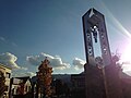 Bell Tower on south side of Kyoshimbashi Bridge 2.JPG 3 264 × 2 448; 1,7 MB
-
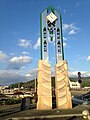 Bell Tower on south side of Kyoshimbashi Bridge.jpg 2 448 × 3 264; 2,71 MB
-
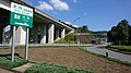 E34-OITA-EXP-KusuIC.jpg 2 048 × 1 152; 2,01 MB
-
 Emblem of Kusu, Oita.svg 512 × 512; 2 KB
-
 Fields near Bungo-Mori Station 1.jpg 3 971 × 2 979; 3,62 MB
-
 Fields near Bungo-Mori Station 2.jpg 4 014 × 3 010; 4,06 MB
-
 Fields near Bungo-Mori Station and Mount Kirikabusan.jpg 4 010 × 3 007; 3,71 MB
-
 Flag of Kusu Oita.JPG 185 × 112; 5 KB
-
 Flag of Kusu Oita.svg 324 × 216; 1 KB
-
 Fog from east side of Bungo-Mori Station in the morning (South).JPG 3 264 × 2 448; 2,25 MB
-
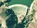 Hiju Dam survey 1974.jpg 610 × 458; 59 KB
-
 Hitabus-kusu.jpg 448 × 299; 37 KB
-
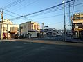 Kasuga Crossroads in Kusu, Oita.JPG 3 264 × 2 448; 2,33 MB
-
 Kasuga No.2 Street in Kusu, Oita.JPG 3 264 × 2 448; 2,03 MB
-
 Kusu Branch of Kyushu Labour Bank 20180331.jpg 3 920 × 2 940; 2,68 MB
-
 Kusu Branch of Oita Prefectural Credit Cooperative.JPG 3 264 × 2 448; 1,71 MB
-
 Kusu in Oita Prefecture Ja.svg 560 × 622; 10 KB
-
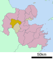
 Kusu in Oita Prefecture.png 1 181 × 901; 36 KB
-
 Kusu Oita chaoter.JPG 70 × 67; 3 KB
-
 Kusu Police Office.jpg 1 536 × 1 152; 232 KB
-
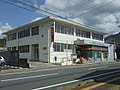 Kusu Post Office.jpg 1 280 × 960; 186 KB
-
 Kusu Town community bus01.jpg 1 280 × 960; 221 KB
-
 Kusu town office.JPG 3 648 × 2 432; 2,58 MB
-
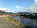
 Kusugawa River and Ichinomurahashi Bridge from train of Kyudai Main Line.jpg 3 782 × 2 837; 4,47 MB
-
 Kusugawa River and Mount Kirikabusan.jpg 3 956 × 2 967; 2,32 MB
-
 Kusugawa River from Kyoshimbashi Bridge (east) 1.jpg 3 988 × 2 991; 2,74 MB
-
 Kusugawa River from Kyoshimbashi Bridge (east) 2.jpg 4 032 × 3 024; 2,71 MB
-
 Kusugawa River from Kyoshimbashi Bridge (east) 3.jpg 4 032 × 3 024; 2,98 MB
-
 Kusugawa River from Kyoshimbashi Bridge (east).JPG 3 264 × 2 448; 2,19 MB
-
 Kusugawa River from Kyoshimbashi Bridge (Southeast).JPG 3 264 × 2 448; 1,9 MB
-
 Kusugawa River from Kyoshimbashi Bridge (west) 1.jpg 4 032 × 3 024; 3,04 MB
-
 Kusugawa River from Kyoshimbashi Bridge (West) 2.JPG 3 264 × 2 448; 1,82 MB
-
 Kusugawa River from Kyoshimbashi Bridge (west) 2.jpg 4 032 × 3 024; 2,72 MB
-
 Kusugawa River from Kyoshimbashi Bridge (west) 3.jpg 4 019 × 3 015; 2,61 MB
-
 Kusugawa River from Kyoshimbashi Bridge (West).JPG 3 264 × 2 448; 2,26 MB
-
 Kusugawa River from Kyoshimbashi Bridge and the north bank (East).JPG 3 264 × 2 448; 2,22 MB
-
 Kusugawa River from Kyoshimbashi Bridge and the north bank (West).JPG 3 264 × 2 448; 1,82 MB
-
 Kusugawa River from Kyoshimbashi Bridge in the morning (East).JPG 3 264 × 2 448; 1,14 MB
-
 Kusugawa River near Yunotsuru Hot Spring from train of Kyudai Main Line.jpg 3 954 × 2 965; 4,83 MB
-
 Kusugawa River on west side of Mikazukinotaki Hot Spring (Northwest).JPG 3 264 × 2 448; 2,31 MB
-
 Kusugawa River on west side of Mikazukinotaki Hot Spring (Southwest) 1.JPG 3 264 × 2 448; 2,17 MB
-
 Kusugawa River on west side of Mikazukinotaki Hot Spring (Southwest) 2.JPG 3 264 × 2 448; 1,83 MB
-
 Kusugawa River on west side of Mikazukinotaki Hot Spring (West).JPG 3 264 × 2 448; 2,07 MB
-
 Kyoshimbashi Bridge on Kusugawa River from south side.jpg 4 032 × 3 024; 2,89 MB
-
 Kyoshimbashi Bridge over Kusugawa River from south side.JPG 3 264 × 2 448; 2,27 MB
-
 Kyudai main line 20220910145142 (52650528594).jpg 4 032 × 3 024; 4,31 MB
-
 Kyudai main line 20220910150114 (52650738913).jpg 4 032 × 3 024; 4,33 MB
-
 Kyudai Main Line on the east side of Bungo-Mori Station 20141115.JPG 3 264 × 2 448; 2,71 MB
-
 Machida, Kokonoe, Kusu District, Oita Prefecture 879-4723, Japan - panoramio.jpg 3 448 × 4 592; 6,8 MB
-
 Michinoei Douwa no sato Kusu.JPG 3 648 × 1 216; 1,32 MB
-
 Michinoeki Jion no taki Kusu.jpg 4 533 × 1 688; 3,18 MB
-
 Miyukibashi Bridge near Mikazuki Waterfall.jpg 3 264 × 2 448; 2,04 MB
-
 Mount Kirikabusan and Kusugawa River in the morning 20141115.JPG 3 264 × 2 448; 1,73 MB
-
 Mount Kirikabusan from east side of Bungo-Mori Station in the morning.JPG 3 264 × 2 448; 2,22 MB
-
 Mount Kirikabusan from Kyoshimbashi Bridge.jpg 3 993 × 2 995; 3,19 MB
-
 Mount Kirikabusan near Bungo-Mori Roundhouse.jpg 3 918 × 2 939; 3,42 MB
-
 Mountains near Mount Kogansenzan from the north end of Kyoshimbashi Bridge.JPG 3 264 × 2 448; 2,46 MB
-
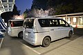 Nissan DBA-NC26 Serena - Honda DBA-RPX Stepwgn (23022418492).jpg 4 608 × 3 072; 5,71 MB
-
 North bank of Kusugawa River from Kyoshimbashi Bridge (West).JPG 3 264 × 2 448; 2,39 MB
-
 Oita amagasetakatsuka interchange.jpg 1 024 × 768; 406 KB
-
 Oita Expressway - Kusu SA - 02.JPG 2 896 × 1 936; 2,03 MB
-
 Oita Kusu Miyama Highschool.jpg 1 600 × 900; 251 KB
-
 Oita Mori Highschool.jpg 1 280 × 960; 260 KB
-
 Oita nishi-kusu tv transposer.jpg 1 000 × 1 504; 475 KB
-
 Oita Prefectural Road No.43 near Kasuga Crossroads.jpg 3 992 × 2 994; 3,72 MB
-
 Oita Prefectural Road No.43 on south side of Kyoshimbashi Bridge.jpg 3 904 × 2 928; 3,25 MB
-
 Oita Prefectural Road No.43 on the west side of Kasuga Crossroads in Kusu, Oita.jpg 2 448 × 3 264; 2,56 MB
-
 Oita Prefectural Road No.678 in front of Bungo-Mori Roundhouse Park.jpg 3 955 × 2 966; 2,83 MB
-
 Oita Prefectural Road No.678 in front of Bungo-Mori Station 2.jpg 3 997 × 2 998; 3,65 MB
-
 Oita Prefectural Road No.678 in front of Bungo-Mori Station.jpg 4 032 × 3 024; 4,32 MB
-
 Oita Prefectural Road No.678 on east side of Bungo-Mori Station.jpg 4 032 × 3 024; 3,89 MB
-
 Oita Prefectural Road No.678 on the east side of Kasuga Crossroads in Kusu, Oita.JPG 3 264 × 2 448; 1,83 MB
-
 Oita Prefectural Road No.678 on west side of Bungo-Mori Station.jpg 3 953 × 2 965; 3,33 MB
-
 Oita-kusu-interchange.jpg 1 280 × 960; 680 KB
-
 Oita-kusu-servicearea.jpg 1 280 × 960; 843 KB
-

-
 Park and bell tower on south side of Kyoshimbashi Bridge.jpg 3 974 × 2 980; 3,49 MB
-
 Red leaves near Mikazukinotaki Hot Spring 20141116.jpg 2 448 × 3 264; 3,9 MB
-
 Shops on the east side of Bungo-Mori Station.JPG 3 264 × 2 448; 2,52 MB
-
 Shotokuhi Stele near the north end of Kyoshimbashi Bridge.JPG 3 264 × 2 448; 3,88 MB
-
 Stele near Kyoshimbashi Bridge.jpg 3 816 × 2 862; 4,67 MB
-
 Tatehata no Kei01.jpg 1 722 × 914; 183 KB
-
 Tatehata no Kei02.jpg 1 322 × 742; 137 KB
-
 夫婦滝(大分県).jpg 656 × 1 024; 660 KB


.JPG)


.JPG)
_1.JPG)
_2.JPG)
.JPG)
.jpg)
.jpg)


.jpg)


.jpg)
_1.jpg)
_2.jpg)
_3.jpg)
.JPG)
.JPG)
_1.jpg)
_2.JPG)
_2.jpg)
_3.jpg)
.JPG)
.JPG)
.JPG)
.JPG)
.JPG)