Category:Litcham
Jump to navigation
Jump to search
English: Litcham is a village and civil parish in the English county of Norfolk. It is situated some west of the city of Norwich.
village and civil parish in Norfolk, United Kingdom  Eglwys yr Holl Saint, Litcham | |||||
| Upload media | |||||
| Instance of | |||||
|---|---|---|---|---|---|
| Location | Breckland, Norfolk, East of England, England | ||||
| Area |
| ||||
| Said to be the same as | Litcham (Wikimedia duplicated page, civil parish) | ||||
| official website | |||||
 | |||||
Subcategories
This category has the following 8 subcategories, out of 8 total.
A
B
- The Bull, Litcham (2 F)
L
- Litcham Common (8 F)
- Litcham War Memorial (2 F)
P
- Priory Farm, Litcham (1 F)
S
- Litcham Secondary School (1 F)
Media in category "Litcham"
The following 117 files are in this category, out of 117 total.
-

-
 A stack of pine logs - geograph.org.uk - 4222039.jpg 640 × 480; 262 KB
-
 A stack of pine logs on a field's edge - geograph.org.uk - 4222034.jpg 640 × 480; 220 KB
-
 Aerial view - geograph.org.uk - 2282671.jpg 982 × 600; 126 KB
-

-

-
 All Saints' church in Litcham - geograph.org.uk - 1829349.jpg 460 × 613; 169 KB
-

-
 All Saints' church, Litcham - geograph.org.uk - 4127500.jpg 4,320 × 3,240; 5.21 MB
-
 B1145 towards Litcham - geograph.org.uk - 5540731.jpg 640 × 480; 91 KB
-
 Back Street (B1145), Litcham - geograph.org.uk - 5540760.jpg 640 × 480; 80 KB
-
 Bend in Lexham Road (B1145) - geograph.org.uk - 4222056.jpg 640 × 420; 179 KB
-
 Bridge Farm Fisheries car park - geograph.org.uk - 524950.jpg 640 × 480; 98 KB
-

-
 Butt Lane, Letcham - geograph.org.uk - 5978724.jpg 1,600 × 1,064; 629 KB
-
 Cattle grid on Litcham Common - geograph.org.uk - 4903910.jpg 2,592 × 1,936; 2.91 MB
-
 Church Street, Litcham - geograph.org.uk - 4127441.jpg 4,320 × 3,240; 3.36 MB
-
 Converted Windmill - geograph.org.uk - 383715.jpg 480 × 640; 128 KB
-
 Copse in field north of the B1145 road - geograph.org.uk - 2762555.jpg 640 × 480; 197 KB
-
 Coronation Cottages - geograph.org.uk - 5540739.jpg 640 × 480; 75 KB
-

-
 Cottages beside Lexham Road - geograph.org.uk - 4222020.jpg 640 × 480; 197 KB
-
 Cottages, Litcham - geograph.org.uk - 5540759.jpg 640 × 480; 67 KB
-
 Dartmoor ponies on Litcham Common in Norfolk - geograph.org.uk - 4696940.jpg 4,320 × 3,240; 5.43 MB
-
 Entering Litcham - geograph.org.uk - 5540758.jpg 640 × 480; 92 KB
-
 Entrance to High House Farm, Litcham - geograph.org.uk - 2282678.jpg 760 × 570; 149 KB
-
 Farm track past Priory Belt - geograph.org.uk - 4222024.jpg 640 × 480; 261 KB
-
 Fields towards Great Wood - geograph.org.uk - 5540130.jpg 640 × 480; 82 KB
-
 Gardener's Plantation - geograph.org.uk - 4222063.jpg 640 × 407; 258 KB
-

-
 George V postbox outside Litcham Post Office - geograph.org.uk - 5557311.jpg 1,072 × 2,231; 363 KB
-
 Grassland beside Litcham Belt - geograph.org.uk - 5540755.jpg 640 × 480; 76 KB
-
 Grazing beside Great Wood - geograph.org.uk - 5540734.jpg 640 × 480; 98 KB
-
 Grazing towards woodland, Litcham - geograph.org.uk - 5540767.jpg 640 × 480; 61 KB
-
 Grazing, Litcham - geograph.org.uk - 5540766.jpg 640 × 480; 87 KB
-
 Great Wood Lexham contains a tumulus - geograph.org.uk - 5990442.jpg 4,608 × 3,456; 5.65 MB
-

-
 K6 telephone box at Litcham - geograph.org.uk - 2282908.jpg 760 × 570; 299 KB
-
 Lane through the plantations towards Lexham Hall in Norfolk - geograph.org.uk - 4694687.jpg 4,320 × 3,240; 6.22 MB
-
 Lexham Road (B1145) - geograph.org.uk - 5540757.jpg 640 × 480; 120 KB
-
 Lexham Road junction - geograph.org.uk - 4222043.jpg 640 × 480; 213 KB
-
 Lexham Solar Farm in Norfolk - geograph.org.uk - 4694850.jpg 4,320 × 3,240; 5.49 MB
-
 Litcham All Saints' church - geograph.org.uk - 2279136.jpg 760 × 570; 386 KB
-
 Litcham Post Office - geograph.org.uk - 5557313.jpg 640 × 480; 74 KB
-
 Litcham Post Office - geograph.org.uk - 6092855.jpg 6,702 × 4,468; 5.39 MB
-
 Litcham School - geograph.org.uk - 6092140.jpg 6,088 × 4,058; 6.98 MB
-
 Litcham's old village sign, housed in the church - geograph.org.uk - 4562106.jpg 2,592 × 3,456; 3.07 MB
-
 Litcham, All Saints Church, Fine c15th painted screen - geograph.org.uk - 6092866.jpg 7,183 × 4,789; 6.92 MB
-
 Litcham, All Saints Church, South doorway - geograph.org.uk - 6092853.jpg 3,879 × 5,818; 5.26 MB
-
 Litcham, All Saints Church, The font - geograph.org.uk - 6092875.jpg 4,168 × 6,252; 5.23 MB
-
 Litcham, All Saints Church, The font - geograph.org.uk - 6092876.jpg 6,787 × 4,524; 6.54 MB
-
 Litcham, All Saints Church, The font - geograph.org.uk - 6092878.jpg 6,605 × 4,403; 5.97 MB
-
 Litcham, All Saints Church, The nave - geograph.org.uk - 6092858.jpg 7,601 × 5,067; 6.52 MB
-
 Litcham, All Saints Church, The nave from the chancel - geograph.org.uk - 6092870.jpg 7,583 × 5,055; 7.37 MB
-
 Litcham, All Saints Church, The north aisle - geograph.org.uk - 6092862.jpg 6,212 × 4,141; 4.42 MB
-
 Litcham, All Saints Church, The organ - geograph.org.uk - 6092873.jpg 6,625 × 4,417; 7.3 MB
-
 Litcham, All Saints Church, The Perpendicular period pulpit - geograph.org.uk - 6092880.jpg 4,620 × 6,930; 6.04 MB
-
 Litcham, All Saints Church, The Royal Arms of Queen Victoria - geograph.org.uk - 6092872.jpg 5,226 × 3,485; 3.97 MB
-
 Litcham, All Saints Church, The screen (left side) - geograph.org.uk - 6092883.jpg 7,315 × 4,877; 7.55 MB
-
 Litcham, All Saints Church, The screen (right side) - geograph.org.uk - 6092881.jpg 6,709 × 4,472; 7.3 MB
-
 Litcham, All Saints Church, Tower doorway - geograph.org.uk - 6092859.jpg 3,631 × 5,445; 3.51 MB
-
 Litcham, All Saints Church, Western aspect - geograph.org.uk - 6092848.jpg 6,526 × 4,350; 7.61 MB
-
 Litcham, All Saints Church, Western aspect - geograph.org.uk - 6092851.jpg 6,363 × 4,240; 7.58 MB
-
 Litcham, Houses and the village sign in Church Street - geograph.org.uk - 6092144.jpg 5,232 × 3,488; 4.24 MB
-
 Litcham, Norfolk - crossroads by The Bull PH - geograph.org.uk - 5621251.jpg 5,184 × 2,920; 4.48 MB
-
 Litcham, Norfolk - view NW along Church St - geograph.org.uk - 5621253.jpg 5,184 × 2,920; 4.79 MB
-
 Litcham, The village sign in Church Street - geograph.org.uk - 6092148.jpg 4,669 × 7,003; 5.99 MB
-
 Litcham, village sign and notice board - geograph.org.uk - 4127683.jpg 3,240 × 4,320; 3.96 MB
-
 Local history Museum - geograph.org.uk - 383793.jpg 480 × 640; 79 KB
-
 Looking south east on the B1145 - geograph.org.uk - 5540736.jpg 640 × 480; 104 KB
-
 Mileham Road into Litcham - geograph.org.uk - 4562188.jpg 640 × 480; 187 KB
-
 Minor road past Sawmill Wood - geograph.org.uk - 4256813.jpg 640 × 480; 239 KB
-
 Ploughing on Litcham Heath, Norfolk - geograph.org.uk - 4279782.jpg 4,320 × 3,240; 5.56 MB
-
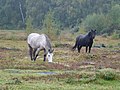
 Ponies on Litcham common - geograph.org.uk - 4887296.jpg 640 × 478; 187 KB
-
 Powered para-glider over Lexham - geograph.org.uk - 2282905.jpg 800 × 766; 151 KB
-
 Public footpath towards Tittleshall in Norfolk - geograph.org.uk - 4694840.jpg 4,320 × 3,240; 5.78 MB
-
-

-
 Rural crossroads by Weasenham Lyngs - geograph.org.uk - 4256806.jpg 640 × 480; 174 KB
-
 Sheep grazing by Coronation Cottages - geograph.org.uk - 4222058.jpg 640 × 606; 393 KB
-
 Sheep on Litcham Heath, Norfolk - geograph.org.uk - 4279774.jpg 4,320 × 3,240; 5.6 MB
-
 Sheep pasture by Coronation Cottages - geograph.org.uk - 4222059.jpg 640 × 540; 351 KB
-
 Sign for the Bull Inn, Litcham - geograph.org.uk - 5540763.jpg 604 × 640; 69 KB
-
 Speed restriction of 40 mph, entering Litcham - geograph.org.uk - 5990445.jpg 4,008 × 3,006; 3.15 MB
-

-
 Stubble field west of Priory Belt - geograph.org.uk - 4222026.jpg 640 × 480; 247 KB
-
-

-
 The B1145 (Lexham Road) - geograph.org.uk - 4222050.jpg 640 × 394; 185 KB
-
 The B1145 (Lexham Road) - geograph.org.uk - 4222053.jpg 640 × 480; 252 KB
-
 The Bull Inn, Litcham - geograph.org.uk - 5540762.jpg 640 × 469; 67 KB
-
 The Bull public house, Litcham - geograph.org.uk - 2282912.jpg 760 × 570; 182 KB
-
 The Corner Shop and The Bull in Litcham, Norfolk - geograph.org.uk - 4696658.jpg 4,320 × 3,240; 5.55 MB
-
-
 The road to East Lexham - geograph.org.uk - 4222047.jpg 640 × 480; 292 KB
-
 Tornado GR4 over Litcham - geograph.org.uk - 4222454.jpg 640 × 534; 174 KB
-
 Track near Oaklands Farm, Litcham, Norfolk - geograph.org.uk - 4694864.jpg 4,320 × 3,240; 6.05 MB
-
 Trees in hedge beside Lexham Road - geograph.org.uk - 4222031.jpg 640 × 480; 181 KB
-

-
 Unused field gate - geograph.org.uk - 5990443.jpg 3,960 × 2,970; 4.29 MB
-
 View across Litcham Heath - geograph.org.uk - 4256810.jpg 640 × 480; 192 KB
-
 View along Church Street, Litcham - geograph.org.uk - 1829333.jpg 640 × 480; 96 KB
-

-
 Wellingham Road near Litcham - geograph.org.uk - 5303132.jpg 480 × 640; 194 KB
-
 Wild ponies on Litcham Common in Norfolk - geograph.org.uk - 4696934.jpg 4,320 × 3,240; 5.56 MB
-
 Woodland entrance in Litcham - geograph.org.uk - 4694593.jpg 4,320 × 3,240; 6.08 MB
-
 Woodland lane at East Lexham - geograph.org.uk - 2982977.jpg 1,024 × 768; 241 KB
-
 Farm track north of Litcham - geograph.org.uk - 504522.jpg 640 × 427; 106 KB
-
 Field boundary south of Wellingham - geograph.org.uk - 504519.jpg 640 × 427; 114 KB
-
 Field hedge - geograph.org.uk - 425252.jpg 640 × 481; 47 KB
-
 Field north of Litcham - geograph.org.uk - 504525.jpg 640 × 427; 77 KB
-

-
 Moors Belt East, near Litcham - geograph.org.uk - 504463.jpg 640 × 427; 91 KB
-
 Oddfellows Hall, Litcham - geograph.org.uk - 383796.jpg 640 × 480; 104 KB
-
 Pig farm near Mileham - geograph.org.uk - 504592.jpg 640 × 427; 80 KB
-
 Set-aside field near Litcham - geograph.org.uk - 504443.jpg 640 × 427; 78 KB
-
 The Great Barrow, Weasenham - geograph.org.uk - 348859.jpg 600 × 450; 58 KB


,_Litcham_-_geograph.org.uk_-_5540760.jpg)
_-_geograph.org.uk_-_4222056.jpg)


_-_geograph.org.uk_-_5540757.jpg)


_-_geograph.org.uk_-_6092883.jpg)
_-_geograph.org.uk_-_6092881.jpg)


_-_geograph.org.uk_-_5835746.jpg)

_-_geograph.org.uk_-_4222050.jpg)
_-_geograph.org.uk_-_4222053.jpg)


