Category:Locator maps of cities in Brevard County, Florida
Jump to navigation
Jump to search
Media in category "Locator maps of cities in Brevard County, Florida"
The following 45 files are in this category, out of 45 total.
-

-

-

-

-

-

-

-

-

-
-

-

-

-

-
-

-
-

-

-

-

-

-

-

-
 FLMap-doton-CapeCanaveral.PNG 300 × 295; 12 KB
-
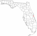
 FLMap-doton-Cocoa.PNG 300 × 295; 12 KB
-
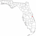
 FLMap-doton-CocoaWest.PNG 300 × 295; 12 KB
-
 FLMap-doton-IndianHarbourBeach.PNG 300 × 295; 12 KB
-
 FLMap-doton-Indiatlantic.PNG 300 × 295; 12 KB
-
 FLMap-doton-Malabar.PNG 300 × 295; 12 KB
-
 FLMap-doton-Melbourne.png 300 × 295; 12 KB
-
 FLMap-doton-MelbourneBeach.PNG 300 × 295; 12 KB
-
 FLMap-doton-MerrittIsland.PNG 300 × 295; 12 KB
-
 FLMap-doton-Micco.PNG 300 × 295; 12 KB
-
 FLMap-doton-Mims.PNG 300 × 295; 12 KB
-
 FLMap-doton-PalmBay.png 300 × 295; 12 KB
-
 FLMap-doton-PalmShores.PNG 300 × 295; 12 KB
-
 FLMap-doton-PortStJohn.PNG 300 × 295; 12 KB
-
 FLMap-doton-Rockledge.PNG 300 × 295; 12 KB
-
 FLMap-doton-SatelliteBeach.PNG 300 × 295; 12 KB
-
 FLMap-doton-Scottsmoor.png 300 × 295; 12 KB
-
 FLMap-doton-Sharpes.PNG 300 × 295; 12 KB
-
 FLMap-doton-SouthPatrickShores.PNG 300 × 295; 12 KB
-
 FLMap-doton-Titusville.PNG 300 × 295; 12 KB
-
 FLMap-doton-WestMelbourne.PNG 300 × 295; 12 KB


