Category:Locator maps of counties of Georgia (U.S. state)
Jump to navigation
Jump to search

States of the United States: Alabama · Alaska · Arizona · Arkansas · California · Colorado · Connecticut · Delaware · Florida · Georgia · Hawaii · Idaho · Illinois · Indiana · Iowa · Kansas · Kentucky · Louisiana · Maine · Maryland · Massachusetts · Michigan · Minnesota · Mississippi · Missouri · Montana · Nebraska · Nevada · New Hampshire · New Jersey · New Mexico · New York · North Carolina · North Dakota · Ohio · Oklahoma · Oregon · Pennsylvania · Rhode Island · South Carolina · South Dakota · Tennessee · Texas · Utah · Vermont · Virginia · Washington · West Virginia · Wisconsin · Wyoming
| NO WIKIDATA ID FOUND! Search for Locator maps of counties of Georgia (U.S. state) on Wikidata | |
| Upload media |
English: Locator maps for counties in Georgia (U.S. state).
Media in category "Locator maps of counties of Georgia (U.S. state)"
The following 200 files are in this category, out of 325 total.
(previous page) (next page)-
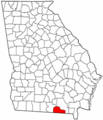
 Appling County Georgia.png 258 × 300; 16 KB
-
 Atkinson County Georgia.png 258 × 300; 14 KB
-
 Bacon County Georgia.png 258 × 300; 15 KB
-
 Baker County Georgia.png 258 × 300; 16 KB
-
 Baldwin County Georgia.png 258 × 300; 16 KB
-
 Banks County Georgia.png 258 × 300; 16 KB
-
 Barrow County Georgia.png 258 × 300; 16 KB
-
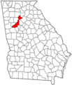
 Bartow County Georgia.png 258 × 300; 15 KB
-
 Ben Hill County Georgia.png 258 × 300; 16 KB
-
 Berrien County Georgia.png 258 × 300; 16 KB
-
 Bibb County Georgia.png 258 × 300; 16 KB
-
 Bleckley County Georgia.png 258 × 300; 16 KB
-
 Brantley County Georgia.png 258 × 300; 16 KB
-
 Brooks County Georgia.png 258 × 300; 16 KB
-
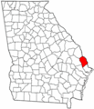
 Bryan County Georgia.png 258 × 300; 17 KB
-
 Bulloch County Georgia.png 258 × 300; 17 KB
-
 Burke County Georgia.png 258 × 300; 15 KB
-
 Butts County Georgia.png 258 × 300; 14 KB
-
 Calhoun County Georgia.png 258 × 300; 16 KB
-
 Camden County Georgia.png 258 × 300; 15 KB
-
 Campbell County Georgia.png 258 × 300; 19 KB
-
 Candler County Georgia.png 258 × 300; 16 KB
-
 Carroll County Georgia.png 258 × 300; 16 KB
-
 Catoosa County Georgia.png 258 × 300; 15 KB
-
 Charlton County Georgia.png 258 × 300; 15 KB
-
 Chatham County Georgia.png 258 × 300; 16 KB
-
 Chattahoochee County Georgia.png 258 × 300; 16 KB
-
 Chattooga County Georgia.png 258 × 300; 16 KB
-
 Cherokee County Georgia.png 258 × 300; 16 KB
-
 Clarke County Georgia.png 258 × 300; 14 KB
-
 Clay County Georgia.png 258 × 300; 16 KB
-
 Clayton County Georgia.png 258 × 300; 16 KB
-
 Clinch County Georgia.png 258 × 300; 16 KB
-
 Cobb County Georgia.png 258 × 300; 15 KB
-
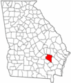
 Coffee County Georgia.png 258 × 300; 16 KB
-
 Colquitt County Georgia.png 258 × 300; 16 KB
-
 Columbia County Georgia.png 258 × 300; 16 KB
-
 Cook County Georgia.png 258 × 300; 16 KB
-
 Coweta County Georgia.png 258 × 300; 16 KB
-
 Crawford County Georgia.png 258 × 300; 16 KB
-
 Crisp County Georgia.png 258 × 300; 16 KB
-
 Dade County Georgia.png 258 × 300; 16 KB
-
 Dawson County Georgia.png 258 × 300; 14 KB
-
 Decatur County Georgia.png 258 × 300; 15 KB
-
 Dekalb County Georgia.png 258 × 300; 14 KB
-
 Dodge County Georgia.png 258 × 300; 15 KB
-
 Dooly County Georgia.png 258 × 300; 16 KB
-
 Dougherty County Georgia.png 258 × 300; 16 KB
-
 Douglas County Georgia.png 258 × 300; 15 KB
-
 Early County Georgia.png 258 × 300; 15 KB
-
 Echols County Georgia.png 258 × 300; 16 KB
-
 Effingham County Georgia.png 258 × 300; 17 KB
-
 Elbert County Georgia.png 258 × 300; 16 KB
-
 Emanuel County Georgia.png 258 × 300; 16 KB
-
 Evans County Georgia.png 258 × 300; 16 KB
-
 Fannin County Georgia.png 258 × 300; 16 KB
-
 Fayette County Georgia.png 258 × 300; 14 KB
-
 Floyd County Georgia.png 258 × 300; 17 KB
-
 Forsyth County Georgia.png 258 × 300; 16 KB
-
 Franklin County Georgia.png 258 × 300; 14 KB
-
 Fulton County Georgia.png 258 × 300; 16 KB
-
 GAMap-doton-Albany.PNG 258 × 300; 19 KB
-
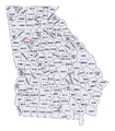 Georgia (U.S. state) counties map.png 817 × 937; 198 KB
-
 Georgia Locator Map with US.PNG 302 × 346; 19 KB
-
 Georgia Locator Map.PNG 298 × 342; 14 KB
-
 Gilmer County Georgia.png 258 × 300; 16 KB
-
 Glascock County Georgia.png 258 × 300; 16 KB
-
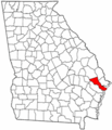
 Glynn County Georgia.png 258 × 300; 17 KB
-
 Gordon County Georgia.png 258 × 300; 16 KB
-
 Grady County Georgia.png 258 × 300; 16 KB
-
 Greene County Georgia.png 258 × 300; 16 KB
-
 Gwinnett County Georgia.png 258 × 300; 16 KB
-
 Habersham County Georgia.png 258 × 300; 16 KB
-
 Hall County Georgia.png 258 × 300; 17 KB
-
 Hancock County Georgia.png 258 × 300; 16 KB
-
 Haralson County Georgia.png 258 × 300; 16 KB
-
 Harris County Georgia.png 258 × 300; 14 KB
-
 Hart County Georgia.png 258 × 300; 15 KB
-
 Heard County Georgia.png 258 × 300; 16 KB
-
 Henry County Georgia.png 258 × 300; 16 KB
-
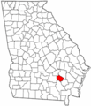
 Houston County Georgia.png 258 × 300; 16 KB
-
 Irwin County Georgia.png 258 × 300; 16 KB
-
 Jackson County Georgia.png 258 × 300; 16 KB
-
 Jasper County Georgia.png 258 × 300; 16 KB
-
 Jeff Davis County Georgia.png 258 × 300; 14 KB
-
 Jefferson County Georgia.png 258 × 300; 16 KB
-
 Jenkins County Georgia.png 258 × 300; 16 KB
-
 Johnson County Georgia.png 258 × 300; 17 KB
-
 Jones County Georgia.png 258 × 300; 16 KB
-
 Lamar County Georgia.png 258 × 300; 16 KB
-
 Lanier County Georgia.png 258 × 300; 15 KB
-
 Laurens County Georgia.png 258 × 300; 16 KB
-
 Lee County Georgia.png 258 × 300; 16 KB
-
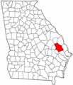
 Liberty County Georgia.png 258 × 300; 17 KB
-
 Lincoln County Georgia.png 258 × 300; 15 KB
-
 Florence marina locator.png 258 × 300; 52 KB
-
 Long County Georgia.png 258 × 300; 16 KB
-
 Lowndes County Georgia.png 258 × 300; 17 KB
-
 Lumpkin County Georgia.png 258 × 300; 15 KB
-
 Macon County Georgia.png 258 × 300; 17 KB
-
 Madison County Georgia.png 258 × 300; 16 KB
-
 Map of Georgia highlighting Appling County.svg 4,437 × 5,142; 432 KB
-
 Map of Georgia highlighting Atkinson County.svg 4,437 × 5,142; 432 KB
-
 Map of Georgia highlighting Bacon County.svg 4,437 × 5,142; 432 KB
-
 Map of Georgia highlighting Baker County.svg 4,437 × 5,142; 432 KB
-
 Map of Georgia highlighting Baldwin County.svg 4,437 × 5,142; 432 KB
-
 Map of Georgia highlighting Banks County.svg 4,437 × 5,142; 432 KB
-
 Map of Georgia highlighting Barrow County.svg 4,437 × 5,142; 432 KB
-
 Map of Georgia highlighting Bartow County.svg 4,437 × 5,142; 432 KB
-
 Map of Georgia highlighting Ben Hill County.svg 4,437 × 5,142; 432 KB
-
 Map of Georgia highlighting Berrien County.svg 4,437 × 5,142; 432 KB
-
 Map of Georgia highlighting Bibb County.svg 4,437 × 5,142; 432 KB
-
 Map of Georgia highlighting Bleckley County.svg 4,437 × 5,142; 432 KB
-
 Map of Georgia highlighting Brantley County.svg 4,437 × 5,142; 432 KB
-
 Map of Georgia highlighting Brooks County.svg 4,437 × 5,142; 432 KB
-
 Map of Georgia highlighting Bryan County.svg 4,437 × 5,142; 432 KB
-
 Map of Georgia highlighting Bulloch County.svg 4,437 × 5,142; 432 KB
-
 Map of Georgia highlighting Burke County.svg 4,437 × 5,142; 432 KB
-
 Map of Georgia highlighting Butts County.svg 4,437 × 5,142; 432 KB
-
 Map of Georgia highlighting Calhoun County.svg 4,437 × 5,142; 432 KB
-
 Map of Georgia highlighting Camden County.svg 4,437 × 5,142; 432 KB
-
 Map of Georgia highlighting Candler County.svg 4,437 × 5,142; 432 KB
-
 Map of Georgia highlighting Carroll County.svg 4,437 × 5,142; 432 KB
-
 Map of Georgia highlighting Catoosa County.svg 4,437 × 5,142; 432 KB
-
 Map of Georgia highlighting Charlton County.svg 4,437 × 5,142; 432 KB
-
 Map of Georgia highlighting Chatham County.svg 4,437 × 5,142; 432 KB
-
 Map of Georgia highlighting Chattahoochee County.svg 4,437 × 5,142; 432 KB
-
 Map of Georgia highlighting Chattooga County.svg 4,437 × 5,142; 432 KB
-
 Map of Georgia highlighting Cherokee County.svg 4,437 × 5,142; 432 KB
-
 Map of Georgia highlighting Clarke County.svg 4,437 × 5,142; 432 KB
-
 Map of Georgia highlighting Clay County.svg 4,437 × 5,142; 432 KB
-
 Map of Georgia highlighting Clayton County.svg 4,437 × 5,142; 432 KB
-
 Map of Georgia highlighting Clinch County.svg 4,437 × 5,142; 432 KB
-
 Map of Georgia highlighting Cobb County.svg 4,437 × 5,142; 432 KB
-
 Map of Georgia highlighting Coffee County.svg 4,437 × 5,142; 432 KB
-
 Map of Georgia highlighting Colquitt County.svg 4,437 × 5,142; 432 KB
-
 Map of Georgia highlighting Columbia County.svg 4,437 × 5,142; 432 KB
-
 Map of Georgia highlighting Cook County.svg 4,437 × 5,142; 432 KB
-
 Map of Georgia highlighting Coweta County.svg 4,437 × 5,142; 432 KB
-
 Map of Georgia highlighting Crawford County.svg 4,437 × 5,142; 432 KB
-
 Map of Georgia highlighting Crisp County.svg 4,437 × 5,142; 432 KB
-
 Map of Georgia highlighting Dade County.svg 4,437 × 5,142; 432 KB
-
 Map of Georgia highlighting Dawson County.svg 4,437 × 5,142; 432 KB
-
 Map of Georgia highlighting Decatur County.svg 4,437 × 5,142; 432 KB
-
 Map of Georgia highlighting DeKalb County.svg 4,437 × 5,142; 432 KB
-
 Map of Georgia highlighting Dodge County.svg 4,437 × 5,142; 432 KB
-
 Map of Georgia highlighting Dooly County.svg 4,437 × 5,142; 432 KB
-
 Map of Georgia highlighting Dougherty County.svg 4,437 × 5,142; 432 KB
-
 Map of Georgia highlighting Douglas County.svg 4,437 × 5,142; 432 KB
-
 Map of Georgia highlighting Early County.svg 4,437 × 5,142; 432 KB
-
 Map of Georgia highlighting Echols County.svg 4,437 × 5,142; 432 KB
-
 Map of Georgia highlighting Effingham County.svg 4,437 × 5,142; 432 KB
-
 Map of Georgia highlighting Elbert County.svg 4,437 × 5,142; 432 KB
-
 Map of Georgia highlighting Emanuel County.svg 4,437 × 5,142; 432 KB
-
 Map of Georgia highlighting Evans County.svg 4,437 × 5,142; 432 KB
-
 Map of Georgia highlighting Fannin County.svg 4,437 × 5,142; 432 KB
-
 Map of Georgia highlighting Fayette County.svg 4,437 × 5,142; 432 KB
-
 Map of Georgia highlighting Floyd County.svg 4,437 × 5,142; 432 KB
-
 Map of Georgia highlighting Forsyth County.svg 4,437 × 5,142; 432 KB
-
 Map of Georgia highlighting Franklin County.svg 4,437 × 5,142; 432 KB
-
 Map of Georgia highlighting Fulton County.svg 4,437 × 5,142; 432 KB
-
 Map of Georgia highlighting Gilmer County.svg 4,437 × 5,142; 432 KB
-
 Map of Georgia highlighting Glascock County.svg 4,437 × 5,142; 432 KB
-
 Map of Georgia highlighting Glynn County.svg 4,437 × 5,142; 432 KB
-
 Map of Georgia highlighting Gordon County.svg 4,437 × 5,142; 432 KB
-
 Map of Georgia highlighting Grady County.svg 4,437 × 5,142; 432 KB
-
 Map of Georgia highlighting Greene County.svg 4,437 × 5,142; 432 KB
-
 Map of Georgia highlighting Gwinnett County.svg 4,437 × 5,142; 432 KB
-
 Map of Georgia highlighting Habersham County.svg 4,437 × 5,142; 432 KB
-
 Map of Georgia highlighting Hall County.svg 4,437 × 5,142; 432 KB
-
 Map of Georgia highlighting Hancock County.svg 4,437 × 5,142; 432 KB
-
 Map of Georgia highlighting Haralson County.svg 4,437 × 5,142; 432 KB
-
 Map of Georgia highlighting Harris County.svg 4,437 × 5,142; 432 KB
-
 Map of Georgia highlighting Hart County.svg 4,437 × 5,142; 432 KB
-
 Map of Georgia highlighting Heard County.svg 4,437 × 5,142; 432 KB
-
 Map of Georgia highlighting Henry County.svg 4,437 × 5,142; 432 KB
-
 Map of Georgia highlighting Houston County.svg 4,437 × 5,142; 432 KB
-
 Map of Georgia highlighting Irwin County.svg 4,437 × 5,142; 432 KB
-
 Map of Georgia highlighting Jackson County.svg 4,437 × 5,142; 432 KB
-
 Map of Georgia highlighting Jasper County.svg 4,437 × 5,142; 432 KB
-
 Map of Georgia highlighting Jeff Davis County.svg 4,437 × 5,142; 432 KB
-
 Map of Georgia highlighting Jefferson County.svg 4,437 × 5,142; 432 KB
-
 Map of Georgia highlighting Jenkins County.svg 4,437 × 5,142; 432 KB
-
 Map of Georgia highlighting Johnson County.svg 4,437 × 5,142; 432 KB
-
 Map of Georgia highlighting Jones County.svg 4,437 × 5,142; 432 KB
-
 Map of Georgia highlighting Lamar County.svg 4,437 × 5,142; 432 KB
-
 Map of Georgia highlighting Lanier County.svg 4,437 × 5,142; 432 KB
-
 Map of Georgia highlighting Laurens County.svg 4,437 × 5,142; 432 KB
-
 Map of Georgia highlighting Lee County.svg 4,437 × 5,142; 432 KB
-
 Map of Georgia highlighting Liberty County.svg 4,437 × 5,142; 432 KB
-
 Map of Georgia highlighting Lincoln County.svg 4,437 × 5,142; 432 KB
-
 Map of Georgia highlighting Long County.svg 4,437 × 5,142; 432 KB
-
 Map of Georgia highlighting Lowndes County.svg 4,437 × 5,142; 432 KB
-
 Map of Georgia highlighting Lumpkin County.svg 4,437 × 5,142; 432 KB
-
 Map of Georgia highlighting Macon County.svg 4,437 × 5,142; 432 KB
-
 Map of Georgia highlighting Madison County.svg 4,437 × 5,142; 432 KB
-
 Map of Georgia highlighting Marion County.svg 4,437 × 5,142; 432 KB
-
 Map of Georgia highlighting McDuffie County.svg 4,437 × 5,142; 432 KB
-
 Map of Georgia highlighting McIntosh County.svg 4,437 × 5,142; 432 KB
-
 Map of Georgia highlighting Meriwether County.svg 4,437 × 5,142; 432 KB


_counties_map.png)


&filefrom=Map+of+Georgia+highlighting+Miller+County.svg#mw-category-media)