Category:Mapledurham
Jump to navigation
Jump to search
village and civil parish in South Oxfordshire district, Oxfordshire, England | |||||
| Upload media | |||||
| Instance of | |||||
|---|---|---|---|---|---|
| Location | South Oxfordshire, Oxfordshire, South East England, England | ||||
| Located in or next to body of water | |||||
| Area |
| ||||
| Said to be the same as | Mapledurham (Wikimedia duplicated page, civil parish) | ||||
 | |||||
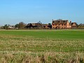
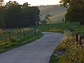
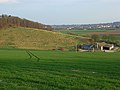
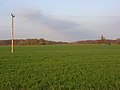
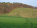
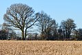
English: Mapledurham is a small village, civil parish and country estate beside the River Thames in Oxfordshire. The parish includes the hamlets of Trench Green and Chazey Heath in the Chiltern Hills above the village.
Subcategories
This category has the following 10 subcategories, out of 10 total.
A
- Mapledurham Almshouse (2 F)
- Appletree Eyot (6 F)
C
H
L
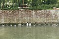
- Mapledurham Lock (19 F)
M
P
- Poplar Island, River Thames (2 F)
S
T
- Trench Green (15 F)
W
- Mapledurham Watermill (13 F)
Media in category "Mapledurham"
The following 200 files are in this category, out of 430 total.
(previous page) (next page)-
 'Decmar', Tinker's Green - geograph.org.uk - 2675975.jpg 1,024 × 683; 158 KB
-
 'Three Chimneys', Jacksons Lane - geograph.org.uk - 3906949.jpg 1,024 × 683; 252 KB
-
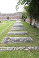 A line of Tombs - geograph.org.uk - 4244711.jpg 533 × 800; 147 KB
-

-
 Across the front - geograph.org.uk - 4673220.jpg 1,024 × 683; 118 KB
-
 Across the North Side - geograph.org.uk - 4673165.jpg 1,024 × 683; 128 KB
-

-
 Ales, Stout and Porter - geograph.org.uk - 3448500.jpg 3,968 × 2,232; 1.98 MB
-
 Almshouses in Mapledurham - geograph.org.uk - 4673256.jpg 1,024 × 683; 170 KB
-
 Along the Wall - geograph.org.uk - 4244709.jpg 1,024 × 683; 188 KB
-
 Altar in St Margaret - geograph.org.uk - 4250688.jpg 533 × 800; 95 KB
-
 Apples ^ Chimneys, Mapledurham - geograph.org.uk - 3670817.jpg 1,600 × 1,188; 684 KB
-
 AppleTree Eyot - geograph.org.uk - 1095949.jpg 640 × 426; 84 KB
-
 Appletree Eyot - geograph.org.uk - 3954340.jpg 640 × 430; 63 KB
-
 Appletree Eyot - geograph.org.uk - 8197.jpg 640 × 431; 91 KB
-
 Approaching Bottom Farm - geograph.org.uk - 856955.jpg 420 × 640; 77 KB
-
 Approaching Scours Lane - geograph.org.uk - 609857.jpg 640 × 477; 104 KB
-
 Arable crop field south of Hodmore Farm - geograph.org.uk - 2717218.jpg 3,648 × 2,736; 1.85 MB
-
 Back of the Mill - geograph.org.uk - 4669877.jpg 1,024 × 683; 157 KB
-
 Back of the Mill - geograph.org.uk - 4672036.jpg 1,024 × 683; 236 KB
-
 Bardolf Hatchment - geograph.org.uk - 4252024.jpg 1,024 × 683; 117 KB
-
 Barns at Bottom Farm, Mapledurham - geograph.org.uk - 427052.jpg 640 × 480; 159 KB
-
 Beech, oak and ash - geograph.org.uk - 858542.jpg 640 × 427; 72 KB
-

-
 Benchmark on Corner Cottage - geograph.org.uk - 2676159.jpg 1,024 × 683; 215 KB
-
 Benchmark on former church hall, Bardolphs Close - geograph.org.uk - 2676240.jpg 683 × 1,024; 224 KB
-
 Benchmark on The Pack Saddle inn - geograph.org.uk - 2677273.jpg 1,024 × 683; 234 KB
-
 Benchmark on The Packhorse - geograph.org.uk - 2675954.jpg 683 × 1,024; 225 KB
-
 Blade in the Distance - geograph.org.uk - 4672591.jpg 1,024 × 683; 162 KB
-
 Blount Memorial - geograph.org.uk - 4252027.jpg 533 × 800; 80 KB
-
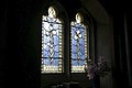 Blue Glass - geograph.org.uk - 4249584.jpg 1,024 × 683; 106 KB
-
 Bluebell wood, Mapledurham, Oxfordshire - geograph.org.uk - 4444814.jpg 800 × 751; 339 KB
-
 Boat near the lock - geograph.org.uk - 4673280.jpg 1,024 × 683; 214 KB
-
 Boats near the Lock - geograph.org.uk - 4673278.jpg 1,024 × 683; 193 KB
-
 Bottom Farm - geograph.org.uk - 2311897.jpg 2,272 × 1,704; 2.08 MB
-
 Bottom Farm - geograph.org.uk - 3252496.jpg 2,560 × 1,920; 1.28 MB
-
 Bricks ^ Manure, That'll Fix It - geograph.org.uk - 3634538.jpg 2,169 × 1,539; 1.2 MB
-
 Bridleway north of Cross Lanes - geograph.org.uk - 348530.jpg 640 × 477; 150 KB
-
 Bridleway to Park Farm - geograph.org.uk - 1234325.jpg 640 × 480; 258 KB
-
 Bridleway, Nuney Green, Oxfordshire - geograph.org.uk - 4807076.jpg 5,788 × 3,909; 7.81 MB
-
 Bums in the Air - geograph.org.uk - 4673274.jpg 1,024 × 683; 190 KB
-
 By New Farm - geograph.org.uk - 3011148.jpg 2,272 × 1,704; 2.35 MB
-
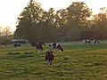 Cattle, Mapledurham - geograph.org.uk - 427180.jpg 640 × 480; 141 KB
-
 Caversham Heath Golf Course 18th green and 1st tee - geograph.org.uk - 2719239.jpg 3,648 × 2,736; 1.86 MB
-
 Caversham Heath Golf Course 2nd fairway and tee - geograph.org.uk - 2719269.jpg 3,648 × 2,736; 2.95 MB
-
 Caversham Heath Golf Course the 15th fairway - geograph.org.uk - 2717866.jpg 3,648 × 2,736; 2.24 MB
-
 Caversham Heath Golf Course the 4th fairway and green - geograph.org.uk - 2718385.jpg 3,648 × 2,736; 1.82 MB
-
 Caversham Heath Golf Course, the path beside the 3rd tee - geograph.org.uk - 2719282.jpg 3,648 × 2,736; 2.15 MB
-
 Central part of the Weir - geograph.org.uk - 4671307.jpg 1,024 × 683; 150 KB
-
 Chancel Ceiling - geograph.org.uk - 4252041.jpg 533 × 800; 125 KB
-
 Chancel ^ Altar - geograph.org.uk - 4250682.jpg 533 × 800; 94 KB
-
 Chazey Wood and King's Hill - geograph.org.uk - 858638.jpg 640 × 427; 92 KB
-
 Chiltern Way bridleway - geograph.org.uk - 858502.jpg 427 × 640; 95 KB
-
 Church hall on Rokeby Drive converted to house - geograph.org.uk - 2676252.jpg 683 × 1,024; 187 KB
-
 Church of St Margaret and Bardolf Aisle - geograph.org.uk - 3307822.jpg 3,648 × 2,736; 2.22 MB
-
 Clock on St Margaret - geograph.org.uk - 4243936.jpg 533 × 800; 176 KB
-
 Clubhouse and first tee Caversham Heath Golf Course - geograph.org.uk - 2717227.jpg 3,648 × 2,736; 2.13 MB
-
 Coat of Arms on the Entrance - geograph.org.uk - 4673148.jpg 1,024 × 683; 193 KB
-
 Former chapel, Tokers Green - geograph.org.uk - 701906.jpg 640 × 482; 340 KB
-
 Corner Cottage, Rokeby Drive - geograph.org.uk - 2676182.jpg 1,024 × 683; 233 KB
-
 Cornfield near Tinkers Green - geograph.org.uk - 26742.jpg 640 × 480; 548 KB
-
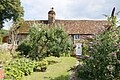 Cottage in Mapledurham - geograph.org.uk - 4673254.jpg 1,024 × 683; 263 KB
-
 Cottage on Jacksons Lane - geograph.org.uk - 3009857.jpg 2,272 × 1,704; 2.53 MB
-
 Cottage ^ Creeper - geograph.org.uk - 3670805.jpg 1,600 × 1,164; 636 KB
-
 Couple of Flowers - geograph.org.uk - 4673146.jpg 1,024 × 683; 141 KB
-
 Cow ^ Conservatory, Mapledurham - geograph.org.uk - 3250136.jpg 1,600 × 1,194; 416 KB
-
 Cross by the Aisle - geograph.org.uk - 4244901.jpg 533 × 800; 142 KB
-
 Cross Farm - geograph.org.uk - 9182.jpg 640 × 418; 104 KB
-
 Dead Wood by the Path - geograph.org.uk - 3705493.jpg 1,600 × 1,200; 711 KB
-
 Deadly pond claims another victim - geograph.org.uk - 2719297.jpg 3,648 × 2,736; 1.74 MB
-
 Delta Force Paintball structure in Chazey Wood - geograph.org.uk - 3906933.jpg 1,024 × 683; 303 KB
-
 Display on the Eagle - geograph.org.uk - 4249503.jpg 1,024 × 683; 158 KB
-
 Door ^ Quinces, Mapledurham - geograph.org.uk - 3670827.jpg 1,600 × 1,151; 874 KB
-
 Downland, Mapledurham - geograph.org.uk - 427064.jpg 640 × 480; 107 KB
-
 Downland, Mapledurham - geograph.org.uk - 427098.jpg 640 × 480; 159 KB
-
 Driver T.F.Gimblett - geograph.org.uk - 4244707.jpg 533 × 800; 106 KB
-
 East towards Mapledurham - geograph.org.uk - 924873.jpg 640 × 427; 191 KB
-
 Edwardian postbox - geograph.org.uk - 858528.jpg 427 × 640; 103 KB
-
 Egyptian Geese - geograph.org.uk - 4671319.jpg 1,024 × 768; 186 KB
-
 Egyptian geese - geograph.org.uk - 4673293.jpg 1,024 × 683; 182 KB
-
 Electrical supply hut - geograph.org.uk - 858717.jpg 640 × 427; 100 KB
-
 End of the Village - geograph.org.uk - 4673260.jpg 1,024 × 683; 192 KB
-
 End of the Weir - geograph.org.uk - 4671318.jpg 1,024 × 683; 170 KB
-
 Entrance to Purley Gardens Moorings - geograph.org.uk - 4500664.jpg 640 × 427; 417 KB
-
 Entrance to Whittles Farm - geograph.org.uk - 2717211.jpg 3,648 × 2,736; 1.94 MB
-
 Eyots in the River Thames near Reading - geograph.org.uk - 3590871.jpg 800 × 600; 156 KB
-
 Face of Old Father Thames - geograph.org.uk - 4673228.jpg 1,024 × 768; 170 KB
-
 Fairway and houses, Mapledurham - geograph.org.uk - 2333123.jpg 640 × 480; 121 KB
-
 Farm buildings, Mapledurham - geograph.org.uk - 6117306.jpg 1,024 × 768; 249 KB
-
 Farm road, Mapledurham - geograph.org.uk - 427199.jpg 640 × 480; 118 KB
-
 Farm road, Mapledurham - geograph.org.uk - 756471.jpg 480 × 640; 158 KB
-
 Farmland and grain store, Mapledurham - geograph.org.uk - 756476.jpg 640 × 480; 125 KB
-
 Farmland at Bottom Shaw - geograph.org.uk - 856966.jpg 640 × 427; 78 KB
-
 Farmland at Mapledurham - geograph.org.uk - 241681.jpg 640 × 480; 114 KB
-
 Farmland at Rose Farm - geograph.org.uk - 858706.jpg 640 × 427; 81 KB
-
 Farmland from the bridleway - geograph.org.uk - 858507.jpg 640 × 414; 91 KB
-
 Farmland, Mapledurham - geograph.org.uk - 2331628.jpg 640 × 480; 160 KB
-
 Farmland, Mapledurham - geograph.org.uk - 427150.jpg 480 × 640; 193 KB
-
 Farmland, Mapledurham - geograph.org.uk - 6108179.jpg 1,024 × 768; 215 KB
-
 Farmland, Mapledurham - geograph.org.uk - 756466.jpg 640 × 480; 106 KB
-
 Farmland, Mapledurham - geograph.org.uk - 756479.jpg 640 × 480; 135 KB
-
 Farmland, Mapledurham, Oxfordshire - geograph.org.uk - 4816314.jpg 2,519 × 1,519; 2.06 MB
-
 Field boundary, Cross Lanes, Oxfordshire - geograph.org.uk - 4816303.jpg 2,697 × 1,789; 4.38 MB
-
 Field near Mapledurham - geograph.org.uk - 4673294.jpg 1,024 × 683; 134 KB
-
-
 Flowers in the Corner - geograph.org.uk - 4250897.jpg 533 × 800; 85 KB
-
 Flowers in the mug - geograph.org.uk - 4249587.jpg 1,024 × 683; 116 KB
-
 Flowers near the Window - geograph.org.uk - 4251921.jpg 1,024 × 683; 132 KB
-
 Flowers round the Tomb - geograph.org.uk - 4248755.jpg 1,024 × 683; 209 KB
-
 Flowers under the cross - geograph.org.uk - 4249582.jpg 533 × 800; 55 KB
-
 Folly in the Corner - geograph.org.uk - 4673160.jpg 1,024 × 683; 172 KB
-
 Font and Flag - geograph.org.uk - 4249515.jpg 533 × 800; 85 KB
-
 Footpath across the golf course - geograph.org.uk - 349404.jpg 640 × 477; 110 KB
-
 Footpath and pasture, Mapledurham - geograph.org.uk - 2333113.jpg 640 × 480; 151 KB
-
 Footpath at Hodmore Farm - geograph.org.uk - 348524.jpg 640 × 477; 103 KB
-
 Footpath through the crops - geograph.org.uk - 3011160.jpg 2,272 × 1,704; 2.2 MB
-
 Footpath to Cane End - geograph.org.uk - 349313.jpg 640 × 477; 122 KB
-
 Footpath to Hodmore Farm - geograph.org.uk - 348518.jpg 640 × 477; 135 KB
-
 Footpath to Hodmore Farm - geograph.org.uk - 348520.jpg 640 × 477; 105 KB
-
 Gate to the Church - geograph.org.uk - 4243877.jpg 1,024 × 683; 230 KB
-
 Gate to the house - geograph.org.uk - 4244888.jpg 533 × 800; 135 KB
-
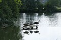 Geese on a Plank - geograph.org.uk - 4669874.jpg 1,024 × 683; 156 KB
-
 Geese on the Island - geograph.org.uk - 4671079.jpg 1,024 × 683; 227 KB
-
 Geese on the Weir - geograph.org.uk - 4671308.jpg 1,024 × 683; 155 KB
-
 Geese under the tree - geograph.org.uk - 4673292.jpg 1,024 × 683; 200 KB
-
 Golfers, Tokers Green - geograph.org.uk - 3250112.jpg 3,596 × 2,456; 1.8 MB
-
 Grain chute - geograph.org.uk - 4670950.jpg 533 × 800; 86 KB
-
 Grain storage barn - geograph.org.uk - 353205.jpg 640 × 480; 96 KB
-
 Grain store - geograph.org.uk - 858684.jpg 640 × 422; 86 KB
-
 Grain store, Mapledurham - geograph.org.uk - 756482.jpg 640 × 480; 140 KB
-
 Grass Down The Middle - geograph.org.uk - 3634582.jpg 2,432 × 1,686; 1.51 MB
-
 Graves in the corner - geograph.org.uk - 4248598.jpg 533 × 800; 163 KB
-
 Graves on the West End - geograph.org.uk - 4248767.jpg 1,024 × 683; 203 KB
-
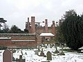 Graveyard of St Margaret's and Mapledurham House - geograph.org.uk - 3307849.jpg 3,648 × 2,736; 1.68 MB
-
 Greendean Farmhouse - geograph.org.uk - 2675765.jpg 1,024 × 683; 188 KB
-
 Harvested field at Mapledurham from Westford Hill - geograph.org.uk - 5271416.jpg 2,288 × 1,712; 710 KB
-

-
 Hidden Weir - geograph.org.uk - 4673295.jpg 1,024 × 768; 217 KB
-
 High Water at the Mill - geograph.org.uk - 3250150.jpg 2,560 × 1,920; 1.63 MB
-
 House ^ Grounds - geograph.org.uk - 4673225.jpg 1,024 × 683; 116 KB
-
 Huntley Wood Cottage - geograph.org.uk - 856923.jpg 640 × 415; 109 KB
-
 In Highland Wood - geograph.org.uk - 349339.jpg 477 × 640; 145 KB
-
 In Highland Wood - geograph.org.uk - 349342.jpg 640 × 477; 148 KB
-
 Jackson's Lane - geograph.org.uk - 2718410.jpg 3,648 × 2,736; 3.26 MB
-
 Jetty on the Bank - geograph.org.uk - 4673283.jpg 1,024 × 683; 240 KB
-
 JoeDaisy Studio - geograph.org.uk - 159507.jpg 250 × 188; 34 KB
-
 Keeping Watch - geograph.org.uk - 4671325.jpg 600 × 800; 105 KB
-
 Kentwood Deeps - geograph.org.uk - 8201.jpg 640 × 431; 135 KB
-
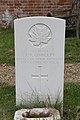
 L. CPL O. A. Robbins - geograph.org.uk - 4244007.jpg 533 × 800; 100 KB
-
 Land at Cross Lanes Farm - geograph.org.uk - 3634576.jpg 1,600 × 1,200; 714 KB
-
 Lane in Nuney Green - geograph.org.uk - 5966071.jpg 1,920 × 1,280; 1.45 MB
-
 Leaving Bottom Wood - geograph.org.uk - 856987.jpg 640 × 427; 73 KB
-
 Left Hand Window - geograph.org.uk - 4250695.jpg 533 × 800; 105 KB
-
 Lilley Farm - geograph.org.uk - 858724.jpg 640 × 427; 60 KB
-
 List of Contributors - geograph.org.uk - 4249499.jpg 533 × 800; 110 KB
-
 Looking at the House - geograph.org.uk - 4252057.jpg 1,024 × 683; 261 KB
-
 Looking at the Weir - geograph.org.uk - 4673275.jpg 1,024 × 683; 171 KB
-
 Looking towards Lilley Farm - geograph.org.uk - 3307719.jpg 3,566 × 2,640; 1.91 MB
-
 Looking up the Tower - geograph.org.uk - 4248592.jpg 533 × 800; 131 KB
-
 Lots of Geese - geograph.org.uk - 4672376.jpg 1,024 × 683; 201 KB
-
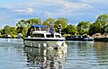 Maggie May heads West on the Thames - geograph.org.uk - 6169295.jpg 3,389 × 2,166; 2.21 MB
-
 Magnolias on the House - geograph.org.uk - 4673142.jpg 1,024 × 683; 245 KB
-
 Major Cecil Alfred Orton - geograph.org.uk - 4243997.jpg 533 × 800; 139 KB
-

-
 The Lodge, Mapledurham - geograph.org.uk - 858519.jpg 640 × 420; 79 KB
-
 Mapledurham Church and House - geograph.org.uk - 4500661.jpg 640 × 480; 390 KB
-
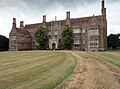
 Mapledurham House - geograph.org.uk - 2343175.jpg 640 × 426; 66 KB
-
 Mapledurham House - geograph.org.uk - 4567653.jpg 2,000 × 1,490; 1.5 MB
-
 Mapledurham House - geograph.org.uk - 4672594.jpg 1,024 × 683; 153 KB
-
 Mapledurham House - geograph.org.uk - 6124499.jpg 4,097 × 1,791; 2.68 MB
-
 Mapledurham House - geograph.org.uk - 6126767.jpg 3,618 × 2,029; 2.12 MB
-
 Mapledurham House and church - geograph.org.uk - 3011152.jpg 3,648 × 2,736; 4.57 MB
-
 Mapledurham House and St Margaret's church - geograph.org.uk - 6124994.jpg 3,675 × 1,997; 1.51 MB
-
 Mapledurham House through the churchyard, Oxfordshire - geograph.org.uk - 1843009.jpg 1,200 × 1,600; 578 KB
-
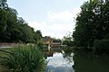
 Mapledurham Lock - geograph.org.uk - 4671311.jpg 1,024 × 683; 167 KB
-
 Mapledurham Lock - geograph.org.uk - 5906704.jpg 4,091 × 1,794; 2.18 MB
-
 Mapledurham mill - geograph.org.uk - 3011155.jpg 2,272 × 1,704; 2.9 MB
-
 Mapledurham Mill - geograph.org.uk - 4500660.jpg 640 × 480; 462 KB
-
 Mapledurham Mill - geograph.org.uk - 4672046.jpg 1,024 × 683; 198 KB
-
 Mapledurham Mill - geograph.org.uk - 6125675.jpg 3,323 × 2,209; 2.66 MB
-
 Mapledurham Village (geograph 4673265).jpg 1,024 × 683; 173 KB
-
 Mapledurham Village with Alms Houses - geograph.org.uk - 159511.jpg 450 × 265; 62 KB
-
 Mapledurham Watermill - geograph.org.uk - 2343180.jpg 640 × 425; 100 KB
-
 Mapledurham Weir - geograph.org.uk - 4669870.jpg 1,024 × 683; 174 KB
-
 Mapledurham Weir - geograph.org.uk - 8204.jpg 640 × 431; 111 KB
-
 Mapledurham weir, with a view of the mill - geograph.org.uk - 5908123.jpg 3,730 × 1,968; 1.87 MB
-
 Men of Mapledurham - geograph.org.uk - 4252052.jpg 533 × 800; 87 KB
-
 Mill Farmhouse - geograph.org.uk - 3307712.jpg 3,042 × 2,531; 1.27 MB
-
 Millstream at Mapledurham - geograph.org.uk - 4669880.jpg 1,024 × 683; 144 KB
-
 Missing Wheel - geograph.org.uk - 4670944.jpg 1,024 × 683; 108 KB
-
 Mixed woodland - geograph.org.uk - 2311898.jpg 2,272 × 1,704; 3.46 MB
-
 Moorings above Mapledurham - geograph.org.uk - 924911.jpg 640 × 427; 182 KB
-
 Narrowboats at Hardwick Estate - 2 - geograph.org.uk - 5637966.jpg 3,323 × 2,209; 2.3 MB
-
 Narrowboats at Hardwick Estate - geograph.org.uk - 5637962.jpg 3,323 × 2,209; 2.79 MB
-
 New Trees in Bardolph's Wood - geograph.org.uk - 3427891.jpg 3,968 × 2,232; 2.17 MB
-
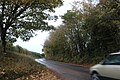
 Newell's Lane - geograph.org.uk - 349395.jpg 640 × 477; 95 KB
-
 Noke End Shaw - geograph.org.uk - 8231.jpg 640 × 431; 109 KB
-
 North side of the House - geograph.org.uk - 4673162.jpg 1,024 × 683; 145 KB
-
 Nuney Wood - geograph.org.uk - 2311894.jpg 1,704 × 2,272; 3.26 MB
-
 Nuney Wood - geograph.org.uk - 3250242.jpg 2,560 × 1,920; 2.54 MB


.jpg)


