Category:Maps made in the 15th century
Jump to navigation
Jump to search
Subcategories
This category has the following 26 subcategories, out of 26 total.
*
-
- 15th-century fortress plans (1 F)
1
- 15th-century celestial maps (1 F)
C
- Ulm Ptolemy (43 F)
P
V
- Vinland Map (7 F)
Media in category "Maps made in the 15th century"
The following 26 files are in this category, out of 26 total.
-
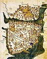
 Constantinople in the 15th century (ver. 1).jpg 1,476 × 1,940; 996 KB
-
 British Isles as depicted in Harley Codex Minuscule 3686.jpg 1,171 × 1,500; 577 KB
-
 Brooklyn Museum - Map The Black Sea.jpg 768 × 575; 84 KB
-
 Brooklyn Museum - Map The Central Mediterranean and All of Italy.jpg 768 × 593; 83 KB
-

-
 Carta marchesato di Oristano.jpg 1,056 × 1,008; 540 KB
-
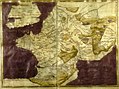 Carte moderne de France par Pietro del Massaio et Hugues Commineau.jpg 1,584 × 1,178; 372 KB
-
 Constantinople in the 15th century (ver. 2).jpg 1,640 × 2,196; 177 KB
-

-
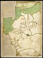
 Hispania in Harley MS 3686 - 15th century.jpg 940 × 1,230; 401 KB
-
 Jean Picart, Civitas Acon sive Ptolomaida (FL199657703 2368146).jpg 5,715 × 5,310; 15.96 MB
-
-

-
 Northwest Africa in Harley MS 3686.jpg 1,136 × 1,520; 339 KB
-
 Old Map Rom 15th century.jpg 408 × 532; 118 KB
-
 Benincasa 1476.jpg 428 × 437; 178 KB
-
 Portolano (Egerton MS 2855, f.2r).jpeg 8,275 × 6,514; 54.61 MB
-
 Portolano (Egerton MS 2855, f.3r).jpeg 8,275 × 6,514; 12.82 MB
-
 Portolano (Egerton MS 2855, f.4r).jpeg 8,275 × 6,514; 56.73 MB
-
 Portolano (Egerton MS 2855, f.5r).jpeg 8,275 × 6,514; 52.15 MB
-
 Portolano (Egerton MS 2855, f.6r).jpeg 8,275 × 6,514; 10.82 MB
-
 Portolano (Egerton MS 2855, f.7r).jpeg 8,275 × 6,514; 10.92 MB
-
 Portolano (Egerton MS 2855, f.8r).jpeg 8,275 × 6,514; 52.71 MB
-
 Île du Levant. Portulan. Benincasa. 1466.jpg 683 × 621; 68 KB
-
 Rome-15th Century.jpg 847 × 639; 260 KB
-
 Wiki Venezia mappa Brenta XV sec.gif 1,275 × 1,280; 198 KB
.jpg)


.jpg)
.jpg)

.jpg)
_by_Florentine_cartographer_Cristoforo_Buondelmonte.jpg)
.E.jpg)


.jpeg)
.jpeg)
.jpeg)
.jpeg)
.jpeg)
.jpeg)
.jpeg)


