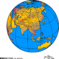
Category:Maps of China
跳至導覽
跳至搜尋
| Category Maps of China on sister projects: | |||||||||
|---|---|---|---|---|---|---|---|---|---|
維基媒體分類 | |||||
| 上傳媒體 | |||||
| 隸屬於 | |||||
|---|---|---|---|---|---|
| 分類結合主題 | |||||
| 中國 | |||||
具有歷史、文化與政治上的意義。現今政治上通常指稱中華人民共和國,少數情形會指涉中華民國  | |||||
| 隸屬於 | |||||
| 名稱由來 |
| ||||
| 可分為 | |||||
| 相異物 | |||||
| 據稱相同 | 大中華地區 | ||||
| 部分重合物 |
| ||||
 | |||||
English: Maps of China
中文(简体):中国的地图
中文(繁體):中國的地圖

子分類
此分類包含以下 53 個子分類,共 53 個。
*
+
A
- Agricultural maps of China (8 F)
- Animated maps of China (14 F)
B
C
- Campus maps of China (17 F)
D
E
- ECHO Daily Maps of China (38 F)
F
G
H
L
M
O
P
- Maps of the Paracel Islands (1 P, 40 F)
- People reading maps in China (2 F)
- Plans of China (5 F)
R
S
- Slope maps of China (9 F)
- Standard Maps of China (24 F)
T
- Time zone maps of China (8 F)
W
X
「Maps of China」分類的媒體檔案
此分類包含以下 200 個檔案,共 328 個。
(上一頁)(下一頁)-
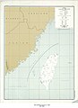
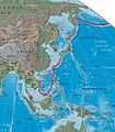
 "FIGHTING CLANS" of the British Indian Empire, 1918 — North East.jpg 1,996 × 1,430;767 KB
-
 "FIGHTING CLANS" of the British Indian Empire, 1918 — North West.jpg 2,012 × 1,372;482 KB
-
 "FIGHTING CLANS" of the British Indian Empire, 1918 — South East.jpg 1,988 × 1,280;423 KB
-
 "FIGHTING CLANS" of the British Indian Empire, 1918 — South West.jpg 2,008 × 1,296;226 KB
-
 107.35149E 34.75769N.png 1,028 × 726;1.03 MB
-

-
 123chinaprcunitedfrontmap.png 872 × 736;31 KB
-
 14 Ochomiles.png 4,480 × 2,472;10.45 MB
-
-
 2005KMT-hepingzhilv-S.png 480 × 563;107 KB
-
 2014 China HDI.png 900 × 794;193 KB
-
 2016 HDI of prefecture level cities in China.png 2,677 × 2,179;445 KB
-
 2017 China HDI.png 900 × 794;192 KB
-
 20170423082541!ดินดอนปากแม่น้ำแยงซี.jpg 534 × 446;59 KB
-
 2018 China HDI (Global Data Lab).png 900 × 794;166 KB
-
 2018年中国医疗健康指数.png 900 × 794;158 KB
-
 2018年中国教育指数.png 900 × 794;156 KB
-
 2019 China HDI (Global Data Lab).png 900 × 794;157 KB
-
 2019年中国医疗健康指数.png 900 × 794;158 KB
-
 2019年中国教育指数.png 900 × 794;156 KB
-
 2021 China HDI (Global Data Lab).png 900 × 794;166 KB
-
 75967 South-China-Sea-1.jpg 9,570 × 6,660;30.8 MB
-
 Banyin-beihuannigang.jpg 800 × 537;123 KB
-
 Banyin-nanping.jpg 745 × 575;76 KB
-
 Bohaiaqua mss 1979147 lrg.jpg 1,650 × 1,100;2.26 MB
-
 Broader definition of north china.jpg 850 × 543;46 KB
-
 Bản đồ hành chính Trung Quốc.png 736 × 600;219 KB
-
 Carte-du-cours-inferieur-du-Yangzi-Jiang.png 2,544 × 1,802;516 KB
-
 Central China cities.PNG 580 × 1,031;71 KB
-
 Central-Eastern China Administrative.png 800 × 600;202 KB
-
 CentralAsiaChinapipeline-zh.png 945 × 608;103 KB
-
 CFLD businiss in China.jpg 1,120 × 721;196 KB
-
 China - DPLA - 47d9ed9c302d647d316224e0519927ec.jpg 2,558 × 3,282;5.56 MB
-
 China - DPLA - 613733e6b24c299500229afd68518b97.jpg 2,550 × 3,270;4.9 MB
-
 China - DPLA - 89937695a86d180511754b411e89c624.jpg 2,550 × 3,276;5.77 MB
-
 China 11b vie.jpg 560 × 550;74 KB
-
 China Communist Controlled Areas, 1945-1947 - DPLA - fcf9e57e32bee59c1519defdd8d46e43.jpg 8,268 × 6,888;6.94 MB
-
 China disputed w1 countrymap.svg 1,000 × 1,000;109 KB
-
 China DNI Solar-resource-map lang-CN GlobalSolarAtlas World-Bank-Esmap-Solargis.png 1,842 × 1,802;2.13 MB
-
 China edcp relief location map BW.jpg 1,968 × 1,567;590 KB
-
 China edcp relief location map Gobi de.jpg 1,968 × 1,567;1 MB
-
 China GHI Solar-resource-map GlobalSolarAtlas World-Bank-Esmap-Solargis.png 1,842 × 1,802;2.33 MB
-
 China GHI Solar-resource-map lang-CN GlobalSolarAtlas World-Bank-Esmap-Solargis.png 1,842 × 1,802;2.13 MB
-
 China grapevine.png 698 × 508;138 KB
-
 China great mountains map en.jpg 1,000 × 1,000;332 KB
-
 China great mountains map zh-CN.jpg 1,000 × 1,000;325 KB
-
 China Loess Plateau and Ordos Desert.png 2,160 × 1,100;155 KB
-
 China Loess Plateau.png 2,160 × 1,100;145 KB
-
 China map updated.png 705 × 705;130 KB
-
 China map.png 705 × 705;135 KB
-
 China Museums.png 2,428 × 1,806;835 KB
-
 China national football team opponents.jpg 1,348 × 768;166 KB
-
 China prefectural-level divisions and administrative divisions (PRoC claim).png 6,246 × 4,937;987 KB
-
 China provinces taiwan.png 268 × 200;8 KB
-
 China provinces zhuang.png 250 × 200;17 KB
-
 China PVOUT Photovoltaic-power-potential-map GlobalSolarAtlas World-Bank-Esmap-Solargis.png 1,842 × 1,802;2.12 MB
-

-
 China Sacred Mountains.png 1,045 × 737;428 KB
-
 China SEZ.jpg 800 × 631;165 KB
-
 China Universities Map.png 1,275 × 902;109 KB
-
 China Vanke‘s Market Coverage.jpg 1,275 × 1,029;194 KB
-
 China's 3D map by Patrick.jpg 880 × 687;259 KB
-
 China, June 1917.png 1,200 × 990;148 KB
-
 China- Taiwan Province (Formosa) - DPLA - b4867306d903453abc942b296f17b18c.jpg 6,192 × 8,512;4.44 MB
-
 China-India Border - DPLA - 7f421b4124e32253b97ce400152d528c.jpg 2,552 × 3,284;5.74 MB
-
 China-India Border- Eastern Sector - DPLA - d08c495b68e5fc1f22600aa3553d5030.jpg 2,534 × 3,256;5.67 MB
-
 China-India Border- Western Sector - DPLA - d5dfc2c8b8bd09b075051503977fbc6d.jpg 2,546 × 3,262;5.85 MB
-
 China-map ko-kore.png 1,181 × 940;476 KB
-
 China-map ko.png 2,500 × 1,827;1.41 MB
-
 China-taiwan.png 1,000 × 681;425 KB
-

-
 China-Vietnam Border - DPLA - 99d8b7208118e619920e93fd421f4fa2.jpg 2,540 × 3,262;5.98 MB
-
 Chinafangyan.jpg 2,669 × 2,171;1.75 MB
-
 ChinaFrench.png 934 × 752;44 KB
-
 ChinaGeography-plus Bahna.jpg 800 × 602;468 KB
-
 Chinaimportant.png 3,000 × 2,000;7.08 MB
-
 Chinamap - 2.png 582 × 414;99 KB
-
 Chine Indochine.jpg 1,652 × 1,144;597 KB
-
 Chine Pyrus bretschneideri.jpg 3,749 × 3,049;465 KB
-
 Chinese central plain.png 268 × 218;28 KB
-
 Chinese Extra-long Railway Tunnels by Province.png 4,812 × 3,480;1,010 KB
-
 Chinese irredentism-expansionism (nationalism).jpg 6,928 × 4,904;1.09 MB
-
 Chinese tensa.jpg 2,677 × 2,183;1.34 MB
-
 Chinese Turkestan with caravan and rifle (1901) (14594951057).jpg 3,780 × 2,410;3.65 MB
-
 Comparison Size with China map.png 518 × 1,402;27 KB
-
 Consular District of China Map zh-hans.JPG 924 × 771;85 KB
-
 Cuisines of China.png 1,275 × 902;92 KB
-
-
 Damang island china location map.jpg 752 × 600;128 KB
-
 Damang island china location map2.jpg 752 × 600;130 KB
-
 Damang island china location map3.jpg 752 × 600;127 KB
-
 Dialect Map of Lower Yangtze Mandarin.png 16,001 × 16,001;1.97 MB
-
 Diaoyu Islands ja.png 1,857 × 450;28 KB
-
 Diaoyu Islands zh-tw.png 1,857 × 450;41 KB
-
 Diaoyu Islands.png 1,857 × 450;111 KB
-
 Difference of Chinese.jpg 2,669 × 2,171;2.12 MB
-
 Diplomatic missions of the People's Republic of China.PNG 1,425 × 625;63 KB
-
 Disputataj landlimoj inter Barato, Ĉinio kaj Pakistano.png 924 × 669;154 KB
-
 Dongguan-map.png 1,000 × 712;634 KB
-
 Double first class universities.png 2,245 × 1,587;222 KB
-
 Dujiangyan-Irrigation-System-TOUR-Map104.jpg 1,004 × 686;880 KB
-
 East Turkestan Location 1x1.png 1,058 × 1,058;183 KB
-
 Fig. 3 Map of Magnetic Anomalies line in South China Sea.jpg 3,165 × 1,755;9.1 MB
-
 Figure 1.tif 3,661 × 2,953;4.06 MB
-
 First Batch of National Parks of China.jpg 2,339 × 1,654;258 KB
-
 First island chain perimeter (marked in red).jpg 509 × 584;69 KB
-
 FLII China.png 1,283 × 872;470 KB
-
 Forest Cover of Chinese Administrative Divisions.png 5,000 × 3,520;1.23 MB
-
 Fossiliferous basins of China.png 2,675 × 1,888;181 KB
-
 Fuanquhua.jpg 418 × 647;62 KB
-
 Gobi desert map.png 1,500 × 1,017;2.99 MB
-
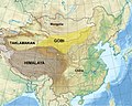 GobiTaklamakanMap.jpg 1,968 × 1,567;656 KB
-
 Gran Planúria del Nord de la Xina.jpg 2,339 × 1,654;205 KB
-
 Great China Map.PNG 603 × 445;91 KB
-
 Great wall of China eastern location.jpg 800 × 490;146 KB
-
 Greater China.GIF 801 × 741;129 KB
-
 Greater Tibet locator map.svg 1,181 × 940;2.6 MB
-
 Guerre de protection de la nation.png 1,124 × 907;438 KB
-
 Gulf of Tonkin location.gif 500 × 500;90 KB
-
 Guo Shoujing Observatories.jpg 1,654 × 2,339;291 KB
-
 Haibei-map.png 1,000 × 1,753;280 KB
-
 Haidong-map.jpg 800 × 1,195;132 KB
-
 Han Dynasty 3.2.2021 M.R.png 3,500 × 1,613;463 KB
-
 HDI of China Provincial Administrative Reginos 2019.png 4,167 × 3,542;621 KB
-
 Heihe-Tengchong-Line.png 981 × 809;38 KB
-
 Hexi Corridor.png 1,109 × 756;1.91 MB
-
 Historicalcapitalsofchina 1900.png 1,080 × 1,150;172 KB
-
 Hoang-Ho river.png 633 × 324;69 KB
-
 Huanghemap zh-hans.png 2,160 × 1,100;152 KB
-
 Huanghemap zh-hant.png 2,160 × 1,100;158 KB
-
 HuaShan-mountain-china-traveling-map-wander-karte-berg-gebirge.jpg 4,000 × 2,913;13.28 MB
-
 Huazhong China.png 800 × 558;173 KB
-
 Hunanese language dialects and accents.jpg 1,000 × 1,401;86 KB
-
 HVDC Yunnan-Guangdong.PNG 460 × 250;42 KB
-
 Jiangnan.png 1,061 × 750;335 KB
-

-
 Jinan dot.png 1,804 × 1,322;279 KB
-
 Khu tự trị Trung Quốc (có màu xanh là cây) 2014-05-30 05-51.png 600 × 489;305 KB
-
 Kiangsu Province Map 1954.jpg 5,000 × 3,765;16.25 MB
-
 Kinmen,Matsu,Wuciou.png 586 × 427;50 KB
-
 Komara Çînê.png 800 × 653;295 KB
-
-
 Lasa-map.png 1,500 × 1,093;609 KB
-
 Llanura del Norte de China (mapa).png 386 × 388;103 KB
-
 Locator AF-PK-IR-TM-UZ-TJ-CN.png 400 × 250;7 KB
-
 LocMap of WH Potala Palace ja.png 280 × 210;31 KB
-
 LocMap of WH Potala Palace.png 280 × 210;31 KB
-
 Manchu State.png 998 × 999;264 KB
-
 Manchukuo locator map.svg 1,260 × 1,003;2.66 MB
-
 Manila - Bangkok (22645252801).jpg 1,600 × 1,067;1.02 MB
-
 Map of China - DPLA - 0c9e8d3059ecb582adea0a6d4cb108cb.jpg 12,472 × 9,513;19.16 MB
-
 Map of China Proper.png 2,409 × 2,048;788 KB
-
 Map of Hsupeng battle (Huaihai campaign) on Nov 05 1948 in Chinese Civil War.png 1,920 × 1,440;573 KB
-
 Map of National central cities in the People's Republic of China.png 2,677 × 2,183;89 KB
-
 Map of Northeastern Asia.jpg 3,953 × 5,120;1.24 MB
-
 Map of One-China Policy.svg 2,754 × 1,398;1.06 MB
-
 Map of prices of engagement gifts in all regions.jpg 520 × 391;168 KB
-
 Map of Sub-provincial level entries in the People's Republic of China.png 6,246 × 4,937;473 KB
-
 Map of the Great Wall of China-2010-14-07.jpg 2,652 × 2,133;1.52 MB
-
-
 Map of Tunganaistan.png 1,024 × 815;300 KB
-
 Map sacred mountains of china.jpg 1,451 × 1,277;389 KB
-
 Mapa etnias china.jpg 373 × 312;24 KB
-
 MapaRad.jpg 3,024 × 4,032;1.81 MB
-
 MapOfBolshoyUssuriyskyIsland.gif 505 × 375;132 KB
-
 MapOfBolshoyUssuriyskyIsland.PNG 479 × 369;173 KB
-
 Maritime Court Territorial Jurisdiction in China.png 4,096 × 3,072;1.49 MB
-
 Mean-wind-speed-map-china-Global-Wind-Atlas.png 3,308 × 2,339;2.75 MB
-
 Mercator China.svg 245 × 196;22 KB
-
 Mia Farrow waiting for contract approval.jpg 5,344 × 5,336;13.23 MB
-

-
 Ming China 1580 AD.jpg 1,089 × 1,515;550 KB
-
 Modèle carte Richaringan - Sud de la Chine.png 1,102 × 832;26 KB
-
 Mongolia and Mongol Autonomous Subjects in The PRC.png 916 × 724;84 KB
-

-
 Nebulasaurus map.jpg 2,126 × 3,159;606 KB
-
 Nh-44-11-jumla-nepal-china.pdf 4,354 × 3,322;9.78 MB
-
 North and South China Partition Map.png 705 × 705;126 KB
-
 North China Areas of Politico-Military Control - DPLA - 38139702ef980d427886291c13766ab8.jpg 7,788 × 7,294;8.06 MB
-
 Northeast China - DPLA - e049ee930afaa6f16ca7c2d7d29533d6.jpg 7,804 × 8,488;5.03 MB
-
 Northeast China smog 2013-10-21 2013294.0350 rotate.jpg 3,600 × 2,800;1.81 MB
-
 Northern China.png 551 × 370;133 KB
-

-
 Operational Navigation Chart E-6, 7th edition.jpg 9,254 × 6,742;18.3 MB
-
 Operational Navigation Chart E-7, 5th edition.jpg 9,254 × 6,657;22.26 MB
-
 Operational Navigation Chart E-8, 6th edition.jpg 8,066 × 5,841;17.05 MB
-
 Operational Navigation Chart F-6, 6th edition.jpg 9,254 × 6,706;21.18 MB
-
 Operational Navigation Chart F-7, 4th edition.jpg 9,254 × 6,703;17.31 MB
-
 Operational Navigation Chart G-6, 7th edition.jpg 9,254 × 6,700;20.67 MB
-
 Operational Navigation Chart G-7, 6th edition.jpg 9,254 × 6,707;20.89 MB
-
 Orthographic projection centred over Gongga Shan 1.png 488 × 487;22 KB
-
 Orthographic projection centred over Gongga Shan 2.png 488 × 487;17 KB
-
 Orthographic projection centred over Gongga Shan 3.png 488 × 487;14 KB
-
-
 Physiography of China.png 2,008 × 2,263;4.91 MB
-
 PR China-SAR & SEZ-Chinese.png 600 × 529;142 KB
-
 PR China-SAR & SEZ-English.png 600 × 529;101 KB
-
 PR China-SAR & SEZ-German.png 600 × 529;148 KB
-
 Project SHARE Map.png 489 × 354;104 KB
-
 Provinces of Yaogong in China.png 800 × 558;125 KB


.jpg)


.jpg)


.png)


.png)


.png)


.png)


_-_DPLA_-_b4867306d903453abc942b296f17b18c.jpg)


.jpg)

_(14594951057).jpg)


.jpg)


_2014-05-30_05-51.png)


.png)


.jpg)


_on_Nov_05_1948_in_Chinese_Civil_War.png)


.jpg)


.jpg)


