Category:Maps of Federation of South Arabia
Jump to navigation
Jump to search
Wikimedia category | |||||
| Upload media | |||||
| Instance of | |||||
|---|---|---|---|---|---|
| Category combines topics | |||||
| Federation of South Arabia | |||||
federal state under British protection in what would become South Arabia    | |||||
| Instance of | |||||
| Location |
| ||||
| Capital | |||||
| Basic form of government |
| ||||
| Official language | |||||
| Inception |
| ||||
| Dissolved, abolished or demolished date |
| ||||
| Population |
| ||||
| Area |
| ||||
| Replaces |
| ||||
 | |||||
Media in category "Maps of Federation of South Arabia"
The following 18 files are in this category, out of 18 total.
-
 Aden (PSF).png 2,028 × 1,956; 765 KB
-
 Aden Protectorate Map.jpg 740 × 537; 38 KB
-
 Aden Yemen on the globe (South Yemen centered orthographic projection).svg 845 × 845; 3.01 MB
-
 Alawi.jpg 800 × 508; 85 KB
-
 Aqrabi.jpg 800 × 508; 85 KB
-
 Audhali.jpg 800 × 508; 85 KB
-
 Dathina.jpg 800 × 508; 85 KB
-
 Federation of South Arabia constituents map - ru.svg 1,200 × 707; 2.56 MB
-
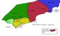
 Federation of South Arabia constituents map - ua.png 1,200 × 707; 132 KB
-
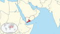 Federation of South Arabia in its region.svg 574 × 317; 6.96 MB
-
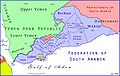
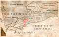
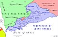 FederationOfSouthArabiaMap.jpg 2,282 × 1,443; 361 KB
-
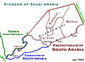
 Map showing the Colony of Aden.jpg 453 × 294; 16 KB
-
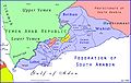
 ProtectorateOfSouthArabiaMap.jpg 912 × 666; 273 KB
-
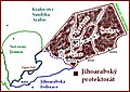 South Arabia Protectorate - czech.jpg 800 × 568; 112 KB
-
 SouthArabiaMap-russian.jpg 941 × 694; 332 KB
-
 Ye mapha.GIF 943 × 567; 14 KB
-
 الجنوب العربي 1965 South Arabia 1965.jpg 1,916 × 1,390; 779 KB
-
 خريطة يافع السفلى.png 1,200 × 762; 1.5 MB
.png)

.svg)


