Category:Maps of Gloucester
Jump to navigation
Jump to search
Maps of the city of Gloucester, England.
Subcategories
This category has only the following subcategory.
!
Media in category "Maps of Gloucester"
The following 18 files are in this category, out of 18 total.
-
 Central Gloucester 1950s Ordnance Survey map.jpg 6,460 × 5,870; 8.01 MB
-
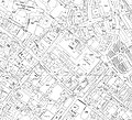
 Commercial Road, Gloucester map.jpg 1,085 × 740; 292 KB
-
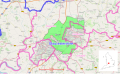 Gloucester & Cheltenham green belt.svg 1,685 × 1,033; 1.7 MB
-
 Gloucester Shire Hall map.JPG 3,000 × 4,000; 4.01 MB
-
 Gloucester unparished area UK locator map.svg 1,187 × 1,266; 139 KB
-
 Holy Trinity Church, Longlevens.jpg 4,655 × 2,765; 1.99 MB
-
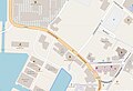
 Innsworth, Gloucester, map.jpg 940 × 619; 408 KB
-
 Ladybellegate Street map.jpg 709 × 697; 183 KB
-
 Location map United Kingdom Gloucester Central.png 2,079 × 1,916; 1.44 MB
-
 Longlevens within Gloucester.jpg 585 × 442; 206 KB
-
 Map of Gloucester attractions.JPG 2,700 × 3,847; 1.33 MB
-
 Mercers Hall, Gloucester.jpg 2,267 × 2,408; 1.21 MB
-
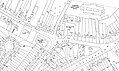
 Northgate Street, Gloucester map.jpg 1,172 × 686; 299 KB
-
 Ordnance Survey One-Inch Sheet 143 Gloucester & Malvern, Published 1953.jpg 8,327 × 9,966; 12.85 MB
-
 Ordnance Survey One-Inch Sheet 143 Gloucester & Malvern, Published 1968.jpg 8,331 × 9,901; 11.58 MB
-
 SoG 1.jpg 1,106 × 916; 576 KB
-
 SoG 2.jpg 1,106 × 916; 649 KB
-
 Southgate Street, Gloucester map.jpg 505 × 679; 239 KB


