<nowiki>Category:Maps of Landkreis Göttingen; categoría de Wikimedia; kategori Wikimedia; Wikimedia category; د ويکيمېډيا وېشنيزه; Vikimedya kategorisi; ویکیمیڈیا زمرہ; kategória projektov Wikimedia; категорія проєкту Вікімедіа; 维基媒体分类; Wikimedia-Kategorie; Викимедиина категорија; kategorija na Wikimediji; विकिपीडिया:श्रेणी; page de catégorie de Wikimedia; kategorija na Wikimediji; विकिपीडिया वर्ग; категорија на Викимедији; Wikimedia-Kategorie; Wikimedia-kategori; kategori Wikimédia; تصنيف ويكيميديا; pajenn rummata eus Wikimedia; Wikimedia:ကဏ္ဍခွဲခြင်း; 維基媒體分類; Wikimedia категориясы; categoría de Wikimedia; Wikimedia-Kategorie; Викимедиа категорияһы; tudalen categori Wikimedia; kategori e Wikimedias; Վիքիմեդիայի նախագծի կատեգորիա; 维基媒体分类; Wikimedia-kategori; ვიკიპედია:კატეგორიზაცია; ウィキメディアのカテゴリ; categoria Wikimedia; تصنيف بتاع ويكيميديا; විකිමීඩියා ප්රභේද පිටුව; categoria Vicimediorum; Vikipidiya:Shopni; Wikimedia-luokka; Wikimedia category; guruhi Vikimedia; катэгорыя ў праекце Вікімэдыя; Викимедиа проектындагы төркем; catigurìa di nu pruggettu Wikimedia; หน้าหมวดหมู่วิกิมีเดีย; Wikimedia:Kategorija; Wikimedia-Kategorie; Wikimedia:Klassys; категория на Уикимедия; categorie a unui proiect Wikimedia; categurìa 'e nu pruggette Wikimedia; Wikimedia-kategori; kawan Wikimèdia; гурӯҳи Викимедиа; 위키미디어 분류; Wikimedia-bólkur; kategorio en Vikimedio; kategori Wikimedia; Wikimedia:Ronnaghys; উইকিমিডিয়া বিষয়শ্রেণী; kategori Wikimedia; 维基媒体分类; וויקימעדיע קאַטעגאָריע; kategorija w projektach Wikimedije; thể loại Wikimedia; Wikimedia projekta kategorija; kategoria ti Wikimedia; categoria de um projeto da Wikimedia; 维基媒体分类; категорияд Ангилал; Wikimedia-kategori; kategori Wikimedia; پۆلی ویکیمیدیا; Wikimedia category; Vikimédia ñemohenda; Wikimédia-kategória; વિકિપીડિયા શ્રેણી; Wikimediako kategoria; категория в проекте Викимедиа; Wikimedia-Kategorie; Kategoriya ning Wikimedia; Wikimedia-kategorie; Wîkîmediya:Kategorî; विकिमिडिया श्रेणी; Wikimedia-Kategorie; קטגוריה במיזמי ויקימדיה; Викимедиа проектындагы төркем; κατηγορία εγχειρημάτων Wikimedia; विकिमिडिया श्रेणी; kategoria w projekcie Wikimedia; Wikimedia-kategoriija; гурӯҳи Викимедиа; Wikimedia-categorie; categoría de Wikimedia; Wikimedia-categorie; categoria di un progetto Wikimedia; катэгорыя ў праекце Вікімедыя; Wikimedia category; 維基媒體分類; Wikimedia kategooria; categoria de Wikimedia; ردهٔ ویکیپدیا; Wikimedia proyektındağı törkem; 維基媒體分類; ẹ̀ka Wikimedia; kategorie na projektech Wikimedia; categoria de um projeto da Wikimedia; Wikimedia-Kategorie; Wikimedia-Kategorie; tumbung Wikimedia; Wikimedia-kategorie; kategorija Wikimedije; kategorya ng Wikimedia; Wikimedia-categorie; Viciméid catagóir; kategori Wikimedia; jamii ya Wikimedia; വിക്കിമീഡിയ വർഗ്ഗം; 維基媒體分類; kategori Wikimedia; Wikimedia-kategory; زمرو:وڪيپيڊيا زمرا بندي; 維基媒體分類; categoría de Wikimedia; विकिमीडिया श्रेणी; 维基媒体分类; விக்கிமீடியப் பகுப்பு</nowiki>
Subcategories
This category has the following 8 subcategories, out of 8 total.


 05 Harz 1809.jpg 1,649 × 1,466; 489 KB
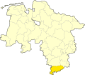 GÖ in Niedersachsen.svg 1,121 × 978; 147 KB
 Göttingen in Hannover 1905.png 794 × 680; 23 KB
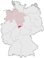 Lage des Landkreises Göttingen in Deutschland.GIF 176 × 234; 3 KB
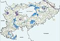 Landkreis Göttingen FFH Gebiete.jpg 3,664 × 2,529; 1.42 MB
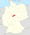 Locator map GÖ in Germany.svg 1,075 × 1,273; 535 KB
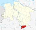 Locator map GÖ in Lower Saxony.svg 1,424 × 1,203; 322 KB
 Lower saxony goe.png 280 × 245; 13 KB
 Lower Saxony GÖ 2016.svg 1,424 × 1,203; 267 KB
 Plan Suedbahn.jpg 4,820 × 4,118; 905 KB
 Preußische Landesaufnahme 1878 (Gieboldehausen1).jpg 3,209 × 2,412; 2.02 MB
 WARTE-KARTE-rosdorf 001 cropped.jpg 946 × 1,218; 502 KB
 WARTE-KARTE-rosdorf 001.jpg 500 × 621; 131 KB


.jpg)

