Category:Maps of Mount Rainier National Park
Jump to navigation
Jump to search
United States national parks: Acadia · American Samoa · Arches · Badlands · Big Bend · Biscayne · Black Canyon of the Gunnison · Bryce Canyon · Canyonlands · Capitol Reef · Carlsbad Caverns · Channel Islands · Congaree · Crater Lake · Cuyahoga Valley · Death Valley · Denali · Dry Tortugas · Everglades · Gateway Arch · Gates of the Arctic · Glacier · Glacier Bay · Grand Canyon · Grand Teton · Great Basin · Great Smoky Mountains · Guadalupe Mountains · Haleakalā · Hawaii Volcanoes · Hot Springs · Indiana Dunes · Isle Royale · Joshua Tree · Kenai Fjords · Kings Canyon · Kobuk Valley · Lake Clark · Lassen Volcanic · Mammoth Cave · Mesa Verde · Mount Rainier · North Cascades · Olympic · Petrified Forest · Pinnacles · Redwood · Rocky Mountain · Saguaro · Sequoia · Shenandoah · Theodore Roosevelt · Virgin Islands · Voyageurs · White Sands · Wind Cave · Wrangell-St. Elias · Yellowstone · Yosemite · Zion
Wikimedia category | |||||
| Upload media | |||||
| Instance of | |||||
|---|---|---|---|---|---|
| Category combines topics | |||||
| Mount Rainier National Park | |||||
national park of the United States    | |||||
| Instance of | |||||
| Named after | |||||
| Location |
| ||||
| Visitor center | |||||
| Operator | |||||
| IUCN protected areas category | |||||
| Inception |
| ||||
| Mountain range | |||||
| Highest point | |||||
| Area |
| ||||
| Visitors per year |
| ||||
| Different from | |||||
| official website | |||||
 | |||||
Subcategories
This category has the following 3 subcategories, out of 3 total.
G
Media in category "Maps of Mount Rainier National Park"
The following 28 files are in this category, out of 28 total.
-
 LocMap Mount Rainier.png 280 × 183; 15 KB
-
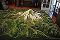
 Mount Rainier model 01.jpg 4,288 × 2,848; 5.62 MB
-
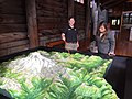
 Mount Rainier model 02.jpg 4,288 × 2,848; 5.28 MB
-
 Mount Rainier model 03.jpg 4,288 × 2,848; 5.52 MB
-
 Mount Rainier National Park.svg 1,000 × 1,000; 35 KB
-
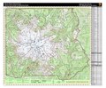
 Mount Rainier vicinity map.png 697 × 646; 115 KB
-
 Mount Rainier Wilderness Zone Map (c691150a-adc1-4682-95f4-ecf4c4cf6d17).pdf 5,418 × 4,481; 41.68 MB
-
 Mount-rainier-lahar-lavaflow-pyroclasticflow-hazardmap.jpg 520 × 672; 83 KB
-
 Natural Resource Education and Interpretation (b4cd91fd-6b46-4d85-9154-059717a6e1b9).JPG 2,016 × 1,512; 1.15 MB
-
 NPS mount-rainier-camp-muir-map.gif 728 × 1,844; 271 KB
-
 NPS mount-rainier-carbon-river-mowich-trail-map.gif 1,924 × 1,487; 208 KB
-
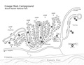
 NPS mount-rainier-cougar-rock-campground-map.gif 1,650 × 1,211; 220 KB
-
 NPS mount-rainier-cougar-rock-campground-map.pdf 1,650 × 1,275; 227 KB
-
 NPS mount-rainier-longmire-trail-map.gif 1,487 × 1,924; 214 KB
-
 NPS mount-rainier-night-sky-map.jpg 1,499 × 966; 358 KB
-
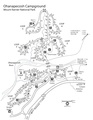
 NPS mount-rainier-ohanapecosh-campground-map.gif 1,275 × 1,650; 210 KB
-
 NPS mount-rainier-ohanapecosh-campground-map.pdf 1,275 × 1,650; 1.22 MB
-
 NPS mount-rainier-ohanapecosh-trail-map.gif 1,487 × 1,924; 201 KB
-
 NPS mount-rainier-paradise-trail-map.gif 1,487 × 1,924; 223 KB
-
 NPS mount-rainier-paradise-winter-trails-map.gif 1,487 × 2,449; 575 KB
-
 NPS mount-rainier-regional-map.gif 620 × 571; 63 KB
-
 NPS mount-rainier-regional-map.pdf 370 × 341; 96 KB
-
 NPS mount-rainier-sunrise-trail-map.gif 1,924 × 1,487; 197 KB
-
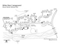
 NPS mount-rainier-white-river-campground-map.gif 1,650 × 1,118; 179 KB
-
 NPS mount-rainier-white-river-campground-map.pdf 1,650 × 1,275; 129 KB
-
 NPS mount-rainier-wilderness-trail-campsite-map.gif 3,849 × 2,974; 1,010 KB
-
 NPS mount-rainier-wilderness-trail-campsite-map.pdf 3,300 × 2,550; 530 KB
-
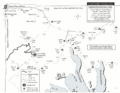
 Rainier-area-map.jpg 418 × 397; 82 KB


.JPG)


