Category:Maps of West Maas en Waal
Jump to navigation
Jump to search
Wikimedia category | |||||
| Upload media | |||||
| Instance of | |||||
|---|---|---|---|---|---|
| Category combines topics | |||||
| West Maas en Waal | |||||
municipality in the Netherlands    .svg) | |||||
| Pronunciation audio | |||||
| Instance of |
| ||||
| Location | Gelderland, Netherlands | ||||
| Head of government |
| ||||
| Inception |
| ||||
| Population |
| ||||
| Area |
| ||||
| Elevation above sea level |
| ||||
| Replaces |
| ||||
| official website | |||||
 | |||||
Subcategories
This category has the following 4 subcategories, out of 4 total.
Media in category "Maps of West Maas en Waal"
The following 16 files are in this category, out of 16 total.
-
 2013-WestMaasenWaal.jpg 2,730 × 1,960; 3.02 MB
-
 BAG woonplaatsen - Gemeente West Maas en Waal.png 2,419 × 2,419; 722 KB
-
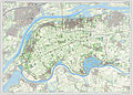
 Gem-WestMaasenWaal-2014Q1.jpg 5,417 × 3,881; 8.25 MB
-
 Gem-WestMaasenWaal-OpenTopo.jpg 6,353 × 4,380; 4.33 MB
-

-
 LocatieWestMaasEnWaal.png 280 × 150; 9 KB
-
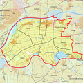
 Map - NL - West Maas en Waal (2009).svg 625 × 575; 2.05 MB
-
 Map NL - West Maas en Waal - Alphen.png 800 × 600; 264 KB
-
 Map NL - West Maas en Waal - Altforst.png 800 × 600; 262 KB
-
 Map NL - West Maas en Waal - Appeltern.png 800 × 600; 262 KB
-
 Map NL - West Maas en Waal - Beneden-Leeuwen.png 800 × 600; 265 KB
-
 Map NL - West Maas en Waal - Boven-Leeuwen.png 800 × 600; 263 KB
-
 Map NL - West Maas en Waal - Dreumel.png 800 × 600; 267 KB
-
 Map NL - West Maas en Waal - Maasbommel.png 800 × 600; 265 KB
-
 Map NL - West Maas en Waal - Wamel.png 800 × 600; 266 KB
-
 NL - locator map municipality code GM0668 (2016).png 2,125 × 1,417; 641 KB


.svg)


.png)