Category:Maps of ancient Sparta
Jump to navigation
Jump to search
Media in category "Maps of ancient Sparta"
The following 31 files are in this category, out of 31 total.
-
 MistraCoronelli1686.jpg 1,486 × 1,140; 643 KB
-

-
 THIRLWALL(1849) p5.014 SPARTA.jpg 2,097 × 1,822; 1.07 MB
-
 THIRLWALL(1849) p5.014 SPARTA AND THEBES.jpg 1,298 × 759; 665 KB
-
 437 of 'Peloponesiaca; a supplement to Travels in the Morea' (11024991166).jpg 2,368 × 2,493; 944 KB
-
 755 of 'A History of Greece' (11026056373).jpg 1,482 × 2,357; 523 KB
-
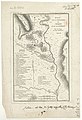
 Antique Map of Classical City of Sparta.jpg 2,218 × 2,071; 2.51 MB
-
 Chremonidean War - First Stage (267-265 BC).tif 3,991 × 3,577; 6.03 MB
-
-
 Map of Archaeological site of Sparta.jpg 3,390 × 1,876; 3.39 MB
-
 Map of Sparta.jpg 2,800 × 2,444; 3.87 MB
-
 Peloponnesian League 506 BC.png 2,479 × 2,289; 2.53 MB
-
 Plan Sparta.svg 443 × 394; 785 KB
-
 Rothert, Bd1Bl04K1 - Entwicklung der spartanischen Führung und Anfänge Athens.jpg 2,866 × 2,737; 1.24 MB
-
 Sparta location.jpg 400 × 379; 82 KB
-
 Sparta Peloponnes.png 712 × 617; 177 KB
-
 Sparta territory.jpg 743 × 681; 201 KB
-
 Sparta Territory.svg 743 × 681; 367 KB
-
 Sparta's losses in 338 BC.png 2,157 × 1,755; 1.42 MB
-
 Sparta1839.jpg 5,288 × 4,191; 2.34 MB
-
 SpartaAndEnvironsMap-SmithGeography.png 693 × 765; 635 KB
-
 SpartaAndEnvironsMapWithoutKey-SmithGeography.png 791 × 743; 770 KB
-
 Spartan Fortifications built by Nabis.png 1,291 × 1,274; 998 KB
-
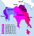
 Spartan Territory Before 371 BC.png 1,361 × 1,433; 1.24 MB
-
 SpartanTerritory.PNG 372 × 394; 29 KB
-
 SpartanTerritory.png 362 × 391; 67 KB
-
 Sparte FR.jpg 2,422 × 2,219; 424 KB
-
 Telemachus Map.jpg 1,094 × 918; 238 KB
-
 TerritorioEspartano.svg 743 × 681; 634 KB
-
 The Fifth Sacred War (281-280 BC).png 2,696 × 3,827; 5.03 MB
-
 Σπάρτη-Χάρτα του Ρήγα-1797- Φύλλο 2.jpg 2,124 × 3,188; 784 KB


_p5.014_SPARTA.jpg)
_p5.014_SPARTA_AND_THEBES.jpg)
.jpg)
.jpg)

_;_De_la_Haye_fils_-_btv1b84915010.jpg)


.png)
