Category:Maps of the London Borough of Camden
Jump to navigation
Jump to search
Subcategories
This category has the following 4 subcategories, out of 4 total.
Media in category "Maps of the London Borough of Camden"
The following 42 files are in this category, out of 42 total.
-

-
 Bloomsbury - map 1.png 640 × 580; 113 KB
-
 Cambridge Gate Mews map.jpg 1,215 × 638; 197 KB
-
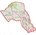
 Camden London UK labelled ward map 2002.svg 1,249 × 1,231; 66 KB
-
 Camden London UK labelled ward map 2022.svg 512 × 499; 79 KB
-
 Camden London UK location map 2.svg 1,355 × 1,266; 2.49 MB
-
 Camden London UK location map.svg 1,355 × 1,266; 2.99 MB
-
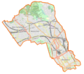
 Camden UK locator map.svg 1,425 × 1,140; 1.06 MB
-
 Camden UK ward map 1978.svg 738 × 728; 27 KB
-
 Camden ward map Frognal 1978.svg 738 × 728; 27 KB
-
 Camden ward map.svg 1,224 × 1,093; 65 KB
-
 Camden.jpg 803 × 794; 384 KB
-
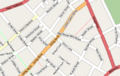 Drury Lane map.png 427 × 270; 130 KB
-
 Gower Street map.png 273 × 346; 97 KB
-
 Gray's Inn Road - map 1.png 360 × 540; 198 KB
-
 Hampstead Met. B Ward Map 1916.svg 875 × 946; 47 KB
-
 Hampstead Town ward map 1978-2002.svg 738 × 728; 29 KB
-
 High Holborn - map 1.png 660 × 440; 181 KB
-
 High Holborn - map.svg 1,126 × 650; 2.68 MB
-
 Holborn Met. B Ward Map 1952.svg 921 × 744; 32 KB
-
 HS1-HS2 Camden link.png 1,429 × 782; 414 KB
-
 Land Registry map of Kingsway Telephone Exchange, 1 of 3.png 2,000 × 2,800; 3.44 MB
-
 Land Registry map of Kingsway Telephone Exchange, 2 of 3.png 2,000 × 2,800; 3.21 MB
-
 Land Registry map of Kingsway Telephone Exchange, 3 of 3.png 1,252 × 2,800; 1.25 MB
-
 Lincoln's Inn Fields Map.jpeg 947 × 808; 170 KB
-
 London Borough of Camden OSM 2020.png 1,130 × 944; 1.75 MB
-
 LondonCamden.svg 962 × 744; 22 KB
-
 Map of Camden.png 842 × 741; 1.07 MB
-
 Map of Red Lion Square disorders, showing key points of interest.png 819 × 662; 298 KB
-
 Map of St. Pancras in 1833 showing Parish Boundaries. Wellcome M0012504.jpg 2,303 × 4,579; 3.04 MB
-
 Plan of Tyndall's buildings, Gray's Inn Lane. Wood engraving Wellcome V0020281ET.jpg 2,274 × 1,374; 1.84 MB
-
 Primrose Hill District Map.svg 1,052 × 744; 805 KB
-
-

-
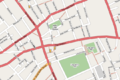
 Regents Park OpenStreetMap 2021.svg 2,548 × 1,396; 18.31 MB
-
 St Giles & Holborn Civil Parish Map 1870.png 7,566 × 4,593; 2.02 MB
-
 St Giles parish, London 1804.jpg 1,693 × 1,273; 2.46 MB
-
 St Pancras and Battle Bridge.png 1,256 × 1,256; 2.68 MB
-
 St Pancras Met. B Ward Map 1916.svg 780 × 1,205; 55 KB
-
 Swiss Cottage ward map 1978-2002.svg 738 × 728; 29 KB
-
 Westhampsteadstations.png 4,530 × 3,750; 80 KB
-
 卡姆登.JPG 213 × 175; 11 KB


