Category:Maps of the history of Dalmatia
Prijeđi na navigaciju
Prijeđi na pretraživanje
Potkategorije
Ova kategorija ima sljedećih 7 potkategorija, od ukupno 7.
I
M
- Maps of Littoral Banovina (2 F)
- Maps of Pagania (51 F)
- Maps of the Illyrian Provinces (38 F)
- Maps of the Kingdom of Dalmatia (16 F)
R
- Maps of the Republic of Ragusa (26 F)
- Maps of Roman Dalmatia (32 F)
Mediji u kategoriji »Maps of the history of Dalmatia«
Prikazane su 52 datoteke u ovoj kategoriji, od njih ukupno 52.
-
 Ancient balkans 4thcentury-es.svg 2.039 × 1.823; 854 KB
-
 Ancient balkans 4thcentury-sr.png 1.113 × 845; 88 KB
-
 Ancient balkans 4thcentury-zh.svg 2.039 × 1.823; 318 KB
-
 Ancient balkans 4thcentury.png 1.113 × 845; 88 KB
-
 AtlBalk1850.jpg 318 × 327; 158 KB
-
 Austria-hungary (ja).png 822 × 416; 82 KB
-
 Austria-Hungary map-pl.svg 783 × 605; 331 KB
-
 Austria-hungary.png 708 × 412; 119 KB
-
 Bosnia around 1412-es.svg 1.896 × 1.655; 862 KB
-
 Bosnia around 1412-sh.png 884 × 826; 113 KB
-
 Bosnia around 1412-sr.png 884 × 826; 110 KB
-
 Bosnia around 1412.png 884 × 826; 113 KB
-
 Bunjevci migrations hu.svg 937 × 900; 88 KB
-
 Bunjevci migrations-sr.png 937 × 900; 107 KB
-
 Bunjevci migrations.png 937 × 900; 128 KB
-
 Croat realms in the first half of 14th century.png 2.230 × 1.944; 208 KB
-
 Dalmatia Croatia Slavonia Bosnia 1720 Matthaeus Seuteri.png 2.230 × 1.944; 150 KB
-
 Dalmatian principalities, 9th century.png 690 × 593; 306 KB
-
 PaganiaZahumljeTravuniaDuklja.svg 805 × 590; 1,08 MB
-
 Pagania Zahumlje Travunia Duklja es.png 698 × 486; 31 KB
-
 Paganija, Zahumlje, Travunija, Duklja, Croatian view-es.svg 805 × 590; 1,08 MB
-
 Paganija, Zahumlje, Travunija, Duklja, Croatian view.png 698 × 486; 37 KB
-
 Eastern Adriatic 1500.svg 1.920 × 1.753; 7 MB
-
 GreekCitiesMapIllyriaAdriatic.png 1.557 × 1.118; 1,87 MB
-
 IllyricumAD6RomanConditionofTribes.png 1.836 × 1.533; 2,56 MB
-
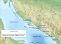
 Liburnia 5th BC-SL.PNG 1.280 × 1.504; 1,1 MB
-
 Map of the Kingdom of Agron of the Ardiaei (English).svg 1.600 × 1.600; 6,46 MB
-
 Map of the Kingdom of Agron of the Ardiaei (Portuguese).svg 1.600 × 1.600; 6,46 MB
-
 Map of the Kingdom of Gentius of the Ardiaei (English).svg 1.600 × 1.600; 6,39 MB
-
 Map of the Kingdom of Gentius of the Ardiaei (Portuguese).svg 1.600 × 1.600; 6,39 MB
-
 Map of the Kingdom of Teuta of the Ardiaei (English).svg 1.600 × 1.600; 6,46 MB
-
 Map of the Kingdom of Teuta of the Ardiaei (Portuguese).svg 1.600 × 1.600; 6,46 MB
-
 Map of the territory of Demetrius of Pharos (English).svg 1.600 × 1.600; 6,43 MB
-
 Map of the territory of Demetrius of Pharos (Portuguese).svg 1.600 × 1.600; 6,43 MB
-
 Map of the Western Balkans around 814 AD.png 478 × 451; 231 KB
-
 Map of Venetian Dalmatian detail.png 1.260 × 715; 340 KB
-
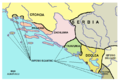
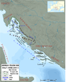
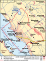
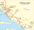 Operation Albia.png 1.132 × 1.009; 418 KB
-
 PAEONIAN ARDIAEAN (ILLYRIAN) DARDANIAN KINGDOMS EXTENT DURING 230 BC.png 1.049 × 938; 1,88 MB
-
 Realm of Hrvoje Vukčić Hrvatinić.png 2.230 × 1.944; 188 KB
-
 Realm of Paul I Šubić.svg 1.920 × 1.753; 6,76 MB
-
 Realms of Hrvatinići.png 2.230 × 1.944; 222 KB
-
 Regnum Sclavorum 754 AD.PNG 660 × 539; 530 KB
-
 Roman Provinces and Church Dioceses IV Century Croatia.png 2.230 × 1.944; 403 KB
-
 Romanized and Hellenized Illyria & Dalmatia (English).svg 1.382 × 1.424; 6,05 MB
-
 Romanized and Hellenized Illyria & Dalmatia (Portuguese).svg 1.382 × 1.424; 6,04 MB
-
 Romanized and Hellenized Illyria & Dalmatia.jpg 550 × 600; 223 KB
-
 South-Eastern Europe, ca. 1090, by User-Hxseek.png 491 × 407; 415 KB
-
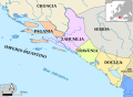
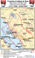
 Spartizione territoriale della Jugoslavia nel 1941.png 1.047 × 894; 122 KB
-
 Zagreb County (historical).png 811 × 784; 87 KB
-
 Zara-Zadar-1920-1947 (without border).png 2.363 × 2.877; 2,01 MB
-
 Zara-Zadar-1920-1947 cropped.png 2.393 × 3.157; 1,34 MB
-
 Zara-Zadar-1920-1947.png 2.449 × 4.017; 1,83 MB


.png)


.svg)
.svg)
.svg)
.svg)
.svg)
.svg)
.svg)
.svg)


_DARDANIAN_KINGDOMS_EXTENT_DURING_230_BC.png)


.svg)
.svg)


.png)
.png)

