Category:Maps of the history of Haiti
Jump to navigation
Jump to search
Subcategories
This category has only the following subcategory.
T
Media in category "Maps of the history of Haiti"
The following 27 files are in this category, out of 27 total.
-
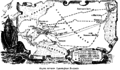
 Aparicion de Haiti independencial.gif 270 × 349; 56 KB
-
 Antilhas - Periòde coloniau vèrs 1790.png 1,717 × 1,153; 258 KB
-
 Cacicatus Hispaniolae.png 1,093 × 527; 215 KB
-
 Columbus routes.png 2,035 × 1,181; 72 KB
-
 Copia de Cacicazgos de la Hispaniola.png 2,341 × 1,171; 38 KB
-
 Devastaciones de Osorio.jpg 4,032 × 3,024; 7.64 MB
-
 División política de la Española durante la dominación haitiana (1822-1844).jpg 4,032 × 3,024; 9.03 MB
-
 En verde los territorios cedidos por los dominicanos a Haití en 1929 y 1936..jpg 4,032 × 3,024; 8.7 MB
-
 Gang war in Haiti.svg 1,357 × 1,057; 1.34 MB
-
 Haiti und Dominikanische Republik - Gebietsentwicklung (mit Gebietszuständen).png 1,893 × 2,647; 621 KB
-
 Haiti und Dominikanische Republik - Gebietsentwicklung.png 1,891 × 868; 228 KB
-
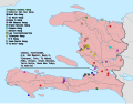
 Haitian Revolution.png 17,390 × 12,990; 4.91 MB
-
 Hispaniola pol D2.svg 1,003 × 508; 127 KB
-
 Invasión de Dessalines (1801-1805).jpg 4,032 × 3,024; 9.68 MB
-
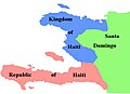 Kingdom of Haiti.jpg 584 × 421; 20 KB
-
 Las devastaciones de osorio Español.svg 2,238 × 1,289; 333 KB
-
 Leclerc Expedition.png 17,390 × 12,990; 5.13 MB
-
 Map of Heinrich Göring's travel to Haiti.jpg 1,186 × 770; 296 KB
-
 Map of Saint Domingue English.svg 5,999 × 5,524; 153 KB
-
 Mapa de Saint Domingue en español.svg 5,999 × 5,524; 152 KB
-
 Primeros territorios ocupados por los franceses.jpg 4,032 × 3,024; 8.95 MB
-
 Saint Domingue 1794.jpg 4,032 × 3,024; 8.94 MB
-
 Saint-domingue occupied during the revolution.tiff 1,870 × 1,498; 10.69 MB
-
 Territory of the Empire of Haiti in English.svg 1,779 × 1,485; 228 KB
-
 The Devastations of Osorio.svg 2,238 × 1,289; 311 KB
-
 Tratado de Aranjuez Espanol.svg 7,186 × 3,464; 88 KB
-
 Treaty of Aranjuez English.svg 7,186 × 3,464; 94 KB


.jpg)


.png)


.jpg)


