Category:Maps of the kingdom of France
Jump to navigation
Jump to search
Countries of Europe: France‡
Subcategories
This category has the following 11 subcategories, out of 11 total.
- Maps of 10th-century France (24 F)
- Maps of 11th-century France (8 F)
- Maps of 14th-century France (47 F)
H
- Maps of the Hundred Years' War (1 P, 109 F)
L
Pages in category "Maps of the kingdom of France"
This category contains only the following page.
Media in category "Maps of the kingdom of France"
The following 73 files are in this category, out of 73 total.
-
 France à la fin du Xe siècle.jpeg 534 × 616; 125 KB
-
 France in the 10th century ru.svg 1,796 × 1,796; 1.15 MB
-
 France.Xe.siecle.png 505 × 520; 56 KB
-
 Le royaume des Francs sous Hugues Capet-es.svg 1,916 × 1,916; 1.37 MB
-
 Le royaume des Francs sous Hugues Capet-fr.svg 1,796 × 1,796; 1.38 MB
-
 ES Francia 1552-1798.png 975 × 737; 118 KB
-
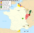
 France 1552 to 1798-en.png 800 × 600; 40 KB
-
 France 1552 to 1798-es.svg 2,584 × 1,796; 696 KB
-
 France 1552 to 1798-fr.png 800 × 600; 32 KB
-
 France 1552 to 1798-fr.svg 2,584 × 1,796; 869 KB
-
 Frankreich mit Eroberungen.png 800 × 600; 36 KB
-
 1789 Estates General map.png 2,000 × 2,050; 419 KB
-
 Medieval Ecclesiastical Divisions of France.jpg 3,010 × 3,890; 3.55 MB
-
 Acquisitions in the Reign of Louis XIV.png 928 × 846; 660 KB
-
 Actas de Hugo Capeto-es.svg 896 × 996; 650 KB
-
 Adquisicións territoriais de Luís XIV-gl.svg 1,717 × 1,662; 522 KB
-
 BorgoñaSiglosXIIXIII.svg 1,068 × 1,081; 1.3 MB
-
 Carte Etat bourguignon (Philippe le Hardi).svg 1,195 × 1,786; 434 KB
-
 Carte Etat bourguignons 1-es.svg 1,195 × 1,786; 1.54 MB
-
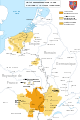
 Carte-Royaume-dArles.png 1,500 × 1,529; 412 KB
-
 Description du Beauvaisis (1640).jpg 762 × 564; 229 KB
-
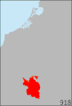 Duchy of Burgundy (918-1477).gif 617 × 907; 68 KB
-
 Duchy of Burgundy (918-1477, Red-Version).gif 617 × 907; 96 KB
-
 Duchy of Burgundy (XIV–XV centuries)-ka.svg 1,300 × 1,265; 1.77 MB
-
 El reino de los francos bajo Hugo Capeto-es.svg 1,796 × 1,796; 1.48 MB
-
 Etat bourguignon Philippe le Bon Fr.png 1,213 × 1,802; 837 KB
-
 Etat bourguignon Philippe le Bon-es.svg 5,442 × 7,100; 2.15 MB
-
 Etat bourguignons.png 1,210 × 1,851; 618 KB
-
 Flag map of Kingdom of France (1767).png 1,148 × 1,148; 757 KB
-
 Flag-map of Kingdom of France (1503).png 1,334 × 1,044; 60 KB
-
 Flag-map of Kingdom of France (1517).png 414 × 468; 18 KB
-
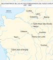
 Forteresses marches de Bretagne.png 2,126 × 1,535; 378 KB
-
 France 1552 to 1798-ca.png 2,000 × 1,390; 576 KB
-
 France 1552 to 1798-de.svg 2,584 × 1,796; 1.49 MB
-
 France 1552-1798.png 800 × 600; 46 KB
-
 France 1643 to 1715-es.svg 1,832 × 1,773; 872 KB
-
 France 1643 to 1715-fr.svg 1,717 × 1,662; 513 KB
-
 France 1643 to 1715-nl.svg 1,717 × 1,662; 513 KB
-
 France frontiers 1601 1766-es.svg 2,024 × 2,754; 2.7 MB
-
 History of France-2.jpg 1,352 × 1,064; 183 KB
-
 History of France-3.jpg 666 × 1,061; 83 KB
-
 Johann Christofle Steinsberger - Royaume de France et conquêtes de Louis le Grand - 001.jpg 7,800 × 6,509; 11.38 MB
-
 Karte Haus Burgund 1.png 2,500 × 3,724; 859 KB
-
 Karte Haus Burgund 2-es.svg 5,442 × 7,100; 1.85 MB
-
 Karte Haus Burgund 2.png 1,200 × 1,787; 250 KB
-
 Karte Haus Burgund 3-es.svg 5,442 × 7,100; 1.74 MB
-
 Karte Haus Burgund 3.png 1,200 × 1,787; 281 KB
-
 Karte Haus Burgund 4 EN.png 2,500 × 3,521; 1.33 MB
-
 Karte Haus Burgund 4 ZH.png 1,200 × 1,690; 840 KB
-
 Karte Haus Burgund 4.png 2,500 × 3,521; 1.36 MB
-
 Karte Haus Burgund 5.png 1,200 × 1,787; 449 KB
-
 Karte Haus Burgund Verwaltu.png 1,200 × 1,787; 227 KB
-
 Karte Königreich Arelat DE.png 1,500 × 1,529; 414 KB
-
 Karte-Haus-Burgund 4-es.svg 5,442 × 7,100; 2.36 MB
-
 Karte-Haus-Burgund 4-FR.png 2,500 × 3,521; 1.34 MB
-
 Karte-Haus-Burgund 5-es.svg 5,442 × 7,100; 2.12 MB
-
 Karte-Haus-Burgund-FR.png 2,500 × 3,724; 831 KB
-
 La Bourgogne aux XI e XIIe siecles ru.svg 1,050 × 1,450; 304 KB
-
 La Bourgogne aux XI e XIIe siecles-uk.svg 1,050 × 1,450; 304 KB
-
 La Bourgogne aux XI et XIIe siècles-es.svg 1,050 × 1,450; 515 KB
-
 La Bourgogne aux XI et XIIe siècles.svg 1,050 × 1,450; 302 KB
-
 Le royaume des Francs sous Hugues Capet-be.svg 1,796 × 1,796; 1.36 MB
-
 Le royaume des Francs sous Hugues Capet-en.svg 1,796 × 1,796; 1.37 MB
-
 Le royaume des Francs sous Hugues Capet-ka.svg 1,796 × 1,800; 1.23 MB
-
 Le royaume des Francs sous Hugues Capet-ru.svg 1,796 × 1,796; 1.07 MB
-
 Louis XIV Expansion.svg 423 × 518; 43 KB
-
 Map Kingdom Arelat AR.png 1,454 × 1,485; 856 KB
-
 Map Kingdom Arelat EN.png 1,310 × 1,338; 209 KB
-
 Map Kingdom Arelat-el.png 1,310 × 1,338; 227 KB
-
 PazDeLosPirineos.svg 1,832 × 1,773; 643 KB
-
 Provinces of France 1322-1789.png 2,388 × 2,452; 10.31 MB
-
 Pyrenäenfriede.svg 916 × 883; 292 KB
-
 The Kingdom of France WDL140.png 1,738 × 1,024; 3.91 MB


.svg)


.jpg)
.gif)
.gif)
-ka.svg)


.png)
.png)
.png)


