Category:Meanders in the United States
Jump to navigation
Jump to search
Subcategories
This category has the following 8 subcategories, out of 8 total.
A
E
H
M
O
P
Media in category "Meanders in the United States"
The following 42 files are in this category, out of 42 total.
-

-

-
 CREEK MEANDERS AND OXBOWS TYPICAL OF THIS GENERAL AREA - NARA - 550543.jpg 3,000 × 2,007; 814 KB
-
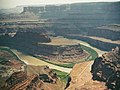 DeadHorsePointjpg.jpg 640 × 480; 106 KB
-
 Defense.gov photo essay 120620-F-MQ656-334.jpg 1,797 × 1,198; 1.88 MB
-
 HarpersFerryNHP from MarylandHts.JPG 620 × 480; 91 KB
-
 Madison River (23426445204).jpg 5,124 × 3,364; 9.71 MB
-
 Meander bends and oxbow.png 3,072 × 2,304; 8.88 MB
-
 Meander-cutoff The-Rincon Meander-Core Colorado-River Utah-USA.jpg 3,308 × 2,196; 6.98 MB
-
 Mississippi River mod.png 395 × 840; 14 KB
-
 MississippiRiverFisk(1952)10a.jpg 2,506 × 3,804; 920 KB
-
 Moccasin-bend-tn1.jpg 2,048 × 1,300; 947 KB
-
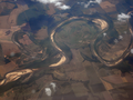
 Montgomery AL satellite map.jpg 581 × 846; 128 KB
-
 Mountains and Meandering Rivers ANWR.jpg 803 × 528; 89 KB
-
 Mountains and meandering rivers.jpg 1,606 × 1,056; 119 KB
-
 Nerr0025 - Flickr - NOAA Photo Library.jpg 1,764 × 1,080; 1.19 MB
-
 Owens River from tableland-750px.jpg 750 × 494; 52 KB
-
 Red River, Louisiana Cross Section1.jpg 5,487 × 6,734; 1.75 MB
-
 Red River, Louisiana Deposits1.jpg 5,341 × 6,771; 6.82 MB
-
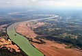
 RedRiverMeandersArkansas1.jpg 3,055 × 3,580; 5.09 MB
-
 RedRockRiverMontana.jpg 4,036 × 2,423; 1.14 MB
-
 Riparian buffer on Bear Creek in Story County, Iowa.JPG 1,500 × 2,100; 276 KB
-
 Rising-sun-indiana-ohio-river--from-above.jpg 664 × 451; 225 KB
-
 Skagit River 8667s.JPG 5,559 × 3,454; 8.16 MB
-
 Skagit River 8685 historical concrete and quarry2.jpg 2,145 × 1,130; 2.29 MB
-
 Skagit River 8685 historical concrete.jpg 1,147 × 907; 1.06 MB
-
 Skagit River 8685.JPG 4,272 × 2,848; 5.5 MB
-
 SloughCreek.jpg 1,999 × 1,277; 641 KB
-
 The Ohio river running between Ohio and West Virginia.jpg 3,950 × 2,700; 734 KB
-
 Tornado.Indiana.L5.2005-11-10.jpg 540 × 540; 156 KB
-
 Visible Spectrum vs IR.jpg 3,984 × 1,493; 1.09 MB
-
 Wabash River Meanders Grayville, Illinois.jpg 2,515 × 2,303; 3.42 MB
-
 Wabash River Meanders, Grayville, Illinois Topo.jpg 2,509 × 2,656; 5.24 MB
-
 Water Carved Canyon.jpg 5,172 × 3,277; 11.32 MB
-
 White River 5856.JPG 2,848 × 4,272; 6.63 MB
-
 White River 5857.JPG 2,848 × 4,272; 5.67 MB
-
 White River 5910.JPG 4,272 × 2,848; 6.14 MB
-
 White River 5937.JPG 4,272 × 2,848; 6.14 MB
-
 White River 5941.JPG 4,272 × 2,848; 5.75 MB
-
 White River 5951.JPG 4,272 × 2,848; 5.43 MB
-
 White River 5965.JPG 2,848 × 4,272; 4.35 MB
-
 WPSP Map.PNG 845 × 624; 109 KB
_in_Linwood,_Carroll_County,_Maryland.jpg)
.jpg)


.jpg)


10a.jpg)


