Category:Metfield
Jump to navigation
Jump to search
English: Metfield is a village in Suffolk, England, but its name is derived from Medefeld or 'Meadow feld' (see Concise Oxford Dictionary of English Place Names). It is situated close to the border with Norfolk, being approximately 5 miles south east of Harleston and 7 miles north west of Halesworth. The population was estimated to be 370 in 1996.
village in United Kingdom  | |||||
| Upload media | |||||
| Instance of | |||||
|---|---|---|---|---|---|
| Location | Mid Suffolk, Suffolk, East of England, England | ||||
 | |||||
Subcategories
This category has the following 5 subcategories, out of 5 total.
Media in category "Metfield"
The following 200 files are in this category, out of 257 total.
(previous page) (next page)-
 Approaching Metfield on Christmas Lane - geograph.org.uk - 3900873.jpg 640 × 480; 156 KB
-
 B1123 Harleston Road - geograph.org.uk - 2722340.jpg 3,072 × 2,304; 1.38 MB
-
 B1123 Harleston Road - geograph.org.uk - 2722367.jpg 3,072 × 2,304; 1.28 MB
-
 B1123 Harleston Road - geograph.org.uk - 2722370.jpg 3,072 × 2,304; 1.36 MB
-
 B1123 Harleston Road - geograph.org.uk - 2722380.jpg 3,072 × 2,304; 1.46 MB
-
 B1123 Harleston Road - geograph.org.uk - 2722447.jpg 3,072 × 2,304; 1.22 MB
-
 B1123 Harleston Road - geograph.org.uk - 3532009.jpg 3,072 × 2,304; 1.31 MB
-
 B1123 Harleston Road ^ The Corner Postbox - geograph.org.uk - 2722515.jpg 3,072 × 2,304; 1.3 MB
-
 B1123 Harleston Road ^ The Corner Postbox - geograph.org.uk - 2722552.jpg 3,072 × 2,304; 1.51 MB
-
 B1123 Harleston Road, Linstead Magna - geograph.org.uk - 3532258.jpg 3,072 × 2,304; 1.36 MB
-
 B1123 Harleston Road, Linstead Magna - geograph.org.uk - 3532265.jpg 3,072 × 2,304; 1.25 MB
-
 Bales in the rain - geograph.org.uk - 2033172.jpg 640 × 480; 48 KB
-
 Barn conversions in Hunters Lane - geograph.org.uk - 3906549.jpg 640 × 480; 217 KB
-
 Bend In Road - geograph.org.uk - 4040753.jpg 1,024 × 768; 253 KB
-
 Birch trees beside Christmas Lane - geograph.org.uk - 3900893.jpg 640 × 480; 189 KB
-
 Bridleway off Metfield Road - geograph.org.uk - 3528311.jpg 3,072 × 2,304; 1.33 MB
-
 Bridleway sign on Metfield Road - geograph.org.uk - 3528317.jpg 2,304 × 3,072; 1.34 MB
-

-
 Buildings at Fir Tree Farm - geograph.org.uk - 4214722.jpg 640 × 480; 169 KB
-
 Captain's Farm in Metfield, Suffolk - geograph.org.uk - 2179054.jpg 580 × 435; 138 KB
-
 Cereal crop beside Christmas Lane - geograph.org.uk - 3906491.jpg 640 × 480; 170 KB
-
 Cereal crop by Metfield Hall - geograph.org.uk - 3906572.jpg 640 × 360; 114 KB
-
 Cereal crop by The Wilderness - geograph.org.uk - 3906485.jpg 640 × 480; 186 KB
-
 Chicken sheds and feed hoppers - geograph.org.uk - 2193241.jpg 700 × 435; 175 KB
-
 Christmas Lane - geograph.org.uk - 2767712.jpg 2,304 × 3,072; 1.47 MB
-
 Christmas Lane - geograph.org.uk - 2767726.jpg 3,072 × 2,304; 1.39 MB
-
 Christmas Lane - geograph.org.uk - 2767740.jpg 2,304 × 3,072; 1.37 MB
-
 Christmas Lane - geograph.org.uk - 2767742.jpg 3,072 × 2,304; 1.44 MB
-
 Christmas Lane - geograph.org.uk - 2767837.jpg 3,072 × 2,304; 1.45 MB
-
 Christmas Lane - geograph.org.uk - 2767851.jpg 3,072 × 2,304; 1.61 MB
-
 Christmas Lane - geograph.org.uk - 2767861.jpg 3,072 × 2,304; 1.32 MB
-
 Christmas Lane sign - geograph.org.uk - 2722542.jpg 3,072 × 2,304; 1.44 MB
-
 Christmas Lane ^ The Corner Postbox - geograph.org.uk - 2722612.jpg 3,072 × 2,304; 1.21 MB
-
 Christmas Lane, Metfield - geograph.org.uk - 2722584.jpg 1,980 × 2,640; 1.16 MB
-
 Christmas Lane, Metfield - geograph.org.uk - 3528270.jpg 3,072 × 2,304; 1.36 MB
-
 Common Farm - geograph.org.uk - 4214777.jpg 640 × 480; 134 KB
-
 Concreted road on Metfield Common - geograph.org.uk - 4214799.jpg 640 × 480; 193 KB
-
 Concreted road on Metfield Common - geograph.org.uk - 4214808.jpg 640 × 480; 167 KB
-
 Concreted road through Metfield Common - geograph.org.uk - 4214765.jpg 640 × 480; 223 KB
-
 Converted Barn, Metfield - geograph.org.uk - 2611205.jpg 640 × 480; 157 KB
-
 Cottages along The Street, Metfield - geograph.org.uk - 2611183.jpg 640 × 480; 150 KB
-
 Cottages along The Street, Metfield - geograph.org.uk - 2611186.jpg 640 × 480; 146 KB
-
 Cottages along The Street, Metfield - geograph.org.uk - 2611199.jpg 640 × 480; 147 KB
-
 Cottages by Metfield church - geograph.org.uk - 2611220.jpg 640 × 480; 218 KB
-
 Cottages in Metfield Road - geograph.org.uk - 3900856.jpg 640 × 564; 176 KB
-
 Cottages in The Street, Metfield - geograph.org.uk - 2611217.jpg 640 × 480; 156 KB
-
 Country Road And Entrance - geograph.org.uk - 4040750.jpg 1,024 × 768; 222 KB
-
 Country track towards Metfield Road - geograph.org.uk - 2620503.jpg 3,264 × 2,448; 2.44 MB
-
 Cracked concrete surface - geograph.org.uk - 4214795.jpg 640 × 480; 216 KB
-

-
 Cratfield Road - geograph.org.uk - 1046536.jpg 640 × 426; 79 KB
-
 Cut Mark Metfield St Johns Church - geograph.org.uk - 6073713.jpg 640 × 640; 193 KB
-
 Defending the road - geograph.org.uk - 725597.jpg 640 × 480; 76 KB
-

-
 Disused WW2 airfield hardstanding - geograph.org.uk - 3900905.jpg 640 × 480; 168 KB
-
 Electricity transformer by Home Farm - geograph.org.uk - 3900868.jpg 640 × 480; 143 KB
-
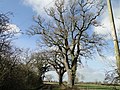 English oaks - geograph.org.uk - 4340028.jpg 640 × 480; 221 KB
-
 Entering Metfield on the B1123 Harleston Road - geograph.org.uk - 2722384.jpg 3,072 × 2,304; 1.34 MB
-
 Entering Metfield on the B1123 Harleston Road - geograph.org.uk - 4398511.jpg 3,072 × 2,304; 1.88 MB
-
 Entering Metfield on the B1123 Harleston Road - geograph.org.uk - 4398521.jpg 3,046 × 2,282; 2.45 MB
-
 Entrance to The Old Vicarage, Metfield - geograph.org.uk - 4340023.jpg 640 × 480; 270 KB
-
 Field boundary hedge - geograph.org.uk - 3906535.jpg 640 × 480; 180 KB
-
 Field Close sign - geograph.org.uk - 2722650.jpg 2,640 × 1,980; 1.97 MB
-
 Field entrance - geograph.org.uk - 3532011.jpg 3,072 × 2,304; 1.35 MB
-
 Field of Oilseed Rape - geograph.org.uk - 4340025.jpg 640 × 480; 145 KB
-

-
 Fields by Common Farm - geograph.org.uk - 4214769.jpg 640 × 480; 226 KB
-
 Fingerposts beside Christmas Lane - geograph.org.uk - 3900897.jpg 640 × 480; 218 KB
-

-
 Footpath off Fressingfield Road - geograph.org.uk - 2722715.jpg 3,072 × 2,304; 1.49 MB
-
 Footpath off Fressingfield Road - geograph.org.uk - 2722716.jpg 3,072 × 2,304; 1.59 MB
-
 Footpath off North Green Road - geograph.org.uk - 3532001.jpg 3,072 × 2,304; 1.31 MB
-
 Footpath off Skinner's Lane - geograph.org.uk - 2722696.jpg 2,304 × 3,072; 1.51 MB
-
 Footpath off Skinner's Lane - geograph.org.uk - 2722701.jpg 1,980 × 2,640; 1.5 MB
-
 Footpath off the B1123 Harleston Road - geograph.org.uk - 2722378.jpg 3,072 × 2,304; 1.42 MB
-
 Footpath off the B1123 Harleston Road - geograph.org.uk - 2722405.jpg 3,072 × 2,304; 1.59 MB
-
 Footpath through an oilseed rape crop - geograph.org.uk - 3900861.jpg 640 × 480; 153 KB
-
 Footpath to Brames Lane - geograph.org.uk - 3528285.jpg 3,072 × 2,304; 1.27 MB
-
 Footpath to Brames Lane - geograph.org.uk - 3528287.jpg 3,072 × 2,304; 1.28 MB
-
 Footpath to Christmas Lane - geograph.org.uk - 2722438.jpg 3,072 × 2,304; 1.29 MB
-
 Footpath to Docking Hall - geograph.org.uk - 2767695.jpg 2,304 × 3,072; 1.51 MB
-
 Footpath to Docking Hall - geograph.org.uk - 2767699.jpg 2,304 × 3,072; 1.38 MB
-
 Footpath to Fressingfield Road - geograph.org.uk - 2722373.jpg 3,072 × 2,304; 1.31 MB
-
 Footpath to Fressingfield ^ North Green Roads - geograph.org.uk - 2722365.jpg 3,072 × 2,304; 1.46 MB
-
 Footpath to Mefield Common ^ entrance to Metfield Hall - geograph.org.uk - 2723218.jpg 3,072 × 2,304; 1.4 MB
-
 Footpath to Metfield Common - geograph.org.uk - 2767697.jpg 2,304 × 3,072; 1.2 MB
-
 Footpath to Mill Lane - geograph.org.uk - 3528283.jpg 3,072 × 2,304; 1.6 MB
-
 Footpath to Mill Mounts - geograph.org.uk - 2722723.jpg 3,072 × 2,304; 1.32 MB
-
 Footpath to the B1123 The Street - geograph.org.uk - 2767830.jpg 3,072 × 2,304; 1.47 MB
-
 Footpath to the B1123 The Street - geograph.org.uk - 2767874.jpg 2,304 × 3,072; 1.54 MB
-
 Footpath to the B1123 ^ Kettles Farm - geograph.org.uk - 2722315.jpg 3,072 × 2,304; 1.4 MB
-
 Footpath to the Old Vicarage - geograph.org.uk - 3900863.jpg 640 × 480; 124 KB
-
 Footpath to The Street - geograph.org.uk - 2767733.jpg 3,072 × 2,304; 1.37 MB
-
 Footpath to The Street - geograph.org.uk - 2767734.jpg 3,072 × 2,304; 1.29 MB
-
 Footpath to The Street - geograph.org.uk - 2767735.jpg 2,304 × 3,072; 1.22 MB
-
 Fressingfield Road ^ Post Office The Street Postbox - geograph.org.uk - 2722658.jpg 3,072 × 2,304; 1.4 MB
-
 Fressingfield Road, Metfield - geograph.org.uk - 2722674.jpg 3,072 × 2,304; 1.26 MB
-
 Fressingfield Road, Metfield - geograph.org.uk - 2722683.jpg 3,072 × 2,304; 1.27 MB
-
 Fressingfield Road, Metfield - geograph.org.uk - 2722709.jpg 2,640 × 1,980; 758 KB
-
 Fressingfield Road, Metfield - geograph.org.uk - 2722722.jpg 3,072 × 2,304; 1.55 MB
-
 Gated entrance to poultry houses - geograph.org.uk - 3900871.jpg 640 × 480; 138 KB
-

-
 Harleston Road through Metfield Common - geograph.org.uk - 3906530.jpg 640 × 480; 150 KB
-
 Heading east on Christmas Lane - geograph.org.uk - 3900892.jpg 640 × 480; 166 KB
-

-

-

-

-
 Memorial To U.S.A.A.F. - geograph.org.uk - 315654.jpg 640 × 480; 71 KB
-
 Metfield Bus Shelter - geograph.org.uk - 1096500.jpg 3,072 × 2,304; 1.38 MB
-

-
 Metfield Chapel - geograph.org.uk - 2722623.jpg 3,072 × 2,304; 1.14 MB
-
 Metfield Chapel - geograph.org.uk - 2722625.jpg 3,072 × 2,304; 1.35 MB
-
 Metfield Common - geograph.org.uk - 4214748.jpg 640 × 480; 220 KB
-
 Metfield Garage - geograph.org.uk - 2767724.jpg 3,072 × 2,304; 1.44 MB
-
 Metfield Garage - geograph.org.uk - 2767729.jpg 3,072 × 2,304; 1.44 MB
-
 Metfield Garage - geograph.org.uk - 4041254.jpg 1,024 × 768; 188 KB
-
 Metfield Garage - geograph.org.uk - 4041258.jpg 1,024 × 768; 222 KB
-
 Metfield Garage - geograph.org.uk - 4041264.jpg 1,024 × 768; 235 KB
-

-
 Metfield Garage and MOT Centre - geograph.org.uk - 3900888.jpg 640 × 480; 130 KB
-
 Metfield Methodist Chapel - geograph.org.uk - 584999.jpg 640 × 480; 95 KB
-
 Metfield Road ^ bridleway - geograph.org.uk - 3528301.jpg 3,072 × 2,304; 1.23 MB
-
 Metfield Road ^ bridleway - geograph.org.uk - 3528307.jpg 3,072 × 2,304; 1.31 MB
-
 Metfield Road ^ footpaths - geograph.org.uk - 3528279.jpg 3,072 × 2,304; 1.3 MB
-
 Metfield Road, Metfield - geograph.org.uk - 3528276.jpg 3,072 × 2,304; 1.35 MB
-
 Metfield Road, Metfield - geograph.org.uk - 3528300.jpg 3,072 × 2,304; 1.36 MB
-
 Metfield Stores - geograph.org.uk - 2722461.jpg 3,072 × 2,304; 1.44 MB
-
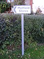 Metfield Stores sign - geograph.org.uk - 2722585.jpg 2,304 × 3,072; 1.53 MB
-
 Metfield Telephone Box - geograph.org.uk - 2722513.jpg 1,785 × 2,636; 1.17 MB
-
 Metfield Village - geograph.org.uk - 1096505.jpg 3,072 × 2,304; 1.41 MB
-
 Metfield Village Hall - geograph.org.uk - 1096494.jpg 3,072 × 2,304; 1.26 MB
-
 Metfield Village Name sign - geograph.org.uk - 4398515.jpg 2,216 × 2,947; 4.17 MB
-
 Metfield Village Name sign - geograph.org.uk - 4398523.jpg 2,995 × 2,244; 2.88 MB
-
 Metfield village sign - geograph.org.uk - 4293440.jpg 480 × 640; 214 KB
-
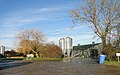
 Metfield Water Tower - geograph.org.uk - 71136.jpg 600 × 400; 36 KB
-
 Mill Lane footpath - geograph.org.uk - 2722534.jpg 3,072 × 2,304; 1.48 MB
-
 Modern house in Christmas Lane - geograph.org.uk - 3900881.jpg 640 × 480; 178 KB
-
 North Green Road - geograph.org.uk - 2722312.jpg 3,072 × 2,304; 1.45 MB
-
 North Green Road - geograph.org.uk - 2722324.jpg 3,072 × 2,304; 1.38 MB
-
 Nunn's Lane footpath - geograph.org.uk - 3532237.jpg 3,072 × 2,304; 1.26 MB
-
 Oaks on a hillock by Metfield village - geograph.org.uk - 3900875.jpg 640 × 480; 151 KB
-

-
 Office Farm Farmhouse - geograph.org.uk - 1771917.jpg 1,600 × 1,200; 589 KB
-

-
 Oilseed rape crop by Elm Farm - geograph.org.uk - 3906514.jpg 640 × 480; 211 KB
-

-

-
 Old concreted road - geograph.org.uk - 4214771.jpg 640 × 480; 205 KB
-
 Old Garage And Petrol Pumps - geograph.org.uk - 4041257.jpg 1,024 × 769; 186 KB
-
 Old Garage Name Sign - geograph.org.uk - 4041260.jpg 1,024 × 768; 180 KB
-
 Old grass cutter - geograph.org.uk - 3906465.jpg 480 × 640; 108 KB
-

-
 Old lorry parked beside a field - geograph.org.uk - 3906450.jpg 640 × 480; 167 KB
-
 Old RAF building - geograph.org.uk - 4214817.jpg 640 × 480; 148 KB
-
 One of the camels at Oasis Camel Centre - geograph.org.uk - 2115985.jpg 480 × 640; 132 KB
-
 Path on Metfield Common - geograph.org.uk - 4214770.jpg 640 × 480; 207 KB
-
 Path to Kettles Farm - geograph.org.uk - 4214759.jpg 640 × 480; 129 KB
-

-
 Pillbox off the B1123 Harleston Road - geograph.org.uk - 3532246.jpg 3,072 × 2,304; 1.49 MB
-
 Pillbox off the B1123 Harleston Road - geograph.org.uk - 3532251.jpg 3,072 × 2,304; 1.46 MB
-
 Playground camel slide at Metfield, Suffolk, England.jpg 480 × 640; 102 KB
-
 Pond near Street Farm, Metfield - geograph.org.uk - 4883559.jpg 3,648 × 2,736; 4.57 MB
-
 Post Office The Street Postbox - geograph.org.uk - 2722663.jpg 2,304 × 3,072; 1.63 MB
-
 Post Office The Street Postbox - geograph.org.uk - 2722665.jpg 2,640 × 1,980; 1.78 MB
-
 Postbox - geograph.org.uk - 4041276.jpg 768 × 1,024; 208 KB
-
 Poultry houses by Home Farm - geograph.org.uk - 3900870.jpg 640 × 480; 114 KB
-

-
 Private road to Metfield Hall - geograph.org.uk - 2179036.jpg 580 × 435; 135 KB
-
 Private road to Metfield Hall - geograph.org.uk - 4214802.jpg 640 × 480; 155 KB
-
 Public footpath past Common Farm - geograph.org.uk - 4214776.jpg 640 × 480; 191 KB
-
 RAF Metfield (USAAF Station 366) - geograph.org.uk - 3906456.jpg 640 × 480; 185 KB
-
 Recently ploughed fields near Lambert farm - geograph.org.uk - 2620492.jpg 3,264 × 2,448; 2.62 MB
-
 Road to the Oasis Camel Centre - geograph.org.uk - 2237891.jpg 640 × 480; 154 KB
-
 Roadsign on Christmas Lane - geograph.org.uk - 2767866.jpg 2,304 × 3,072; 1.47 MB
-
 Roadsign on Christmas Lane - geograph.org.uk - 3528273.jpg 2,304 × 3,072; 1.67 MB
-
 Roadsign on Skinner's Lane - geograph.org.uk - 2722688.jpg 2,304 × 3,072; 1.47 MB
-
 Roadsign on the B1123 Harleston Road - geograph.org.uk - 2722451.jpg 2,304 × 3,072; 1.3 MB
-
 Roadsign on the B1123 Harleston Road - geograph.org.uk - 2722538.jpg 2,304 × 3,072; 1.28 MB
-

-

-
 Seldom used bridge over drainage ditch - geograph.org.uk - 4214812.jpg 640 × 480; 286 KB
-

-
 Sheds by Metfield Hall - geograph.org.uk - 3906574.jpg 640 × 394; 97 KB
-
 Skinner's Lane, Metfield - geograph.org.uk - 2722692.jpg 1,980 × 2,640; 1.37 MB
-
 Snow shows up the blue - geograph.org.uk - 2179045.jpg 580 × 435; 119 KB
-
 St.Johns Meadow sign - geograph.org.uk - 2722679.jpg 3,072 × 2,304; 1.49 MB
-
 St.Johns Meadow, Metfield - geograph.org.uk - 2722676.jpg 3,072 × 2,304; 1.27 MB
-
 Strange face peeking through the hedge - geograph.org.uk - 2115994.jpg 480 × 640; 136 KB
-
 Street Farm, Metfield - geograph.org.uk - 2611208.jpg 640 × 480; 158 KB
-
 Street Farm, Metfield - geograph.org.uk - 2611214.jpg 640 × 480; 181 KB
-
 Thatched cottage in Hunters Lane - geograph.org.uk - 2179002.jpg 580 × 435; 103 KB
-
 Thatched cottage in Hunters Lane - geograph.org.uk - 3906547.jpg 640 × 601; 188 KB
-
 The B1123 at Linstead Green - geograph.org.uk - 252861.jpg 1,600 × 1,200; 483 KB
-
 The B1123, heading towards Metfield - geograph.org.uk - 367050.jpg 640 × 457; 65 KB
-
 The Corner Postbox - geograph.org.uk - 2722557.jpg 3,072 × 2,304; 1.44 MB
-
 The Corner Postbox - geograph.org.uk - 2722560.jpg 2,304 × 3,072; 1.51 MB
-
 The Doctor's Lodge, Metfield - geograph.org.uk - 2611223.jpg 640 × 480; 203 KB
-
 The entrance to Docking Hall - geograph.org.uk - 2767690.jpg 3,072 × 2,304; 1.47 MB
-
 The grave of Florence Kate Grange - geograph.org.uk - 4395498.jpg 768 × 1,024; 687 KB


_-_geograph.org.uk_-_3906461.jpg)


_-_geograph.org.uk_-_3906456.jpg)


