Category:Metropolitan Borough of Rotherham
Zur Navigation springen
Zur Suche springen

Verwaltungseinheit in England    | |||||
| Medium hochladen | |||||
| Ist ein(e) | |||||
|---|---|---|---|---|---|
| Ort | South Yorkshire, Yorkshire and the Humber, England | ||||
| Hauptstadt | |||||
| Gesetzgebende Körperschaft |
| ||||
| Exekutivorgan |
| ||||
| Leiter der Regierung oder Verwaltung |
| ||||
| Datum der Gründung, Erstellung, Entstehung, Erbauung |
| ||||
| Einwohnerzahl |
| ||||
| Fläche |
| ||||
| Verschieden von | |||||
| offizielle Website | |||||
 | |||||
Unterkategorien
Es werden 44 von insgesamt 44 Unterkategorien in dieser Kategorie angezeigt:
In Klammern die Anzahl der enthaltenen Kategorien (K), Seiten (S), Dateien (D)
A
B
- Bramley, Rotherham (62 D)
C
D
- Dalton, South Yorkshire (82 D)
F
G
- Gildingwells (71 D)
H
- Hooton Levitt (37 D)
K
L
M
N
O
R
S
T
U
W
- Woodsetts (77 D)
Medien in der Kategorie „Metropolitan Borough of Rotherham“
Folgende 200 Dateien sind in dieser Kategorie, von 1.095 insgesamt.
(vorherige Seite) (nächste Seite)-
 "Rock Tavern", Highthorn Road, Swinton - geograph.org.uk - 3250057.jpg 4.383 × 2.922; 2,69 MB
-
 "The Bridge Bar", Swinton - geograph.org.uk - 3250040.jpg 4.369 × 2.913; 3,07 MB
-
 "The Corn Law Rhymer" in Rotherham - geograph.org.uk - 4123636.jpg 1.851 × 2.467; 1,32 MB
-
 "The Donfield Tavern", Eldon Road, Rotherham - geograph.org.uk - 3603965.jpg 3.339 × 2.505; 1,59 MB
-
 "The Fairways" public house, Brinsworth - geograph.org.uk - 3200727.jpg 4.194 × 2.996; 3,31 MB
-
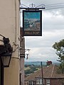
 "The Hilltop", Richmond Park, Kimberworth - geograph.org.uk - 2577219.jpg 2.372 × 1.779; 731 KB
-
 "The Hilltop"- pub sign with a view to the west - geograph.org.uk - 2577222.jpg 1.681 × 2.241; 768 KB
-
 "The Kimberworth Park" pub restaurant - geograph.org.uk - 3084693.jpg 4.290 × 2.860; 2,5 MB
-
 "The Kingfisher", Rotherham - geograph.org.uk - 3084670.jpg 2.980 × 4.172; 2,51 MB
-
 "The Place", Rotherham - geograph.org.uk - 3603900.jpg 3.648 × 2.736; 2,22 MB
-
 "The Queens" public house, Rawmarsh - geograph.org.uk - 3250084.jpg 4.228 × 3.020; 2,77 MB
-
 "The Stag", Stag Roundabout, Rotherham - geograph.org.uk - 3604337.jpg 3.428 × 2.571; 1,83 MB
-
 'Bird Estate' at Thorpe Hesley, from Hague Lane, Wentworth - geograph.org.uk - 3303064.jpg 2.990 × 2.228; 2,32 MB
-
 17 miles from Chesterfield (geograph 1793049).jpg 518 × 389; 147 KB
-
 A family of bears - geograph.org.uk - 3406869.jpg 800 × 600; 211 KB
-
 A pair of footbridges - geograph.org.uk - 5707224.jpg 800 × 600; 88 KB
-

-
 A6109 approaching Junction 34, M1 - geograph.org.uk - 2808847.jpg 640 × 480; 49 KB
-
 A6109 heading west - geograph.org.uk - 2808836.jpg 640 × 480; 52 KB
-
 A6109 towards the M1, Junction 34 - geograph.org.uk - 2808841.jpg 640 × 480; 64 KB
-
 A6178 heading east - geograph.org.uk - 2808637.jpg 640 × 480; 51 KB
-
 A6178 Sheffield Road at Templeborough - geograph.org.uk - 6120993.jpg 1.024 × 768; 95 KB
-

-
 A618 towards Rotherham - geograph.org.uk - 2582477.jpg 1.600 × 1.200; 516 KB
-
 A629 approaching roundabout - geograph.org.uk - 2809115.jpg 640 × 480; 55 KB
-
 A629 at College Road Roundabout - geograph.org.uk - 6121005.jpg 1.024 × 770; 145 KB
-
 A629 towards Rotherham - geograph.org.uk - 2809098.jpg 640 × 480; 98 KB
-
 A629 towards Rotherham - geograph.org.uk - 2809103.jpg 640 × 480; 80 KB
-
 A629 towards Rotherham - geograph.org.uk - 2809108.jpg 640 × 480; 56 KB
-
 A630 towards Doncaster - geograph.org.uk - 2582971.jpg 1.600 × 1.200; 360 KB
-
 A631 at Rotherway Roundabout - geograph.org.uk - 4906301.jpg 1.200 × 799; 349 KB
-
 A633 towards Rotherham - geograph.org.uk - 2810436.jpg 640 × 480; 111 KB
-
 Above the Dearne valley. - geograph.org.uk - 3944857.jpg 640 × 480; 61 KB
-

-
 Across Scholes Ground - geograph.org.uk - 3948048.jpg 2.528 × 1.806; 863 KB
-

-
 After the storm from Aldi's car park - geograph.org.uk - 4626661.jpg 1.024 × 967; 152 KB
-
 Aldwarke - River Don weir - geograph.org.uk - 2452912.jpg 1.600 × 1.200; 556 KB
-
 Aldwarke - steelworks re-heating shop - geograph.org.uk - 2452915.jpg 1.600 × 1.243; 386 KB
-
 Aldwarke Acon, Rawmarsh - geograph.org.uk - 2262125.jpg 640 × 480; 94 KB
-
 Aldwarke Lane, Aldwarke (1) - geograph.org.uk - 4837486.jpg 626 × 640; 203 KB
-
 Aldwarke Lane, Aldwarke (2) - geograph.org.uk - 4837495.jpg 640 × 490; 176 KB
-
 Aldwarke Lock - geograph.org.uk - 5707234.jpg 800 × 600; 98 KB
-
 Aldwarke Weir - geograph.org.uk - 5707233.jpg 800 × 600; 131 KB
-
 All Saints Square, Rotherham - geograph.org.uk - 6113311.jpg 1.024 × 768; 201 KB
-
 All Saints, Wath upon Dearne, path - geograph.org.uk - 5956764.jpg 640 × 480; 99 KB
-
 Alleyway off Quarry Street, Rawmarsh - geograph.org.uk - 6112292.jpg 1.024 × 768; 215 KB
-
 Allotments off Herringthorpe Valley Road - geograph.org.uk - 2582985.jpg 1.600 × 1.200; 673 KB
-
 Alma Tavern, Rotherham - geograph.org.uk - 4876621.jpg 671 × 1.024; 167 KB
-
 An old variety of apple - geograph.org.uk - 1823224.jpg 2.270 × 2.980; 3,64 MB
-
 Angler by Rotherham Cut - geograph.org.uk - 3604025.jpg 3.648 × 2.736; 2,1 MB
-
 Angling Centre, Brampton Bierlow, near Barnsley - geograph.org.uk - 3134001.jpg 1.777 × 1.316; 825 KB
-
 Another photo of Keppel's Column - geograph.org.uk - 3738125.jpg 1.200 × 1.600; 392 KB
-
 Antique Shop, Swinton - geograph.org.uk - 2372853.jpg 640 × 502; 63 KB
-
 Apartments on Moorgate - geograph.org.uk - 3258421.jpg 1.024 × 768; 152 KB
-
 Approaching Roundwood Farm - geograph.org.uk - 6029079.jpg 1.024 × 768; 199 KB
-
 Approaching Swinton - geograph.org.uk - 5707790.jpg 800 × 600; 115 KB
-
-
 Arqiva aerial on Dropingwell Road - geograph.org.uk - 2306712.jpg 768 × 1.024; 103 KB
-
 Arriving at Greasbrough from Wentworth - geograph.org.uk - 3738322.jpg 1.600 × 1.200; 521 KB
-
 At Barbot Farm, Greasbrough - geograph.org.uk - 3948121.jpg 2.590 × 1.850; 1,01 MB
-
 At Low Stubbin - geograph.org.uk - 3171839.jpg 4.509 × 2.706; 3,39 MB
-
 August clouds over Sheffield - geograph.org.uk - 4123601.jpg 2.488 × 1.866; 783 KB
-
 B6089 Car Hill at Barbot Hill Road junction - geograph.org.uk - 6121007.jpg 1.024 × 768; 99 KB
-

-
 B6089 heading north, Greasbrough - geograph.org.uk - 2810321.jpg 640 × 480; 71 KB
-
 B6089 Stubbin Road at Higher Stubbin - geograph.org.uk - 6121012.jpg 1.024 × 769; 126 KB
-
 B6089 The Whins at Nether Haugh boundary - geograph.org.uk - 6121009.jpg 1.024 × 768; 90 KB
-
 B6090 heading east - geograph.org.uk - 2810421.jpg 640 × 480; 91 KB
-
 Baaa^ Mother and twin lambs at Scholes - geograph.org.uk - 3948079.jpg 1.815 × 2.540; 2,1 MB
-
 Back-to-back bus shelters - geograph.org.uk - 4127464.jpg 800 × 600; 106 KB
-
 Barkers Park - geograph.org.uk - 1943255.jpg 2.560 × 1.920; 1,41 MB
-
 Barkers Park, Kimberworth - geograph.org.uk - 3084694.jpg 2.827 × 3.957; 2,63 MB
-
 Barnsley Road - geograph.org.uk - 4319980.jpg 640 × 480; 62 KB
-
 Barrage on the River Don - geograph.org.uk - 5707232.jpg 800 × 600; 134 KB
-
 Beefeater on East Bawtry Road, Rotherham - geograph.org.uk - 3982824.jpg 1.600 × 1.013; 535 KB
-
 Beeversleigh Flats - geograph.org.uk - 3406894.jpg 594 × 800; 109 KB
-
 Benchmark on Hill Top Stores - geograph.org.uk - 2306679.jpg 640 × 480; 95 KB
-
 Bennett Close, Sandhill, Rawmarsh - geograph.org.uk - 3250083.jpg 4.606 × 2.764; 2,66 MB
-
 Between Rawmarsh and Kilnhurst - geograph.org.uk - 2980237.jpg 640 × 379; 44 KB
-
 Birch tree by the Kilnhurst Cut - geograph.org.uk - 6028814.jpg 1.024 × 768; 126 KB
-
 Blackamoor Road - geograph.org.uk - 5707787.jpg 800 × 600; 115 KB
-
 Blue Bricks - geograph.org.uk - 2238380.jpg 3.264 × 2.448; 926 KB
-
 Boats at Rotherham Canal Navigation Junction - geograph.org.uk - 5082398.jpg 4.608 × 3.456; 3,78 MB
-
 BOC Offices on Bawtry Road - geograph.org.uk - 3845957.jpg 3.746 × 2.622; 1,95 MB
-
 Boston Castle Road towards Moorgate Road - geograph.org.uk - 5914838.jpg 1.600 × 1.064; 681 KB
-
 Boston Castle Terrance, Rotherham - geograph.org.uk - 4905663.jpg 1.200 × 799; 324 KB
-
 Boston Castle, Rotherham - geograph.org.uk - 4905694.jpg 1.200 × 799; 275 KB
-
 Boston Castle, Rotherham - geograph.org.uk - 4905732.jpg 1.200 × 799; 277 KB
-
 Boston Castle, Rotherham - geograph.org.uk - 5914837.jpg 1.600 × 1.064; 613 KB
-
 Bottom of Percy Street, Rotherham - geograph.org.uk - 6113317.jpg 1.024 × 768; 150 KB
-
 Bow Bridge Close, Rotherham - geograph.org.uk - 2943394.jpg 640 × 480; 69 KB
-

-
 Bradgate Park - geograph.org.uk - 2809110.jpg 640 × 480; 95 KB
-
 Bradgate Park, Rotherham - geograph.org.uk - 3982874.jpg 1.600 × 1.064; 643 KB
-
 Bradmarsh Business Park, Rotherham - geograph.org.uk - 3948227.jpg 2.592 × 1.944; 1,78 MB
-
 Brampton Fixings on Brampton Road - geograph.org.uk - 4008837.jpg 1.600 × 1.064; 429 KB
-
 Brampton Road, Wath upon Dearne - geograph.org.uk - 4008753.jpg 1.600 × 1.056; 449 KB
-
 Bray Plantation - geograph.org.uk - 2809096.jpg 480 × 640; 144 KB
-
 Bridge closure - geograph.org.uk - 1826520.jpg 4.416 × 3.312; 5,58 MB
-
 Bridge detail - dyke north of Hague Avenue, Rawmarsh - geograph.org.uk - 3249886.jpg 4.608 × 3.072; 3,8 MB
-
 Bridge over the River Dearne - geograph.org.uk - 5035209.jpg 4.999 × 3.749; 3,7 MB
-
 Bridge Street Bridge, Rotherham - geograph.org.uk - 4197855.jpg 1.600 × 1.064; 780 KB
-
 Bridge Street Bridge, Rotherham - geograph.org.uk - 4197859.jpg 1.600 × 1.064; 570 KB
-
 Bridge Street, Rotherham - geograph.org.uk - 2582945.jpg 1.600 × 1.200; 338 KB
-
 Bridges over the River Don at Holmes - geograph.org.uk - 4215358.jpg 1.600 × 1.200; 527 KB
-
 Bridleway approaching Scholes Coppice - geograph.org.uk - 3738127.jpg 1.600 × 1.200; 820 KB
-
 Bridleway at Thorpe Hesley - geograph.org.uk - 3738006.jpg 1.600 × 1.200; 723 KB
-
 Bridleway towards Munsbrough Lane - geograph.org.uk - 4198009.jpg 1.598 × 1.600; 1,35 MB
-
 Broad Street, Parkgate - geograph.org.uk - 5073785.jpg 4.395 × 3.314; 3,35 MB
-
 Broadmarsh Way, Rotherham - geograph.org.uk - 4861708.jpg 640 × 480; 68 KB
-
 Broadmarsh Way, Rotherham - geograph.org.uk - 4861711.jpg 640 × 473; 55 KB
-
 Brook flowing towards Morley Pond - geograph.org.uk - 4198450.jpg 1.600 × 1.064; 881 KB
-
 Broom Crescent - geograph.org.uk - 5670911.jpg 640 × 427; 198 KB
-
 Building on Forge Way, Rotherham - geograph.org.uk - 2917143.jpg 640 × 371; 39 KB
-
 Building on Moorgate Road, Rotherham - geograph.org.uk - 5914847.jpg 1.600 × 1.064; 672 KB
-
 Building site on Ridge Road - geograph.org.uk - 3666955.jpg 2.560 × 1.920; 1,11 MB
-
 Building site on Thorpe Street - geograph.org.uk - 1943626.jpg 2.560 × 1.920; 702 KB
-
 Buildings at the Corus steelworks - geograph.org.uk - 2980246.jpg 640 × 306; 47 KB
-
 Buildings on Boston Castle Grove - geograph.org.uk - 5914835.jpg 1.600 × 1.064; 807 KB
-
 Buildings on Sherwood Crescent, Rotherham - geograph.org.uk - 3982846.jpg 1.600 × 1.106; 593 KB
-
 Bulrushes blowing - geograph.org.uk - 2779592.jpg 3.264 × 2.448; 2,5 MB
-
 Bunker at Grange Park Golf Club - geograph.org.uk - 3084697.jpg 3.070 × 4.298; 2,7 MB
-
 Bunker at the 14th green - geograph.org.uk - 2713401.jpg 1.024 × 768; 140 KB
-
 Burns Way - geograph.org.uk - 3357458.jpg 640 × 480; 73 KB
-
 Bus in College Road - geograph.org.uk - 5965639.jpg 640 × 480; 64 KB
-
 Bus Shelter on Town Lane, Wingfield - geograph.org.uk - 4198378.jpg 1.600 × 1.064; 796 KB
-
 Bus stop on Herringthorpe Lane, Rotherham - geograph.org.uk - 3080452.jpg 1.024 × 603; 140 KB
-
 Bus stop on Upper Wortley Road - geograph.org.uk - 2713394.jpg 1.024 × 768; 276 KB
-
 Businesses on Main Street, Rotherham - geograph.org.uk - 4123608.jpg 2.533 × 1.689; 1,12 MB
-
 Butchers Arms on Station Road, Swinton - geograph.org.uk - 3983101.jpg 1.600 × 922; 480 KB
-
 By a former railway track at Ockley Bottom - geograph.org.uk - 4453734.jpg 4.894 × 3.713; 5,35 MB
-
 By wash below Milestone Lock, Chesterfield Canal (geograph 1793052).jpg 518 × 389; 139 KB
-
 Café Nomad, Boston Castle Road, Rotherham - geograph.org.uk - 4905655.jpg 1.200 × 799; 559 KB
-
 Camelot Play Castle on Tenter Street, Rotherham - geograph.org.uk - 4197907.jpg 1.600 × 1.064; 553 KB
-
 Canal at Kilnhurst - geograph.org.uk - 2193814.jpg 3.264 × 2.448; 580 KB
-

-
 Canal bridge, Swinton - geograph.org.uk - 2192571.jpg 3.264 × 2.448; 707 KB
-
 Canklow Bank - geograph.org.uk - 4357031.jpg 3.264 × 2.448; 4,18 MB
-
 Canklow Woods, Rotherham - geograph.org.uk - 5914825.jpg 1.600 × 1.064; 1,14 MB
-
 Canklow Woods, Rotherham - geograph.org.uk - 5914826.jpg 1.600 × 1.064; 1,23 MB
-
 Car park and the Station Inn - geograph.org.uk - 3207194.jpg 640 × 427; 101 KB
-
 Car park in the park - geograph.org.uk - 3510921.jpg 800 × 600; 131 KB
-
 Car park, Swinton Station - geograph.org.uk - 2810460.jpg 640 × 480; 68 KB
-
 Carnoustie Close, Swinton - geograph.org.uk - 3250049.jpg 4.307 × 2.872; 2,44 MB
-
 Cars on a transporter - geograph.org.uk - 2505580.jpg 3.648 × 2.736; 5,14 MB
-
 Cast iron figure by Green Lane, Kimberworth Hills - geograph.org.uk - 4453739.jpg 3.665 × 4.895; 5,16 MB
-
 Celtic Court off Simmonite Road, Kimberworth Park - geograph.org.uk - 4198119.jpg 1.600 × 1.064; 725 KB
-
 Centenary Riverside - geograph.org.uk - 2341660.jpg 640 × 480; 294 KB
-
 Centenary Riverside - geograph.org.uk - 2876119.jpg 2.848 × 2.144; 1,46 MB
-
 Centenary Way and the River Rother - geograph.org.uk - 2861513.jpg 2.848 × 2.144; 1,51 MB
-
 Central Library and Arts Centre, Rotherham - geograph.org.uk - 2250333.jpg 1.024 × 768; 114 KB
-
 Cherry Trees Care Home - geograph.org.uk - 4198101.jpg 1.600 × 1.064; 541 KB
-
 Chesterton Road, Rotherham - geograph.org.uk - 2582968.jpg 1.600 × 1.200; 330 KB
-
 Children fishing on the Rotherham Cut - geograph.org.uk - 3604008.jpg 3.648 × 2.736; 1,96 MB
-
 Chiltern House on Moorgate Lane, Rotherham - geograph.org.uk - 5914879.jpg 1.600 × 1.117; 634 KB
-
 Church Street (A6022) - geograph.org.uk - 2810445.jpg 640 × 480; 49 KB
-
 Church Street (A6022) - geograph.org.uk - 2810452.jpg 640 × 480; 77 KB
-
 Church Street in Greasbrough - geograph.org.uk - 5069768.jpg 4.608 × 3.456; 3,4 MB
-
 Church Street in Greasbrough - geograph.org.uk - 5069769.jpg 4.350 × 3.250; 3,03 MB
-
 Church Street in Wath Upon Dearne - geograph.org.uk - 4747337.jpg 4.608 × 3.456; 3,88 MB
-
 Church Street in Wath Upon Dearne - geograph.org.uk - 5762573.jpg 4.000 × 3.000; 3,46 MB
-
 Civic Building, Rotherham - geograph.org.uk - 2250328.jpg 1.024 × 768; 156 KB
-
 Class 153 at Swinton - geograph.org.uk - 2845049.jpg 640 × 426; 100 KB
-

-
 Class 47 diesel locomotive at Wath - geograph.org.uk - 2308290.jpg 1.591 × 1.239; 1,39 MB
-
 Clifton Avenue, Rotherham - geograph.org.uk - 3603905.jpg 3.558 × 2.542; 1,77 MB
-
 Clifton Park - Doncaster Road Entrance - geograph.org.uk - 5069728.jpg 4.608 × 3.456; 4,39 MB
-
 Clifton Park bandstand - geograph.org.uk - 3666965.jpg 2.560 × 1.920; 1,35 MB
-
 Clifton park bandstand. - geograph.org.uk - 4590789.jpg 640 × 359; 74 KB
-
 Clifton Park Museum - geograph.org.uk - 4346924.jpg 4.976 × 3.659; 5,09 MB
-
 Clough Green off Rodger Road, Rotherham - geograph.org.uk - 4197921.jpg 1.600 × 1.064; 498 KB
-
 Co-op Bank, Bridgegate - geograph.org.uk - 5965678.jpg 640 × 480; 80 KB
-

-
 Coal Authority Mine Gas Monitor - geograph.org.uk - 4198293.jpg 1.100 × 1.600; 1,17 MB
-
 Coat of arms of Rotherham Metropolitan Borough Council.png 1.500 × 1.406; 1,15 MB
-
 Cobbled footpath descending towards Rawmarsh - geograph.org.uk - 3738342.jpg 1.600 × 1.200; 562 KB
-
 Commemorative Plaque in Thorpe Hesley - geograph.org.uk - 3390545.jpg 4.000 × 3.000; 2,71 MB
-
 Common Land near Kimberworth Park - geograph.org.uk - 5234795.jpg 4.532 × 3.389; 3,26 MB
-
 Concord View Road from West Hill, Kimberworth - geograph.org.uk - 2577235.jpg 2.326 × 1.745; 1,02 MB
-
 Concrete plant, Wath Upon Dearne - geograph.org.uk - 2980211.jpg 640 × 368; 45 KB
-
 Confluence of the Don and the Rother - geograph.org.uk - 2858397.jpg 2.848 × 2.144; 1,53 MB
-
 Cooling system for the steel works - geograph.org.uk - 1827885.jpg 3.557 × 2.301; 5,22 MB
-
 Corner of Church Street and Queen Street in Swinton - geograph.org.uk - 5308287.jpg 4.461 × 3.243; 3,3 MB
-
 Cottages at Blackamoor - geograph.org.uk - 3249888.jpg 4.344 × 2.896; 2,87 MB
-
 Cottages at Higher Stubbin - geograph.org.uk - 5074196.jpg 4.003 × 3.050; 3,27 MB
-
 Cottages at Low Stubbin with view to Hoober Stand - geograph.org.uk - 3171852.jpg 3.730 × 2.984; 2,94 MB
-
 Cottages in Scholes Village - geograph.org.uk - 2713366.jpg 1.024 × 768; 289 KB
-
 Course of a former railway - geograph.org.uk - 6015951.jpg 1.024 × 768; 147 KB
-
 Crane at Waddington's Boat and Timber yard - geograph.org.uk - 6015992.jpg 1.024 × 760; 167 KB
-
 Cricket Pavilion Clifton Lane - geograph.org.uk - 2841481.jpg 3.264 × 2.176; 3,27 MB
-
 Crop Field near Abdy Farm - geograph.org.uk - 4747318.jpg 4.608 × 3.456; 3,91 MB
-
 Crop Fields near Bassingthorpe Farm - geograph.org.uk - 5069742.jpg 4.608 × 3.456; 3,84 MB
-
 Crossroads in Greasbrough - geograph.org.uk - 5069746.jpg 4.608 × 3.456; 3,58 MB
-
 Cycle path beside the A6123 - geograph.org.uk - 2582980.jpg 1.600 × 1.200; 432 KB
-
 Cycle path beside the A6123 - geograph.org.uk - 2582987.jpg 1.600 × 1.200; 387 KB
-
 Cyclists having a rest on the Trans Pennine Trail - geograph.org.uk - 4006771.jpg 1.600 × 1.064; 598 KB
-
 Cyclists on the Trans Pennine Trail - geograph.org.uk - 4006776.jpg 1.600 × 1.064; 594 KB
-

-
 Deckchair sculptures at Centenary Riverside - geograph.org.uk - 2858355.jpg 2.848 × 2.144; 1,53 MB


.jpg)


_-_geograph.org.uk_-_4837486.jpg)
_-_geograph.org.uk_-_4837495.jpg)


.jpg)


_-_geograph.org.uk_-_2810445.jpg)
_-_geograph.org.uk_-_2810452.jpg)


,_1990_-_geograph.org.uk_-_2751257.jpg)


