Category:Milnathort
Jump to navigation
Jump to search
village in Perth and Kinross, Scotland, UK  | |||||
| Upload media | |||||
| Instance of | |||||
|---|---|---|---|---|---|
| Location |
| ||||
| Population |
| ||||
 | |||||
Subcategories
This category has the following 3 subcategories, out of 3 total.
B
- Burleigh Castle (1 P, 12 F)
M
- Milnathort Town Hall (3 F)
Media in category "Milnathort"
The following 83 files are in this category, out of 83 total.
-
 Arable land, Milnathort - geograph.org.uk - 1607556.jpg 640 × 480; 122 KB
-
 Arlary House gates - geograph.org.uk - 197809.jpg 640 × 480; 92 KB
-
 Back Burn, Milnathort - geograph.org.uk - 1660555.jpg 480 × 640; 101 KB
-
 Burgher Bridge - geograph.org.uk - 1607544.jpg 640 × 480; 135 KB
-
 By Upper Tillyrie - geograph.org.uk - 159347.jpg 640 × 426; 237 KB
-
 Chicken Sheds at Balado Airfield - geograph.org.uk - 354043.jpg 640 × 480; 81 KB
-
 FAHR M1000 combine.jpg 1,200 × 903; 456 KB
-
 Farmland by Finderlie - geograph.org.uk - 158987.jpg 640 × 426; 256 KB
-
 Farmland by Nether Tillyrie - geograph.org.uk - 159348.jpg 640 × 426; 248 KB
-
 Footpath and cycle track - geograph.org.uk - 286413.jpg 640 × 480; 138 KB
-
 Golf Ball - geograph.org.uk - 122984.jpg 640 × 480; 49 KB
-
 Grazing land by Shanwell - geograph.org.uk - 159340.jpg 640 × 426; 255 KB
-

-
 Jolly Beggars, Milnathort - geograph.org.uk - 1449329.jpg 480 × 640; 80 KB
-
 Jolly Beggars, Milnathort - geograph.org.uk - 1654336.jpg 640 × 480; 98 KB
-
 Little used bridge - geograph.org.uk - 1607553.jpg 480 × 640; 109 KB
-
 Loo in the Park - geograph.org.uk - 204575.jpg 640 × 480; 146 KB
-
 Massey Ferguson 40 combine at Milnathort.jpg 2,063 × 1,547; 575 KB
-
 Milnathort Post Office - geograph.org.uk - 1660414.jpg 480 × 640; 67 KB
-
 No rest for the farmers - geograph.org.uk - 159833.jpg 640 × 480; 103 KB
-
 Pillar box, Milnathort - geograph.org.uk - 1654333.jpg 480 × 640; 74 KB
-
 Skate Park - geograph.org.uk - 268817.jpg 640 × 384; 72 KB
-
 T in the Park, Balado Bridge - geograph.org.uk - 30211.jpg 640 × 480; 109 KB
-
 Tannerhall Farm - geograph.org.uk - 197808.jpg 640 × 480; 86 KB
-
 The Tolbooth, Milnathort - geograph.org.uk - 962264.jpg 640 × 480; 54 KB
-
 Track of old railway near Butterwell - geograph.org.uk - 1228771.jpg 640 × 480; 71 KB
-
 Two rollers in a field - geograph.org.uk - 159345.jpg 640 × 426; 228 KB
-
 Arlary Farm - geograph.org.uk - 159836.jpg 640 × 480; 92 KB
-
 Balado Airfield - geograph.org.uk - 354030.jpg 640 × 480; 120 KB
-
 Balado Home Farm - geograph.org.uk - 159033.jpg 640 × 426; 235 KB
-
 Birds on a pond - geograph.org.uk - 681149.jpg 640 × 480; 119 KB
-
 Birniehill - geograph.org.uk - 695131.jpg 640 × 480; 56 KB
-
 Bishop Hill from Wester Balgedie. - geograph.org.uk - 9136.jpg 640 × 480; 56 KB
-
 Blairnathort Farm - geograph.org.uk - 197811.jpg 640 × 480; 53 KB
-
 Blairnathort farm buildings - geograph.org.uk - 197810.jpg 640 × 480; 64 KB
-
 By Huntly Hall - geograph.org.uk - 159342.jpg 640 × 426; 216 KB
-
 Commuters' story - geograph.org.uk - 695124.jpg 640 × 480; 57 KB
-
 Covered reservoir, Middleton - geograph.org.uk - 695134.jpg 640 × 440; 60 KB
-
 Dalquaich - geograph.org.uk - 159008.jpg 640 × 426; 269 KB
-
 Farm Road - geograph.org.uk - 286411.jpg 640 × 466; 105 KB
-
 Farm track near Orwell Farm - geograph.org.uk - 286398.jpg 640 × 480; 96 KB
-
 Farmland near Orwell Farm - geograph.org.uk - 286405.jpg 640 × 480; 107 KB
-
 Fish Ponds - geograph.org.uk - 290571.jpg 640 × 480; 92 KB
-
 Flood Deposits near Tillyrie - geograph.org.uk - 320872.jpg 640 × 480; 157 KB
-
 Flooded Field at Ballingall - geograph.org.uk - 320889.jpg 640 × 480; 89 KB
-
 Gallowhill Farm - geograph.org.uk - 268767.jpg 640 × 480; 102 KB
-
 Grazing Land at Seggie Bank - geograph.org.uk - 306184.jpg 640 × 374; 61 KB
-
 Health Centre and Leisure Centre - geograph.org.uk - 268802.jpg 640 × 480; 92 KB
-
 Holton Farm House - geograph.org.uk - 197796.jpg 640 × 480; 111 KB
-
 Horses Grazing - geograph.org.uk - 159837.jpg 640 × 480; 104 KB
-
 Junction 7 - geograph.org.uk - 204577.jpg 640 × 480; 144 KB
-
 Lathro Housing Estate - geograph.org.uk - 268787.jpg 640 × 480; 88 KB
-
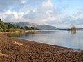
 Loch Leven - geograph.org.uk - 301612.jpg 640 × 480; 55 KB
-
 Loch Leven, north shore - geograph.org.uk - 125739.jpg 640 × 480; 87 KB
-
 Loch shore - geograph.org.uk - 290569.jpg 640 × 480; 119 KB
-
 M90 Flyover - geograph.org.uk - 159831.jpg 640 × 480; 69 KB
-
 Mary's Gate - geograph.org.uk - 268840.jpg 640 × 387; 100 KB
-
 Mary's Gate - geograph.org.uk - 268848.jpg 640 × 466; 107 KB
-
 Mawcarse House - geograph.org.uk - 197817.jpg 640 × 480; 115 KB
-
 Mawhill Crossroads - geograph.org.uk - 159023.jpg 640 × 426; 237 KB
-
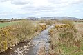 North Queich by Dalqueich - geograph.org.uk - 158998.jpg 640 × 426; 247 KB
-
 North Shore Loch Leven - geograph.org.uk - 290567.jpg 640 × 480; 90 KB
-
 North shore of Loch Leven - geograph.org.uk - 317611.jpg 600 × 398; 29 KB
-
 Orwell Church - geograph.org.uk - 290565.jpg 640 × 436; 96 KB
-
 Orwell Church - geograph.org.uk - 290566.jpg 640 × 480; 132 KB
-
 Path to Meikle Seggie - geograph.org.uk - 320875.jpg 640 × 480; 124 KB
-
 Pow Burn - geograph.org.uk - 286418.jpg 640 × 480; 87 KB
-
 Pow Burn and Pow Mill - geograph.org.uk - 290570.jpg 640 × 480; 128 KB
-
 Reflected Sheep - geograph.org.uk - 320878.jpg 640 × 480; 85 KB
-
 Road - geograph.org.uk - 373604.jpg 640 × 424; 46 KB
-
 Road from Tillywhally - geograph.org.uk - 197803.jpg 640 × 480; 54 KB
-
 Shore and Marshland - geograph.org.uk - 290568.jpg 640 × 480; 85 KB
-
 Small Dam - geograph.org.uk - 320864.jpg 640 × 480; 138 KB
-
 Small wood - geograph.org.uk - 125744.jpg 640 × 480; 159 KB
-
 Standing Stones - geograph.org.uk - 286394.jpg 640 × 480; 90 KB
-
 Stream near Tillyrie - geograph.org.uk - 320868.jpg 640 × 480; 128 KB
-
 The Lecket Stane - geograph.org.uk - 370327.jpg 640 × 480; 138 KB
-
 The North Queich at Ballingall - geograph.org.uk - 158978.jpg 640 × 426; 260 KB
-
 Tillywhally House - geograph.org.uk - 197793.jpg 640 × 480; 111 KB
-
 Triangulation pillar - geograph.org.uk - 373592.jpg 640 × 424; 61 KB
-
 Turfhills - geograph.org.uk - 268778.jpg 640 × 480; 99 KB
-
 Village street in Middleton - geograph.org.uk - 197805.jpg 640 × 480; 101 KB
-
 Woodland Walk - geograph.org.uk - 268831.jpg 640 × 480; 147 KB


_(14597369439).jpg)


