Category:Mining in Germany
Gezinti kısmına atla
Arama kısmına atla
| Medya yükle | |||||
| Nedir |
| ||||
|---|---|---|---|---|---|
| Geniş kapsamda | |||||
| Konumu |
| ||||
| |||||
Deutsch: Bergbau und Abbau von Bodenschätzen in Deutschland.
Alt kategoriler
Bu kategoride, aşağıdaki 35 alt kategori dahil toplam 35 alt kategori vardır.
"Mining in Germany" kategorisindeki ortam dosyaları
Bu kategoride yer alan toplam 46 dosyanın 46 adedi aşağıdadır.
-
 Abkehrschein Morgenstern 1939.jpg 1.600 × 1.126; 1,3 MB
-
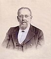 Heinrich von Achenbach.jpg 1.324 × 1.528; 214 KB
-
 Alte Elisabeth.jpg 500 × 336; 103 KB
-
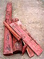 Ausbauhölzer.JPG 1.200 × 1.600; 616 KB
-
 Bergbau stollen1.jpg 500 × 332; 75 KB
-
 BergbauKunstAnimation.gif 320 × 202; 79 KB
-
 Bergisch Gladbach - Bergisches Museum 37 ies.jpg 3.888 × 2.592; 1,24 MB
-

-

-
 Das Ruhrgebiet als Seenplatte.jpg 800 × 445; 103 KB
-
 David Richtschacht.jpg 500 × 359; 113 KB
-
 DörenbergSchnautgangstein retouched.jpg 2.038 × 3.072; 1,91 MB
-
 Eb kb brand erbisdorf.jpg 1.200 × 1.402; 1,56 MB
-
 Eb-formation branderbisdorf.2.jpg 1.200 × 1.271; 1,16 MB
-
 ETH-BIB-Deutschland-Grube und Kokerei, Ober-Schlesien-Dia 247-02205.tif 3.368 × 2.833; 27,38 MB
-
 ETH-BIB-Deutschland-Grube, Separation-Dia 247-02192.tif 3.524 × 2.830; 9,58 MB
-
 ETH-BIB-Deutschland-Grube, von Osten, Ober-Schlesien-Dia 247-02206.tif 3.293 × 2.825; 8,96 MB
-
 Gabe Gottes.jpg 3.072 × 2.304; 472 KB
-
 Grube Viktoria Gilsbach.jpg 5.312 × 2.988; 8,1 MB
-
 Hausmarke Andreas Blau.JPG 645 × 801; 80 KB
-
 Höfer (Eschede) IMG 0963.jpg 3.888 × 2.592; 6,54 MB
-
 Höfer (Eschede) IMG 0965.jpg 3.888 × 2.592; 3,87 MB
-
 Höfer (Eschede) IMG 0966.jpg 3.888 × 2.592; 5,52 MB
-
 Höfer (Eschede) IMG 0967.jpg 3.888 × 2.592; 3,96 MB
-
 Höfer (Eschede) IMG 0968.jpg 3.888 × 2.592; 4,52 MB
-
 Höfer (Eschede) IMG 0969.jpg 2.592 × 3.888; 5,42 MB
-
 Höfer (Eschede) IMG 0970.jpg 3.888 × 2.592; 5,81 MB
-
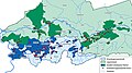
 Italian Gastarbeiter Coal Mines Western Germany.png 800 × 532; 349 KB
-
 Lachtertafel 1821.JPG 1.091 × 822; 361 KB
-
 Mansfelder Schlackenstein SW RK01.jpg 3.212 × 3.189; 2,07 MB
-
 Mansfelder Schlackenstein SW RK02.jpg 3.200 × 3.200; 2 MB
-
 Mittelalterliche Baue.jpg 1.920 × 2.560; 3,11 MB
-
 Naumann, geognostische charte sachsen 1836.JPG 1.477 × 2.422; 728 KB
-
 Saxonia Museum fuer saechsische Vaterlandskunde V 41.jpg 2.471 × 1.749; 1 MB
-
 Scaling in Rohr01.jpeg 640 × 480; 93 KB
-
 Schachtkomplex 371 im Ergebirgskreis 2H1A8452WI.jpg 4.888 × 3.102; 4,62 MB
-
 Schurfschein.jpg 1.139 × 1.913; 2,47 MB
-
 St Anna Zschorlau 08.jpg 3.072 × 2.048; 1,02 MB
-
 Stollenmundloch02.jpg 1.536 × 1.024; 528 KB
-
 Strossenbau 2.png 896 × 560; 144 KB
-
 Tonabbau bei Haus Kilver.jpg 2.048 × 735; 167 KB
-
 Verstufungstafel Ursula Tiefer Erbstolln.jpg 2.080 × 1.544; 314 KB
-
 Wetterkarte Phillipsstollen Sauerland GLAM 368 PK.jpg 3.828 × 2.555; 2,44 MB
-
 Wetterkarte Phillipsstollen Sauerland GLAM 372 PK.jpg 3.181 × 2.353; 1,86 MB
-
 Zeche Monopol Schacht Grimberg 1.jpg 1.784 × 1.340; 242 KB
-
 Бремсберг.jpg 1.788 × 2.706; 4,34 MB


_IMG_0963.jpg)
_IMG_0965.jpg)
_IMG_0966.jpg)
_IMG_0967.jpg)
_IMG_0968.jpg)
_IMG_0969.jpg)
_IMG_0970.jpg)


