Category:Missouri River
跳转到导航
跳转到搜索
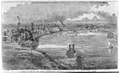
密西西比河的一条支流  Missourifloden vid Saint Joseph, Missouri. Kansas är på andra sidan floden.  | |||||
| 上传媒体 | |||||
| 隶属于 | |||||
|---|---|---|---|---|---|
| 名称由来 | |||||
| 位置 | |||||
| 长度 |
| ||||
| 河流出口 | |||||
| 集水区 | |||||
| 集水区国家 | |||||
| 支流 |
| ||||
| 流经湖泊 | |||||
| 区别于 | |||||
 | |||||
分类“Missouri River”中的媒体文件
以下150个文件属于本分类,共150个文件。
-
-
 "Great Bend of the Missouri River - showing packing-houses" LCCN2007681582.tif 1,536 × 940;1.38 MB
-

-
-
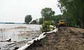
 2019 Midwestern U.S. floods - March 21st, 2019 (40835829263).jpg 3,669 × 1,852;2.25 MB
-
-
 American Prairie Reserve.JPG 4,928 × 3,264;12.48 MB
-
-
 Annals of the Carnegie Museum (1908-1909) (18225443578).jpg 3,553 × 2,198;1.2 MB
-

-
 West Kansas from 8th and Bluff St (NYPL b11707634-G90F435 007F).tiff 3,072 × 1,771;15.57 MB
-
 The flood of Kansas City, Missouri (NYPL b11707634-G90F435 008F).tiff 3,072 × 1,771;15.57 MB
-
 West Kansas from Wyandotte, Kansas City, Missouri (NYPL b11707634-G90F435 010F).tiff 3,072 × 1,747;15.36 MB
-
 From Junction 6th and Bluff (NYPL b11707634-G90F435 017F).tiff 3,072 × 1,691;14.86 MB
-
 Badger Lake State Wildlife Management Area - Mar 11, 2020.jpg 4,944 × 3,840;6.51 MB
-
 Badger Lake State Wildlife Management Area aerial 02.jpg 4,288 × 2,848;3.11 MB
-
 Badger Lake State Wildlife Management Area aerial 02A.jpg 4,288 × 2,848;9.12 MB
-
 Beaver Hut on the Missouri. Karl Bodmer. Detail.jpg 1,998 × 1,053;615 KB
-
 Bird's eye view of Wyandotte, Wyandotte Co., Kansas 1869.jpg 1,508 × 1,028;456 KB
-
 BNSF Sioux City Bridge.jpg 1,200 × 806;488 KB
-
 Bodmer5455.jpg 1,436 × 1,068;239 KB
-
 Bridge to the Sun.jpg 3,264 × 2,448;1.03 MB
-
 Bull Creek bottom, in Missouri Breaks, Montana.JPG 1,024 × 768;197 KB
-
 By the boat ramp at Running Water, SD.jpg 1,280 × 960;618 KB
-

-
 Centrarchid larvae.jpg 2,560 × 1,920;3.65 MB
-
 Chouteau Bridge from Riverfront Park (cropped).jpg 2,285 × 677;556 KB
-
 Chouteau Bridge from Riverfront Park.jpg 3,098 × 1,355;1.22 MB
-
 Confluence of Missouri and Mississippi above St. Louis.jpg 685 × 685;185 KB
-
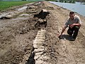
 Crow Creek Site.jpg 232 × 144;24 KB
-
 Dakota Dunes Sandbagging DVIDS411395.jpg 3,868 × 1,848;870 KB
-
 Dakota Dunes Sandbagging DVIDS411396.jpg 2,648 × 3,368;741 KB
-
 Dakota Dunes Sandbagging DVIDS411397.jpg 4,256 × 2,556;1.35 MB
-
 Dakota Dunes Sandbagging DVIDS411399.jpg 2,832 × 4,256;672 KB
-
 Defense.gov photo essay 110604-F-KZ880-123.jpg 4,272 × 2,848;2.19 MB
-
 Defense.gov photo essay 110604-F-SE263-025.jpg 3,000 × 2,000;2.05 MB
-
 Diorama - Missouri River P6070768.JPG 3,072 × 2,304;1.13 MB
-

-
 Fig 10 Section showing the pre-Glacial valley.jpg 1,503 × 1,008;238 KB
-
 Fishing Spot 1.JPG 3,648 × 2,736;2.78 MB
-
 Fishing Spot 2.JPG 3,648 × 2,736;2.67 MB
-
 Fishing Spot 3.JPG 3,648 × 2,736;2.43 MB
-
 Flickr - Furryscaly - Beaver.jpg 1,024 × 636;153 KB
-
 Flickr - Furryscaly - Maybe Tomorrow.jpg 1,276 × 800;835 KB
-
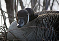 Flickr - Furryscaly - Mother Goose.jpg 1,024 × 711;352 KB
-
 Flickr - Furryscaly - Sand Martins...and Guest.jpg 1,024 × 805;658 KB
-
 Frigid Morning - Missouri River (16405422618).jpg 4,505 × 2,918;7.42 MB
-
 From Kansas to Missouri (3668468958).jpg 2,048 × 1,536;808 KB
-

-
 FtLincoln-MissouriRiver.jpg 820 × 488;81 KB
-
 Gavins-point-dam1.jpg 1,058 × 646;206 KB
-

-
 Glacial Formation of the Missouri River PA130672.JPG 3,072 × 2,304;1.16 MB
-
 Goldenrod Showboat at Waverly, Missouri.tif 2,548 × 1,482;3.62 MB
-
 Fort Pierre (on the Missouri) (NYPL Hades-118495-54619).tif 3,411 × 3,243;31.65 MB
-
 Kansas (City.) (NYPL Hades-118782-54907).tif 5,140 × 4,933;72.55 MB
-

-

-
 Holter Lake.jpg 600 × 402;48 KB
-

-
 Ice in the Missouri River (MODIS 2020-03-31).jpg 2,997 × 2,318;1.07 MB
-
 Inspection (6634465109).jpg 2,048 × 1,536;1.64 MB
-
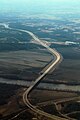 Interstate 435 over Missouri River.jpg 800 × 1,200;469 KB
-
 ISS013-E-46370.jpg 3,032 × 2,064;869 KB
-
 Iss069e060883.jpg 5,568 × 3,712;1.8 MB
-
Journallewisandclarke 06 lewis-clark 64kb.ogg 10分36秒;3.24 MB
-
 KC-floods.jpg 2,075 × 1,465;520 KB
-

-
 Lake Sharpe Big Bend.jpg 639 × 632;185 KB
-
-
 Lewis and Clark, Teton Council Site.jpg 2,000 × 1,333;1.29 MB
-
 LewisandClarkLandingOmaha.jpg 3,221 × 1,713;1.15 MB
-
 Lower Missouri River.jpg 2,576 × 1,932;1.26 MB
-
-
 Me on Missouri.jpg 2,592 × 1,936;1.87 MB
-
 Milkriverpan.jpg 10,610 × 2,570;4.44 MB
-
 Missouri River 001.JPG 800 × 600;295 KB
-
 Missouri River Aerial Photos - Jul. 17, 2011 (5951516324).jpg 3,456 × 2,592;3.16 MB
-
 Missouri River Aerial Photos 7 17 11 (5951538914).jpg 3,456 × 2,592;2.95 MB
-
 Missouri River Angler (50236685661).jpg 4,546 × 3,031;2.4 MB
-
 Missouri river at hwy 364.jpg 4,000 × 3,000;2.84 MB
-
 Missouri River at Kansas City.jpg 800 × 570;119 KB
-
 Missouri River fishing.JPG 2,560 × 1,920;1.38 MB
-
 Missouri River Fishing.JPG 2,560 × 1,920;1.62 MB
-
 Missouri River from Museum P6070779.JPG 2,304 × 3,072;1.06 MB
-
 Missouri River joins the Mississippi River.JPG 800 × 600;71 KB
-

-
 Missouri river reflecting a hazy setting Sun.jpg 3,263 × 2,175;338 KB
-
 Missouri River south of Sioux City aerial 01.jpg 4,288 × 2,848;3.35 MB
-
 Missouri River Sunrise (51251797356).jpg 3,648 × 2,736;1.9 MB
-
 Missouri River.JPG 3,648 × 2,736;3.04 MB
-
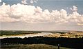
 Missouri Valley (north to So Dakota) PA130643.JPG 3,072 × 2,304;1.4 MB
-
 Missouri-Mississippi confluence.jpg 498 × 597;45 KB
-
Missouri-River-Morning-Drone-Shot.webm 7.9秒, 1,920 × 1,080;4.36 MB
-
 Missouri? Fishing.JPG 3,648 × 2,736;2.56 MB
-
 Missouri?.JPG 3,648 × 2,736;2.69 MB
-
 Missouririver1.jpg 800 × 600;112 KB
-
 The Missouri River basin development program (IA missouririverbas2951miss).pdf 1,137 × 1,518,52页;16.85 MB
-
 MNRR At the North Alabama wreck site 20070807171612.jpg 1,280 × 960;324 KB
-
 Moriverbridge.jpg 792 × 594;70 KB
-
 Nishnabotna River aerial.jpg 771 × 442;39 KB
-

-
 Nodaway-confluence.jpg 3,072 × 2,304;1.8 MB
-
 North Dakota National Guard (37175027664).jpg 4,288 × 2,848;6.23 MB
-
 Oahe Dam Flooding 061511.jpg 2,048 × 1,536;1.1 MB
-
 Oahe Powerhouse.jpg 2,506 × 1,344;363 KB
-
 OmahaNE Aerial.jpg 1,361 × 1,021;436 KB
-
 On the banks of the Missouri.jpg 487 × 640;128 KB
-
 Painted Horse.JPG 2,336 × 1,699;1.5 MB
-
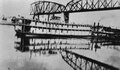
 Panorama of Sibley Railroad Bridge looking west.png 9,686 × 3,822;48.14 MB
-
 Panorama of Sioux City, Iowa, from Missouri River - NARA - 285935.jpg 3,000 × 2,307;1.82 MB
-
 Panorama of Sioux City, Iowa, from Missouri River - NARA - 285935.tif 3,000 × 2,307;6.6 MB
-
 Ponca-stammens vandring - Ponca migration.png 3,040 × 2,748;244 KB
-
 PSM V25 D617 Cross section of river valley.jpg 3,565 × 2,129;271 KB
-
 PSM V25 D619 Exposed section of river bank.jpg 3,564 × 1,970;694 KB
-
 Quindaro Ruins Overlook view.jpg 3,669 × 2,485;5.31 MB
-
 Railroad car transfer ferry, H. C. Nutt, Missouri River (10058011626).jpg 1,000 × 775;514 KB
-
 Railroad cars on ice bridge, Missouri River (10058295736).jpg 1,000 × 743;418 KB
-
 Railroad cars on ice bridge, Missouri River (10058329583).jpg 1,000 × 781;459 KB
-

-
 River Overlook P6070793.JPG 3,072 × 2,304;1.47 MB
-
 Scale-BLM-12 upper missouririver breaksnm.jpg 400 × 267;76 KB
-
 Scenic View from Leavenworth North Esplanade Park.jpg 4,288 × 2,848;6.49 MB
-
 Sgt Floyd Monument PA140779.JPG 3,072 × 2,304;1.49 MB
-
 Side channel of the Missouri river showing erosion and downed trees.jpg 3,263 × 2,175;347 KB
-
 Sioux City from the south aerial 01.jpg 4,288 × 2,848;3.67 MB
-
 Sioux City from the south aerial 01A.jpg 4,288 × 2,848;10.77 MB
-
 Sioux City Railroad Bridge.jpg 2,816 × 1,584;498 KB
-
 Siouxland Veterans Memorial Bridge.jpg 1,000 × 600;128 KB
-
 Sketch of Water Supply System - NARA - 140696322.jpg 5,152 × 5,152;2.22 MB
-
 Snagboat Mandan from bluff on Missouri River - NARA - 285910.jpg 1,828 × 3,000;2.46 MB
-
 Snagboat Mandan from bluff on Missouri River - NARA - 285910.tif 1,828 × 3,000;5.23 MB
-
 Springfield Harbor 2.jpg 6,041 × 1,510;10.01 MB
-
 Springfield Harbor.jpg 4,703 × 1,451;7.91 MB
-

-
 Steamer August Wohlt. Hermann (^), Missouri - NARA - 285933.jpg 3,000 × 1,875;909 KB
-
 Steamer August Wohlt. Hermann (^), Missouri - NARA - 285933.tif 3,000 × 1,875;5.36 MB
-
 Stern wheel ferry on the Missouri River - NARA - 285441.jpg 3,000 × 1,540;723 KB
-
 Stern wheel ferry on the Missouri River - NARA - 285441.tif 3,000 × 1,540;4.41 MB
-

-
 The "Muddy Missouri" River (3668465728).jpg 3,072 × 2,304;3.26 MB
-

-

-
 Theb0865 - Flickr - NOAA Photo Library.jpg 904 × 1,360;529 KB
-
 Train on Sibley Railroad Bridge.png 2,880 × 1,624;7.13 MB
-
-
 US75 Blackbird Overlook view.JPG 2,560 × 1,553;1.67 MB
-
 USACE Fort Thompson Big Bend Dam.jpg 1,500 × 1,001;599 KB
-
 View of Great Flood of 1993 from sky.jpg 250 × 164;23 KB
-
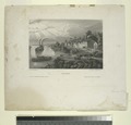
 VIEW ON THE MISSOURI RIVER, ABOVE GREAT BEND. - Audubon Journal.jpg 2,505 × 1,433;675 KB


%27_(11305026406).jpg)
.jpg)
.jpg)


_(18225443578).jpg)


.jpg)
.jpg)
_(14780145152).jpg)


_(20758142515).jpg)
.jpg)
.jpg)


.jpg)


.jpg)
.jpg)
.jpg)


.jpg)

_PA130643.JPG)


.jpg)

.jpg)


.jpg)
.jpg)


.jpg)
,_Missouri_-_NARA_-_285933.jpg)


.jpg)
_(14578929590).jpg)
_as_imagined_by_Mandan_artist_Sitting_Rabbit,_ca_1907.png)


.jpg)
.jpg)
分类: