Category:Mountfield, East Sussex
Jump to navigation
Jump to search
village in East Sussex, UK  | |||||
| Upload media | |||||
| Instance of | |||||
|---|---|---|---|---|---|
| Location | Rother, East Sussex, South East England, England | ||||
| Area |
| ||||
| Said to be the same as | Mountfield (Wikimedia duplicated page, civil parish) | ||||
| official website | |||||
 | |||||
English: Mountfield is a village and civil parish in the Rother District of East Sussex three miles (4.8 km) north-west of Battle. It is mentioned in the Domesday Book.
Norsk bokmål: Mountfield er en landsby og et verdslig sogn i East Sussex i England. Stedet ligger omkring fem km nordvest for Battle.

Subcategories
This category has the following 5 subcategories, out of 5 total.
M
- Mountfield Court (8 F)
- Mountfield Methodist Chapel (5 F)
O
- Oasts in Mountfield (22 F)
V
- Vinehall Street (26 F)
Media in category "Mountfield, East Sussex"
The following 200 files are in this category, out of 488 total.
(previous page) (next page)-
 Mountfield Post Office Directory of Sussex 1866 pp. 2094-2095.png 643 × 437; 414 KB
-
 Mountfield Post Office Directory of Sussex 1878 p. 284.jpg 1,051 × 688; 663 KB
-
 Mountfield East Sussex in Kelly's Directory of Sussex 1915 pp.523-24.jpg 646 × 574; 207 KB
-
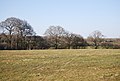
 A line of trees near Glottenham Farm - geograph.org.uk - 1730565.jpg 640 × 430; 143 KB
-
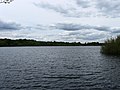
 A reed filled pond - geograph.org.uk - 3735278.jpg 640 × 430; 65 KB
-

-
 A21, John's Cross Road, John's Cross - geograph.org.uk - 2140007.jpg 4,320 × 3,240; 3.68 MB
-
 A21, John's Cross Road, John's Cross - geograph.org.uk - 2140016.jpg 4,320 × 3,240; 3.72 MB
-
 A2100 - geograph.org.uk - 5835484.jpg 1,024 × 681; 131 KB
-
 A2100 towards Battle - geograph.org.uk - 2001671.jpg 1,024 × 679; 241 KB
-
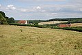
 Across Oakwood Farm - geograph.org.uk - 1279645.jpg 640 × 428; 59 KB
-
 Apple orchard - geograph.org.uk - 3735260.jpg 640 × 430; 78 KB
-
 Apple trees - geograph.org.uk - 3719867.jpg 640 × 430; 112 KB
-
 Archer Wood - geograph.org.uk - 4414204.jpg 1,440 × 1,080; 1.12 MB
-
 Avenue of Chestnuts - geograph.org.uk - 451659.jpg 640 × 427; 128 KB
-
 Baldwin's Farm - geograph.org.uk - 1172032.jpg 640 × 427; 478 KB
-
 Baldwin's Farm - geograph.org.uk - 1172241.jpg 640 × 480; 581 KB
-
 Baldwin's Farm - geograph.org.uk - 1286006.jpg 640 × 480; 73 KB
-
 Baldwin's Farm - geograph.org.uk - 385579.jpg 640 × 428; 149 KB
-
 Baldwin's Farm - geograph.org.uk - 4892528.jpg 640 × 480; 67 KB
-
 Baldwin's Farmhouse - geograph.org.uk - 3485401.jpg 4,288 × 3,216; 5.84 MB
-
 Bank's Cottages - geograph.org.uk - 1728915.jpg 640 × 430; 177 KB
-
 Bank's Cottages, Mountfield Lane - geograph.org.uk - 1728917.jpg 640 × 430; 149 KB
-
 Barn at Itterton Manor - geograph.org.uk - 4414205.jpg 1,440 × 1,080; 582 KB
-
 Barn at Itterton Manor - geograph.org.uk - 4414207.jpg 2,000 × 1,500; 1.63 MB
-
 Barn at Itterton Manor - geograph.org.uk - 4414208.jpg 2,000 × 1,500; 1.36 MB
-
 Barn at Itterton Manor - geograph.org.uk - 4414209.jpg 1,440 × 1,080; 900 KB
-
 Barn off Mountfield Lane - geograph.org.uk - 3493986.jpg 640 × 430; 83 KB
-
 Barn, Glottenham Farm - geograph.org.uk - 1730561.jpg 640 × 430; 126 KB
-
 Barn, Glottenham Manor - geograph.org.uk - 1730549.jpg 640 × 430; 131 KB
-
 Barn, Oakwood Farm - geograph.org.uk - 3719842.jpg 640 × 430; 94 KB
-
 Battle Wood (2) - geograph.org.uk - 1726823.jpg 640 × 430; 198 KB
-
 Battle Wood - geograph.org.uk - 1726789.jpg 640 × 430; 128 KB
-
 Battle Wood - geograph.org.uk - 1726818.jpg 640 × 430; 191 KB
-
 Bikers at Route 1066 Café - geograph.org.uk - 4466690.jpg 1,600 × 1,200; 512 KB
-
 Bluebells, Collier's Croft Wood - geograph.org.uk - 1285900.jpg 480 × 640; 155 KB
-
 Bottonhold Wood - geograph.org.uk - 1728898.jpg 640 × 430; 110 KB
-
 Bottonhold Wood - geograph.org.uk - 1730502.jpg 640 × 430; 120 KB
-
 Bottonhold Wood - geograph.org.uk - 2984884.jpg 640 × 430; 90 KB
-
 Bottonhold Wood seen across fields - geograph.org.uk - 1730489.jpg 640 × 430; 117 KB
-

-
 British Gypsum - geograph.org.uk - 1726910.jpg 640 × 430; 128 KB
-
 British Gypsum works at Mountfield - geograph.org.uk - 5305060.jpg 4,582 × 3,436; 2.69 MB
-
 Broken Stile and Footbridge - geograph.org.uk - 1285927.jpg 480 × 640; 147 KB
-
 Building by Mountfield Place - geograph.org.uk - 5764099.jpg 5,046 × 3,364; 3.4 MB
-
 Bushy Shaw - geograph.org.uk - 1286155.jpg 640 × 480; 53 KB
-
 By the A21 - geograph.org.uk - 5835481.jpg 1,024 × 681; 111 KB
-
 Caravan and Camping Centre, John's Cross - geograph.org.uk - 2138073.jpg 4,320 × 3,240; 3.73 MB
-
 Castle Farm - geograph.org.uk - 1285887.jpg 640 × 480; 73 KB
-
 Castle Wood - geograph.org.uk - 1285877.jpg 480 × 640; 147 KB
-
 Church Cottages - geograph.org.uk - 1285850.jpg 640 × 480; 74 KB
-
 Church Road - geograph.org.uk - 1172419.jpg 640 × 480; 651 KB
-
 Church Road - geograph.org.uk - 1285843.jpg 640 × 480; 113 KB
-

-
 Clump of trees along an unnamed stream - geograph.org.uk - 1730495.jpg 640 × 430; 118 KB
-
 Collier's Croft Wood - geograph.org.uk - 1285894.jpg 480 × 640; 162 KB
-
 Collier's Croft Wood by Mountfield Lane - geograph.org.uk - 1728905.jpg 640 × 430; 199 KB
-
 Coppiced trees in Line Wood - geograph.org.uk - 1726785.jpg 640 × 430; 201 KB
-
 Coppiced Woodland - geograph.org.uk - 1171983.jpg 640 × 480; 633 KB
-
 Cottage by the A21 - geograph.org.uk - 2698868.jpg 640 × 430; 81 KB
-

-
 Cottage on Solomon's Lane - geograph.org.uk - 1726829.jpg 640 × 430; 139 KB
-
 Cottages, Poppinghole Lane - geograph.org.uk - 3735297.jpg 640 × 430; 77 KB
-
 Countryside near John's Cross - geograph.org.uk - 3735265.jpg 640 × 430; 71 KB
-
 Countryside near John's Cross - geograph.org.uk - 3735295.jpg 640 × 430; 86 KB
-
 Countryside near Poppinghole Lane - geograph.org.uk - 3735302.jpg 640 × 430; 85 KB
-
 Countryside near Robertsbridge - geograph.org.uk - 3498744.jpg 640 × 430; 78 KB
-
 Cowshed near Woodsdale - geograph.org.uk - 1084300.jpg 640 × 427; 109 KB
-
 Crowhurst Farm - geograph.org.uk - 1182506.jpg 640 × 427; 463 KB
-
 Curious Sheep, Glottenham Farm - geograph.org.uk - 1289916.jpg 640 × 480; 99 KB
-
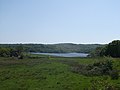
 Darwell Reservoir - geograph.org.uk - 1172026.jpg 640 × 427; 513 KB
-
 Darwell Reservoir - geograph.org.uk - 1286231.jpg 480 × 640; 77 KB
-
 Darwell Reservoir - geograph.org.uk - 1286256.jpg 640 × 480; 73 KB
-
 Darwell Reservoir - geograph.org.uk - 1289820.jpg 640 × 480; 59 KB
-
 Darwell Reservoir - geograph.org.uk - 1289867.jpg 640 × 480; 85 KB
-
 Darwell Reservoir - geograph.org.uk - 2399181.jpg 2,256 × 1,496; 822 KB
-
 Darwell Reservoir - geograph.org.uk - 2455614.jpg 2,256 × 1,496; 771 KB
-
 Darwell Reservoir - geograph.org.uk - 3486957.jpg 4,288 × 3,216; 4.77 MB
-
 Darwell Reservoir - geograph.org.uk - 3486978.jpg 4,288 × 3,216; 3.95 MB
-
 Darwell Reservoir - geograph.org.uk - 3493955.jpg 640 × 430; 94 KB
-
 Darwell Reservoir - geograph.org.uk - 3493957.jpg 640 × 430; 69 KB
-
 Darwell Reservoir - geograph.org.uk - 3498627.jpg 640 × 430; 79 KB
-
 Darwell Reservoir - geograph.org.uk - 3498631.jpg 640 × 430; 64 KB
-
 Darwell Reservoir - geograph.org.uk - 3498637.jpg 640 × 430; 68 KB
-

-
-
 Darwell Valley - geograph.org.uk - 3498634.jpg 640 × 430; 62 KB
-
 Darwell Valley - geograph.org.uk - 3499069.jpg 640 × 385; 50 KB
-
 Darwell Wood - geograph.org.uk - 1286206.jpg 480 × 640; 147 KB
-
 Dens Wood - geograph.org.uk - 1289832.jpg 480 × 640; 111 KB
-
 Dens Wood - geograph.org.uk - 3493994.jpg 640 × 430; 74 KB
-
 Derelict barn at Itterton Manor - geograph.org.uk - 4414210.jpg 1,440 × 1,080; 862 KB
-

-
 Derelict looking barn - geograph.org.uk - 3498609.jpg 640 × 430; 56 KB
-
 Destined for Perry^ - geograph.org.uk - 1279699.jpg 640 × 428; 61 KB
-
 Down the Hill to Robertsbridge - geograph.org.uk - 1285734.jpg 640 × 480; 66 KB
-
 Dressage area - geograph.org.uk - 3499094.jpg 640 × 430; 76 KB
-
 Drive from Mountfield Place - geograph.org.uk - 5764094.jpg 5,184 × 3,456; 6.11 MB
-
 Drive from Mountfield Place - geograph.org.uk - 5764102.jpg 5,184 × 3,456; 5.94 MB
-
 Drive to Mountfield Court - geograph.org.uk - 2733842.jpg 640 × 287; 66 KB
-
 Drive to Mountfield Place - geograph.org.uk - 5764103.jpg 5,184 × 3,456; 5.95 MB
-
 Early-purple orchid (Orchis mascula) beside Mountfield Lane - geograph.org.uk - 3485935.jpg 3,216 × 4,288; 5.23 MB
-
 Easterden Lane - geograph.org.uk - 1726911.jpg 640 × 430; 144 KB
-
 Eatenden Lane - geograph.org.uk - 1171987.jpg 640 × 480; 805 KB
-
 Eatenden Lane - geograph.org.uk - 2739532.jpg 640 × 480; 167 KB
-
 Eatenden Lane - geograph.org.uk - 4001857.jpg 640 × 480; 178 KB
-
 Eatenden Lane - geograph.org.uk - 456625.jpg 640 × 427; 130 KB
-
 Eatenden Lane - geograph.org.uk - 5229382.jpg 640 × 426; 54 KB
-
 Eatenden Lane - geograph.org.uk - 5378185.jpg 640 × 425; 44 KB
-
 Eatenden Lane - geograph.org.uk - 5418387.jpg 640 × 426; 59 KB
-
 Eatenden Lane in Eatenden Wood - geograph.org.uk - 1811805.jpg 1,024 × 679; 283 KB
-
 Eatenden Lane in Upper Hucksteep Wood - geograph.org.uk - 2408273.jpg 1,600 × 1,061; 621 KB
-
 Eatenden Lane, facing Mountfield - geograph.org.uk - 1747185.jpg 640 × 425; 112 KB
-
 Embryonic Cider - geograph.org.uk - 1279658.jpg 428 × 640; 51 KB
-
-
 Entrance to Crowhurst Wood - geograph.org.uk - 2387572.jpg 1,496 × 2,256; 855 KB
-
 Entrance to Edlins Farm - geograph.org.uk - 2455606.jpg 640 × 424; 74 KB
-
 Entrance to Gypsum works - geograph.org.uk - 1192940.jpg 640 × 424; 93 KB
-
 Entrance to Mountfield Court Estate - geograph.org.uk - 3484003.jpg 4,288 × 3,216; 6.84 MB
-
 Entrance to The Banks - geograph.org.uk - 1811813.jpg 800 × 530; 166 KB
-
 Faint path - geograph.org.uk - 3735280.jpg 640 × 430; 68 KB
-
 Farm buildings, Darwell Valley - geograph.org.uk - 3499049.jpg 640 × 430; 76 KB
-
 Farm Pasture near Mountfield Lane - geograph.org.uk - 3487048.jpg 4,288 × 3,216; 4.1 MB
-
 Farm Track near Glottenham Manor - geograph.org.uk - 1289898.jpg 640 × 480; 105 KB
-
 Farmland by the A21 - geograph.org.uk - 2698890.jpg 640 × 346; 32 KB
-
 Field by A21 - geograph.org.uk - 5959882.jpg 1,024 × 681; 96 KB
-
 Field by Mountfield Lane - geograph.org.uk - 1728841.jpg 640 × 430; 107 KB
-
 Field by the Hastings Line - geograph.org.uk - 4725256.jpg 640 × 326; 42 KB
-
 Field in Battle Wood - geograph.org.uk - 4189813.jpg 640 × 308; 35 KB
-
 Field in Battle Wood - geograph.org.uk - 4756480.jpg 640 × 367; 42 KB
-
 Field near Baldwin's Farm - geograph.org.uk - 1171980.jpg 640 × 427; 630 KB
-
 Field near Baldwin's Farm - geograph.org.uk - 1172431.jpg 640 × 427; 119 KB
-
 Field near Glottenham Manor - geograph.org.uk - 1289890.jpg 640 × 480; 95 KB
-
 Field north of The Darwell Stream - geograph.org.uk - 1730535.jpg 640 × 430; 125 KB
-
 Fields off Mountfield Lane - geograph.org.uk - 1728929.jpg 640 × 430; 86 KB
-
 Flood Plain near Bottonhold Wood - geograph.org.uk - 1285704.jpg 640 × 480; 83 KB
-
 Flowery copse - geograph.org.uk - 4772340.jpg 640 × 428; 223 KB
-
 Footbridge in Darwell Wood - geograph.org.uk - 3485631.jpg 4,288 × 3,216; 6.27 MB
-
 Footbridge over Darwell Stream - geograph.org.uk - 1285688.jpg 480 × 640; 169 KB
-
 Footbridge over The Darwell Stream - geograph.org.uk - 1730519.jpg 640 × 430; 153 KB
-
 Footbridge over The Darwell Stream - geograph.org.uk - 1730566.jpg 640 × 430; 207 KB
-

-

-
 Footpath along the River Line - geograph.org.uk - 1724175.jpg 640 × 430; 209 KB
-
 Footpath beside Walter's Wood - geograph.org.uk - 3482146.jpg 4,288 × 3,216; 6.07 MB
-

-

-

-
 Footpath follows the hedge northwards - geograph.org.uk - 1730500.jpg 640 × 430; 133 KB
-
 Footpath from Mountfield Lane to Glottenham Manor - geograph.org.uk - 5989217.jpg 1,600 × 1,200; 558 KB
-
 Footpath from Mountfield to Whatlington - geograph.org.uk - 6141298.jpg 1,024 × 768; 424 KB
-
 Footpath from Mountfield to Whatlington - geograph.org.uk - 6141620.jpg 1,024 × 768; 782 KB
-
 Footpath from Mountfield to Whatlington - geograph.org.uk - 6143291.jpg 1,024 × 768; 634 KB
-
 Footpath from Mountfield to Whatlington - geograph.org.uk - 6143299.jpg 1,024 × 768; 724 KB
-
 Footpath gate at Mountfield Lane - geograph.org.uk - 5989209.jpg 1,600 × 1,200; 704 KB
-
 Footpath gate from Glottenham Manor to Mountfield lane - geograph.org.uk - 5989222.jpg 1,600 × 1,200; 618 KB
-

-
 Footpath in Collier's Croft Wood - geograph.org.uk - 3485341.jpg 4,288 × 3,216; 7.33 MB
-
 Footpath in Simmett's Wood - geograph.org.uk - 2399191.jpg 1,061 × 1,600; 693 KB
-
 Footpath in Spring Wood - geograph.org.uk - 3484270.jpg 3,216 × 4,288; 7.59 MB
-
 Footpath leaves Baldwin's Farm Track - geograph.org.uk - 3485540.jpg 4,288 × 3,216; 7.54 MB
-
 Footpath off Mountfield Lane - geograph.org.uk - 1728842.jpg 640 × 404; 114 KB
-
 Footpath off Mountfield Lane - geograph.org.uk - 3498606.jpg 640 × 430; 102 KB
-
 Footpath through an orchard - geograph.org.uk - 3719846.jpg 640 × 430; 80 KB
-
 Footpath through an orchard - geograph.org.uk - 3719873.jpg 640 × 430; 88 KB
-
 Footpath through an orchard - geograph.org.uk - 3735258.jpg 640 × 430; 92 KB
-
 Footpath through Little Crabden Wood (2) - geograph.org.uk - 1726796.jpg 640 × 430; 184 KB
-
 Footpath through Little Crabden Wood - geograph.org.uk - 1726794.jpg 640 × 430; 195 KB
-
 Footpath through the orchard - geograph.org.uk - 3719864.jpg 640 × 430; 99 KB
-
 Footpath to Glottenham Manor - geograph.org.uk - 1289882.jpg 640 × 480; 93 KB
-
 Footpath to Glottenham Manor - geograph.org.uk - 3484132.jpg 4,288 × 3,216; 6.58 MB
-
 Footpath to Glottenham Manor - geograph.org.uk - 3486951.jpg 4,288 × 3,216; 6.48 MB
-
 Footpath to Hunter's Farm - geograph.org.uk - 3493950.jpg 640 × 430; 127 KB
-
 Footpath to Little Crabden Wood - geograph.org.uk - 1726787.jpg 640 × 430; 135 KB
-
 Footpath to Robertsbridge - geograph.org.uk - 3498742.jpg 640 × 430; 66 KB
-
 Footpath to Simmett's Wood - geograph.org.uk - 3485578.jpg 4,288 × 3,216; 7 MB
-
 Footpath to Walter's Wood - geograph.org.uk - 3482117.jpg 4,288 × 3,216; 7.5 MB
-
 Footpath toff Kent Lane - geograph.org.uk - 3493948.jpg 640 × 430; 78 KB
-
 Fording the Stream - geograph.org.uk - 1285965.jpg 480 × 640; 201 KB
-
 Four Geese - geograph.org.uk - 2733838.jpg 640 × 480; 116 KB
-
 Four Geese - geograph.org.uk - 2733841.jpg 640 × 480; 135 KB
-
 Fruit Grafting - geograph.org.uk - 1279677.jpg 428 × 640; 57 KB
-
 Fungus on a Beech Tree - geograph.org.uk - 340167.jpg 640 × 480; 168 KB
-
 Gate and stile into Round Wood - geograph.org.uk - 3486994.jpg 4,288 × 3,216; 6.28 MB
-
 Gate in the shade, near Simmett's Wood - geograph.org.uk - 3485558.jpg 4,288 × 3,216; 7.04 MB
-
 Gate into Spring Wood - geograph.org.uk - 3484245.jpg 4,022 × 3,216; 7.03 MB
-
 Gate near Dray Shaw - geograph.org.uk - 3487064.jpg 4,288 × 3,216; 5.17 MB
-

-

-
 Gates at Mount Place - geograph.org.uk - 5764092.jpg 5,184 × 3,456; 5.12 MB
-
 Gates at Mountfield Place - geograph.org.uk - 5764093.jpg 5,184 × 3,456; 5.17 MB
-
 Glimpse of Darwell Reservoir - geograph.org.uk - 4892536.jpg 640 × 480; 62 KB
-
 Glimpses of Darwell Reservoir - geograph.org.uk - 3485587.jpg 4,288 × 3,216; 7.56 MB
-
 Glottenham - geograph.org.uk - 1289914.jpg 640 × 480; 78 KB
-
 Glottenham Castle - geograph.org.uk - 3499089.jpg 640 × 430; 152 KB
-
 Glottenham Farm - geograph.org.uk - 3499093.jpg 640 × 430; 63 KB
-
 Glottenham Farm - geograph.org.uk - 3499100.jpg 640 × 430; 86 KB
-
 Glottenham Lane - geograph.org.uk - 1289923.jpg 480 × 640; 145 KB
-
 Glottenham Manor - geograph.org.uk - 1289919.jpg 640 × 480; 127 KB
-
 Glottenham Manor - geograph.org.uk - 1730546.jpg 640 × 430; 123 KB


_-_geograph.org.uk_-_1726823.jpg)


_beside_Mountfield_Lane_-_geograph.org.uk_-_3485935.jpg)


_-_geograph.org.uk_-_1726796.jpg)


