Category:Narborough, Leicestershire
Jump to navigation
Jump to search
English: Narborough is a village south of Leicester, England. It lies in the Blaby district of Leicestershire. Its name originally meant 'North Stronghold'.

village and civil parish in Leicestershire, UK  | |||||
| Upload media | |||||
| Instance of | |||||
|---|---|---|---|---|---|
| Location | Blaby, Leicestershire, East Midlands, England | ||||
| official website | |||||
 | |||||
Subcategories
This category has the following 5 subcategories, out of 5 total.
Media in category "Narborough, Leicestershire"
The following 156 files are in this category, out of 156 total.
-
 A bridge that once carried the Enderby Branch Railway - geograph.org.uk - 5040198.jpg 2,000 × 1,500; 557 KB
-
-
 All Saints Church in Narborough - geograph.org.uk - 5543031.jpg 491 × 800; 92 KB
-
 Approaching Narborough - geograph.org.uk - 511772.jpg 640 × 409; 108 KB
-
 Bales at Flash Farm - geograph.org.uk - 3268440.jpg 1,578 × 883; 613 KB
-
 Blaby Council Offices.jpg 4,080 × 3,060; 2.94 MB
-
 Blinded by the light - geograph.org.uk - 3753077.jpg 1,024 × 675; 93 KB
-
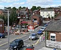
 Bus on Leicester Road, Narborough - geograph.org.uk - 3378911.jpg 1,024 × 768; 136 KB
-
 C Road - geograph.org.uk - 2648851.jpg 800 × 530; 196 KB
-
 Cattle grazing - geograph.org.uk - 5224461.jpg 640 × 480; 75 KB
-
 Church of St Pius X, Narborough - geograph.org.uk - 2573134.jpg 4,000 × 3,000; 2.84 MB
-
 Church View, Narborough - geograph.org.uk - 5697073.jpg 480 × 640; 62 KB
-
 Construction at Carlton Park - geograph.org.uk - 3268942.jpg 3,146 × 2,463; 1.66 MB
-
 Cosby Road in Littlethorpe - geograph.org.uk - 5278544.jpg 800 × 491; 78 KB
-
 Coventry Road (B4114) - geograph.org.uk - 5224367.jpg 640 × 480; 63 KB
-
 Coventry Road (B4114), Narborough - geograph.org.uk - 5224377.jpg 640 × 480; 72 KB
-
 Coventry Road - geograph.org.uk - 3693732.jpg 640 × 478; 52 KB
-
 Coventry Road and Railway - geograph.org.uk - 511794.jpg 640 × 460; 95 KB
-
 Coventry Road in Narborough - geograph.org.uk - 5247792.jpg 800 × 578; 90 KB
-
 Desford Road, Narborough - geograph.org.uk - 511842.jpg 640 × 470; 96 KB
-
 Dismantled Railway - geograph.org.uk - 2648694.jpg 800 × 530; 183 KB
-
 Dismantled Railway - geograph.org.uk - 2648697.jpg 800 × 530; 196 KB
-
 Disused railway bridge over Forest Road - geograph.org.uk - 5224472.jpg 640 × 480; 116 KB
-
 Disused railway bridge over Forest Road - geograph.org.uk - 5224474.jpg 640 × 480; 114 KB
-

-
 Enderby Graffiti - geograph.org.uk - 2057808.jpg 2,652 × 591; 889 KB
-
 Enderby Graffiti - geograph.org.uk - 2089094.jpg 3,049 × 709; 1.22 MB
-
 Entering Narborough - geograph.org.uk - 5224371.jpg 640 × 480; 68 KB
-
 Entering Narborough along Leicester Road - geograph.org.uk - 2573132.jpg 4,000 × 3,000; 2.85 MB
-
 Factory, Carlton Park - geograph.org.uk - 5224953.jpg 640 × 480; 60 KB
-
-
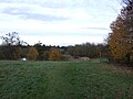
 Farmland in the Soar Valley - geograph.org.uk - 4449546.jpg 640 × 431; 62 KB
-
 Farmland viewed from the Whistle Way - geograph.org.uk - 4191180.jpg 1,600 × 1,290; 755 KB
-

-
 Field near Lodge Farm - geograph.org.uk - 5565160.jpg 800 × 460; 85 KB
-
 Flooded fields near the River Soar - geograph.org.uk - 4329363.jpg 1,600 × 1,259; 708 KB
-

-
-
 Footpath through Carlton Park - geograph.org.uk - 5048546.jpg 2,000 × 1,500; 275 KB
-
 Forest Road - geograph.org.uk - 5224469.jpg 640 × 480; 57 KB
-
 Forest Road - geograph.org.uk - 5224477.jpg 640 × 480; 99 KB
-
 Forest Road - geograph.org.uk - 5224949.jpg 640 × 480; 59 KB
-
 Forest Road - geograph.org.uk - 5441382.jpg 1,600 × 900; 290 KB
-
 Forest Road bridge, M69 motorway - geograph.org.uk - 3589421.jpg 640 × 480; 56 KB
-
 Forest Road in Enderby - geograph.org.uk - 4191190.jpg 1,600 × 1,227; 669 KB
-
 Former Quarry Line - geograph.org.uk - 2647374.jpg 800 × 530; 175 KB
-
 Former Quarry Line - geograph.org.uk - 2647375.jpg 800 × 530; 137 KB
-
 Former Quarry Line - geograph.org.uk - 2648704.jpg 800 × 530; 174 KB
-
 Former Quarry Line - geograph.org.uk - 2648716.jpg 800 × 530; 175 KB
-
 Former Quarry Line - geograph.org.uk - 2648723.jpg 800 × 530; 192 KB
-
 Former Quarry Line - geograph.org.uk - 2648732.jpg 800 × 530; 195 KB
-
 Former Quarry Line - geograph.org.uk - 2648756.jpg 800 × 530; 137 KB
-
 Former Quarry Line - geograph.org.uk - 2648770.jpg 800 × 530; 170 KB
-
 Former Quarry Line - geograph.org.uk - 2648778.jpg 800 × 530; 175 KB
-
 Former Quarry Line - geograph.org.uk - 2648812.jpg 800 × 530; 195 KB
-
 Former Quarry Line - geograph.org.uk - 2648827.jpg 800 × 530; 134 KB
-
 Former Quarry Line - geograph.org.uk - 2648863.jpg 800 × 530; 174 KB
-
 Former Quarry Line - geograph.org.uk - 2648867.jpg 800 × 530; 175 KB
-
 Former Railway - geograph.org.uk - 2648846.jpg 800 × 530; 193 KB
-
 Graffiti covered former railway bridge - geograph.org.uk - 4191165.jpg 1,600 × 1,356; 603 KB
-

-
 Houses on Desford Road, Narborough - geograph.org.uk - 5224955.jpg 640 × 480; 100 KB
-
 Houses on Forest Road, Enderby - geograph.org.uk - 5224487.jpg 640 × 480; 53 KB
-
 Houses on Station Road, Littlethorpe - geograph.org.uk - 5224964.jpg 640 × 480; 58 KB
-
 In the Soar Valley - geograph.org.uk - 4449101.jpg 640 × 426; 58 KB
-
 Industrial units, Narborough - geograph.org.uk - 5224374.jpg 640 × 480; 67 KB
-

-
 King Edward Avenue in Narborough - geograph.org.uk - 4329344.jpg 1,600 × 1,043; 698 KB
-

-
 Line to Birmingham - geograph.org.uk - 2173262.jpg 800 × 531; 112 KB
-
 Lodge Farm - geograph.org.uk - 4449084.jpg 640 × 426; 53 KB
-
 Looking south along the M1 motorway - geograph.org.uk - 4162714.jpg 1,600 × 1,200; 467 KB
-
 M69 towards Coventry - geograph.org.uk - 5224467.jpg 640 × 480; 44 KB
-
 Map Narborough Leicestershire 1886.jpg 2,000 × 1,077; 604 KB
-
 Meade family of Narborough.jpg 1,500 × 818; 315 KB
-
 Narborough Congregational Church - geograph.org.uk - 2573144.jpg 4,000 × 3,000; 2.93 MB
-
 Narborough Hall - geograph.org.uk - 2574801.jpg 4,000 × 3,000; 2.84 MB
-
 Narborough Hall, Leicestershire, UK.jpg 720 × 480; 116 KB
-
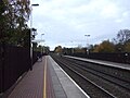
 Narborough railway station, Leicestershire - geograph.org.uk - 3827788.jpg 1,024 × 768; 237 KB
-
 Narborough, Leicestershire - geograph.org.uk - 509630.jpg 640 × 528; 131 KB
-
 Natwest Bank, Narborough - geograph.org.uk - 5224957.jpg 640 × 480; 58 KB
-
 Nineteenth-century benchmark on Narborough church - geograph.org.uk - 4519388.jpg 2,560 × 1,920; 1.02 MB
-
 Notice of ownership of Narborough Hall 1847.jpg 950 × 278; 95 KB
-
 Oak Road in Littlethorpe - geograph.org.uk - 5295880.jpg 800 × 600; 121 KB
-
 Old Line - geograph.org.uk - 2173329.jpg 800 × 531; 93 KB
-
 Old railway bridge crossing Huncote Road - geograph.org.uk - 4191078.jpg 1,600 × 1,343; 470 KB
-
 Path, Carlton Park, Narborough - geograph.org.uk - 5224951.jpg 640 × 480; 69 KB
-
-

-
 Railway line at Narborough - geograph.org.uk - 3931753.jpg 1,944 × 2,592; 2.81 MB
-
-

-
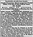
 Results of Sale of Narborough Estate 1880.jpg 800 × 1,068; 370 KB
-
 River Soar - geograph.org.uk - 3429720.jpg 640 × 480; 61 KB
-
 River Soar from Langham Bridge - geograph.org.uk - 511832.jpg 640 × 490; 101 KB
-
 Riverside Way in Littlethorpe - geograph.org.uk - 5299213.jpg 800 × 551; 155 KB
-
 Roundabout on the B4114 - geograph.org.uk - 4162734.jpg 1,600 × 1,211; 694 KB
-
 Sale of interest in Narborough Hall 1869.jpg 1,000 × 1,096; 412 KB
-
 School playing fields - geograph.org.uk - 5224480.jpg 640 × 480; 47 KB
-

-

-

-
-
 Sign for the Old Inn, Littlethorpe - geograph.org.uk - 5224967.jpg 640 × 564; 53 KB
-

-

-
 Small green space in Narborough - geograph.org.uk - 5566528.jpg 800 × 521; 169 KB
-

-
 South Leicestershire Railway - geograph.org.uk - 5781570.jpg 3,055 × 2,147; 1.78 MB
-
 Stile on Whistle Way - geograph.org.uk - 169037.jpg 640 × 427; 184 KB
-
 Sycamore Road in Littlethorpe - geograph.org.uk - 5255429.jpg 800 × 546; 152 KB
-
 Sycamore Way in Littlethorpe - geograph.org.uk - 5461119.jpg 800 × 541; 103 KB
-
-
-
 The end of Whistle Way at Enderby - geograph.org.uk - 2326396.jpg 3,264 × 1,898; 2.57 MB
-
 The M69 towards Forest Road bridge - geograph.org.uk - 3795897.jpg 1,200 × 900; 298 KB
-
 The Narborough Arms, Narborough - geograph.org.uk - 5224960.jpg 640 × 480; 71 KB
-
 The Old Inn - geograph.org.uk - 5781555.jpg 3,265 × 2,459; 1.33 MB
-

-
 The Old Inn, Littlethorpe - geograph.org.uk - 5224966.jpg 640 × 480; 59 KB
-
 The Pastures, Narborough - geograph.org.uk - 168968.jpg 640 × 427; 120 KB
-
 The Plough Inn, Littlethorpe - geograph.org.uk - 5224962.jpg 640 × 480; 61 KB
-
 The River Soar and floodplain - geograph.org.uk - 4449082.jpg 640 × 426; 43 KB
-
 The River Soar at Langham Bridge - geograph.org.uk - 4329352.jpg 1,600 × 1,196; 650 KB
-
 The River Soar from Langham Bridge - geograph.org.uk - 2574808.jpg 4,000 × 3,000; 2.86 MB
-
 The southern end of the Whistle Way - geograph.org.uk - 5043119.jpg 1,500 × 2,000; 471 KB
-
 The Whistle Way footpath - geograph.org.uk - 2877639.jpg 3,264 × 2,448; 3.85 MB
-
-
 Traffic lights on Huncote Road - geograph.org.uk - 4162745.jpg 1,600 × 1,462; 515 KB
-
 Traffic on the B4114 Coventry Road - geograph.org.uk - 5247897.jpg 800 × 647; 83 KB
-

-
 Trees and Fields - geograph.org.uk - 2648832.jpg 800 × 530; 129 KB
-
 View from Church tower 2.jpg 571 × 369; 57 KB
-
 Warwick Road in Littlethorpe - geograph.org.uk - 3926114.jpg 1,600 × 1,074; 448 KB
-
 Whistle Way - geograph.org.uk - 5038672.jpg 2,000 × 1,500; 585 KB
-
 Whistle Way at Narborough - geograph.org.uk - 5566530.jpg 800 × 512; 167 KB
-
 Whistle Way bridge crossing Forest Road - geograph.org.uk - 4794726.jpg 800 × 540; 152 KB
-
 Whistle Way crosses Huncote Road - geograph.org.uk - 5042086.jpg 2,000 × 1,500; 217 KB
-
 Whistle Way crossing Huncote Road - geograph.org.uk - 5692587.jpg 800 × 576; 132 KB
-
 Whistle Way cycleway and footpath in Enderby - geograph.org.uk - 4191264.jpg 1,600 × 1,183; 814 KB
-
 Whistle Way near Narborough - geograph.org.uk - 2326390.jpg 3,249 × 2,019; 2.9 MB
-
 Whistle Way near Narborough - geograph.org.uk - 2326392.jpg 3,264 × 2,448; 3.25 MB
-
 Whistle Way near Narborough - geograph.org.uk - 2326395.jpg 2,448 × 3,264; 3.23 MB
-
 Whistle Way, Narborough - geograph.org.uk - 169023.jpg 640 × 427; 177 KB
-
 Works entrance, Carlton Park - geograph.org.uk - 5224954.jpg 640 × 480; 74 KB
-
 Coventry Road, Narborough - geograph.org.uk - 164584.jpg 640 × 427; 133 KB
-
 Forest Road near Enderby - geograph.org.uk - 511879.jpg 640 × 478; 109 KB
-
 Forest Road near Narborough - geograph.org.uk - 511877.jpg 640 × 459; 101 KB
-
 Forest Road, Narborough - geograph.org.uk - 511874.jpg 640 × 485; 113 KB
-
 Huncote Road, Narborough - geograph.org.uk - 511776.jpg 640 × 480; 105 KB
-
 M69 - geograph.org.uk - 511880.jpg 640 × 396; 83 KB
-
 On Whistle Way - geograph.org.uk - 169036.jpg 640 × 427; 204 KB
-
 The Ashlands, Enderby - geograph.org.uk - 169000.jpg 640 × 427; 145 KB
-
 The B4114 Coventry Road - geograph.org.uk - 511786.jpg 640 × 482; 102 KB
-
 The Copt Oak, Narborough - geograph.org.uk - 169033.jpg 640 × 427; 103 KB
-
 View of Huncote Land-fill Site - geograph.org.uk - 169035.jpg 640 × 514; 175 KB


_-_geograph.org.uk_-_5224367.jpg)
,_Narborough_-_geograph.org.uk_-_5224377.jpg)


_-_geograph.org.uk_-_5223031.jpg)


,_Narborough_-_geograph.org.uk_-_5224950.jpg)


