Category:Natrona County, Wyoming
Jump to navigation
Jump to search
county in Wyoming, United States    | |||||
| Upload media | |||||
| Instance of | |||||
|---|---|---|---|---|---|
| Named after | |||||
| Location | Wyoming, Estados Unidos | ||||
| Capital | |||||
| Inception |
| ||||
| Population |
| ||||
| Area |
| ||||
| official website | |||||
 | |||||
Mga ubos-nga-kaarangay
Ini nga kaarangay mayda han mga nasunod nga 9 nga mga ubos-nga-kaarangay, tikang hin 9 nga kabug-osan.
Media ha kaarangay nga "Natrona County, Wyoming"
An mga nasunod nga 35 ka mga fayl aada han hini nga kaarangay, tikang hin 35 nga kabug-osan.
-
 Flag of Natrona County, Wyoming.gif 362 × 216; 24 nga KB
-
 Photograph of the Red Buttes - NARA - 516886.jpg 3,000 × 2,283; 1.44 nga MB
-
 1909 07 30 Seminole Mercantile Co Bucknum Wy Casper Press.png 576 × 393; 277 nga KB
-

-
 Artist Point (59629584).jpeg 865 × 1,300; 780 nga KB
-

-
 Casper Banner.jpg 4,928 × 705; 1.69 nga MB
-
 Casperpanorama.jpg 4,928 × 1,296; 2.61 nga MB
-
 Crotalus viridis (2022).jpg 3,600 × 2,400; 2.81 nga MB
-
 Downtown Arminto.jpg 1,200 × 859; 813 nga KB
-
 East from Independence Rock. Natrona County, Wyoming - NARA - 517400.jpg 3,000 × 1,849; 1.21 nga MB
-
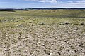 East of Dry Creek.jpg 3,600 × 2,400; 4.01 nga MB
-
 Edness Kimball Wilkins State Park - Wyoming.jpg 9,284 × 6,175; 54.67 nga MB
-
 Geological section of Salt Creek Oil Field.png 401 × 170; 32 nga KB
-
 HellsHalfAcre.JPG 1,500 × 1,125; 513 nga KB
-
 Independence Rock, Wyoming, USA, July 2015.jpg 5,256 × 3,750; 6.75 nga MB
-
 Jackson Canyon Area of Critical Environmental Concern, Wyoming (15475312589).jpg 800 × 571; 95 nga KB
-
 Jackson Canyon Area of Critical Environmental Concern, Wyoming (15659267241).jpg 686 × 960; 144 nga KB
-
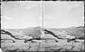
 Looking out upon the plains, from near the head of Horse Creek. Natrona County, Wyoming. - NARA - 516858.jpg 3,000 × 2,295; 1.35 nga MB
-
 May 14, 2014 – Casper, WY (14364934287).jpg 2,469 × 1,829; 1.94 nga MB
-
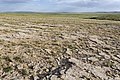
 Northwest of Arminto.jpg 3,600 × 2,400; 4.18 nga MB
-
 OIL WELLS NEAR TEAPOT DOME, WYOMING - NARA - 549207.jpg 2,019 × 3,000; 847 nga KB
-
 OIL WELLS NEAR TEAPOT DOME, WYOMING - NARA - 549208.jpg 3,000 × 2,024; 611 nga KB
-
 OIL WELLS NEAR TEAPOT DOME, WYOMING - NARA - 549209.jpg 2,036 × 3,000; 807 nga KB
-
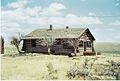 Old homestead natrona co wy.jpg 1,168 × 790; 575 nga KB
-
 Photograph of the Red Buttes 1870.gif 600 × 457; 76 nga KB
-
 Salt Creek Oil Field well.jpg 737 × 551; 127 nga KB
-
 Soputh of Notches Dome.jpg 3,600 × 2,400; 3.89 nga MB
-

-

-

-
 Train near Casper, Wyoming LCCN2010630857.tif 5,616 × 3,744; 120.34 nga MB
-
 USA Natrona County, Wyoming age pyramid.svg 520 × 600; 7 nga KB
-

-
 Wyoming Highway 220 near Martin's Cove in Natrona County, Wyoming.jpg 5,184 × 3,456; 7.19 nga MB


.jpeg)

.jpg)


.jpg)
.jpg)

.jpg)


