Category:New Alresford
Aller à la navigation
Aller à la recherche
localité britannique  | |||||
| Téléverser des médias | |||||
| Nature de l’élément | |||||
|---|---|---|---|---|---|
| Lieu | cité de Winchester, Hampshire, Angleterre du Sud-Est, Angleterre | ||||
 | |||||
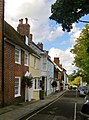
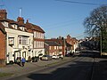
English: New Alresford or simply Alresford (pronounced Allsford) is a small town and civil parish in Hampshire, England. It is situated some 12 km north-east of the city of Winchester, and 20 km south-west of the town of Alton. In the 2001 census the population of Alresford was 5,200.
Sous-catégories
Cette catégorie comprend 17 sous-catégories, dont les 17 ci-dessous.
A
- Alresford Methodist Church (7 F)
B
J
K
N
- New Farm Chapel, Alresford (7 F)
O
- Old Fulling Mill (10 F)
P
R
- River Itchen in New Alresford (12 F)
S
- Swan Hotel, New Alresford (8 F)
T
- Toll House, New Alresford (7 F)
W
Média dans la catégorie « New Alresford »
Cette catégorie comprend 330 fichiers, dont les 200 ci-dessous.
(page précédente) (page suivante)-
 Access to the churchyard - geograph.org.uk - 4768403.jpg 1 024 × 734 ; 269 kio
-
 Alre Valley - geograph.org.uk - 122129.jpg 640 × 479 ; 272 kio
-
 Alresford (Hampshire) railway station - geograph.org.uk - 4312962.jpg 1 600 × 1 200 ; 310 kio
-
 Alresford - Cottages - geograph.org.uk - 1616034.jpg 640 × 480 ; 75 kio
-
 Alresford - Fire Station - geograph.org.uk - 1616488.jpg 640 × 480 ; 69 kio
-
 Alresford - geograph.org.uk - 4302408.jpg 3 909 × 2 605 ; 7,31 Mio
-
 Alresford - geograph.org.uk - 4302413.jpg 6 000 × 4 000 ; 7,16 Mio
-
 Alresford - geograph.org.uk - 4302420.jpg 5 880 × 3 307 ; 5,44 Mio
-
 Alresford - geograph.org.uk - 5641380.jpg 3 339 × 2 227 ; 7,58 Mio
-
 Alresford - Nat West Bank - geograph.org.uk - 1616077.jpg 640 × 480 ; 72 kio
-
 Alresford - Old Fire Station - geograph.org.uk - 1616024.jpg 640 × 480 ; 59 kio
-
 Alresford - Police Station - geograph.org.uk - 1615965.jpg 640 × 480 ; 114 kio
-
 Alresford - The Old Sun - geograph.org.uk - 1616376.jpg 640 × 480 ; 63 kio
-
 Alresford - Town Houses - geograph.org.uk - 1616058.jpg 640 × 480 ; 72 kio
-
 Alresford - Town Houses - geograph.org.uk - 1616065.jpg 640 × 480 ; 95 kio
-
 Alresford - Warehouse Conversion - geograph.org.uk - 1615963.jpg 640 × 480 ; 61 kio
-
 Alresford Bowling Club - geograph.org.uk - 2456570.jpg 2 560 × 1 920 ; 2,35 Mio
-
 Alresford bridge said to date from the year 1190.jpg 935 × 1 102 ; 77 kio
-
 Alresford Builders Merchants Ltd - geograph.org.uk - 3965971.jpg 2 048 × 1 536 ; 563 kio
-
 Alresford Builders Merchants Ltd - geograph.org.uk - 4768343.jpg 1 543 × 1 143 ; 702 kio
-
 Alresford cascade.jpg 794 × 1 309 ; 82 kio
-
 Alresford Drove track - geograph.org.uk - 1751670.jpg 2 848 × 2 144 ; 1,55 Mio
-
 Alresford fire station - geograph.org.uk - 279884.jpg 640 × 426 ; 192 kio
-
 Alresford Golf Course - geograph.org.uk - 869257.jpg 640 × 427 ; 115 kio
-
 Alresford High Street - geograph.org.uk - 2222107.jpg 640 × 426 ; 190 kio
-
 Alresford High Street - geograph.org.uk - 2222113.jpg 640 × 426 ; 228 kio
-
 Alresford Interiors - geograph.org.uk - 4768386.jpg 1 531 × 1 141 ; 700 kio
-
 Alresford Linen Company - geograph.org.uk - 2456516.jpg 2 560 × 1 920 ; 2,2 Mio
-
 Alresford PO Dec 1992 - Flickr - sludgegulper.jpg 1 127 × 1 733 ; 102 kio
-
 Alresford SO24 PO Dec 1992 - Flickr - sludgegulper.jpg 1 740 × 1 194 ; 114 kio
-
 Alresford St John the Baptist.jpg 396 × 463 ; 15 kio
-
 Alresford station - geograph.org.uk - 4466639.jpg 1 296 × 972 ; 244 kio
-
 Alresford station buffet - geograph.org.uk - 5584148.jpg 5 202 × 3 465 ; 2,92 Mio
-
 Alresford station platform - geograph.org.uk - 5584157.jpg 5 202 × 3 465 ; 3,4 Mio
-
 Alresford to Winchester Railway - geograph.org.uk - 2118272.jpg 1 704 × 2 272 ; 2,99 Mio
-
 Alresford Watercress Festival - geograph.org.uk - 5256247.jpg 2 560 × 1 920 ; 2,62 Mio
-
 Alresford, Buying bread - geograph.org.uk - 4479608.jpg 3 456 × 2 304 ; 1,88 Mio
-
 Alresford, Hampshire ... the old post office (just!) (4923356252).jpg 2 304 × 3 072 ; 2,62 Mio
-
 Alresford, Hampshire ... The post office is in the Co - op. (4923353608).jpg 2 953 × 2 107 ; 3,52 Mio
-
 Alresford, Hampshire, The 'Horse and Groom' - geograph.org.uk - 5028159.jpg 5 184 × 3 456 ; 6,47 Mio
-
 Alresford, Hampshire, West Street during the Watercress Festival - geograph.org.uk - 2952784.jpg 3 264 × 2 448 ; 3,86 Mio
-

-
 Approaching Winchester Road, Alresford, Hampshire - geograph.org.uk - 3167999.jpg 4 406 × 2 979 ; 6,56 Mio
-
 Arlebury Park House - geograph.org.uk - 3977292.jpg 1 600 × 1 070 ; 445 kio
-
 Arlebury Park House, Alresford, Hampshire - geograph.org.uk - 2662968.jpg 2 645 × 1 601 ; 2,83 Mio
-
 Arriving in New Alresford - geograph.org.uk - 3435909.jpg 640 × 427 ; 93 kio
-
 B3046 passes under the Mid-Hants Railway - geograph.org.uk - 2547805.jpg 3 123 × 2 459 ; 1,25 Mio
-
 Back of a Signal - geograph.org.uk - 3973407.jpg 3 624 × 2 592 ; 1,28 Mio
-
 Barber's Shop, Alresford (caricature) RMG PW4961.jpg 1 280 × 814 ; 1,56 Mio
-
 Barclays Bank. Alresford - geograph.org.uk - 3977327.jpg 1 600 × 1 200 ; 333 kio
-
 Basingclog Morris - geograph.org.uk - 5256274.jpg 2 560 × 1 920 ; 2,62 Mio
-
 Bay Tree House.jpg 4 000 × 2 672 ; 4,19 Mio
-
 Benenden Green, Arlesford - geograph.org.uk - 872147.jpg 640 × 427 ; 125 kio
-
 Bow Row - geograph.org.uk - 2456588.jpg 2 560 × 1 920 ; 2,36 Mio
-
 Broad Street, Alresford - geograph.org.uk - 6001476.jpg 1 920 × 1 280 ; 1,26 Mio
-
 Broad Street, Alresford - geograph.org.uk - 6013045.jpg 1 850 × 1 166 ; 1,49 Mio
-
 Broad Street, Alresford, Hampshire - geograph.org.uk - 3113176.jpg 1 024 × 768 ; 418 kio
-
 Broad Street, Alresford, Hampshire - geograph.org.uk - 3113186.jpg 768 × 1 024 ; 392 kio
-
 Broad Street, Alresford, Hampshire - geograph.org.uk - 3113209.jpg 1 024 × 768 ; 473 kio
-
 Broad Street, Alresford, Hampshire - geograph.org.uk - 3113218.jpg 1 024 × 768 ; 437 kio
-
 Broad Street, Alresford, Hampshire - geograph.org.uk - 3169358.jpg 4 132 × 2 643 ; 5,87 Mio
-
 Broad Street, New Alresford - geograph.org.uk - 1327617.jpg 428 × 640 ; 98 kio
-
 Broad Street, New Alresford - geograph.org.uk - 97871.jpg 640 × 480 ; 96 kio
-
 Broad Street, west side, New Alresford - geograph.org.uk - 3785683.jpg 640 × 480 ; 138 kio
-
 CableArlesford-2.jpg 4 321 × 2 881 ; 5,62 Mio
-
 CableArlesford-3.jpg 3 661 × 2 441 ; 5,13 Mio
-
 Car park at Alresford station - geograph.org.uk - 2433132.jpg 2 560 × 1 920 ; 1,19 Mio
-
 Car park at Alresford station - geograph.org.uk - 2433397.jpg 1 600 × 1 200 ; 546 kio
-
 Car park at Perins School - geograph.org.uk - 4768332.jpg 1 024 × 762 ; 229 kio
-
 Cardew House, New Alresford - geograph.org.uk - 3963313.jpg 1 793 × 1 245 ; 428 kio
-

-
 Celebratory plaque to a great man (2) - geograph.org.uk - 2158262.jpg 640 × 480 ; 45 kio
-
 Centre of Alresford, Hampshire - geograph.org.uk - 3112876.jpg 1 024 × 768 ; 378 kio
-
 Charters Estate Agents, Alresford - geograph.org.uk - 3977311.jpg 1 600 × 1 200 ; 364 kio
-
 Christmas Leave - geograph.org.uk - 4302737.jpg 4 545 × 3 409 ; 4,27 Mio
-
 Corfe Close, Alresford - geograph.org.uk - 5884531.jpg 4 886 × 3 142 ; 1,67 Mio
-
 Cottages in Old Alresford - geograph.org.uk - 110001.jpg 640 × 480 ; 120 kio
-
 Cottages on East Street - geograph.org.uk - 2456539.jpg 2 560 × 1 920 ; 1,91 Mio
-
 Crocodile Teeth at New Alresford, Hampshire - geograph.org.uk - 2662317.jpg 3 030 × 2 016 ; 7,8 Mio
-

-
 Cutting east of Alresford station - geograph.org.uk - 3547501.jpg 640 × 480 ; 141 kio
-
 Departure for Ropley - geograph.org.uk - 6161252.jpg 1 024 × 768 ; 205 kio
-
 Dichenson Walk, Alresford - geograph.org.uk - 869180.jpg 427 × 640 ; 183 kio
-
 Disused Railway Bridge crossing Alresford Road (B3047) - geograph.org.uk - 5299998.jpg 4 000 × 3 000 ; 3,55 Mio
-
 Doctors' surgery in Station Road - geograph.org.uk - 2167193.jpg 640 × 480 ; 51 kio
-
 Does this water taste chalky to you^ - geograph.org.uk - 3159371.jpg 3 320 × 2 016 ; 2,43 Mio
-
 Ducks on River Alre Alresford, Hampshire - geograph.org.uk - 3114395.jpg 1 024 × 768 ; 580 kio
-
 Ducks, River Alre - geograph.org.uk - 3785600.jpg 640 × 480 ; 181 kio
-
 Early days at Alresford - Watercress Line - geograph.org.uk - 5248432.jpg 1 800 × 1 162 ; 178 kio
-
 East Street - geograph.org.uk - 2456237.jpg 2 560 × 1 920 ; 2,17 Mio
-
 East Street - geograph.org.uk - 2456533.jpg 2 560 × 1 920 ; 1,78 Mio
-
 East Street, Alresford - geograph.org.uk - 3973312.jpg 3 500 × 2 412 ; 2,01 Mio
-
 East Street, Alresford - geograph.org.uk - 5584135.jpg 5 202 × 3 465 ; 2,62 Mio
-
 East Street, Alresford, Hampshire - geograph.org.uk - 3169332.jpg 4 091 × 2 700 ; 4,48 Mio
-
 Eel House Notice - geograph.org.uk - 1931429.jpg 3 544 × 2 568 ; 2,49 Mio
-
 Eel House on the Arle - geograph.org.uk - 1931465.jpg 3 392 × 2 648 ; 3,77 Mio
-
 Entering New Alresford from the east - geograph.org.uk - 1837583.jpg 640 × 480 ; 154 kio
-
 Exiting Perins school - geograph.org.uk - 4330091.jpg 640 × 504 ; 69 kio
-
 Farmland near the Itchen - geograph.org.uk - 3563103.jpg 640 × 425 ; 166 kio
-
 Fire Engine passing under Bridge, Alresford, Hampshire - geograph.org.uk - 3114556.jpg 768 × 1 024 ; 417 kio
-
 Fleur de Lys - geograph.org.uk - 5256267.jpg 2 560 × 1 920 ; 2,28 Mio
-

-
 Former "Peaceful Home" pub - geograph.org.uk - 3969611.jpg 1 578 × 1 185 ; 345 kio
-
 Former A31 Road, New Alresford, Hampshire - geograph.org.uk - 2662910.jpg 3 076 × 2 047 ; 7,72 Mio
-
 Former A31 Road, New Alresford, Hampshire - geograph.org.uk - 2662923.jpg 2 801 × 1 864 ; 7,65 Mio
-
 Former home to NatWest Bank - geograph.org.uk - 4768384.jpg 1 531 × 1 139 ; 838 kio
-
 Georgian New Alresford - geograph.org.uk - 2554436.jpg 2 560 × 1 920 ; 2,02 Mio
-
 GFB MST.ED88 (22061216119).jpg 1 365 × 910 ; 1,09 Mio
-
 Part of Alresford Golf Course - geograph.org.uk - 872351.jpg 427 × 640 ; 122 kio
-
 Graveyard wall in St John's churchyard (1) - geograph.org.uk - 2166882.jpg 640 × 454 ; 98 kio
-
 Great Weir, New Alresford - geograph.org.uk - 1327366.jpg 640 × 428 ; 147 kio
-
 Haig Road - New Alresford - geograph.org.uk - 4904286.jpg 3 264 × 1 840 ; 3,11 Mio
-
 Hair Art - East Street - geograph.org.uk - 4768392.jpg 1 539 × 1 127 ; 775 kio
-
 Hankins Court - geograph.org.uk - 5596880.jpg 800 × 600 ; 146 kio
-
 Headley Close, Alresford - geograph.org.uk - 869275.jpg 539 × 640 ; 124 kio
-

-
 Here comes another one! - geograph.org.uk - 671304.jpg 640 × 411 ; 71 kio
-
 Historic East Street - geograph.org.uk - 2456554.jpg 2 560 × 1 920 ; 2,03 Mio
-
 House in Broad Street, Alresford, Hampshire - geograph.org.uk - 3113203.jpg 768 × 1 024 ; 412 kio
-
 Houses along East Street - geograph.org.uk - 4768389.jpg 1 529 × 1 146 ; 780 kio
-
 Houses along East Street - geograph.org.uk - 4768394.jpg 1 540 × 1 138 ; 1 004 kio
-
 Houses along East Street - geograph.org.uk - 4768397.jpg 1 521 × 1 122 ; 700 kio
-
 Houses in New Farm Road.jpg 640 × 427 ; 95 kio
-
 Houses on Pound Hill - geograph.org.uk - 5495829.jpg 640 × 480 ; 93 kio
-
 Houses on Tichborne Down - geograph.org.uk - 5582239.jpg 640 × 427 ; 89 kio
-

-
 Jacklyns Lane Railway Bridge - geograph.org.uk - 2986585.jpg 4 288 × 3 216 ; 3,39 Mio
-
 Junction of Broad Street, East Street and West Street - geograph.org.uk - 2432878.jpg 1 600 × 1 200 ; 575 kio
-
 Ladywell Cottage, New Alresford - geograph.org.uk - 3785937.jpg 640 × 480 ; 141 kio
-

-
 Lavender at the Long Barn - geograph.org.uk - 5883655.jpg 5 184 × 3 456 ; 5,29 Mio
-
 Leaving New Alresford - geograph.org.uk - 1837582.jpg 640 × 480 ; 158 kio
-
 Local Colour, New Alresford - geograph.org.uk - 2456247.jpg 2 560 × 1 920 ; 2,19 Mio
-
 Long Barn, Alresford - geograph.org.uk - 5883654.jpg 5 175 × 3 075 ; 3,1 Mio
-
 Long Load! - geograph.org.uk - 697478.jpg 640 × 509 ; 79 kio
-

-
 Looking along Tichborne Down, Alresford - geograph.org.uk - 869276.jpg 427 × 640 ; 130 kio
-
 Looking along Tichborne Down, Alresford - geograph.org.uk - 869644.jpg 640 × 427 ; 110 kio
-
 Looking down Pound Hill - geograph.org.uk - 4768335.jpg 1 515 × 1 132 ; 788 kio
-
 Looking down Sun Hill, Alresford - geograph.org.uk - 869220.jpg 640 × 427 ; 144 kio
-
 Looking up Broad Street - geograph.org.uk - 4768383.jpg 1 531 × 1 093 ; 795 kio
-
 Lord Nelson ready to leave from Alresford - geograph.org.uk - 4655383.jpg 4 000 × 3 000 ; 3,95 Mio
-
 Lord Nelson, No 850 - geograph.org.uk - 5256282.jpg 2 560 × 1 920 ; 2,72 Mio
-
 Maple Close, Alresford - geograph.org.uk - 869676.jpg 640 × 427 ; 117 kio
-
 Memorial Garden, Alresford, Hampshire - geograph.org.uk - 3114340.jpg 768 × 1 024 ; 497 kio
-
 Mid-Hants Railway - geograph.org.uk - 5641453.jpg 3 657 × 2 439 ; 7,57 Mio
-
 Mid-Hants Railway - geograph.org.uk - 5641456.jpg 3 339 × 2 227 ; 7,61 Mio
-
 Mid-Hants Railway - geograph.org.uk - 5641459.jpg 3 498 × 2 333 ; 7,67 Mio
-
 Mid-Hants Railway - geograph.org.uk - 5641461.jpg 3 578 × 2 386 ; 7,58 Mio
-
 Mid-Hants Railway Approaching Alresford - geograph.org.uk - 4087884.jpg 640 × 480 ; 347 kio
-
 Mill Race, New Alresford - geograph.org.uk - 3969620.jpg 2 048 × 1 536 ; 1,05 Mio
-
 Mill Stream, New Alresford - geograph.org.uk - 4088166.jpg 640 × 481 ; 428 kio
-
 Moda Rosa, West Street, New Alresford - geograph.org.uk - 3969661.jpg 1 663 × 1 244 ; 440 kio
-
 Morris Band - geograph.org.uk - 5256259.jpg 2 560 × 1 920 ; 2,35 Mio
-
 Morris Traveller in Alresford - geograph.org.uk - 2850497.jpg 409 × 640 ; 60 kio
-

-

-

-
 New Alresford - geograph.org.uk - 1327364.jpg 640 × 428 ; 87 kio
-
 New Alresford - Morris Dancers - geograph.org.uk - 5256251.jpg 2 560 × 1 920 ; 2,49 Mio
-
 New Alresford - Morris Side - geograph.org.uk - 5256256.jpg 2 560 × 1 920 ; 2,41 Mio
-
 New Alresford fire station - geograph.org.uk - 4330093.jpg 640 × 480 ; 65 kio
-
 New Alresford in Bloom - geograph.org.uk - 2554420.jpg 2 560 × 1 920 ; 2,42 Mio
-
 New Alresford main street - geograph.org.uk - 2222183.jpg 640 × 426 ; 193 kio
-
 New Alresford railway station - geograph.org.uk - 6161253.jpg 1 024 × 768 ; 178 kio
-
 New Alresford roof tops - geograph.org.uk - 5736433.jpg 640 × 480 ; 126 kio
-
 New Alresford, houses in Broad Street - geograph.org.uk - 5133997.jpg 760 × 1 024 ; 186 kio
-
 New Alresford, Mill Hill - geograph.org.uk - 4088167.jpg 640 × 480 ; 321 kio
-
 New Alresford, Seward's Bridge - geograph.org.uk - 4166439.jpg 640 × 548 ; 387 kio
-
 New Alresford, Sun Lane - geograph.org.uk - 5129791.jpg 1 024 × 768 ; 210 kio
-
 New Alresford, The Avenue (B3047) - geograph.org.uk - 4166425.jpg 640 × 480 ; 289 kio
-
 New Alresford, view west along East Street - geograph.org.uk - 5129844.jpg 890 × 1 024 ; 142 kio
-
 New Farm Road, Alresford - geograph.org.uk - 3977268.jpg 1 600 × 1 232 ; 546 kio
-
 NewAlresford-WestSt.jpg 2 816 × 2 112 ; 1,51 Mio
-
 Now a Police Station - geograph.org.uk - 4768336.jpg 1 536 × 1 150 ; 846 kio
-
 Oak Hill, Alresford - geograph.org.uk - 872157.jpg 640 × 427 ; 105 kio
-
 Oak Hill, Alresford - geograph.org.uk - 872169.jpg 640 × 427 ; 107 kio
-
 Old Alresford Pond - geograph.org.uk - 5143180.jpg 750 × 1 024 ; 256 kio
-
 Old Alresford Pond - geograph.org.uk - 5641378.jpg 4 294 × 2 414 ; 7,65 Mio
-
 Old Cottages on East Street - geograph.org.uk - 2456561.jpg 2 560 × 1 920 ; 2,18 Mio
-
 Old Farm Shed - geograph.org.uk - 4903560.jpg 3 264 × 1 840 ; 2,51 Mio
-
 Old Post Office building..jpg 4 000 × 2 672 ; 5,05 Mio
-
 Old School House Restaurant including Railings.jpg 4 000 × 2 672 ; 4,51 Mio
-
 Old Stoup, New Alresford - geograph.org.uk - 2456283.jpg 1 920 × 2 560 ; 2,22 Mio
-
 Old Toll House, New Alresford - geograph.org.uk - 6114695.jpg 640 × 441 ; 138 kio
-
 Orchard Close, Alresford - geograph.org.uk - 869278.jpg 640 × 427 ; 114 kio
-
 Ordnance Survey Cut Mark - geograph.org.uk - 5358935.jpg 4 000 × 3 000 ; 4,77 Mio
-
 Ordnance Survey Flush Bracket G3136 - geograph.org.uk - 5358927.jpg 4 000 × 3 000 ; 2,9 Mio
-
 Outdoor gym - Perins - geograph.org.uk - 4330083.jpg 640 × 434 ; 93 kio
-
 Ovington Village - geograph.org.uk - 229029.jpg 640 × 480 ; 93 kio
-
 Painting the Town Green - geograph.org.uk - 2554427.jpg 2 560 × 1 920 ; 1,83 Mio
-
 Parking at Perins School - geograph.org.uk - 4768402.jpg 1 600 × 1 200 ; 393 kio
-
 Part of Perins School - geograph.org.uk - 5495833.jpg 640 × 480 ; 130 kio
-

-
 Perfect for development - geograph.org.uk - 4768347.jpg 1 568 × 1 121 ; 1,06 Mio
-
 Perins School - geograph.org.uk - 5495831.jpg 640 × 480 ; 120 kio
-
 Perins School - original buildings - geograph.org.uk - 4330090.jpg 768 × 1 024 ; 163 kio
-
 Pinglestone Farm - geograph.org.uk - 3547460.jpg 640 × 480 ; 133 kio
-
 Pizza Express, New Alresford - geograph.org.uk - 3966058.jpg 2 048 × 1 536 ; 544 kio
-
 Plaque on house in Broad Street, Alresford, Hampshire - geograph.org.uk - 3113195.jpg 1 024 × 768 ; 378 kio


_railway_station_-_geograph.org.uk_-_4312962.jpg)


_(4923356252).jpg)
.jpg)


_RMG_PW4961.jpg)


_-_geograph.org.uk_-_2158262.jpg)


_-_geograph.org.uk_-_5299998.jpg)


.jpg)

_-_geograph.org.uk_-_2166882.jpg)


_Enseigne_Riouffe_-_geograph.org.uk_-_5136157.jpg)
_Sous_Lieutenant_Garnier_-_geograph.org.uk_-_5136175.jpg)
_Marie_Louise_Fournier_-_geograph.org.uk_-_5136213.jpg)


_-_geograph.org.uk_-_4166425.jpg)


