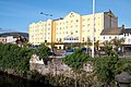
Category:Newry
Jump to navigation
Jump to search

city in Northern Ireland  | |||||
| Upload media | |||||
| Instance of | |||||
|---|---|---|---|---|---|
| Location |
| ||||
| Different from | |||||
 | |||||
Mga ubos-nga-kaarangay
Ini nga kaarangay mayda han mga nasunod nga 16 nga mga ubos-nga-kaarangay, tikang hin 16 nga kabug-osan.
B
- Ballykeel Dolmen and Cairn (8 F)
- Bessbrook and Newry Tramway (9 F)
C
E
- Eamonn Rooney Coach Hire (12 F)
H
M
- Maps of Newry (2 F)
- Moleys Coaches (bus company) (1 F)
N
P
S
- Signs in Newry (31 F)
- St Patrick's, Drumintee (3 F)
- Sugar Island Bridge, Newry (5 F)
Media ha kaarangay nga "Newry"
An mga nasunod nga 200 ka mga fayl aada han hini nga kaarangay, tikang hin 1,309 nga kabug-osan.
(nahiuna nga pakli) (masunod nga pakli)-
 "Crash at no cost to you.." on Downshire Road - geograph.org.uk - 2890538.jpg 1,024 × 709; 188 nga KB
-
 "We defy you^ Do your worst" an Éirígí Graffiti in Edward Street - geograph.org.uk - 3444807.jpg 1,024 × 789; 152 nga KB
-
 'B^Q', Newry - geograph.org.uk - 4333400.jpg 640 × 443; 62 nga KB
-
 'The Newry Navvy', Newry - geograph.org.uk - 3769414.jpg 640 × 568; 91 nga KB
-
 NEWENHAM(1830) p181 LOUDH - AUGHNACLOUGH MULLIN.jpg 2,647 × 1,946; 3.63 nga MB
-
 20180404 144108 Killowen Rd.jpg 2,880 × 2,160; 2.44 nga MB
-
 20180404 144111 Killowen Rd.jpg 2,880 × 2,160; 2.58 nga MB
-
 218 on the Wellington Bank - geograph.org.uk - 334321.jpg 640 × 426; 116 nga KB
-
 225 at Cloghogue - geograph.org.uk - 315201.jpg 640 × 426; 152 nga KB
-
 225 at Cloghogue - geograph.org.uk - 315207.jpg 640 × 426; 140 nga KB
-
 A bend with a view on Ashgrove Road - geograph.org.uk - 2891281.jpg 1,024 × 768; 192 nga KB
-
 A fine line of topiary trees at Camlough - geograph.org.uk - 3995158.jpg 1,024 × 754; 116 nga KB
-
 A flyover on the new Newry Bypass - geograph.org.uk - 1479630.jpg 640 × 480; 60 nga KB
-
 A rainy Millvale Road, Newry - geograph.org.uk - 3444742.jpg 1,024 × 756; 128 nga KB
-

-
 A sangar at Ardmore PSNI station - geograph.org.uk - 2890371.jpg 1,024 × 776; 135 nga KB
-
 A Saturday Morning Chat in John Mitchel's Place - geograph.org.uk - 1561780.jpg 640 × 588; 98 nga KB
-
 A Second Hand Dealer in John Mitchel's Place, Newry - geograph.org.uk - 1563164.jpg 640 × 315; 70 nga KB
-
 A section of the large and crowded St Mary's Cemetery - geograph.org.uk - 1895143.jpg 1,024 × 736; 115 nga KB
-
 A sheugh east of Limekiln Road - geograph.org.uk - 3941043.jpg 1,024 × 768; 357 nga KB
-
 A short terrace of Victorian villas above the Dublin Road - geograph.org.uk - 5079282.jpg 3,758 × 2,644; 6 nga MB
-
 A side and rear view of Newry Town Hall - geograph.org.uk - 3441039.jpg 1,024 × 768; 202 nga KB
-
 A statue of John Mitchel at John Mitchel Place - geograph.org.uk - 2072087.jpg 967 × 1,024; 324 nga KB
-
 A surviving remnant of Victorian housing in Barcroft Park - geograph.org.uk - 3944876.jpg 1,024 × 755; 182 nga KB
-
 A yacht moored in the Albert Basin - geograph.org.uk - 3092163.jpg 1,024 × 721; 138 nga KB
-
 A.O.H. Marchers Assembling in The Mall - geograph.org.uk - 227245.jpg 640 × 437; 72 nga KB
-
 A1 Motor Auctions, Craigmore Road, Newry - geograph.org.uk - 6105985.jpg 4,000 × 3,000; 2.48 nga MB
-
 A1 Safety and Workware, Downshire Road - geograph.org.uk - 2890489.jpg 1,024 × 551; 112 nga KB
-
 A1-A25 junction, Newry - geograph.org.uk - 4671252.jpg 800 × 600; 98 nga KB
-
 A2 Newry to Warrenpoint Road - geograph.org.uk - 800078.jpg 640 × 480; 87 nga KB
-
 A2 Newry to Warrenpoint Road - geograph.org.uk - 800086.jpg 640 × 480; 120 nga KB
-
 Abbeycest2.png 294 × 429; 60 nga KB
-
 Access road to the Albert Basin - geograph.org.uk - 1564037.jpg 640 × 442; 81 nga KB
-
 Advertising hoarding facing Dublin Road - geograph.org.uk - 3016878.jpg 1,024 × 828; 164 nga KB
-
 Advertising St Patrick's Day attractions at Bellini's in Newry - geograph.org.uk - 5316689.jpg 2,854 × 2,933; 1.28 nga MB
-
 Air Monitoring Station on Trevor Hill - geograph.org.uk - 2888674.jpg 1,024 × 769; 156 nga KB
-
 Air pollution monitoring station on Trevor Hill, Newry - geograph.org.uk - 5152794.jpg 2,801 × 3,843; 1.68 nga MB
-
 Altnaveigh Road junction on the Chancellor's Road - geograph.org.uk - 6095883.jpg 3,810 × 2,486; 4.88 nga MB
-
 Altnaveigh Road, Newry - geograph.org.uk - 3860909.jpg 3,264 × 2,448; 2.19 nga MB
-
 Apartment block on Dublin Road, Newry - geograph.org.uk - 3568329.jpg 1,024 × 768; 186 nga KB
-
 Apartments in Glen Ri Court - geograph.org.uk - 2890172.jpg 1,024 × 574; 153 nga KB
-
 Apartments in Heslips Lane off the Dublin Road, Newry - geograph.org.uk - 5946553.jpg 3,914 × 2,882; 5.54 nga MB
-
 Apartments on Dublin Road - geograph.org.uk - 1892489.jpg 1,024 × 741; 187 nga KB
-
 Approaching Ballybot Bridge from The Mall - geograph.org.uk - 1564906.jpg 640 × 421; 76 nga KB
-
 Approaching Dublin Bridge, Newry - geograph.org.uk - 1972387.jpg 1,024 × 664; 155 nga KB
-
 Approaching the A1 underpass on the Carrivekeeney Road - geograph.org.uk - 6107584.jpg 3,259 × 2,005; 3.06 nga MB
-
 Approaching the centre of Newry along Dublin Road - geograph.org.uk - 3494119.jpg 1,024 × 635; 190 nga KB
-
 Approaching the Dublin Road Bridge at Newry - geograph.org.uk - 3016867.jpg 1,024 × 745; 150 nga KB
-
 Approaching the Egyptian Arch over the A25 - geograph.org.uk - 4326693.jpg 1,600 × 926; 261 nga KB
-

-
 Approaching the junction of Martins Lane and Barcroft Park - geograph.org.uk - 3943262.jpg 1,024 × 601; 200 nga KB
-
 Approaching the junction of Sandys Street and Trevor Hill - geograph.org.uk - 3494348.jpg 1,024 × 669; 184 nga KB
-
 Archway of the former Linen Hall - geograph.org.uk - 5153090.jpg 3,753 × 2,815; 1.64 nga MB
-
 Ardmore PSNI Station, Newry - geograph.org.uk - 2890309.jpg 762 × 1,024; 178 nga KB
-
 Armagh Road running through the north-western suburbs of Newry - geograph.org.uk - 6122970.jpg 3,484 × 1,974; 3.69 nga MB
-
 Arthur Street Mews, Newry - geograph.org.uk - 5070284.jpg 2,172 × 1,181; 950 nga KB
-
 Arts Centre, Bank Parade - geograph.org.uk - 1892689.jpg 1,024 × 544; 131 nga KB
-
 At the Corbet Station - geograph.org.uk - 1407701.jpg 640 × 480; 80 nga KB
-
 Auto-Spares in Kilmorey Street, Newry - geograph.org.uk - 5187466.jpg 3,743 × 2,110; 1.27 nga MB
-
 Ballinlare Court off Barcroft Park Road, Newry - geograph.org.uk - 3943360.jpg 1,024 × 768; 189 nga KB
-
 Ballykeel Road, Cabra, at its junction with the A25 (geograph 5721801).jpg 2,612 × 2,012; 2.13 nga MB
-
 Ballymacdermott Court Tomb Forecourt (149659173).jpeg 2,048 × 1,368; 1.17 nga MB
-
 Balmoral Park, Newry - geograph.org.uk - 1892582.jpg 1,024 × 740; 131 nga KB
-
 Balmoral Park, Newry - geograph.org.uk - 5027515.jpg 3,996 × 2,996; 4.47 nga MB
-
 Bancroft Park at its junction with Martins Lane - geograph.org.uk - 3941906.jpg 1,024 × 766; 169 nga KB
-
 Bank of Ireland on Trevor Hill Newry - geograph.org.uk - 1498177.jpg 640 × 480; 62 nga KB
-
 Bank Parade Bridge - geograph.org.uk - 1564890.jpg 640 × 438; 81 nga KB
-
 Banks and Offices in Marcus Square, Newry - geograph.org.uk - 3441607.jpg 1,024 × 736; 160 nga KB
-
 Bar clock, Newry - geograph.org.uk - 3700265.jpg 607 × 509; 88 nga KB
-
 Barney's Pet Food Superstore in The Mall, Newry - geograph.org.uk - 3861241.jpg 1,024 × 768; 171 nga KB
-
 Basin Walk Newry - geograph.org.uk - 1498000.jpg 640 × 480; 64 nga KB
-
 Basin Walk, Newry - geograph.org.uk - 1557736.jpg 640 × 441; 54 nga KB
-
 Bateman ^ Moores fire hydrant cover, Newry - geograph.org.uk - 3699660.jpg 640 × 424; 165 nga KB
-
 Belinis on the corner of Merchant's Quay and Monaghan Street - geograph.org.uk - 1892670.jpg 1,024 × 918; 199 nga KB
-

-
-
 Bellinis Bar and Restaurant, Newry - geograph.org.uk - 4326646.jpg 1,600 × 1,200; 417 nga KB
-
 Bellmont Hall Georgian Guest House, 1 Downshire Road, Newry - geograph.org.uk - 3956305.jpg 1,024 × 650; 166 nga KB
-
 Belmont Hall - a Georgian Guest House - geograph.org.uk - 2891297.jpg 1,024 × 768; 257 nga KB
-
 Bench Mark, Newry - geograph.org.uk - 3771496.jpg 640 × 640; 214 nga KB
-
 Bench Mark, Newry - geograph.org.uk - 3771541.jpg 640 × 444; 95 nga KB
-
 Bench Mark, Newry - geograph.org.uk - 3771545.jpg 640 × 640; 222 nga KB
-
 Bend in the A1 (Downshire Road) south of the Damolly Roundabout - geograph.org.uk - 2890527.jpg 1,024 × 766; 181 nga KB
-
 Bend in the Altnaveigh Road - geograph.org.uk - 6104470.jpg 1,431 × 782; 530 nga KB
-
 Bend in the Bernish Road - geograph.org.uk - 3948238.jpg 1,024 × 768; 219 nga KB
-
 Bend on Temple Hill Road, Newry - geograph.org.uk - 5188689.jpg 4,000 × 3,000; 3.19 nga MB
-
 Berrill's Interiors, The Mall, Newry - geograph.org.uk - 3450560.jpg 1,007 × 1,024; 257 nga KB
-
 Beware of Ambulances Emerging - geograph.org.uk - 3444785.jpg 1,024 × 744; 151 nga KB
-
 Bill posting announcing the arrival of Tesco to Newry - geograph.org.uk - 3505601.jpg 1,024 × 768; 178 nga KB
-
 Blackthorn Grange off Monks Hill Road - geograph.org.uk - 5214762.jpg 2,837 × 2,098; 772 nga KB
-
 Blocked off road off Altnaveigh Road - geograph.org.uk - 3948261.jpg 1,024 × 767; 124 nga KB
-
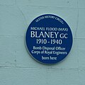 Blue plaque commemorating Capt. Max Blaney RE GC - geograph.org.uk - 5035672.jpg 1,389 × 1,389; 1.05 nga MB
-
 Boarded up premises in Bridge Street, Newry - geograph.org.uk - 5043177.jpg 3,000 × 4,000; 2.55 nga MB
-
 Boat on the bank of the Newry Canal - geograph.org.uk - 5316601.jpg 3,262 × 2,663; 2.18 nga MB
-
 Boats moored at the Albert Basin - geograph.org.uk - 5432790.jpg 4,000 × 3,000; 2.6 nga MB
-
 Boss on the Sugar Island Mill - geograph.org.uk - 5152874.jpg 2,002 × 2,823; 1.54 nga MB
-
 Boundary Stone and Bench Mark, Newry - geograph.org.uk - 6143866.jpg 1,074 × 1,280; 1.93 nga MB
-
 Boyle Bingo Club, Merchant's Quay, Newry - geograph.org.uk - 4210948.jpg 766 × 1,024; 153 nga KB
-
 BoyleSports turf accountants in Francis Street - geograph.org.uk - 5196660.jpg 4,000 × 3,000; 2.24 nga MB
-
 Bridge linking Bleary Bungalows and Newry's Martin's Lane - geograph.org.uk - 3941429.jpg 1,024 × 768; 180 nga KB
-
 Bridge Street at the junction with Dominic Street - geograph.org.uk - 1892424.jpg 1,024 × 607; 152 nga KB
-
 Bridge Street bridge across the Newry Canal - geograph.org.uk - 5316610.jpg 4,000 × 3,000; 3.68 nga MB
-
 Bridge Street from Dublin Bridge, Newry - geograph.org.uk - 1564059.jpg 640 × 370; 57 nga KB
-
 Bridge Street, Newry - geograph.org.uk - 1892407.jpg 909 × 1,024; 196 nga KB
-
 Buildings at the entrance to Abbey Way, Newry - geograph.org.uk - 1978039.jpg 1,024 × 616; 137 nga KB
-
 Buildings at the western end of Upper Water Street, Newry - geograph.org.uk - 5152827.jpg 3,676 × 2,138; 1.62 nga MB
-
 Buildings on Merchant's Quay overlooking the Newry Canal - geograph.org.uk - 3495697.jpg 1,024 × 768; 170 nga KB
-
 Buildings on the northside of Marcus Square - geograph.org.uk - 1891659.jpg 1,024 × 748; 233 nga KB
-
 Buildings on Trevor Hill - geograph.org.uk - 5027508.jpg 2,655 × 1,986; 2.98 nga MB
-
 Bumps and Babies, Kildare Street, Newry - geograph.org.uk - 3382282.jpg 1,024 × 768; 189 nga KB
-
 Bungalows in Glenpatrick Lawns, Newry - geograph.org.uk - 5275275.jpg 4,000 × 3,000; 2.42 nga MB
-
 Bunscoil pupils singing at Christmas time.jpg 3,264 × 2,448; 1,016 nga KB
-
 Bus entrance into Newry's Ulsterbus Station - geograph.org.uk - 3494248.jpg 1,024 × 699; 160 nga KB
-
 Buses exiting into Bridge Street from the Newry Ulsterbus Station - geograph.org.uk - 4341473.jpg 1,600 × 1,198; 320 nga KB
-
 Business premises on the north-eastern side of Abbey Way, Newry - geograph.org.uk - 2493796.jpg 1,024 × 586; 161 nga KB
-
 Business units at Downshire Court - geograph.org.uk - 2891289.jpg 1,024 × 702; 172 nga KB
-
 Business units on Merchant's Quay viewed across the Newry Canal - geograph.org.uk - 3495725.jpg 1,024 × 768; 200 nga KB
-
 Business units on the Warrenpoint Road - geograph.org.uk - 2072765.jpg 1,024 × 768; 167 nga KB
-
 Businesses at Sugar Island - geograph.org.uk - 3444830.jpg 653 × 1,024; 96 nga KB
-
 Businesses in Downshire Close, Newry - geograph.org.uk - 2890199.jpg 1,024 × 552; 126 nga KB
-
 Businesses in the middle section of Francis Street, Newry - geograph.org.uk - 5196654.jpg 4,000 × 3,000; 2.96 nga MB
-
 Businesses on Merchants Quay, Newry - geograph.org.uk - 4152087.jpg 1,024 × 766; 184 nga KB
-
 Businesses on Sugar Island, Newry - geograph.org.uk - 3505482.jpg 1,024 × 768; 178 nga KB
-
 Businesses on The Mall in Newry - geograph.org.uk - 5027495.jpg 3,221 × 1,920; 2.88 nga MB
-
 Businesses overlooking the Newry Canal - geograph.org.uk - 3758798.jpg 1,024 × 768; 212 nga KB
-

-
 B^Q Store at Damolly Retail Park - geograph.org.uk - 4945791.jpg 1,600 × 1,044; 298 nga KB
-
 B^Q Store at Damolly Retail Park, Newry - geograph.org.uk - 6067782.jpg 3,624 × 2,176; 3.15 nga MB
-
 Camlough Mountain from high above Newry. - geograph.org.uk - 228427.jpg 640 × 480; 37 nga KB
-
 Canal Court Hotel from the Needham Bridge - geograph.org.uk - 1480817.jpg 640 × 429; 89 nga KB
-
 Canal Court, Newry - geograph.org.uk - 4326619.jpg 1,600 × 1,167; 345 nga KB
-
 Canal Quay Bridge and the Clanrye Mills - geograph.org.uk - 1561450.jpg 640 × 480; 74 nga KB
-
 Canal Street from Sugar Island, Newry - geograph.org.uk - 1972350.jpg 926 × 1,024; 171 nga KB
-
 Car Dealers on A25 Newry - geograph.org.uk - 4671611.jpg 1,632 × 918; 335 nga KB
-
 Car park along High Street Newry - geograph.org.uk - 1497488.jpg 640 × 480; 82 nga KB
-
 Car park and small shops to the rear of Merchant's Quay - geograph.org.uk - 1973108.jpg 1,024 × 606; 161 nga KB
-
 Car park at the back of Hill Street - geograph.org.uk - 3441618.jpg 1,024 × 720; 179 nga KB
-
 Car Park at the Daisy Hill Hospital, Newry - geograph.org.uk - 5735672.jpg 3,942 × 2,922; 5.35 nga MB
-
 Car park at the Quay Shopping Centre, Newry - geograph.org.uk - 5135590.jpg 3,918 × 2,888; 5.65 nga MB
-
 Car Park between Abbey Way and Lower Water Street - geograph.org.uk - 1891883.jpg 1,024 × 573; 142 nga KB
-
 Car parks at the Quays Shopping-Leisure Complex - geograph.org.uk - 1730114.jpg 640 × 341; 41 nga KB
-
 Car Wash on the corner of Monaghan Street and Railway Avenue - geograph.org.uk - 3444000.jpg 1,024 × 768; 201 nga KB
-
 Carnagat Road off Camlough Road - geograph.org.uk - 2948448.jpg 1,024 × 607; 98 nga KB
-
 Carnagat Road, Newry - geograph.org.uk - 6211880.jpg 2,406 × 1,606; 1.47 nga MB
-
 Carrivekeeney Road, Corrinshigo - geograph.org.uk - 3860940.jpg 3,264 × 2,448; 3 nga MB
-
 Cathedral Gardens, Hill Street - geograph.org.uk - 1891855.jpg 1,024 × 751; 212 nga KB
-
 Cathedral Passage - geograph.org.uk - 1892261.jpg 768 × 1,024; 185 nga KB
-
 Catherine Street, Newry - geograph.org.uk - 3444814.jpg 1,024 × 659; 132 nga KB
-
 Catherine Street, Newry - geograph.org.uk - 3982889.jpg 1,024 × 506; 97 nga KB
-
 Cemetery chapel at Monks Hill Municipal Cemetery, Newry - geograph.org.uk - 5215366.jpg 3,603 × 1,900; 961 nga KB
-
 Chancellor's Road at the junction with Carnagat Lane - geograph.org.uk - 6104533.jpg 3,010 × 2,052; 2.66 nga MB
-
 Chancellors Road at Corrinshigo - geograph.org.uk - 3860932.jpg 3,264 × 2,448; 1.47 nga MB
-
 Chapel at Monks Hill Municipal Cemetery, Newry - geograph.org.uk - 5214597.jpg 4,000 × 3,000; 3.55 nga MB
-
 Chequer Hill off Armagh Road, Newry - geograph.org.uk - 3422084.jpg 1,024 × 679; 100 nga KB
-
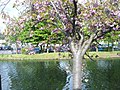
 Cherry blossom along the banks of the Newry Canal - geograph.org.uk - 2891928.jpg 1,024 × 768; 250 nga KB
-
 Cherry Blossom along the Newry Canal - geograph.org.uk - 3494259.jpg 768 × 1,024; 378 nga KB
-
 Cherry Blossom alongside the Newry Canal - geograph.org.uk - 1872251.jpg 1,024 × 768; 340 nga KB
-
 Children's play ground on Gallow's Hill - geograph.org.uk - 3441380.jpg 1,024 × 768; 181 nga KB
-
 Church Avenue, Newry - geograph.org.uk - 2889733.jpg 1,024 × 631; 148 nga KB
-
 Church Street, Newry - geograph.org.uk - 3441431.jpg 1,024 × 768; 205 nga KB
-
 Clanrye River below Dublin Bridge - geograph.org.uk - 1972389.jpg 1,024 × 768; 247 nga KB
-
 Clanrye River from Dublin Bridge, Newry - geograph.org.uk - 1872323.jpg 1,024 × 668; 124 nga KB
-
 Commercial buildings and offices on Trevor Hill - geograph.org.uk - 3755231.jpg 1,024 × 768; 155 nga KB
-
 Commuter Traffic at the lower end of Bridge Street - geograph.org.uk - 1730089.jpg 480 × 640; 43 nga KB
-
 Commuters' cars entering the Abbey Way car park - geograph.org.uk - 3441464.jpg 1,024 × 689; 163 nga KB
-
 Constructing the Newry Ship Canal section of the Greenway - geograph.org.uk - 5600059.jpg 1,780 × 1,334; 2.07 nga MB
-
 Construction site off Rathfriland Road - geograph.org.uk - 1892587.jpg 1,024 × 768; 172 nga KB
-
 Contrasting architectural styles on Monaghan Street - geograph.org.uk - 1972335.jpg 1,024 × 615; 174 nga KB
-
 Convent of Mercy, Kilmorey Road (geograph 1894699).jpg 1,024 × 731; 176 nga KB
-
 Convent of the Poor Clares, Newry - geograph.org.uk - 3441556.jpg 1,024 × 768; 174 nga KB
-
 Convent of the Sisters of Mercy, Home Avenue - geograph.org.uk - 2072698.jpg 1,024 × 768; 166 nga KB
-
 Converted warehouses on Merchant's Quay - geograph.org.uk - 1892383.jpg 1,024 × 768; 177 nga KB
-
 Converted warehouses on Merchants' Quay, Newry - geograph.org.uk - 1478779.jpg 640 × 461; 76 nga KB
-
 Corn Market junction on Francis Street - geograph.org.uk - 5196672.jpg 4,000 × 3,000; 2.13 nga MB
-
 Corn Market Street viewed across the Newry Canal - geograph.org.uk - 1892380.jpg 1,024 × 768; 169 nga KB
-
 Corn Market. Newry - geograph.org.uk - 5017944.jpg 2,602 × 2,464; 2.49 nga MB
-
 Corry Obelisk Newry County Down Northern Ireland (16356338443).jpg 1,949 × 2,000; 1.78 nga MB
-

-
 Cottage overlooking the railway line on the fringes of Newry - geograph.org.uk - 5073623.jpg 2,325 × 911; 923 nga KB
-
 Country Carpets Showrooms on Chancellor's Road, Bessbook - geograph.org.uk - 6104537.jpg 3,177 × 2,000; 2.06 nga MB
-
 Cross Border buses at Newry's Ulsterbus Station - geograph.org.uk - 4152044.jpg 1,024 × 739; 166 nga KB
-
 Cross roads on Chancellor's Road - geograph.org.uk - 6107566.jpg 3,301 × 2,053; 3.17 nga MB
-
 Crowds Listen to Speakers in the Mall - geograph.org.uk - 227251.jpg 640 × 437; 83 nga KB
-
 Crown Mound, Newry, Co. Down.jpg 3,154 × 2,161; 1.21 nga MB
-
 Cue Club Casino in Basin Walk, Newry - geograph.org.uk - 5152789.jpg 3,960 × 2,946; 4.59 nga MB
-
 Cul de sac off Edward Street - geograph.org.uk - 3444794.jpg 1,024 × 768; 118 nga KB
-
 Cunninghams and William Goss ^ Sons on Merchant's Quay - geograph.org.uk - 4336442.jpg 1,600 × 1,197; 324 nga KB
-
 Currys at Damolly Retail Park - geograph.org.uk - 2896669.jpg 1,024 × 768; 115 nga KB
-
-
 Damolly Retail Park - geograph.org.uk - 2896672.jpg 1,024 × 768; 233 nga KB
-
 Damolly Retail Park, Newry - geograph.org.uk - 5275279.jpg 4,000 × 2,595; 2.09 nga MB
-
 Debenham's Store, Newry - geograph.org.uk - 3016634.jpg 1,024 × 755; 173 nga KB
-
 Dennison Commercial Ltd on the Newry side of the A1 - geograph.org.uk - 3941986.jpg 1,024 × 767; 138 nga KB
-
 Dennison Commercials Newry - geograph.org.uk - 6212643.jpg 3,706 × 2,578; 3.84 nga MB
-
 Derelict buildings at the former Sacred Heart Grammar School, Newry - geograph.org.uk - 5084937.jpg 4,000 × 3,000; 6.12 nga MB
-
 Derelict farmhouse off Altnaveigh Road - geograph.org.uk - 3948252.jpg 1,024 × 695; 118 nga KB
-
 Derelict property in Newry's Zone of Transition - geograph.org.uk - 3505721.jpg 1,024 × 768; 176 nga KB
-
 Derryveagh Cottages, Newry - geograph.org.uk - 3982860.jpg 1,024 × 757; 125 nga KB
-
 Descending Barcroft Park Road - geograph.org.uk - 3944890.jpg 1,024 × 766; 189 nga KB
-
 Descending into town along the High Street - geograph.org.uk - 3441445.jpg 1,024 × 691; 157 nga KB


_p181_LOUDH_-_AUGHNACLOUGH_MULLIN.jpg)


.jpg)
.jpeg)


_south_of_the_Damolly_Roundabout_-_geograph.org.uk_-_2890527.jpg)


.jpg)


.jpg)


