Category:North East England
Nenda kwa urambazaji
Nenda kwa kutafuta
region of England  | |||||
| Upload media | |||||
| Ni mfano wa | |||||
|---|---|---|---|---|---|
| Mahali | Uingereza | ||||
| Mji mkuu | |||||
| Idadi ya watu |
| ||||
| Area |
| ||||
 | |||||
Vijamii
Jamii hii ina vijamii 11 vifuatavyo, kati ya jumla ya 11.
C
N
P
S
T
Midia katika jamii "North East England"
Mafaili 58 yanayofuata yamo katika jamii hii, kati ya jumla ya 58.
-
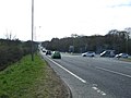
 A695 heading west - geograph.org.uk - 3441767.jpg 640 × 480; 76 KB
-
 A695 heading west - geograph.org.uk - 3441775.jpg 640 × 480; 72 KB
-
 A695 heading west - geograph.org.uk - 3441809.jpg 640 × 480; 62 KB
-
 A695 towards Prudhoe - geograph.org.uk - 3441779.jpg 640 × 480; 55 KB
-
 Cable drums, Offshore Technology Park - geograph.org.uk - 3523474.jpg 640 × 360; 265 KB
-
 Clockburn Lake - geograph.org.uk - 3440397.jpg 640 × 480; 75 KB
-
 Coalway Lane - geograph.org.uk - 3441807.jpg 640 × 480; 109 KB
-
 Column of Liberty - geograph.org.uk - 3471421.jpg 533 × 800; 134 KB
-
 Cromwell Road - geograph.org.uk - 3523467.jpg 640 × 360; 212 KB
-
 Cycle - foot path, Bill Quay - geograph.org.uk - 3523455.jpg 640 × 426; 278 KB
-
 Cycle - foot path, Pelaw Main - geograph.org.uk - 3523477.jpg 640 × 360; 258 KB
-
 Demolished site - geograph.org.uk - 3539867.jpg 640 × 480; 75 KB
-
 Derwent riverside walk, Gibside - geograph.org.uk - 3630422.jpg 2,000 × 1,500; 660 KB
-
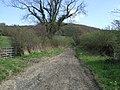
 Derwent Walk - geograph.org.uk - 3440103.jpg 640 × 480; 135 KB
-
 Derwent Walk at Derwenthaugh - geograph.org.uk - 3440405.jpg 640 × 480; 115 KB
-
 Derwent Walk Country Park - geograph.org.uk - 3440151.jpg 640 × 480; 83 KB
-
 Dog walkers on the Derwent Walk - geograph.org.uk - 3440116.jpg 640 × 480; 138 KB
-
 Farmland off Maiden Lane - geograph.org.uk - 3441784.jpg 640 × 480; 44 KB
-
 Farmland off the A695 - geograph.org.uk - 3441763.jpg 640 × 480; 90 KB
-
 Farmland, Bradley Fell - geograph.org.uk - 3441805.jpg 640 × 480; 60 KB
-
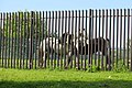 Fence and horses - geograph.org.uk - 3523431.jpg 640 × 426; 301 KB
-
 Field entrance off the A695 - geograph.org.uk - 3441772.jpg 640 × 480; 60 KB
-
 Flats in Allerdene - geograph.org.uk - 3639256.jpg 4,000 × 3,000; 2.7 MB
-
 Footbridge over the River Derwent - geograph.org.uk - 3440493.jpg 640 × 480; 65 KB
-
 Gibside Hall - geograph.org.uk - 3469865.jpg 800 × 533; 132 KB
-
 Gibside, The Octagon Pond - geograph.org.uk - 3469874.jpg 800 × 533; 146 KB
-
 Grazing, Blackburn Fell - geograph.org.uk - 3441617.jpg 640 × 480; 86 KB
-
 Holiday Inn Express, Gateshead - geograph.org.uk - 3434529.jpg 1,600 × 994; 253 KB
-
 John Stornack Fleck - South Shields F.C.jpg 525 × 541; 109 KB
-
 Lemington Gut - geograph.org.uk - 3466582.jpg 1,024 × 768; 267 KB
-
 Lemington Road (A6085) - geograph.org.uk - 3442309.jpg 640 × 480; 64 KB
-
 Maiden Lane - geograph.org.uk - 3441786.jpg 640 × 480; 94 KB
-
 Old wagonway bridge, Gibside - geograph.org.uk - 3630443.jpg 2,000 × 1,333; 704 KB
-
 Power lines near Stargate - geograph.org.uk - 3441766.jpg 640 × 480; 72 KB
-
 Remains of Lemington Staiths - geograph.org.uk - 3466680.jpg 1,024 × 768; 304 KB
-
 Remains of Lemington Staiths - geograph.org.uk - 3466860.jpg 1,024 × 768; 390 KB
-
 Remains of Lemington Staiths, Lemington Gut - geograph.org.uk - 3466644.jpg 1,024 × 768; 340 KB
-
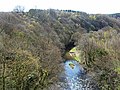
 River Derwent at Clockburn - geograph.org.uk - 3440166.jpg 640 × 480; 90 KB
-
 River Derwent from Nine Arches Viaduct - geograph.org.uk - 3440130.jpg 640 × 480; 110 KB
-
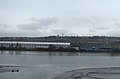
 River Tyne - geograph.org.uk - 3523427.jpg 640 × 426; 298 KB
-
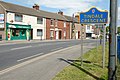 Road entering Tindale Crescent - geograph.org.uk - 3540310.jpg 1,500 × 1,000; 1.31 MB
-
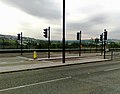 Road junction Scotswood Road - geograph.org.uk - 3535352.jpg 640 × 499; 70 KB
-
 Ryton Golf Course - geograph.org.uk - 3434565.jpg 640 × 552; 41 KB
-
 Service station on Scotswood Road - geograph.org.uk - 3442314.jpg 640 × 480; 59 KB
-
 Sharp bend on the Derwent Walk - geograph.org.uk - 3440123.jpg 640 × 480; 108 KB
-
 Slow traffic on the A1 - geograph.org.uk - 3495434.jpg 2,592 × 1,944; 1.67 MB
-
 South Shields F.C 1947-1949.jpg 4,032 × 3,024; 3.95 MB
-
 Supermarket off Lemington Road - geograph.org.uk - 3442303.jpg 640 × 480; 97 KB
-
 The Octagon Pond, Gibside - geograph.org.uk - 3630482.jpg 2,000 × 1,333; 502 KB
-
 The River Tyne - geograph.org.uk - 3434525.jpg 800 × 528; 49 KB
-
 The Stables, Gibside - geograph.org.uk - 3629465.jpg 2,000 × 1,404; 1.13 MB
-
 Travelodge Gateshead - geograph.org.uk - 3434527.jpg 1,600 × 997; 192 KB
-
 View along Fellside Road to Byermoor Farm - geograph.org.uk - 3386407.jpg 4,608 × 3,456; 5.15 MB
-
 View of Burnopfield Farm - geograph.org.uk - 3386415.jpg 4,608 × 3,456; 5.16 MB
-
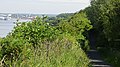
 View up river - geograph.org.uk - 3523415.jpg 640 × 426; 233 KB
-
 View west from Fellside Road - geograph.org.uk - 3386403.jpg 4,608 × 3,456; 5.13 MB
-
 Wing of Walkergate Hospital - geograph.org.uk - 3377140.jpg 1,500 × 1,047; 1.5 MB
-
 Woodland near Tyneside Golf Course - geograph.org.uk - 3434557.jpg 588 × 640; 81 KB


_-_geograph.org.uk_-_3442309.jpg)


