Category:Northland Region
Przejdź do nawigacji
Przejdź do wyszukiwania
Regions of New Zealand: Auckland · Bay of Plenty · Canterbury · Gisborne · Hawke's Bay · Manawatu-Whanganui · Marlborough · Nelson · Otago · Northland · Southland · Taranaki · Tasman · Waikato · Wellington · West Coast
Outlying islands, territories and dependencies: Antipodes Islands · Auckland Islands · Bounty Islands · Chatham Islands · Kermadec Islands · Snares Islands · Three Kings Islands · Tokelau – Territory with specific status: Ross Dependency
Associated countries: Cook Islands · Niue
Outlying islands, territories and dependencies: Antipodes Islands · Auckland Islands · Bounty Islands · Chatham Islands · Kermadec Islands · Snares Islands · Three Kings Islands · Tokelau – Territory with specific status: Ross Dependency
Associated countries: Cook Islands · Niue
region Nowej Zelandii   | |||||
| Prześlij plik multimedialny | |||||
| Jest to | |||||
|---|---|---|---|---|---|
| Miejsce | Nowa Zelandia | ||||
| Stolica | |||||
| Liczba ludności |
| ||||
| Powierzchnia |
| ||||
 | |||||
Podkategorie
Poniżej wyświetlono 27 spośród wszystkich 27 podkategorii tej kategorii.
- Satellite pictures of the Northland Region (28 plików)
!
- Quality images of Northland Region (2 pliki)
*
+
C
- Cemeteries in Northland Region (1 plik)
D
G
M
N
P
- Postcards of Northland Region (2 pliki)
R
- Ruapekapeka (10 plików)
S
T
Pliki w kategorii „Northland Region”
Poniżej wyświetlono 42 spośród wszystkich 42 plików w tej kategorii.
-
 NZ-Northland plain map.png 378 × 423; 11 KB
-
 NZ-Northland plain map2.png 378 × 423; 12 KB
-
 Position of Northland.png 405 × 590; 7 KB
-
 .Thelymitra aemula (3) - cropped.jpg 1000 × 1000; 509 KB
-
 Andra's Cove, Northland, New Zealand, 5th. Dec. 2010 - Flickr - PhillipC.jpg 4288 × 2848; 2,91 MB
-
 Carte physique Northland.png 756 × 957; 422 KB
-
 Carte physique Northland.svg 754 × 954; 3,12 MB
-
 Charles Fergusson on motor tour in Northland.jpg 5773 × 4349; 7,43 MB
-

-
 Dargaville rail carts 1.jpg 6000 × 4000; 9,42 MB
-
 Dargaville rail carts 2.jpg 6000 × 4000; 9,67 MB
-
 Dargaville yard.jpg 3888 × 2592; 3,87 MB
-
 Donnellys Crossing road-rail bridge.jpg 3888 × 2592; 3,47 MB
-
 Drone view of boat in ocean (Unsplash).jpg 3992 × 2992; 13,96 MB
-
 Flag Map of Northland Region.png 790 × 969; 95 KB
-
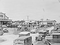 Fleet of cars parked on a street in Maungaturoto (AM 78935-1).jpg 1275 × 953; 577 KB
-
 Mangakahia Twin Bridges, Nukutawhiti, New Zealand.jpg 3162 × 2140; 6,17 MB
-
 Maungatūroto railway.jpg 3888 × 2592; 4,99 MB
-
 Ngatikahu iwi location.PNG 1003 × 1457; 42 KB
-
 North Auckland Peninsula.png 992 × 653; 370 KB
-
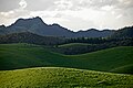 Northland hills.jpg 3872 × 2592; 5,65 MB
-
 Northland Tusked Weta DOC.jpg 3360 × 2248; 3,07 MB
-
 Northland within North Island 2023.png 784 × 920; 102 KB
-
 NorthlandRegionPopulationDensity.png 1208 × 1380; 181 KB
-
 Old House (31859126071).jpg 5548 × 3856; 5,97 MB
-
 Old World Charm (18782227913).jpg 4608 × 3310; 9,28 MB
-
 Sandspit Northland 1992.jpg 1249 × 887; 138 KB
-
 Scallop shell. (10167163783).jpg 2400 × 1582; 3,95 MB
-
 Sericospilus n.sp.nr. cumberi.jpg 451 × 673; 39 KB
-
 Sir Charles Fergusson speaking at a public meeting, Northland.jpg 5712 × 4366; 7,19 MB
-
 The Face of Innovation? (15289681759).jpg 3264 × 2448; 1,78 MB
-
 Thelymitra aemula (2).jpg 2048 × 1367; 1,24 MB
-
 Thelymitra aemula (3).jpg 1360 × 2048; 1,24 MB
-
 Thelymitra aemula (4).jpg 2048 × 1366; 1,31 MB
-
 Thelymitra aemula (5).jpg 2048 × 1366; 1,23 MB
-
 Thelymitra aemula.jpg 1360 × 2048; 1,35 MB
-
 This is What My Workshops Look Like (15289958708).jpg 2459 × 1843; 2,31 MB
-
 Virtual Campfire Near a Virtual Beach (15476591345).jpg 2940 × 2240; 1,95 MB
-
 Waimamaku countryside.jpg 3888 × 2592; 3,24 MB
-
 Waimamaku River.jpg 3888 × 2592; 3,73 MB
-
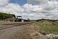
 Waiōtira junction.jpg 2592 × 3888; 2,99 MB
-
 Waiōtira overview.jpg 3888 × 2592; 3,77 MB


_-_cropped.jpg)


.jpg)

.jpg)


.jpg)
.jpg)

.jpg)


.jpg)
.jpg)
.jpg)
.jpg)
.jpg)

.jpg)
.jpg)


