Category:Ohio State Route 4
Jump to navigation
Jump to search
 | number: | (four) |
|---|---|---|
| State highways in Ohio: | 2 · 3 · 4 · 5 · 7 · 8 · 9 · 10 · 11 · 12 · 13 · 14 · 15 · 16 · 17 · 18 · 19 · 21 |
highway in Ohio  | |||||
| Upload media | |||||
| Instance of | |||||
|---|---|---|---|---|---|
| Location | Ohio | ||||
| Transport network | |||||
| Connects with |
| ||||
| Owned by | |||||
| Maintained by | |||||
| Inception |
| ||||
| Length |
| ||||
| |||||
Subcategories
This category has the following 8 subcategories, out of 8 total.
Media in category "Ohio State Route 4"
The following 46 files are in this category, out of 46 total.
-
 A.B. Graham Building.jpg 6,016 × 4,000; 6.83 MB
-
 Attica, Ohio as viewed from Main Street.JPG 3,264 × 2,448; 3.45 MB
-
 Bimm Fireproof Warehouse.jpg 4,000 × 6,016; 6.43 MB
-
 Center Street Corner Market.jpg 4,032 × 3,024; 5.98 MB
-
 Delco Building during reconstruction.jpg 6,016 × 4,000; 6.28 MB
-
 Emmanuel United Church of Christ.jpg 2,816 × 2,112; 2.1 MB
-
 Fields at Stebbins High School.jpg 2,816 × 2,112; 1.13 MB
-
 Fifth Street Bridge Dayton 2023.jpg 6,240 × 4,160; 8.46 MB
-
 First Congregational Church in Sandusky.jpg 2,816 × 2,112; 2.82 MB
-
 Former library in Marion, Ohio.jpg 2,816 × 2,112; 1.41 MB
-
 Fourth and Sandusky, Chatfield.jpg 6,016 × 4,000; 7.13 MB
-
 Germantown Road Bridge Middletown OH 2023a.jpg 6,240 × 4,160; 9.15 MB
-
 Germantown Road Bridge Middletown OH 2023b.jpg 6,240 × 4,160; 10.54 MB
-
 Germantown Road Bridge Middletown OH 2023c.jpg 6,240 × 4,160; 8.21 MB
-
 Levi Rathburn House site in Mechanicsburg.jpg 2,816 × 1,584; 2.41 MB
-
 Lincoln Park (Marion, Ohio) 2.jpg 4,032 × 3,024; 2.5 MB
-
 Lincoln Park (Marion, Ohio).jpg 4,032 × 3,024; 3.38 MB
-
 Lincoln Park 2.jpg 4,032 × 3,024; 7.29 MB
-
 Lincoln Park 3.jpg 4,032 × 3,024; 2.69 MB
-
 Marion County Courthouse, Marion.jpg 2,816 × 2,112; 2.29 MB
-
 Mechanicsburg Commercial Historic District, blue sky.jpg 2,816 × 2,112; 2.73 MB
-
 Mechanicsburg Commercial Historic District.jpg 2,816 × 2,112; 1.47 MB
-
 OH 4 Bypass map alternate colors.svg 1,006 × 592; 1.54 MB
-
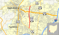 OH 4 Bypass map.svg 1,006 × 592; 890 KB
-
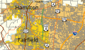
 OH 4 map.svg 1,006 × 592; 269 KB
-
 OH State Routes 4 19 100 south at US 30.jpg 2,272 × 1,704; 1.14 MB
-
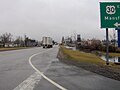
 OH-369 ^ Lower Valley Pk Exit on OH-4 Northbound 04-24-2011 - panoramio.jpg 1,409 × 456; 225 KB
-
-
 OH-4 Southbound merges with I-70 Westbound 04-24-2011 - panoramio.jpg 1,387 × 838; 389 KB
-
 OH-4.svg 600 × 600; 3 KB
-
 Ohio Turnpike December 2020.jpg 4,032 × 3,024; 1.51 MB
-
 Reedtown former school.jpg 6,016 × 4,000; 6.18 MB
-
 Sandusky and Main in Mechanicsburg.jpg 2,816 × 2,112; 1.45 MB
-
 Sandusky, Ohio 90 East Cleveland OH-4 7695530624 o.jpg 2,400 × 1,600; 2.55 MB
-
 Scioto Ordnance Plant 2.jpg 4,032 × 3,024; 1.81 MB
-
 Siamese houses on SR 4.jpg 6,016 × 4,000; 6.43 MB
-
 Springfield Metallic Casket Company.jpg 6,016 × 4,000; 6.28 MB
-
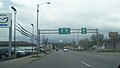
 US-40 West Exit on OH-4 Southbound 04-24-2011 - panoramio.jpg 2,290 × 751; 480 KB
-
 US-40 West ^ OH-4 South Exit on US-68 Southbound 04-24-2011 - panoramio.jpg 2,185 × 781; 564 KB
-

-
 Veterans Memorial Coliseum 2.jpg 4,032 × 3,024; 4.79 MB
-
 Veterans Memorial Coliseum.jpg 4,032 × 3,024; 2.95 MB
-
 Wagner Palace in Sandusky.jpg 2,816 × 2,112; 2.53 MB
-
 William D. Curtis House.jpg 2,816 × 2,112; 2.56 MB
-
 WYNT.jpg 4,032 × 3,024; 5.62 MB
-
 Zion Lutheran Church in Sandusky.jpg 2,816 × 2,112; 2.37 MB


_2.jpg)
.jpg)


