Category:Old Deer
Jump to navigation
Jump to search
village in the district of Buchan, Aberdeenshire, Scotland, UK  | |||||
| Upload media | |||||
| Instance of | |||||
|---|---|---|---|---|---|
| Location |
| ||||
| Population |
| ||||
 | |||||
English: Old Deer, a parish and village in the district of Buchan, Aberdeenshire, Scotland. The population as of 1901 was 4,313. The village lies on the Deer or South Ugie Water, 10.1 miles west of Peterhead, and two miles from Mintlaw station on the Great North of Scotland Railway Company's branch line from Aberdeen to Peterhead.
Media in category "Old Deer"
The following 47 files are in this category, out of 47 total.
-
 Aden House, Stables.jpg 4,032 × 2,268; 3.15 MB
-
 Aden House.jpg 4,032 × 2,268; 4.59 MB
-
 Braeside of Fetterangus - geograph.org.uk - 188621.jpg 640 × 424; 88 KB
-
 Bulwark Croft - geograph.org.uk - 833559.jpg 640 × 480; 55 KB
-
 Deer Abbey, outline of the abbey church - geograph.org.uk - 1775248.jpg 1,600 × 1,064; 494 KB
-
 Deer Abbey, outline of the chancel - geograph.org.uk - 1775692.jpg 1,600 × 1,064; 613 KB
-
 Deer Abbey, outline of the cloister - geograph.org.uk - 1775682.jpg 1,600 × 1,064; 422 KB
-
-
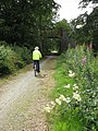
 Formartine and Buchan Way - geograph.org.uk - 509884.jpg 640 × 480; 68 KB
-
 Formartine and Buchan Way -Another Bridge - geograph.org.uk - 509299.jpg 480 × 640; 110 KB
-
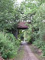
 Formartine and Buchan Way by Deer Abbey. - geograph.org.uk - 164086.jpg 640 × 438; 180 KB
-

-
 Old Deer from Aden Park - panoramio.jpg 5,370 × 3,356; 5.57 MB
-
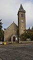 Old Deer Parish Church.jpg 2,268 × 4,032; 3.8 MB
-
 Old Deer.jpg 640 × 438; 100 KB
-
 Ramsons - geograph.org.uk - 432912.jpg 640 × 480; 158 KB
-
 The Ruined Aden House. - geograph.org.uk - 116777.jpg 636 × 428; 152 KB
-
 Aden Arms Hotel, Old Deer - geograph.org.uk - 225487.jpg 480 × 360; 43 KB
-
 Aden country park campsite 2 - geograph.org.uk - 774870.jpg 640 × 480; 74 KB
-
 Aden country park campsite 3 - geograph.org.uk - 774875.jpg 640 × 480; 79 KB
-
 Auchrynie - geograph.org.uk - 997407.jpg 640 × 426; 70 KB
-
 C2B - geograph.org.uk - 433018.jpg 640 × 480; 81 KB
-
 Cattle - geograph.org.uk - 432897.jpg 640 × 480; 109 KB
-
 Chapel Park, Mintlaw - geograph.org.uk - 431806.jpg 640 × 480; 57 KB
-
 Dens of Crichie - geograph.org.uk - 433029.jpg 640 × 480; 141 KB
-
 Drive to Slampton - geograph.org.uk - 433069.jpg 640 × 480; 90 KB
-
 Dumped Tyres in the Forest - geograph.org.uk - 267866.jpg 640 × 480; 133 KB
-

-
 Farm building - geograph.org.uk - 432910.jpg 640 × 480; 61 KB
-
 Fields towards Drinnie's Wood - geograph.org.uk - 357629.jpg 640 × 480; 62 KB
-
 Forest Walk Closed - geograph.org.uk - 267871.jpg 640 × 480; 134 KB
-

-

-
 From the B9030 - geograph.org.uk - 433022.jpg 640 × 480; 87 KB
-
 Greencroft - geograph.org.uk - 394120.jpg 640 × 480; 57 KB
-
 Kinnadie Farm - geograph.org.uk - 394110.jpg 640 × 480; 72 KB
-
 Little Skillymarno Farm - geograph.org.uk - 495002.jpg 640 × 480; 98 KB
-
 Loudon Wood Stone Circle - geograph.org.uk - 256267.jpg 640 × 480; 119 KB
-
 North Cortiecram Farm - geograph.org.uk - 470234.jpg 640 × 480; 115 KB
-
 Path to Observatory - geograph.org.uk - 357630.jpg 640 × 480; 93 KB
-
 Road to Upper Crichie - geograph.org.uk - 433032.jpg 640 × 480; 143 KB
-
 Sign at Little Blackpots - geograph.org.uk - 470227.jpg 640 × 480; 116 KB
-
 Signpost a West Crichie - geograph.org.uk - 470223.jpg 640 × 480; 141 KB
-
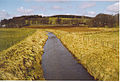 South Ugie Water, by Saplinbrae. - geograph.org.uk - 164091.jpg 640 × 438; 127 KB
-
 The Bungalow - geograph.org.uk - 494993.jpg 640 × 480; 96 KB
-
 View towards Woodside Croft - geograph.org.uk - 390545.jpg 640 × 480; 73 KB
-
 Woodside Croft - geograph.org.uk - 390563.jpg 640 × 480; 98 KB


