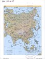
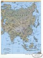
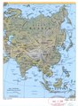
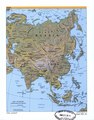
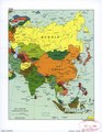
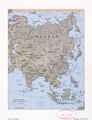
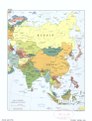
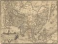
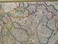
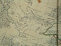
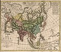
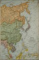
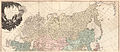
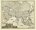
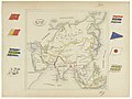
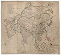
Category:Old maps of Asia
Pereiti į navigaciją
Jump to search
Vidutinio klimato regionai: Šiaurės Amerika · Pietų Amerika · Afrika · Europa · Azija · Okeanija – Poliariniai regionai: Antarktida · Arktis – Other regions: Eurazija
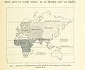
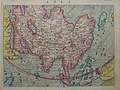
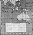
Old maps of Asia.
Use the appropriate category for maps showing all or a large part of Azija. See subcategories for smaller areas:
| If the map shows | Category to use |
|---|---|
| Azija on a recently created map | Category:Maps of Asia or its subcategories |
| Azija on a map created more than 70 years ago | Category:Old maps of Asia or its subcategories |
| the history of Azija on a recently created map | Category:Maps of the history of Asia or its subcategories |
| the history of Azija on a map created more than 70 years ago | Category:Old maps of the history of Asia or its subcategories |

Wikimedia category | |||||
| Įkelti mediją | |||||
| Tai yra | |||||
|---|---|---|---|---|---|
| Kategorija sujungia temas | |||||
| |||||
Subkategorijos
Rodomos 43 subkategorijos (iš viso yra 43 subkategorijos).
*
A
B
C
- Maps of Caucasus (1 F)
K
- Old maps of Kamchatka (45 F)
L
M
- Mao Kun map (75 F)
N
O
- Old cartoon maps of Asia (1 F)
P
R
S
T
Daugialypės terpės rinkmenos kategorijoje „Old maps of Asia“
Rodoma 200 šios kategorijos rinkmenų (iš viso kategorijoje yra 329 rinkmenos).
(ankstesnis puslapis) (kitas puslapis)-
 "Asia Noviter Delineata". Amsterdam, Guglielmus Blaeu, 1635.jpg 1 024 × 778; 785 KiB
-
 "Asia," by Giovanni Botero, an edition from 1659 northwest.jpg 800 × 600; 132 KiB
-
 "Asia," by Giovanni Botero, an edition from 1659 southwest.jpg 800 × 600; 130 KiB
-

-
 "Asia," from 'Relazioni Universali', by Giovanni Botero (1544-1617).jpg 1 024 × 768; 501 KiB
-
 "Iamboli" would seem to correspond to Sumatra.jpg 555 × 675; 116 KiB
-

-

-
 "Typus Communicationis maris Caspy, cum Persico et Euxino." (22042637618).jpg 3 324 × 3 369; 2,87 MiB
-
 'Claudius Bombarnac' by Léon Benett 14.jpg 1 512 × 1 071; 595 KiB
-
 'Michael Strogoff' by Jules Férat 19.jpg 2 361 × 1 541; 929 KiB
-
 'Michael Strogoff' by Jules Férat 80.jpg 2 369 × 1 549; 926 KiB
-

-

-

-

-

-

-

-
 14 of 'Ethnographie des peuples de l'Europe avant Jésus-Christ, etc' (11096368133).jpg 3 671 × 2 953; 2,4 MiB
-

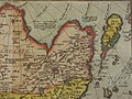
-
 1570 Map of Formosa (Taiwan) and Surrounding Countries 福爾摩沙臺灣.jpg 480 × 428; 144 KiB
-
 1599 Edward Wright Japan Map.png 910 × 596; 1,09 MiB
-
 16th Century map of Persia Wellcome L0044811.jpg 3 614 × 2 660; 3,54 MiB
-
-

-

-

-

-
 Anville Nouvel atlas de la Chine - Page15 Chine generale couleur.jpg 2 500 × 1 755; 2,87 MiB
-
 Carte la plus generale et qui comprend la Chine, la Tartarie Chinoise, et le Thibet (1734).jpg 3 000 × 2 106; 3,14 MiB
-
 CEM-44-La-Chine-la-Tartarie-Chinoise-et-le-Thibet-1734-2568.jpg 2 552 × 1 832; 2,5 MiB
-

-

-

-

-
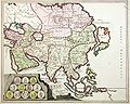
 1799 Clement Cruttwell Map of Asia - Geographicus - Asia-cruttwell-1799.jpg 3 500 × 3 008; 3,03 MiB
-
 1855 Colton Map of Balochistan.jpg 1 068 × 743; 275 KiB
-
 1855 Colton Map of India or Hindostan - Geographicus - India-cbl-1855.jpg 2 495 × 3 000; 2,23 MiB
-

-

-
 1855 Colton Map of Persia, Afghanistan, and Arabia - Geographicus - PersiaArabia-colton-1855.jpg 3 000 × 2 453; 2,11 MiB
-
 1864 Mitchell Map of Australia and Polynesia - Geographicus - Oceanica-mitchell-1864.jpg 4 000 × 3 186; 2,9 MiB
-
 1894 Map of Asia.jpg 3 482 × 2 920; 2,61 MiB
-
 18th-century Maldives map by Pierre Mortier (cropped).jpg 971 × 623; 241 KiB
-
 18th-century Maldives map by Pierre Mortier.jpg 920 × 617; 237 KiB
-
 1904 map of Asia.png 3 927 × 3 172; 32,7 MiB
-
 1911 Britannica - Map of Asia1.png 661 × 984; 1,57 MiB
-
 1911 Britannica - Map of Asia2.png 658 × 980; 1,68 MiB
-
 1911 Britannica - Map of Asia3.png 850 × 851; 678 KiB
-
 311 of 'From Peking to Petersburg, etc' (11249160735).jpg 4 439 × 2 568; 3,17 MiB
-
 315 of 'Sintfluth und Völkerwanderungen, etc' (11304174415).jpg 1 577 × 1 311; 415 KiB
-

-

-
 Arab Caliphate.jpg 888 × 674; 220 KiB
-
 Arab Caliphate.svg 350 × 334; 1,04 MiB
-

-
 A lengthly inscription discusses Arrian and the Indica.jpg 818 × 675; 149 KiB
-
 A map of Asia - with its principal divisions LOC 2006636642.jpg 6 615 × 6 179; 6,47 MiB
-
 A map of Asia - with its principal divisions LOC 2006636642.tif 6 615 × 6 179; 116,94 MiB
-

-
 Age of Exploration-map.jpg 424 × 544; 40 KiB
-
 AMH-5343-NA Map of Diu.jpg 2 400 × 1 729; 505 KiB
-
 AMH-5509-NA Map of the coast of China, from Conglay to Lantao.jpg 2 400 × 1 362; 525 KiB
-
 AMH-6065-NA Map of the village of Kotta near Colombo.jpg 2 400 × 1 703; 375 KiB
-
 Amsterdam 1685 1700 ca.png 1 772 × 1 509; 5,88 MiB
-
 Amsterdam1685..jpg 3 150 × 2 719; 4,5 MiB
-
 An atlas of commercial geography (1913) (14778283051).jpg 2 928 × 2 414; 1,83 MiB
-
 Annales de géographie (1891) (14595330298).jpg 2 960 × 1 882; 1,03 MiB
-
 Archiv für Naturgeschichte (1918) (20332763255).jpg 2 832 × 1 888; 926 KiB
-
 Asia 1597 a closer view.jpg 800 × 600; 181 KiB
-
 Asia 1597.jpg 800 × 600; 177 KiB
-
 Asia 1892 amer ency brit.jpg 2 072 × 1 544; 779 KiB
-
 Asia 1920-1922.jpg 720 × 1 378; 376 KiB
-
 Asia according to the best authorities. LOC 2006636626.jpg 6 356 × 4 952; 3,52 MiB
-
 Asia according to the best authorities. LOC 2006636626.tif 6 356 × 4 952; 90,05 MiB
-
 Asia according to the best authorities. LOC 2007627523.jpg 6 222 × 4 920; 4,03 MiB
-
 Asia according to the best authorities. LOC 2007627523.tif 6 222 × 4 920; 87,58 MiB
-
 Asia and Europe. 2-75. LOC 76693349.jpg 14 591 × 11 400; 22,78 MiB
-
 Asia and Europe. 2-75. LOC 76693349.tif 14 591 × 11 400; 475,9 MiB
-
 Asia and Europe. 8-67. LOC 75696232.jpg 14 611 × 11 564; 13,1 MiB
-
 Asia and its islands according to D'Anville. LOC 2002624012.jpg 14 501 × 12 693; 30,79 MiB
-
 Asia from Court Game of Geography MET DP862907.jpg 808 × 1 202; 342 KiB
-
 Asia LOC 2006636621.jpg 10 754 × 14 031; 22,94 MiB
-
 Asia LOC 2006636622.jpg 8 964 × 6 351; 9,22 MiB
-
 Asia LOC 2006636622.tif 8 964 × 6 351; 162,88 MiB
-
 Asia LOC 2018588021.jpg 7 210 × 6 207; 7,86 MiB
-
 Asia LOC 2018588021.tif 7 210 × 6 207; 128,04 MiB
-

-

-
 Asia, 1812.jpg 2 966 × 2 457; 1,77 MiB
-
 Asia, by Giovanni Botero, an edition from 1659 Central Asia.jpg 800 × 600; 135 KiB
-
 Asia, by Giovanni Botero, an edition from 1659 northeast.jpg 800 × 600; 133 KiB
-
 Asia, by Giovanni Botero, an edition from 1659 the whole map.jpg 800 × 600; 136 KiB
-
 Asia. LOC 00552391.jpg 3 384 × 4 412; 2,28 MiB
-
 Asia. LOC 00552391.tif 3 384 × 4 412; 42,72 MiB
-
 Asia. LOC 00557173.jpg 2 347 × 3 115; 1,02 MiB
-
 Asia. LOC 00557173.tif 2 347 × 3 115; 20,92 MiB
-
 Asia. LOC 2001621192.jpg 2 353 × 3 132; 878 KiB
-
 Asia. LOC 2001621192.tif 2 353 × 3 132; 21,08 MiB
-
 Asia. LOC 2003630196.jpg 2 527 × 3 298; 992 KiB
-
 Asia. LOC 2003630196.tif 2 527 × 3 298; 23,84 MiB
-
 Asia. LOC 2003630209.jpg 2 261 × 3 024; 1,06 MiB
-
 Asia. LOC 2003630209.tif 2 261 × 3 024; 19,56 MiB
-
 Asia. LOC 2004621115.jpg 2 260 × 3 064; 993 KiB
-
 Asia. LOC 2004621115.tif 2 260 × 3 064; 19,81 MiB
-
 Asia. LOC 2004625267.jpg 2 460 × 3 149; 1,12 MiB
-
 Asia. LOC 2004625267.tif 2 460 × 3 149; 22,16 MiB
-
 Asia. LOC 2005632134.jpg 5 975 × 4 799; 5,64 MiB
-
 Asia. LOC 2005632134.tif 5 975 × 4 799; 82,04 MiB
-
 Asia. LOC 2006458917.jpg 2 516 × 3 246; 959 KiB
-
 Asia. LOC 2006458917.tif 2 516 × 3 246; 23,37 MiB
-
 Asia. LOC 2007630645.jpg 3 369 × 4 401; 2,67 MiB
-
 Asia. LOC 2007630645.tif 3 369 × 4 401; 42,42 MiB
-
 Asia. LOC 2008620736.jpg 3 368 × 4 393; 1,46 MiB
-
 Asia. LOC 2008620736.tif 3 368 × 4 393; 42,33 MiB
-
 Asia. LOC 2010588612.jpg 3 335 × 4 359; 2,28 MiB
-
 Asia. LOC 2010588612.tif 3 335 × 4 359; 41,59 MiB
-
 Asia. LOC 2014588823.jpg 2 492 × 3 273; 1,17 MiB
-
 Asia. LOC 2014588823.tif 2 492 × 3 273; 23,34 MiB
-
 Asia. LOC 97681474.jpg 2 489 × 3 255; 1,37 MiB
-
 Asia. LOC 97681474.tif 2 489 × 3 255; 23,18 MiB
-
 Asiae Nova Descriptio - Asia.jpg 5 838 × 4 406; 12,82 MiB
-

-

-
 Asie - Fonds Ancely - B315556101 A LEVASSEUR 100.jpg 2 955 × 2 079; 2,05 MiB
-
 Asie-physique.JPG 1 805 × 1 777; 969 KiB
-
 Asien 1844.jpg 5 475 × 4 481; 7,31 MiB
-
 Asien Bd1.jpg 2 500 × 1 974; 1,96 MiB
-

-
 Azsia dewit.jpg 2 333 × 1 861; 7,7 MiB
-
 Barbaria(Somalia).jpg 1 524 × 1 198; 252 KiB
-
 Bartholomew's general map of Asia. LOC 2006635248.jpg 9 505 × 7 415; 8,26 MiB
-
 Bartholomew's general map of Asia. LOC 2006635248.tif 9 505 × 7 415; 201,64 MiB
-

-

-
 Brockhaus and Efron Encyclopedic Dictionary b2 955-4.jpg 3 531 × 2 552; 4,94 MiB
-
 Brockhaus and Efron Jewish Encyclopedia e1 555-0.jpg 1 071 × 753; 154 KiB
-
 Brockhaus and Efron Jewish Encyclopedia e1 557-0.jpg 1 056 × 756; 154 KiB
-
 Butterflies from China, Japan, and Corea (1892) (20510661145).jpg 3 965 × 1 784; 2,33 MiB
-

-
-
 Canada - its history, productions, and natural resources (microform) (1886) (20614100625).jpg 3 330 × 3 712; 3,87 MiB
-
 Carte des voyages de Mr Tavernier Jean-Baptiste dressée sur ses écrits, 17ème siècle.png 1 600 × 1 200; 1,25 MiB
-
 CEM-09-Asiae-Nova-Descriptio-Central-Asia-2509.jpg 2 048 × 1 536; 1,57 MiB
-
 CEM-09-Asiae-Nova-Descriptio-China-2510.jpg 2 048 × 1 536; 1,55 MiB
-
 CEM-09-Asiae-Nova-Descriptio-Kitaia-lacus-2511.jpg 1 600 × 1 200; 1,02 MiB
-
 CEM-09-Asiae-Nova-Descriptio-Tartaria-2508.jpg 2 048 × 1 536; 1,59 MiB
-
 CEM-15-Asia-Mercator-1595-Tartaria-2532.jpg 2 560 × 1 920; 2,11 MiB
-
 CEM-44-La-Chine-la-Tartarie-Chinoise-et-le-Thibet-1734-Amur-2572.jpg 2 492 × 1 872; 1,85 MiB
-
 CEM-44-La-Chine-la-Tartarie-Chinoise-et-le-Thibet-1734-Kashgar-2573.jpg 2 560 × 1 920; 2,08 MiB
-
-
 China 1814-1816.jpg 28 165 × 15 994; 75,85 MiB
-
 China Sea LOC 84696453.jpg 11 794 × 15 668; 16,33 MiB
-
-

-
 Detail of plate 11 showing Cambalu Wellcome L0071619.jpg 4 000 × 4 173; 3,8 MiB
-
 Detail of plate 11 showing Magnus Chan Wellcome L0071618.jpg 4 680 × 4 044; 5,55 MiB
-
 Detail of plate 9 showing Samarchand Wellcome L0071617.jpg 5 200 × 3 080; 3,24 MiB
-
 Detailed map of Asia .png 1 772 × 1 567; 6,14 MiB
-
 Die Ostindischen Inseln 1844.jpg 5 461 × 4 482; 6,05 MiB
-
 Distribution of Cynips.png 616 × 397; 33 KiB
-
 East Indies from the best authorites (4232062898).jpg 2 000 × 1 596; 2,87 MiB
-
 Eastern Hemisphere 1300 BC.png 3 240 × 1 903; 8,1 MiB
-
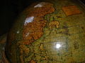 EmeryMolyneux-terrestrialglobe-Asia-1592-20061127.jpg 640 × 480; 70 KiB
-
 Empire of Timourlan in1400.jpg 1 573 × 704; 719 KiB
-
 Ethnic map of Asia Minor and Caucasus in 1914.jpg 1 270 × 795; 163 KiB
-
 Europe since 1815 (1910) (14741841436).jpg 1 786 × 3 034; 794 KiB
-
 Exploration et missions de Doudart de Lagrée.jpg 1 054 × 1 438; 466 KiB
-
 Exposition geographique XIII Tableau Comprenant L'Asie et l'Afrique.png 11 260 × 8 291; 121,06 MiB
-
 Fifty years of Europe, 1870-1919 (1919) (14784101325).jpg 1 268 × 2 050; 752 KiB
-
 Fifty years of Europe, 1870-1919 (1919) (14801445583).jpg 1 746 × 2 938; 750 KiB
-
 Frederick de Wit. Maps of Asia. copper engraving. 1670s.gif 2 436 × 1 896; 4,36 MiB
-
 From a full-sized map of Asia by Ortelius, 1595 north east.jpg 800 × 600; 158 KiB
-
 From a full-sized map of Asia by Ortelius, 1595 northwest.jpg 800 × 600; 177 KiB
-
 From a full-sized map of Asia by Ortelius, 1595 southwest.jpg 800 × 600; 169 KiB
-
 From a full-sized map of Asia by Ortelius, 1595 the whole map.jpg 800 × 600; 137 KiB
-

-

-
 Gerard-de-Jode-Asia-Partum-Orbis-Maxima-1593.jpg 2 480 × 1 754; 6,86 MiB
-
 Guillaume de L'Isle - 1731- Paris.jpg 800 × 492; 96 KiB
-
 Iaponia Regnvm Japonia Regnum (1665).jpg 1 707 × 1 306; 378 KiB
-
 Iran e Bozorg2.jpg 745 × 595; 92 KiB
-
 Iran Turan map 1843.jpg 7 864 × 6 918; 12,74 MiB
-
 Jambudweep.jpg 1 137 × 1 142; 546 KiB
-
 Jean Baptiste Bourguignon d'Anville - Asia - 1787.jpg 23 988 × 10 459; 126,83 MiB
-
 Journal of three voyages along the coast of China - Map of the Coast of Siam China.jpg 1 938 × 2 306; 504 KiB
-
 Kaart van Azië Accuratissima totius Asiæ tabula recens emendata (titel op object), NG-501-64.jpg 5 382 × 4 502; 4,84 MiB
-
 Kaart van Azië Asia (titel op object), BI-B-FM-090-4.jpg 3 596 × 2 586; 1,29 MiB
-

-
 Kaart van Azië, RP-T-1929-6.jpg 5 438 × 4 092; 2,61 MiB
-

-
 Karte von Hoch-Asien.jpg 11 875 × 8 821; 22,81 MiB
-
 KokugunYochi1849 full.png 3 296 × 1 000; 4,52 MiB
-
 L'Asie - btv1b531192443.jpg 8 204 × 7 307; 9,63 MiB
-
 L'Asie - btv1b8469861z.jpg 4 440 × 4 256; 2,69 MiB
-
 L'Asie - carte des parties septentrionales de l'Asie - btv1b85927670.jpg 4 214 × 3 515; 2,48 MiB
-

-

-


,_c.1591-98_and_later_editions_the_whole_map*;.jpg)
.jpg)

,_%22India%22_and_%22China%22_map_in_1659,_from-_%22Asia,%22_from_%27Relazioni_Universali%27,_by_Giovanni_Botero_(1544-1617),_c.1591-98_and_later_editions_the_whole_map*;_(cropped).jpg)
.jpg)
.jpg)


.jpg)
.jpg)
.jpg)
.jpg)
.jpg)
%27_(11246478725).jpg)
%27_(11246859385).jpg)
.jpg)
.jpg)
_and_Surrounding_Countries_%E7%A6%8F%E7%88%BE%E6%91%A9%E6%B2%99%E8%87%BA%E7%81%A3.jpg)


.jpg)


_-_Geographicus_-_PersiaArabia-c-55.jpg)


.jpg)


.jpg)
.jpg)
.jpg)
%27_(11163799295).jpg)


_(14591118708).jpg)


_(14777855042).jpg)


_(14778283051).jpg)
_(14595330298).jpg)
_(20332763255).jpg)


.jpg)

.jpg)


_(20510661145).jpg)

_(1886)_(20587846666).jpg)
_(1886)_(20614100625).jpg)


_(14781885834).jpg)
_(14781887444).jpg)


.jpg)


_(14741841436).jpg)


_(14784101325).jpg)
_(14801445583).jpg)


_(14597846070).jpg)
_(14784546415).jpg)


.jpg)


,_NG-501-64.jpg)
,_BI-B-FM-090-4.jpg)
_Les_Indes_Orientales_et_Occidentales_et_autres_lieux_(serietitel),_BI-1972-1043-4.jpg)


_par_G._de_L%27Isle..._;_N._Guerard_inv._et_fecit_-_btv1b85927566.jpg)