Category:Old maps of Halifax, Nova Scotia
Jump to navigation
Jump to search
| Upload media | |||||
| |||||
Subcategories
This category has the following 2 subcategories, out of 2 total.
Media in category "Old maps of Halifax, Nova Scotia"
The following 28 files are in this category, out of 28 total.
-
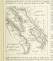
 ROSSER(1869) p0707 HALIFAX HARBOUR.jpg 2,019 × 3,119; 3.55 MB
-
-
 IMRAY(1884) p0749 HALIFAX.jpg 1,603 × 2,639; 2.7 MB
-

-
 A Chart of the harbour of Halifax - Jefferys - btv1b530894958.jpg 8,368 × 5,968; 4.57 MB
-

-

-
 A Draught of the harbour of Hallifax - J. Cook - btv1b53089743f.jpg 9,464 × 6,833; 7.41 MB
-
 A draught of the harbour of Hallifax and the adjacent coast in Nova Scotia (2675428704).jpg 2,000 × 1,527; 2.41 MB
-

-
 Admiralty Chart No 2410 Nova Scotia Mars Head to Shut-In Island, Published 1855.jpg 8,139 × 12,001; 10.79 MB
-
 Admiralty Chart No 311 Halifax Harbour, Published 1891, Large Corrections 1935.jpg 11,052 × 16,255; 72.08 MB
-
 Halifax Harbour RMG K0577.jpg 1,280 × 679; 640 KB
-
 Halifax map 1894.jpg 1,243 × 1,678; 460 KB
-
 Halifax Nova Scotia 1878.jpg 4,397 × 5,564; 1.91 MB
-
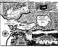 Halifaxmap1750.jpg 696 × 579; 200 KB
-

-

-

-
 Map of Halifax c. 1890.JPG 1,243 × 1,678; 449 KB
-
-
 NSRW Halifax Map.jpg 623 × 566; 110 KB
-

-
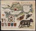
 Plan of the New Town of Halifax in Nova Scotia, 1749.jpg 2,493 × 1,851; 1.45 MB
-

-

-
 The harbour of Halifax RMG K0114.jpg 946 × 1,280; 1.26 MB
-
 The harbour of Halifax RMG K0115.jpg 989 × 1,280; 1.38 MB
_p0707_HALIFAX_HARBOUR.jpg)
%27_(11250847756).jpg)
_p0749_HALIFAX.jpg)
%27_(11246450574).jpg)

.jpg)


.jpg)


,_avril_1889_(22852808120).jpg)


,_1878_(23159013982).jpg)

_(14577451559).jpg)
_(14764098595).jpg)

