Category:Old maps of Utrecht
Jump to navigation
Jump to search
This category is for historic maps (over 70 years old) for Utrecht province, the Netherlands.
Subcategories
This category has the following 4 subcategories, out of 4 total.
A
G
U
Media in category "Old maps of Utrecht"
The following 47 files are in this category, out of 47 total.
-
 Kerkenkaart Oversticht - Bisdom Utrecht.jpg 2,672 × 3,803; 13.47 MB
-
 Kaerius1617Ultraiectum.jpg 3,500 × 2,712; 3.19 MB
-
 1628 Kaart van Holland en Utrecht.jpg 6,272 × 4,845; 8.3 MB
-
 1628 Ultraiec tinus Hondius'.jpg 3,370 × 2,696; 9.94 MB
-
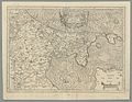
 "Ultraiectum dominium" (22068687498).jpg 3,893 × 3,030; 3.03 MB
-
 IJsselstein-Blaeu-1665.jpg 1,253 × 796; 608 KB
-
 1694 Lubbenes.jpg 550 × 263; 28 KB
-

-
-
 De VII Vereenigde Nederlandsche Provinciën COLLBN Port 3 N 87 - sheet 3.tif 8,449 × 6,330; 153.01 MB
-
-

-
 7 Sup Hol 1573 Sgrooten.jpg 1,971 × 1,758; 2.94 MB
-
 Beeldsnijder-Noord Holland.jpg 1,446 × 1,617; 457 KB
-
 Blaeu 1645 - Ultraiectum Dominium.jpg 3,661 × 3,053; 4.55 MB
-
 COMITATUS HOLLANDIAE 1682.jpg 4,400 × 3,653; 4.19 MB
-
 Comitatus Hollandiae et dominii Ultrajectini tabula - F. de Wit - btv1b53039594n (09 of 16).jpg 11,068 × 7,341; 9.62 MB
-
 Comitatus Hollandiae et dominii Ultrajectini tabula - F. de Wit - btv1b53039594n (11 of 16).jpg 11,087 × 7,332; 11.13 MB
-
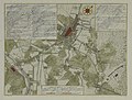
 De Ronde Venen 1665.JPG 860 × 593; 139 KB
-
 Departement utrecht 1802.jpg 598 × 499; 478 KB
-
 DeRoij1715UltrajectinæCr.jpg 5,337 × 4,403; 9.38 MB
-
 FMIB 43958 Zuyder Polder.jpeg 895 × 1,016; 417 KB
-
 Heerlijkheid utrecht.jpg 1,000 × 740; 349 KB
-
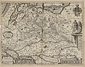
 Holland & Sticht Utrecht, Gerardus Mercator, Atlas Sive Cosmographicae, etc.jpg 1,797 × 1,949; 2.14 MB
-
 Holland1477.png 336 × 333; 188 KB
-
 Joost Jansz Bilhamer-Beeldsnijder-Kaart van Noord-Holland 1575.jpg 2,790 × 3,160; 3.18 MB
-
 Kaart Bernard de Roij - 1696.png 1,021 × 639; 1.03 MB
-
 Kaart uit 1648 met percelen van de voormalige abdij Oostbroek te De Bilt.jpg 1,400 × 995; 421 KB
-
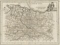
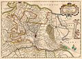
 Kaart van de provincie Utrecht Episcop. Ultraiectinus (titel op object), RP-P-AO-5-5A.jpg 5,272 × 4,494; 4.03 MB
-

-
 Kaart Vechtstreek door Daniël Stoopendaal in De Zegepralende Vecht 1719.jpg 1,381 × 2,682; 2.89 MB
-
 Kaerius1617UltraiectumCr.jpg 800 × 600; 267 KB
-
 Lambert-van-den-Bos-Lieuwe-van-Aitzema-Historien-onses-tyds MGG 0418.tif 4,188 × 3,429; 41.12 MB
-
 Landkaarten, polders, Noorderbuursche Polder, Bestanddeelnr 253-6807.jpg 3,465 × 2,383; 3.05 MB
-
 Map of Sticht Utrecht, around 1650.jpg 902 × 647; 540 KB
-
 Nederhorst.JPG 1,936 × 1,936; 1.3 MB
-
 Oude landkaart.jpg 808 × 474; 282 KB
-
 Oude Rijn Blaeu.jpg 795 × 497; 188 KB
-
 Steevlied op minuutkaart uit 1832.jpg 1,445 × 893; 268 KB
-
 Ten Brink's nieuwe Zak-Atlasje van Nederland voor sport en op reis 1922 scan07.jpg 5,479 × 4,820; 5.48 MB
-
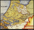
 TopographicMapUtrecht1820.png 5,600 × 4,400; 38.67 MB
-
 Ultraiectum dominium - Petrus Kaerius excud. - btv1b53043163p (1 of 2).jpg 5,770 × 4,581; 5.8 MB
-
 Utrecht 1892.jpg 6,161 × 3,950; 18.19 MB
-
 Waterstaat en grensscheiding van Holland, Utrecht en Gelderland (3381208445).jpg 2,000 × 1,486; 1.02 MB
-
 Waverveen.JPG 2,592 × 1,936; 1.78 MB
-
 Wiltenburch.jpg 386 × 589; 94 KB
-
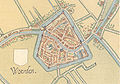 Woerden c1550map.jpg 906 × 632; 935 KB


.jpg)


.jpg)
.jpg)

.jpg)


.jpg)
.jpg)


,_RP-P-AO-5-5A.jpg)


.jpg)

.jpg)


