Category:Old maps of the City of London
Jump to navigation
Jump to search
Subcategories
This category has the following 7 subcategories, out of 7 total.
Media in category "Old maps of the City of London"
The following 54 files are in this category, out of 54 total.
-

-
 10 of 'The History of the Parish of Holy Trinity, Minories, etc. MS. note' (11037508165).jpg 4,324 × 5,519; 3.72 MB
-
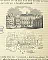
 121 of 'Memoirs of Bartholomew Fair ... Fourth edition' (11299136075).jpg 1,234 × 917; 412 KB
-

-
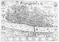
 17th century map of London (W.Hollar).jpg 5,500 × 4,382; 5.78 MB
-
 ONL (1887) 1.013 - Part of Modern London, Showing the Ancient Wall (map).jpg 1,800 × 1,311; 993 KB
-
 ONL (1887) 1.015 - Plan of Roman London.jpg 1,756 × 1,300; 719 KB
-
 ONL (1887) 1.145 - Map of Fleet Street, the Temple, etc, 1720.jpg 1,778 × 1,394; 814 KB
-
 ONL (1887) 1.336 - Old Map of the Ward of Cheap, about 1750.jpg 1,924 × 2,295; 1.35 MB
-
 ONL (1887) 1.450 - Map of Broad Street and Cornhill Wards, 1750.jpg 1,924 × 1,980; 1.35 MB
-
 209 of 'Rambles round London Town' (11169715865).jpg 1,702 × 1,420; 770 KB
-

-
-

-

-
 89 of '(Street Re-alignment and Re-construction of Central London.)' (11182562285).jpg 5,077 × 2,447; 1.62 MB
-
 Beare Lane, London from Hollar's map.jpg 800 × 603; 457 KB
-
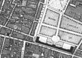
 Blackfriars Theatres, London - location map.png 1,097 × 1,612; 638 KB
-
 Bull and Mouth Street from Ogilby & Morgan's map.jpg 1,919 × 1,079; 1.45 MB
-
 City of London Ogilby and Morgan's Map of 1677.jpg 4,000 × 2,366; 4.12 MB
-
 Copperplate map Bishopsgate.jpg 703 × 1,874; 605 KB
-
 Copperplate map Bridewell.jpg 760 × 940; 281 KB
-
 Copperplate map E City.jpg 3,029 × 2,282; 3.04 MB
-
 Copperplate map London Stone.jpg 499 × 317; 98 KB
-
 Copperplate map Moorfields.jpg 3,006 × 2,164; 2.28 MB
-
 Copperplate map St Brides.jpg 210 × 245; 42 KB
-
 Copperplate map St Pauls.jpg 671 × 828; 285 KB
-
 Copperplate map W City.jpg 3,029 × 2,230; 2.48 MB
-
 1098 of 'Old and New London, etc' (11188083074).jpg 2,848 × 1,924; 1.59 MB
-
 Fisher's Folly.jpg 989 × 1,036; 791 KB
-
 Herald Office, London - Stanford Map of London, 1862.jpg 180 × 221; 52 KB
-
 Ireland in London (1889) (14581084350).jpg 1,798 × 682; 115 KB
-
 London - John Norden's map of 1593 version 2.jpg 2,487 × 1,769; 3.75 MB
-
 London - John Norden's map of 1593.jpg 4,000 × 3,760; 4.01 MB
-
 London and Westminster improved, illustrated by plans Fleuron T138431-12.png 3,027 × 2,408; 406 KB
-
 London in the Roman Period, Stukeley, 1720.jpg 2,672 × 4,000; 1.78 MB
-
 London map showing Shakespearean theatres.png 2,000 × 1,228; 178 KB
-
 London theatres C16—C17, after Redwood.png 2,000 × 1,228; 337 KB
-
 London theatres C16—C17, after Redwood.svg 2,000 × 1,228; 461 KB
-
 London. (16947338831).jpg 1,415 × 2,000; 548 KB
-
 Map of Spitalfields Area - 1787.jpg 557 × 418; 130 KB
-
 Map of the central portion of the City of London Wellcome L0005006.jpg 1,640 × 1,228; 948 KB
-
 Map of the city of London. Wellcome M0012961.jpg 3,879 × 2,792; 2.89 MB
-
 Map showing position of Barber's Hall. Wellcome L0001243.jpg 1,114 × 1,718; 1.11 MB
-
 Map.London.gutted.1666.jpg 2,369 × 1,879; 847 KB
-
 Rocque e1 MoorgateCrop.jpg 602 × 431; 255 KB
-
 Royal College of Physicians, Warwick Lane, London, with a ma Wellcome V0013094.jpg 2,066 × 3,409; 2.84 MB
-
 St Luke's Hospital, Cripplegate, London, with a map of Cripp Wellcome L0011833.jpg 1,099 × 1,687; 849 KB
-
 St Luke's Hospital, Cripplegate, London, with a map of Cripp Wellcome V0013202.jpg 2,289 × 3,593; 3.71 MB
-
 Transactions (1866) (14764138481).jpg 1,748 × 2,914; 353 KB
-
 VintyWardAgas1572.jpg 760 × 426; 56 KB
-
 W. Maitland; History of London; map. Wellcome L0001244.jpg 1,528 × 1,198; 1,000 KB
-
 Wenceslas Hollar - London before the fire (State 1).jpg 2,906 × 1,904; 1.91 MB
-
 Wenceslas Hollar - London before the fire (State 2).jpg 2,900 × 1,980; 1.86 MB
.jpg)
.jpg)
.jpg)
.jpg)
.jpg)
_1.013_-_Part_of_Modern_London,_Showing_the_Ancient_Wall_(map).jpg)
_1.015_-_Plan_of_Roman_London.jpg)
_1.145_-_Map_of_Fleet_Street,_the_Temple,_etc,_1720.jpg)
_1.336_-_Old_Map_of_the_Ward_of_Cheap,_about_1750.jpg)
_1.450_-_Map_of_Broad_Street_and_Cornhill_Wards,_1750.jpg)
.jpg)
_no._1-26%27_(11169575363).jpg)
)%27_(11233566684).jpg)
_..._Eighteenth_edition%27_(11007187665).jpg)
%27_(11182562285).jpg)


.jpg)


.jpg)


.jpg)
.jpg)
.jpg)
_(14581084350).jpg)
_(14764138481).jpg)