Category:Onllwyn
Jump to navigation
Jump to search
village and community in Neath Port Talbot, Wales | |||||
| Upload media | |||||
| Instance of | |||||
|---|---|---|---|---|---|
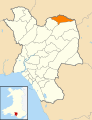
| Location | Neath Port Talbot County Borough, Wales | ||||
| Population |
| ||||
 | |||||
Cymraeg: Pentref ym mwrdeisdref sirol Castell-nedd Port Talbot yw Onllwyn. Mae hefyd yn enw'r ward etholiadol, sy'n cynnwyd Dyffryn Cellwen a Banwen. Saif tua 12 milltir i'r gogledd-ddwyrain o dref Castell Nedd, ychydig i'r gogledd o Flaendulais, ar y briffordd A4109 a ger tarddle Afon Dulais.
English: for the hill of this name northwest of Merthyr Tydfil see Penmoelallt
Media in category "Onllwyn"
The following 169 files are in this category, out of 169 total.
-
 2010 Wales Neath Port Talbot Community Onllwyn map.svg 512 × 666; 423 KB
-
 2024 Wales Neath Port Talbot Community Onllwyn map.svg 512 × 666; 548 KB
-
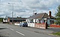
 20mph zone, Dyffryn Cellwen - geograph.org.uk - 2680473.jpg 640 × 435; 79 KB
-
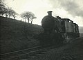
 37230 at Onllwyn washery (1).jpg 1,600 × 1,057; 364 KB
-
 37230 at Onllwyn washery.jpg 1,600 × 1,056; 412 KB
-
 A Coal train heads down the Valley - geograph.org.uk - 804359.jpg 640 × 427; 85 KB
-
 A4109 at Coelbren turn, Onllwyn - geograph.org.uk - 4669356.jpg 640 × 481; 57 KB
-

-
 A4109 Inter Valley Road at Banwern Pyrddin - geograph.org.uk - 5890655.jpg 1,024 × 722; 110 KB
-
 A4109 Inter Valley Road heading east - geograph.org.uk - 5890656.jpg 1,024 × 754; 169 KB
-
 A4109 Inter Valley Road heading east - geograph.org.uk - 5890657.jpg 1,024 × 731; 167 KB
-
 A4109 northbound at Tynewydd - geograph.org.uk - 4669351.jpg 640 × 480; 49 KB
-

-
 Aberhenwaun Uchaf - geograph.org.uk - 6243921.jpg 3,264 × 2,448; 2.47 MB
-
 Access track to wind turbines - geograph.org.uk - 3152299.jpg 640 × 480; 81 KB
-
 Afon Dulais - geograph.org.uk - 6245690.jpg 2,048 × 1,536; 1.71 MB
-
 Afon Pyrddin - geograph.org.uk - 5182324.jpg 640 × 480; 156 KB
-

-
 Banwen Food ^ Wine, Dyffryn Cellwen - geograph.org.uk - 2680487.jpg 640 × 493; 72 KB
-
 Banwen Pond - geograph.org.uk - 5559045.jpg 1,280 × 960; 224 KB
-
 Banwen RFC - geograph.org.uk - 2683444.jpg 640 × 418; 58 KB
-
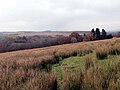
 Banwen viewed from a hillside track - geograph.org.uk - 3152207.jpg 640 × 415; 81 KB
-
 Banwen, Roman Road crosses Nant Cellwen - geograph.org.uk - 2683600.jpg 640 × 480; 108 KB
-

-
 Blast Furnaces at Banwen Ironworks - geograph.org.uk - 4695539.jpg 1,200 × 960; 341 KB
-

-

-

-
 Camnant House - geograph.org.uk - 4879336.jpg 3,264 × 2,448; 1.71 MB
-
 Changing pavilion, Banwen RFC - geograph.org.uk - 2683476.jpg 640 × 369; 62 KB
-
 Channel in wall at Banwen Ironworks - geograph.org.uk - 4695503.jpg 768 × 1,024; 188 KB
-
 Charging Bank Wall at Banwen Ironworks - geograph.org.uk - 4695489.jpg 900 × 1,200; 311 KB
-

-
 Class 60 locomotive at Onllwyn Washery - geograph.org.uk - 5954844.jpg 3,888 × 5,184; 6.03 MB
-
 Class 60 locomotive at Onllwyn Washery - geograph.org.uk - 5954849.jpg 5,182 × 2,915; 4.9 MB
-
 Coal train at Onllwyn (geograph 5954838).jpg 4,678 × 3,508; 5.58 MB
-
 Coal train at Onllwyn (geograph 5954857).jpg 5,184 × 3,888; 5.97 MB
-
 Coal train at Onllwyn (geograph 7004515).jpg 4,935 × 3,701; 5.34 MB
-
 Coal train at Onllwyn - geograph.org.uk - 5717283.jpg 5,184 × 3,888; 6.26 MB
-
 Coal train at Onllwyn - geograph.org.uk - 5717285.jpg 5,184 × 3,888; 5.82 MB
-
 Coal train at Onllwyn - geograph.org.uk - 5717291.jpg 5,184 × 3,888; 5.63 MB
-
 Coal train at Onllwyn - geograph.org.uk - 5717299.jpg 3,888 × 5,184; 6.21 MB
-
 Coal train at Onllwyn - geograph.org.uk - 5954836.jpg 4,242 × 3,181; 4.19 MB
-
 Coal train at Onllwyn - geograph.org.uk - 5954841.jpg 5,182 × 2,915; 5.21 MB
-
 Coal train at Onllwyn - geograph.org.uk - 5954918.jpg 4,064 × 3,047; 4.53 MB
-
 Coal train at Pantyffordd - geograph.org.uk - 5954827.jpg 4,041 × 3,030; 3.73 MB
-
 Coelbren Roman marching camp - geograph.org.uk - 2718489.jpg 800 × 600; 137 KB
-
 Craig Clwyd - geograph.org.uk - 66027.jpg 640 × 434; 72 KB
-
 Cross Road, Dyffryn Cellwen - geograph.org.uk - 2680521.jpg 640 × 408; 63 KB
-
 Curiously worded sign, Banwen - geograph.org.uk - 3152204.jpg 640 × 548; 86 KB
-
 Danger Keep Out notices, Onllwyn - geograph.org.uk - 2680304.jpg 427 × 640; 75 KB
-
 Departure from Onllwyn - geograph.org.uk - 5954939.jpg 3,661 × 4,881; 6.11 MB
-
 Dyffryn Cellwen Cemetery - geograph.org.uk - 2680622.jpg 640 × 343; 61 KB
-
 Dyffryn Cellwen Cemetery plaque - geograph.org.uk - 2680627.jpg 640 × 348; 93 KB
-

-

-

-
 Eastern boundary of Onllwyn - geograph.org.uk - 2680458.jpg 640 × 440; 89 KB
-

-
 Electricity Pylons - geograph.org.uk - 4879436.jpg 3,264 × 2,448; 2.66 MB
-

-
 Engine House at Banwen Ironworks - geograph.org.uk - 4695478.jpg 1,200 × 900; 267 KB
-
 English Electric Type 3 D6813 (8254686471).jpg 783 × 570; 259 KB
-
 English Electric Type 3 D6882 (8412218652).jpg 811 × 559; 262 KB
-
 English Electric Type 3 D6888 (8255760932).jpg 798 × 538; 254 KB
-
 English Electric Type 3 D6888 (8411120709).jpg 813 × 595; 234 KB
-
 English Electric Type 3 D6935 (8255758668).jpg 805 × 559; 253 KB
-

-
 Footbridge across Camnant - geograph.org.uk - 4897433.jpg 2,448 × 3,264; 2.74 MB
-

-
 Footbridge over the railway near Onllwyn - geograph.org.uk - 3050270.jpg 3,648 × 2,736; 2.62 MB
-
 Footpath at Ton Pyrddin Farm - geograph.org.uk - 4897381.jpg 2,448 × 3,264; 3.68 MB
-
 Footpath to Afon Pyrddin - geograph.org.uk - 4879377.jpg 2,448 × 3,264; 2.65 MB
-
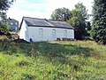 Former Noddfa chapel, Dyffryn Cellwen - geograph.org.uk - 2680508.jpg 640 × 480; 122 KB
-
 Former Onllwyn post office - geograph.org.uk - 2680346.jpg 640 × 480; 78 KB
-
 Ger Cae Eithin - Near Cae Eithin - geograph.org.uk - 5176664.jpg 640 × 480; 73 KB
-

-

-
 Heol y coedwigoedd - Forestry track - geograph.org.uk - 6031386.jpg 1,024 × 768; 201 KB
-

-
 Hugh llewelyn 3608 & 9777 (7865805894).jpg 784 × 554; 200 KB
-
 Hugh llewelyn 4255 (7865808542).jpg 789 × 576; 266 KB
-

-
 Khartoum Terrace bungalows, Onllwyn - geograph.org.uk - 2680313.jpg 640 × 390; 55 KB
-
 Kingdom Hall, Banwen - geograph.org.uk - 2683639.jpg 640 × 480; 68 KB
-

-

-
 Llwybr Onllwyn - Onllwyn Footpath - geograph.org.uk - 5285793.jpg 640 × 480; 97 KB
-
 Loading coal at Onllwyn (geograph 7004511).jpg 2,672 × 3,562; 2.93 MB
-

-
 Lorry-load of coal at Onllwyn - geograph.org.uk - 5717277.jpg 4,819 × 3,614; 5.72 MB
-
 Main Road houses, Dyffryn Cellwen - geograph.org.uk - 2680524.jpg 640 × 593; 82 KB
-
 Main Road houses, Dyffryn Cellwen - geograph.org.uk - 2680697.jpg 640 × 410; 61 KB
-

-
 Moorlands, Dyffryn Cellwen - geograph.org.uk - 2680694.jpg 640 × 362; 53 KB
-
 Neath ^ Brecon Railway cutting at Onllwyn - geograph.org.uk - 5717280.jpg 5,184 × 3,888; 6.65 MB
-
 North-west face of furnace at Banwen Ironworks - geograph.org.uk - 4695570.jpg 1,200 × 900; 327 KB
-

-
 Off-road bikers south of Banwen - geograph.org.uk - 3152230.jpg 640 × 529; 74 KB
-

-
 Onllwyn Cemetery - geograph.org.uk - 4878445.jpg 3,264 × 2,448; 2.74 MB
-
 Onllwyn Coal Washery - geograph.org.uk - 229109.jpg 640 × 400; 174 KB
-

-
-
 Onllwyn washery - geograph.org.uk - 5717307.jpg 5,125 × 3,844; 5.76 MB
-
 Onllwyn Washery and coal train - geograph.org.uk - 5954906.jpg 5,182 × 2,915; 4.75 MB
-
 Onllwyn Welfare Hall - geograph.org.uk - 2680355.jpg 640 × 480; 71 KB
-
 Onllwyn Welfare Hall - geograph.org.uk - 4878450.jpg 3,264 × 2,448; 2.45 MB
-
 Ordnance Survey Rivet - geograph.org.uk - 4993380.jpg 444 × 640; 117 KB
-
 Pentre Banwen - Banwen Village - geograph.org.uk - 5285800.jpg 640 × 480; 86 KB
-

-
 Pond, Banwen Pyrddin - geograph.org.uk - 3152242.jpg 640 × 480; 98 KB
-

-

-
 Public convenience, Dyffryn Cellwen - geograph.org.uk - 2680470.jpg 640 × 480; 74 KB
-
 Railhead at Onllwyn - geograph.org.uk - 5717302.jpg 5,184 × 3,888; 5.99 MB
-
 Railhead at Onllwyn - geograph.org.uk - 5717310.jpg 3,846 × 5,128; 7.34 MB
-
 Railtour at Onllwyn - geograph.org.uk - 5707076.jpg 5,184 × 3,888; 6.3 MB
-
 Railtour at Pantyffordd - geograph.org.uk - 5707082.jpg 5,184 × 3,888; 5.96 MB
-
 Railway crossing (geograph 6245693).jpg 3,001 × 2,272; 2.2 MB
-

-

-
 Remnants of a railway track, Onllwyn - geograph.org.uk - 2680255.jpg 640 × 480; 106 KB
-
 Riverside Outlet at Banwen Ironworks - geograph.org.uk - 4695511.jpg 1,200 × 900; 226 KB
-
 Road junction, Dyffryn Cellwen - geograph.org.uk - 2680465.jpg 640 × 361; 52 KB
-

-

-
 Roman Camp - geograph.org.uk - 4879328.jpg 3,264 × 2,448; 3.71 MB
-
 Roman Fort - geograph.org.uk - 4878455.jpg 3,264 × 2,448; 3.08 MB
-
 Roman Fort - geograph.org.uk - 4902649.jpg 5,472 × 3,648; 7.15 MB
-
 Roman Road heads away from Banwen - geograph.org.uk - 2683613.jpg 640 × 480; 67 KB
-
 Roman Road houses, Banwen - geograph.org.uk - 3152195.jpg 640 × 537; 73 KB
-
 Roman Road Mosaic - geograph.org.uk - 4902624.jpg 3,648 × 5,472; 6.25 MB
-

-
 Sarn Helen - geograph.org.uk - 5285829.jpg 640 × 480; 69 KB
-
 Sarn Helen - geograph.org.uk - 5766113.jpg 3,264 × 2,448; 3.65 MB
-
 Sarn Helen above Banwen - geograph.org.uk - 5766109.jpg 2,448 × 3,264; 2.3 MB
-
 Sarn Helen at Banwen - geograph.org.uk - 4902631.jpg 3,436 × 4,946; 6.13 MB
-
 Sarn Helen cafe - geograph.org.uk - 3971966.jpg 768 × 1,024; 171 KB
-
 Sarn Helen Marker Stone - geograph.org.uk - 4879254.jpg 2,448 × 3,264; 1.06 MB
-
 Sarn Helen Mosaic - geograph.org.uk - 5766099.jpg 2,448 × 3,264; 2.88 MB
-
 Sarn Helen Mosaic - geograph.org.uk - 5766104.jpg 3,264 × 2,448; 3.13 MB
-
 Scwd Einion Gam - geograph.org.uk - 2021695.jpg 681 × 1,024; 279 KB
-

-

-
 South-east face of furnace at Banwen Ironworks - geograph.org.uk - 4695559.jpg 1,200 × 960; 291 KB
-

-
 Sunrise over Onllwyn - geograph.org.uk - 148358.jpg 640 × 480; 39 KB
-
 T-junction, Banwen Pyrddin - geograph.org.uk - 3152238.jpg 640 × 398; 59 KB
-

-
 The old straight road (2) - geograph.org.uk - 880487.jpg 640 × 480; 54 KB
-
 The old straight road - geograph.org.uk - 880474.jpg 640 × 480; 61 KB
-
 Ton Pyrddin Farm - geograph.org.uk - 4879344.jpg 3,264 × 2,448; 1.36 MB
-
 Toncastell Farmhouse - geograph.org.uk - 4897437.jpg 3,264 × 2,448; 3.84 MB
-
 Tonyfildre Farm - geograph.org.uk - 4879263.jpg 3,264 × 2,448; 1.87 MB
-
 Track junction south of Banwen - geograph.org.uk - 3152224.jpg 640 × 480; 104 KB
-
 Trackside hut near Pantyffordd - geograph.org.uk - 5954818.jpg 5,184 × 3,888; 5.8 MB
-
 Two Streams - geograph.org.uk - 4878462.jpg 3,264 × 2,448; 4.27 MB
-
 Uwchben Banwen - Above Banwen - geograph.org.uk - 5285818.jpg 640 × 480; 116 KB
-
 Wembley Avenue houses, Onllwyn - geograph.org.uk - 2680454.jpg 640 × 476; 79 KB
-
 Wembley Avenue, Onllwyn - geograph.org.uk - 2680324.jpg 640 × 432; 68 KB
-
 Western boundary of Dyffryn Cellwen - geograph.org.uk - 2680462.jpg 640 × 401; 61 KB
-
 Wind turbine - geograph.org.uk - 5766091.jpg 2,448 × 3,264; 507 KB
-
 Wind turbine north of Glynneath - geograph.org.uk - 3152320.jpg 604 × 640; 72 KB
-

-
 Ynys Domlyd - geograph.org.uk - 5176651.jpg 640 × 480; 104 KB
-
 Footbridge over the railway near Tynewydd - geograph.org.uk - 229104.jpg 640 × 414; 183 KB
-
 Open cast workings near Blaengwrach - geograph.org.uk - 65971.jpg 640 × 481; 78 KB
-
 View from SN8508 - geograph.org.uk - 128268.jpg 640 × 480; 48 KB


.jpg)


.jpg)
.jpg)
.jpg)


.jpg)
.jpg)
.jpg)
.jpg)
.jpg)


.jpg)
.jpg)


.jpg)


.jpg)


_-_geograph.org.uk_-_880487.jpg)


