Category:Oud Groevenbeek, Ermelo
Jump to navigation
Jump to search
| Object location | | View all coordinates using: OpenStreetMap |
|---|
building in Ermelo, Netherlands  | |||||
| Upload media | |||||
| Instance of | |||||
|---|---|---|---|---|---|
| Part of |
| ||||
| Location | Ermelo, Gelderland, Netherlands | ||||
| Street address |
| ||||
| Located on street |
| ||||
| Heritage designation |
| ||||
 | |||||
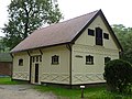
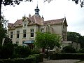
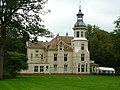
Nederlands: Landgoed in Ermelo met een villa uit 1908 en bijgebouwen; in beheer bij Natuurmonumenten.
|
This is a category about rijksmonumentcomplex number 523870
|
Hoofdgebouw:
|
This is a category about rijksmonument number 523871
|
Historische aanleg:
|
This is a category about rijksmonument number 523872
|
Koetshuis:
|
This is a category about rijksmonument number 523873
|
Tuinmanswoning:
|
This is a category about rijksmonument number 523874
|
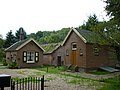
Boerderij met bakhuis:
|
This is a category about rijksmonument number 523875
|
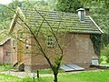
Wasgebouw:
|
This is a category about rijksmonument number 523876
|
Druivenkas:
|
This is a category about rijksmonument number 523877
|
Watertoren:
|
This is a category about rijksmonument number 523878
|
| Address |
|
Subcategories
This category has the following 3 subcategories, out of 3 total.
Media in category "Oud Groevenbeek, Ermelo"
The following 108 files are in this category, out of 108 total.
-
 20160622 Oud Groevenbeek1 Putten.jpg 5,184 × 3,456; 4 MB
-
 20160622 Oud Groevenbeek2 Putten.jpg 5,184 × 3,456; 4 MB
-
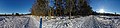
 Ermelo - Groevenbeekse Heide - Winter February 2021 24 - 360° Panorama.jpg 13,312 × 3,089; 48.89 MB
-
 Ermelo - Groevenbeekse Heide - Winter February 2021 26 - 360° Panorama.jpg 13,312 × 3,130; 51.76 MB
-
 Ermelo - Groevenbeekse Heide - Winter February 2021 27 - 360° Panorama.jpg 13,312 × 3,112; 51.47 MB
-
 Ermelo - Landgoed Oud Groevenbeek - Groevenbeeklaan - Winter February 2021 01.jpg 3,976 × 2,652; 7.25 MB
-
 Ermelo - Landgoed Oud Groevenbeek - Groevenbeeklaan - Winter February 2021 02.jpg 3,976 × 2,652; 7.85 MB
-
 Ermelo - Landgoed Oud Groevenbeek - Groevenbeeklaan - Winter February 2021 03.jpg 3,976 × 2,652; 6.53 MB
-
 Ermelo - Landgoed Oud Groevenbeek - Groevenbeeklaan - Winter February 2021 04.jpg 2,652 × 3,976; 7.37 MB
-

-
 Ermelo - Landgoed Oud Groevenbeek - Groevenbeeklaan - Winter February 2021 06.jpg 3,976 × 2,652; 6.09 MB
-
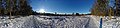
 Ermelo - Landgoed Oud Groevenbeek - Groevenbeeklaan - Winter February 2021 07 - 360° Panorama.jpg 13,312 × 3,094; 48.43 MB
-
 Ermelo - Landgoed Oud Groevenbeek - Groevenbeeklaan - Winter February 2021 08 - 360° Panorama.jpg 13,312 × 3,049; 47.79 MB
-
-
 Ermelo - Landgoed Oud Groevenbeek - Groevenbeeklaan - Winter February 2021 10 - 360° Panorama.jpg 12,800 × 2,979; 43.97 MB
-
 Ermelo - Landgoed Oud Groevenbeek - Groevenbeeklaan - Winter February 2021 11.jpg 3,976 × 2,652; 5.75 MB
-
 Ermelo - Landgoed Oud Groevenbeek - Groevenbeeklaan - Winter February 2021 12 - 360° Panorama.jpg 13,312 × 2,755; 47.29 MB
-
 Ermelo - Landgoed Oud Groevenbeek - Groevenbeeklaan - Winter February 2021 13 - 360° Panorama.jpg 13,312 × 2,692; 46.39 MB
-
 Ermelo - Landgoed Oud Groevenbeek - Groevenbeeklaan - Winter February 2021 14.jpg 3,976 × 2,652; 6.83 MB
-
 Ermelo - Landgoed Oud Groevenbeek - Groevenbeeklaan - Winter February 2021 15 - 360° Panorama.jpg 13,312 × 3,124; 52.38 MB
-
 Ermelo - Landgoed Oud Groevenbeek - Groevenbeeklaan - Winter February 2021 16 - 360° Panorama.jpg 13,312 × 3,052; 51.32 MB
-

-

-
-
-
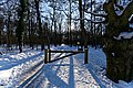
 Ermelo - Landgoed Oud Groevenbeek - Oud Groevenbeeklaan - Winter February 2021 21.jpg 3,976 × 2,652; 7.06 MB
-
 Ermelo - Landgoed Oud Groevenbeek - Oud Groevenbeeklaan - Winter February 2021 22.jpg 3,976 × 2,652; 7.74 MB
-
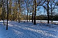
 Ermelo - Landgoed Oud Groevenbeek - Oud Groevenbeeklaan - Winter February 2021 23.jpg 3,976 × 2,652; 7.22 MB
-
 Ermelo - Oud - Groevenbeek-1.jpg 900 × 1,200; 318 KB
-
 Ermelo - Oud Groevenbeek -achterzijde - 2.jpg 4,272 × 2,848; 3.12 MB
-
 Ermelo - Oud Groevenbeek -achterzijde.jpg 2,848 × 4,272; 3.87 MB
-

-

-
 Exterieur OVERZICHT KAS - Ermelo - 20313751 - RCE.jpg 1,181 × 1,200; 385 KB
-
 Exterieur OVERZICHT KAS - Ermelo - 20313752 - RCE.jpg 1,200 × 1,200; 465 KB
-
 Exterieur OVERZICHT KAS - Ermelo - 20313753 - RCE.jpg 1,192 × 1,200; 447 KB
-
 Exterieur OVERZICHT PARK MET LANDHUIS - Ermelo - 20339659 - RCE.jpg 1,186 × 1,200; 477 KB
-
 Hoofdgebouw, gezicht op dakkapel en schoorsteen - Ermelo - 20375926 - RCE.jpg 1,200 × 1,200; 324 KB
-
 Hoofdgebouw, overzicht achtergevel - Ermelo - 20375918 - RCE.jpg 1,200 × 1,200; 366 KB
-
 Hoofdgebouw, overzicht achtergevel - Ermelo - 20375920 - RCE.jpg 1,200 × 1,200; 363 KB
-
 Hoofdgebouw, overzicht linker zijgevel - Ermelo - 20375911 - RCE.jpg 1,200 × 1,200; 307 KB
-
 Hoofdgebouw, overzicht vanuit tuin - Ermelo - 20375921 - RCE.jpg 1,200 × 1,200; 475 KB
-
 Hoofdgebouw, overzicht voorgevel - Ermelo - 20375917 - RCE.jpg 1,200 × 1,200; 333 KB
-
 Hoofdgebouw, overzicht zijgevel en achtergevel - Ermelo - 20375919 - RCE.jpg 1,200 × 1,200; 335 KB
-
 Hoofdgebouw, tegels boven raam, detail - Ermelo - 20375925 - RCE.jpg 1,200 × 1,200; 281 KB
-
 INTERIEUR, OVERZICHT WANDBESPANNING IN DE JACHTKAMER - Ermelo - 20303620 - RCE.jpg 1,194 × 1,200; 290 KB
-
 Interieur, paardenboxen in koetshuis, - Ermelo - 20375929 - RCE.jpg 1,200 × 1,200; 220 KB
-
 Interieur, voederbakken in koetshuis, - Ermelo - 20375930 - RCE.jpg 1,200 × 1,200; 220 KB
-
 Koetshuis, overzicht achtergevel - Ermelo - 20375922 - RCE.jpg 1,200 × 1,200; 439 KB
-
 Koetshuis, overzicht voorgevel - Ermelo - 20375912 - RCE.jpg 1,200 × 1,200; 391 KB
-
 Oud Groevenbeek (30445912833).jpg 4,000 × 3,000; 3.04 MB
-
 Oud Groevenbeek - 1.jpg 3,648 × 2,736; 4.79 MB
-
 Oud Groevenbeek - 10.jpg 3,648 × 2,736; 4.08 MB
-
 Oud Groevenbeek - 11.jpg 3,648 × 2,736; 4.7 MB
-
 Oud Groevenbeek - 12.jpg 3,648 × 2,736; 4.72 MB
-
 Oud Groevenbeek - 2.jpg 3,648 × 2,736; 4.86 MB
-
 Oud Groevenbeek - 3.jpg 3,648 × 2,736; 4.63 MB
-
 Oud Groevenbeek - 4.jpg 3,648 × 2,736; 5.13 MB
-
 Oud Groevenbeek - 5.jpg 3,648 × 2,736; 5.15 MB
-
 Oud Groevenbeek - 6.jpg 3,648 × 2,736; 4.96 MB
-
 Oud Groevenbeek - 9.jpg 3,648 × 2,736; 4.65 MB
-
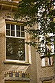
 Oud Groevenbeek, Ermelo 01.JPG 4,512 × 3,384; 10.07 MB
-
 Oud Groevenbeek, Ermelo 02.JPG 4,302 × 2,747; 10.02 MB
-
 Oud Groevenbeek-0001 - Landhuis Manor.jpg 1,024 × 683; 730 KB
-
 Oud Groevenbeek-0007 - Landhuis Manor.jpg 1,024 × 683; 625 KB
-
 Oud Groevenbeek-0010 - Landhuis Manor.jpg 683 × 1,024; 830 KB
-
 Oud Groevenbeek-0013 - Landhuis Manor Door.jpg 683 × 1,024; 709 KB
-
 Oud Groevenbeek-0014 - Landhuis Manor - Mailbox (detail).jpg 1,024 × 683; 649 KB
-
 Oud Groevenbeek-0015 - Landhuis Manor - Door knob (detail).jpg 683 × 1,024; 352 KB
-

-
 Oud Groevenbeek-0017 - Landhuis Manor - Original sink in toilet (detail).jpg 683 × 1,024; 748 KB
-
 Oud Groevenbeek-0018 - Landhuis Manor - Stairs.jpg 683 × 1,024; 417 KB
-

-
 Oud Groevenbeek-0024 - Landhuis Manor - Ceiling.jpg 683 × 1,024; 472 KB
-
 Oud Groevenbeek-0028 - Landhuis Manor - window crank (detail).jpg 683 × 1,024; 513 KB
-
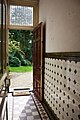
 Oud Groevenbeek-0034 - Landhuis Manor - garden view from inside.jpg 683 × 1,024; 557 KB
-
 Oud Groevenbeek-0042 - Landhuis Manor.jpg 1,024 × 683; 664 KB
-
 Oud Groevenbeek-0048 - Landhuis Manor - Window latch (detail).jpg 1,024 × 683; 423 KB
-
 Oud Groevenbeek-0052 - Landhuis Manor.jpg 683 × 1,024; 543 KB
-
 Oud Groevenbeek-0057 - Landhuis Manor.jpg 1,024 × 683; 828 KB
-
 Oud Groevenbeek-0059 - Landhuis Manor - Tiles (detail).jpg 1,024 × 683; 717 KB
-
 Oud Groevenbeek-0062 - Landhuis Manor.jpg 683 × 1,024; 503 KB
-
 Oud Groevenbeek-0063 - Landhuis Manor.jpg 683 × 1,024; 457 KB
-
 Oud Groevenbeek-0066 - Landhuis Manor - attic.jpg 1,024 × 683; 479 KB
-
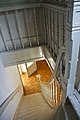 Oud Groevenbeek-0069 - Landhuis Manor - stairs.jpg 683 × 1,024; 544 KB
-
 Oud Groevenbeek-0070 - Landhuis Manor - kitchen.jpg 683 × 1,024; 626 KB
-
 Oud Groevenbeek-0072 - Landhuis Manor.jpg 683 × 1,024; 603 KB
-
 Oud Groevenbeek-0074 - Landhuis Manor - Stained glass.jpg 683 × 1,024; 570 KB
-
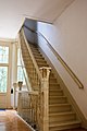 Oud Groevenbeek-0075 - Landhuis Manor - stairs.jpg 683 × 1,024; 569 KB
-
 Oud Groevenbeek-0076 - Landhuis Manor -stairs.jpg 683 × 1,024; 459 KB
-
 Oud Groevenbeek-0078 - Landhuis Manor.jpg 683 × 1,024; 656 KB
-
 Oud Groevenbeek-0082 - Landhuis Manor.jpg 1,024 × 683; 795 KB
-
 Oud Groevenbeek-0085 - Landhuis Manor.jpg 683 × 1,024; 615 KB
-
 Oud Groevenbeek-0088 - Landhuis Manor - window.jpg 683 × 1,024; 966 KB
-
 Oud Groevenbeek-0093 - Landhuis Manor.jpg 683 × 1,024; 737 KB
-
 Oud Groevenbeek-0100 - Landhuis Manor - window (detail).jpg 683 × 1,024; 739 KB
-
 Oud Groevenbeek-0101 - Landhuis Manor - window stained glass (detail).jpg 1,024 × 683; 735 KB
-
 Oud Groevenbeek-0102 - Landhuis Manor.jpg 1,024 × 683; 1.13 MB
-
 Oud Groevenbeek-0104 - Landhuis Manor - Back view.jpg 1,024 × 683; 935 KB
-
 Oud Groevenbeek-0107 - Landhuis Manor - Sundial in the garden.jpg 683 × 1,024; 587 KB
-
 Oud Groevenbeek-0117 - Landhuis Manor - Back view.jpg 1,024 × 683; 673 KB
-
 Oud Groevenbeek-0121 - Coach house.jpg 1,024 × 683; 885 KB
-
 Overzicht boerderij met bakhuis - Ermelo - 20375914 - RCE.jpg 1,200 × 1,200; 422 KB
-
 Overzicht kas - Ermelo - 20375913 - RCE.jpg 1,200 × 1,200; 433 KB
-
 Overzicht park met hoofdgebouw - Ermelo - 20375932 - RCE.jpg 1,200 × 1,200; 359 KB
-
 Overzicht park met kas - Ermelo - 20375931 - RCE.jpg 1,200 × 1,200; 486 KB
-
 Toren van hoofdgebouw - Ermelo - 20375924 - RCE.jpg 1,200 × 1,200; 164 KB
-
 Zonnewijzer - Ermelo - 20375923 - RCE.jpg 1,200 × 1,200; 386 KB


_-_Ermelo_-_20339657_-_RCE.jpg)


.jpg)


.jpg)
.jpg)

.jpg)

.jpg)

.jpg)


.jpg)


.jpg)


.jpg)
.jpg)


