Category:Oud Katholieke Kerk, Dordrecht
Jump to navigation
Jump to search
| Object location | | View all coordinates using: OpenStreetMap |
|---|
church in Dordrecht, Netherlands  | |||||
| Upload media | |||||
| Instance of | |||||
|---|---|---|---|---|---|
| Location | Dordrecht, South Holland, Netherlands | ||||
| Street address |
| ||||
| Located on street | |||||
| Architect | |||||
| Heritage designation |
| ||||
| Inception |
| ||||
| Religion or worldview | |||||
 | |||||
Nederlands: St Maria Maior - anno 1842
|
This is a category about rijksmonument number 13866
|
| Address |
|
Media in category "Oud Katholieke Kerk, Dordrecht"
The following 24 files are in this category, out of 24 total.
-
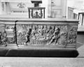
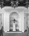
 Altaar - Dordrecht - 20061387 - RCE.jpg 955 × 1,200; 231 KB
-
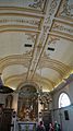
 Altaarruimte.jpg 934 × 1,344; 429 KB
-
 Bleijenhoek, 3311 Dordrecht, Netherlands - panoramio (12).jpg 1,148 × 2,048; 298 KB
-
 Bleijenhoek, 3311 Dordrecht, Netherlands - panoramio (13).jpg 2,048 × 1,148; 252 KB
-
 Bleijenhoek, 3311 Dordrecht, Netherlands - panoramio (14).jpg 2,048 × 1,148; 316 KB
-
 Bleijenhoek, 3311 Dordrecht, Netherlands - panoramio (15).jpg 2,048 × 1,148; 379 KB
-
 Bleijenhoek, 3311 Dordrecht, Netherlands - panoramio (16).jpg 1,148 × 2,048; 338 KB
-
 Bleijenhoek, 3311 Dordrecht, Netherlands - panoramio (18).jpg 2,048 × 1,148; 326 KB
-
 Bleijenhoek, 3311 Dordrecht, Netherlands - panoramio (7).jpg 1,148 × 2,048; 556 KB
-
 Buitenaanzicht.jpg 1,944 × 2,592; 1.76 MB
-
 Communiebank - Dordrecht - 20061390 - RCE.jpg 1,200 × 957; 256 KB
-
 Detail communiebank - Dordrecht - 20061391 - RCE.jpg 1,200 × 955; 228 KB
-
 Detail communiebank - Dordrecht - 20061392 - RCE.jpg 1,200 × 959; 272 KB
-
 Detail communiebank - Dordrecht - 20061393 - RCE.jpg 1,200 × 958; 243 KB
-
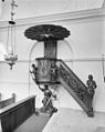
 Doopvont - Dordrecht - 20061394 - RCE.jpg 957 × 1,200; 193 KB
-
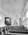 Interieur naar het altaar - Dordrecht - 20061385 - RCE.jpg 963 × 1,200; 171 KB
-
 Interieur naar het orgel - Dordrecht - 20061386 - RCE.jpg 950 × 1,200; 166 KB
-
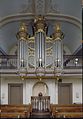 Interieur, aanzicht orgel, orgelnummer 370 - Dordrecht - 20369007 - RCE.jpg 836 × 1,200; 181 KB
-
 Preekstoel - Dordrecht - 20061388 - RCE.jpg 963 × 1,200; 190 KB
-
 Preekstoel - Dordrecht - 20061389 - RCE.jpg 955 × 1,200; 170 KB
-
 RM13866 Dordrecht - Voorstraat 120.jpg 1,944 × 2,592; 1.85 MB
-
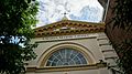
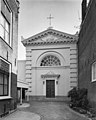 Voorgevel - Dordrecht - 20061383 - RCE.jpg 960 × 1,200; 225 KB
-
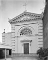 Voorgevel - Dordrecht - 20061384 - RCE.jpg 956 × 1,200; 182 KB
-
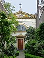
 Voorgevel met ingangspartij - Dordrecht - 20376940 - RCE.jpg 941 × 1,200; 272 KB


.jpg)
.jpg)
.jpg)
.jpg)
.jpg)
.jpg)
.jpg)


