Category:Oxford
Перайсці да навігацыі
Перайсці да пошуку
city in Oxfordshire, England      | |||||
| Запампаваць медыя | |||||
| Вымаўленне (гукавы файл) | |||||
|---|---|---|---|---|---|
| Гэта |
| ||||
| Святы-заступнік | |||||
| Месцазнаходжанне | Оксфард, Оксфардшыр, Паўднёва-Усходняя Англія, Англія | ||||
| Знаходзіцца на беразе вадаёма | |||||
| Дата заснавання / стварэння |
| ||||
| Ключавая падзея |
| ||||
| Колькасць насельніцтва |
| ||||
| Плошча |
| ||||
| Не блытаць з | |||||
| афіцыйны сайт | |||||
 | |||||
Падкатэгорыі
Паказаны 26 падкатэгорый з 26.
A
B
- Benchmarks in Oxford (345 F)
C
- Oxford City Council (9 F)
E
- Europe Business Assembly (6 F)
F
- Featured pictures of Oxford (23 F)
G
H
N
P
- Public footpaths in Oxford (30 F)
R
S
T
U
- Unidentified locations in Oxford (13 F)
V
W
~
Мультымедыя ў катэгорыі "Oxford"
У гэтай катэгорыі ёсць наступныя 200 файлаў з агульнага ліку 2 954.
(папярэдняя старонка) (наступная старонка)-
 Oxford Montage 2012.png 799 × 1 000; 1,25 MB
-
 A40 Elsfield Way - geograph.org.uk - 6236983.jpg 1 024 × 684; 263 KB
-
 A40 Elsfield Way - geograph.org.uk - 6236987.jpg 1 024 × 684; 286 KB
-
 A40 North Way heading west - geograph.org.uk - 6236973.jpg 1 024 × 684; 379 KB
-
 A40 Northern By-pass Road - geograph.org.uk - 6236975.jpg 1 024 × 684; 300 KB
-
 A40 Northern By-pass Road - geograph.org.uk - 6236976.jpg 1 024 × 684; 324 KB
-
 A4142 Eastern Bypass Road - geograph.org.uk - 6236963.jpg 1 024 × 684; 350 KB
-
 A4142 Eastern Bypass Road - geograph.org.uk - 6236964.jpg 1 024 × 684; 247 KB
-
 A4142 Eastern Bypass Road - geograph.org.uk - 6236967.jpg 1 024 × 684; 300 KB
-
 A4142 Eastern Bypass Road - geograph.org.uk - 6236968.jpg 1 024 × 684; 288 KB
-
 Banbury Road, Oxford - geograph.org.uk - 6273645.jpg 800 × 600; 160 KB
-
 Barclays Bank cheque - 1920.jpg 1 600 × 703; 324 KB
-
 Beech Road in Headington - geograph.org.uk - 6124175.jpg 2 700 × 2 025; 419 KB
-
 Bicycle parking, Oxford Railway Station - geograph.org.uk - 6271227.jpg 800 × 481; 116 KB
-
 Binsey Lane - bridge over Bulstake Stream - geograph.org.uk - 6270596.jpg 1 280 × 960; 531 KB
-
 Blankets in the bushes - geograph.org.uk - 1410417.jpg 640 × 480; 119 KB
-
 Blenheim Drive - geograph.org.uk - 5965782.jpg 1 024 × 681; 155 KB
-
 Bluebell on Warneford Meadow - geograph.org.uk - 6124098.jpg 2 025 × 2 700; 587 KB
-
 Boat and Cattle (35882736073).jpg 4 608 × 2 592; 1,75 MB
-
 Boundary Brook - geograph.org.uk - 5986355.jpg 2 025 × 2 700; 897 KB
-
 Boundary Brook - geograph.org.uk - 5986356.jpg 2 025 × 2 700; 829 KB
-
 Boundary Brook - geograph.org.uk - 5986367.jpg 2 025 × 2 700; 811 KB
-
 Boundary Brook - geograph.org.uk - 5986368.jpg 2 025 × 2 700; 729 KB
-
 Boundary Brook - geograph.org.uk - 6124126.jpg 2 025 × 2 700; 927 KB
-
 Boundary Brook by Warneford Meadow - geograph.org.uk - 6124093.jpg 2 025 × 2 700; 815 KB
-
 Boundary Brook near Lye Valley - geograph.org.uk - 5930469.jpg 2 025 × 2 700; 790 KB
-
 BP filling station - geograph.org.uk - 5944009.jpg 1 024 × 681; 110 KB
-
 Bridge to Port Meadow - geograph.org.uk - 5957729.jpg 1 024 × 681; 155 KB
-
 Broken charging point - geograph.org.uk - 5924750.jpg 4 000 × 3 000; 5,03 MB
-
 Built with cyclists in mind - geograph.org.uk - 3558165.jpg 640 × 424; 125 KB
-
 Bulstake Stream in Oxford - geograph.org.uk - 5703187.jpg 2 700 × 2 025; 962 KB
-
 Bulwark's Lane in Oxford - geograph.org.uk - 5102811.jpg 981 × 1 500; 266 KB
-
 Bulwarks Lane - geograph.org.uk - 4245115.jpg 1 024 × 683; 230 KB
-

-
 Bungalow on Woodlands Road, Headington - geograph.org.uk - 2483259.jpg 1 600 × 1 200; 605 KB
-
 Burners on - geograph.org.uk - 4525291.jpg 1 024 × 768; 100 KB
-
 Burners on the Balloon - geograph.org.uk - 4525289.jpg 1 024 × 768; 143 KB
-
 Bus in Home Close - geograph.org.uk - 5618194.jpg 640 × 426; 63 KB
-
 By the A44 - geograph.org.uk - 5944004.jpg 1 024 × 681; 231 KB
-
 By the A44 - geograph.org.uk - 5944008.jpg 1 024 × 681; 141 KB
-
 By the A44 - geograph.org.uk - 5965796.jpg 1 024 × 681; 126 KB
-
 By the River Thames - geograph.org.uk - 5515445.jpg 640 × 426; 90 KB
-
 Cafe on Botley Road, Oxford - geograph.org.uk - 6270507.jpg 800 × 514; 91 KB
-
 Campus Shops - geograph.org.uk - 5192839.jpg 1 024 × 768; 137 KB
-
 Canal, path and river - geograph.org.uk - 4043860.jpg 640 × 430; 100 KB
-
 Canalside camping in Oxford - geograph.org.uk - 4091279.jpg 800 × 733; 231 KB
-
 Canterbury Rd - geograph.org.uk - 4001579.jpg 640 × 430; 71 KB
-
 Canterbury Rd - geograph.org.uk - 5965762.jpg 1 024 × 681; 226 KB
-
 Car export wagons and a new mini. - geograph.org.uk - 5666646.jpg 5 202 × 3 465; 4,44 MB
-

-
 Cardigan Street at the junction of Albert Street - geograph.org.uk - 4836406.jpg 2 220 × 1 610; 1,07 MB
-
 Carlton and Wolsey Roads, Oxford - geograph.org.uk - 1985395.jpg 1 440 × 1 080; 959 KB
-
 Carlton Rd - geograph.org.uk - 4015143.jpg 640 × 455; 61 KB
-
 Caroline Street - geograph.org.uk - 3338084.jpg 640 × 480; 80 KB
-
 Castle Mill Stream Oxford - geograph.org.uk - 6096534.jpg 640 × 480; 100 KB
-
 Cat behind wall (1563308444).jpg 800 × 611; 81 KB
-
 Cat behind wall (2007 photo; cropped 2023).jpg 212 × 212; 17 KB
-
 Catherine Street, Oxford (1) - geograph.org.uk - 3941607.jpg 1 024 × 768; 135 KB
-
 Catherine Street, Oxford (2) - geograph.org.uk - 3941616.jpg 1 024 × 768; 123 KB
-
 Cattle grazing - geograph.org.uk - 5948348.jpg 1 024 × 681; 150 KB
-
 Cattle grazing, Port Meadow - geograph.org.uk - 5961743.jpg 1 024 × 681; 148 KB
-
 Cattle on Port Meadow - geograph.org.uk - 5957686.jpg 1 024 × 681; 155 KB
-
 Cattle on Port Meadow - geograph.org.uk - 5957696.jpg 1 024 × 681; 119 KB
-
 Cavell Rd - geograph.org.uk - 3953076.jpg 640 × 430; 69 KB
-
 CentreEudaimoniaTop.jpg 4 000 × 2 250; 9,41 MB
-
 Charlbury Rd - geograph.org.uk - 5923314.jpg 4 032 × 3 024; 3,39 MB
-
 Chatham Rd - geograph.org.uk - 5562562.jpg 640 × 426; 52 KB
-
 Checking out a Stall - geograph.org.uk - 4332822.jpg 1 024 × 768; 164 KB
-
 Checking the End - geograph.org.uk - 4520646.jpg 1 024 × 768; 113 KB
-

-
 Cherwell - New College Sports Ground - geograph.org.uk - 3312979.jpg 800 × 531; 131 KB
-
 Cherwell District , The A40 - geograph.org.uk - 4060753.jpg 3 903 × 2 592; 6,88 MB
-
 Cherwell Valley Line - geograph.org.uk - 5944062.jpg 1 024 × 681; 263 KB
-
 Cherwell Valley Line - geograph.org.uk - 5944066.jpg 1 024 × 681; 156 KB
-
 Cherwell Valley Line - geograph.org.uk - 5961749.jpg 1 024 × 681; 264 KB
-
 Cherwell Valley Line - geograph.org.uk - 5961750.jpg 1 024 × 650; 202 KB
-
 Chestnuts at night - geograph.org.uk - 4595142.jpg 1 624 × 1 090; 1,84 MB
-
 Children's play area in Cutteslowe Park - geograph.org.uk - 2356461.jpg 1 500 × 1 000; 306 KB
-
 Chimney at Warneford Hospital - geograph.org.uk - 3762137.jpg 683 × 1 024; 121 KB
-
 Christ Church College, Oxford - geograph.org.uk - 6272377.jpg 3 019 × 2 212; 1,84 MB
-
 Christ Church Library - geograph.org.uk - 6272829.jpg 2 048 × 1 536; 692 KB
-
 Christ Church School - geograph.org.uk - 2349668.jpg 640 × 480; 85 KB
-
 Christ Church War Memorial Garden - geograph.org.uk - 6270060.jpg 800 × 600; 150 KB
-
 Christchurch College - geograph.org.uk - 5930220.jpg 1 024 × 768; 321 KB
-
 Christchurch Old Buildings, Osney Lane - geograph.org.uk - 4242710.jpg 1 024 × 683; 180 KB
-
 Church Walk - geograph.org.uk - 5961804.jpg 1 024 × 681; 232 KB
-
 City Grounds - geograph.org.uk - 4059431.jpg 1 024 × 768; 199 KB
-
 City of Oxford boundary marker - geograph.org.uk - 2443921.jpg 3 000 × 4 000; 3,28 MB
-
 City of Oxford boundary marker - geograph.org.uk - 2444231.jpg 3 000 × 4 000; 4,44 MB
-
-
 Class 50 at Oxford, 1982 - geograph.org.uk - 3185479.jpg 639 × 392; 141 KB
-
 Claymond Road - geograph.org.uk - 4352820.jpg 640 × 480; 85 KB
-
 Clear and present danger - geograph.org.uk - 3558138.jpg 640 × 424; 162 KB
-
 Clearing land for houses - geograph.org.uk - 5147275.jpg 3 632 × 856; 2 MB
-
 College entrance on Dunstan Road, Headington - geograph.org.uk - 6274993.jpg 4 319 × 2 973; 3,87 MB
-
 Construction at Medical Sciences Campus - geograph.org.uk - 5360509.jpg 4 000 × 3 000; 4,84 MB
-
 Convent oxford started by Marian Hughes postcard.jpg 1 000 × 602; 93 KB
-
 Copse Lane - geograph.org.uk - 6273823.jpg 800 × 600; 143 KB
-
 Cornerstone Christian Centre - geograph.org.uk - 3968784.jpg 3 872 × 2 592; 1,56 MB
-
 Court Farm Road - geograph.org.uk - 2813232.jpg 1 600 × 947; 468 KB
-
 Cox's Alley and Gladstone Road - geograph.org.uk - 5762999.jpg 640 × 480; 98 KB
-
 Crane at Old Road Campus - geograph.org.uk - 5529543.jpg 4 000 × 3 000; 4,5 MB
-
 Crossroads on Tree Lane - geograph.org.uk - 3953061.jpg 640 × 372; 53 KB
-
 Crowds queue to visit Christchurch - geograph.org.uk - 5930213.jpg 1 024 × 768; 244 KB
-
 Crown St - geograph.org.uk - 3958944.jpg 640 × 430; 73 KB
-
 Cuckoo Lane in Headington - geograph.org.uk - 6124202.jpg 2 700 × 2 025; 908 KB
-
 Cuckoo Lane in Headington - geograph.org.uk - 6124266.jpg 2 025 × 2 700; 667 KB
-
 Cunliffe Close - geograph.org.uk - 4001686.jpg 640 × 430; 86 KB
-
 Cycle Lane, A4165 - geograph.org.uk - 3989866.jpg 640 × 430; 95 KB
-

-
 Cycle track and footpath by Hinksey Lake - geograph.org.uk - 5627391.jpg 2 700 × 2 025; 779 KB
-
 Cycle track under the Kennington Roundabout - geograph.org.uk - 6075161.jpg 2 700 × 2 009; 281 KB
-

-
 D'Overbroecke College - geograph.org.uk - 4001621.jpg 640 × 430; 81 KB
-
 D'Overbroecke College - geograph.org.uk - 4001650.jpg 640 × 430; 90 KB
-
 D'Overbroecke College - geograph.org.uk - 4001655.jpg 640 × 430; 84 KB
-
 Daisies beside the River Thames, Oxford - geograph.org.uk - 4510125.jpg 550 × 825; 274 KB
-
 Daisies beside the River Thames, Oxford - geograph.org.uk - 4510128.jpg 550 × 825; 269 KB
-
 Damage to building showing construction method - geograph.org.uk - 6031683.jpg 3 000 × 4 000; 3,8 MB
-
 David Cox.png 473 × 301; 155 KB
-
 Demolition for new housing - geograph.org.uk - 5147291.jpg 4 288 × 3 216; 2,4 MB
-
 Demolition of the former MFI and Halfords building - geograph.org.uk - 4424617.jpg 2 063 × 1 370; 1,37 MB
-
 Dene Road, Headington - geograph.org.uk - 6273909.jpg 800 × 600; 111 KB
-

-
 Distributary of the River Thames - geograph.org.uk - 5618184.jpg 640 × 426; 124 KB
-

-
 Disturbing the calm - geograph.org.uk - 3918716.jpg 768 × 1 024; 257 KB
-

-
 Duck Inspecting River Cherwell from Christ Church Meadow Walk (36623400333).jpg 6 000 × 4 000; 2,56 MB
-
 Duke Street - geograph.org.uk - 5856702.jpg 5 184 × 3 456; 5,06 MB
-
 Dunstan Park, Headington - geograph.org.uk - 6273831.jpg 800 × 600; 134 KB
-
 Dunstan Road - geograph.org.uk - 2434591.jpg 1 024 × 768; 257 KB
-
 Dunstan Road - geograph.org.uk - 2442285.jpg 1 024 × 768; 207 KB
-
 Dunstan road from the cemetery - geograph.org.uk - 2460580.jpg 1 024 × 768; 231 KB
-

-

-
 East Oxford Conservative Club - geograph.org.uk - 3313002.jpg 800 × 531; 106 KB
-
 East Oxford Health Centre - geograph.org.uk - 2146700.jpg 1 500 × 1 000; 147 KB
-
 Eastern Bypass Road - geograph.org.uk - 1090558.jpg 640 × 480; 59 KB
-
 Edgeway Road - geograph.org.uk - 5249048.jpg 640 × 427; 86 KB
-
 Electric Avenue, Osney - geograph.org.uk - 6217759.jpg 4 000 × 3 000; 4,65 MB
-
 Electrical Substation - geograph.org.uk - 4426223.jpg 4 288 × 2 416; 1,19 MB
-
 Electrical Substation - geograph.org.uk - 4426360.jpg 1 280 × 960; 205 KB
-
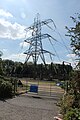 Electricity pylon, Osney Mead - geograph.org.uk - 5863663.jpg 3 456 × 5 184; 4,99 MB
-
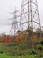 Electricity pylons in Kendal Copse - geograph.org.uk - 5613976.jpg 2 025 × 2 700; 632 KB
-
 Electricity sub station - geograph.org.uk - 4352789.jpg 640 × 480; 83 KB
-
 Electricity sub station, Nowell Road - geograph.org.uk - 3608993.jpg 480 × 640; 81 KB
-
-
 Electricity substation, Ferry Hinksey Road - geograph.org.uk - 5855922.jpg 5 184 × 3 456; 4,15 MB
-
 Electricity substation, Headley Way, Oxford - geograph.org.uk - 3672573.jpg 2 560 × 1 911; 2,32 MB
-
 Electricity substation, Osney Mead - geograph.org.uk - 5863670.jpg 3 456 × 5 184; 5,49 MB
-

-
 Elim Chapel, Helen Road - geograph.org.uk - 6217755.jpg 4 000 × 3 000; 4,51 MB
-
 Elim Church, Oxford - geograph.org.uk - 4211466.jpg 800 × 519; 119 KB
-
 Elizabeth II postbox on Old Road, New Headington - geograph.org.uk - 6275007.jpg 2 276 × 4 496; 3,34 MB
-
 Elizabeth Jennings Way - geograph.org.uk - 5965775.jpg 1 024 × 681; 131 KB
-
 Elizabeth Jennings Way Bridge - geograph.org.uk - 4028148.jpg 640 × 430; 81 KB
-
 Ellesmere Rd - geograph.org.uk - 3953062.jpg 640 × 430; 69 KB
-
 Ellesmere Road, Rose Hill - geograph.org.uk - 3871940.jpg 1 600 × 1 251; 466 KB
-
 Elmthorpe Road - geograph.org.uk - 4712031.jpg 1 280 × 960; 477 KB
-
 Elsfield Hall, the home of OPP - geograph.org.uk - 3223225.jpg 1 024 × 683; 166 KB
-
 Elsfield Way in Cutteslowe - geograph.org.uk - 2356445.jpg 1 500 × 1 000; 192 KB
-
 Elsfield Way waiting to get on the Cutteslowe Roundabout - geograph.org.uk - 3093011.jpg 1 600 × 1 200; 341 KB
-
 Elsfield Way, Cutteslowe - geograph.org.uk - 5544420.jpg 2 304 × 1 728; 1,24 MB
-

-
 End of row of houses on Church Way - geograph.org.uk - 3862882.jpg 691 × 1 024; 173 KB
-
 End of the Oxford Canal - geograph.org.uk - 4043862.jpg 640 × 430; 86 KB
-
 ENG Oxford Hilltop Road 07.jpg 4 032 × 3 024; 2,58 MB
-
 ENG Oxford Hilltop Road 08.jpg 4 032 × 3 024; 3,06 MB
-
 ENG Oxford Unidentified 05.jpg 4 032 × 3 024; 1,07 MB
-

-
 Entrance to Rushley Hall - geograph.org.uk - 2434617.jpg 1 024 × 768; 307 KB
-
 Entrance to the former Oxford Gaol - geograph.org.uk - 6171893.jpg 1 024 × 768; 282 KB
-

-
 ESSO filling Station - geograph.org.uk - 4052103.jpg 640 × 430; 57 KB
-

-
 Ethnic makeup of Oxford by single year ages.svg 3 467 × 2 303; 43 KB
-
 Europcar - Osney Mead - geograph.org.uk - 5863658.jpg 5 184 × 3 456; 4,17 MB
-

-
 Exercise Machines by the Track - geograph.org.uk - 5654581.jpg 3 567 × 2 592; 4,25 MB
-
 Fairlawn End - geograph.org.uk - 4015228.jpg 640 × 430; 69 KB
-
 Family of swans on the Oxford Canal - geograph.org.uk - 4527987.jpg 1 024 × 872; 289 KB
-
 Fan vaulted ceiling - geograph.org.uk - 6272721.jpg 2 048 × 1 536; 786 KB
-
 Farmhouse at Medley Manor Farm - geograph.org.uk - 5713184.jpg 680 × 1 024; 162 KB
-
 Fenced off site in the Oxpens - geograph.org.uk - 3323042.jpg 1 500 × 1 000; 164 KB
-
 Fenced-off boarded-up housing in Oxford - geograph.org.uk - 4089911.jpg 800 × 708; 231 KB
-
 Fencing at the school - geograph.org.uk - 2119343.jpg 1 024 × 768; 189 KB
-
 Ferry Hinksey Road - geograph.org.uk - 5855918.jpg 5 184 × 3 456; 4,15 MB
-
 Ferry Hinksey Road - geograph.org.uk - 5855925.jpg 5 184 × 3 456; 4,46 MB
-
 Ferry Hinksey Road - geograph.org.uk - 5855930.jpg 5 184 × 3 456; 4,04 MB
-

-
 First Methodist Meeting House - geograph.org.uk - 4318897.jpg 1 024 × 768; 162 KB
-
 First Turn - geograph.org.uk - 5965788.jpg 1 024 × 681; 162 KB
-
 Five Mile Drive - geograph.org.uk - 4275378.jpg 1 600 × 1 200; 847 KB
-
 Flame On - geograph.org.uk - 4520659.jpg 1 024 × 768; 164 KB
-
 Flats near recreation ground - geograph.org.uk - 6273815.jpg 800 × 600; 107 KB
-
 Flats on Binsey Lane - geograph.org.uk - 4865526.jpg 1 996 × 1 464; 749 KB
-
 Flats on the A40 London Road, Sandhills - geograph.org.uk - 4836099.jpg 2 236 × 1 632; 1 011 KB
-
 Flats on the corner of Jackson Road - geograph.org.uk - 4161673.jpg 3 872 × 2 592; 3,29 MB
-
 Flyers in Frewin Court - geograph.org.uk - 2427937.jpg 640 × 480; 104 KB


.jpg)


.jpg)
.jpg)
_-_geograph.org.uk_-_3941607.jpg)
_-_geograph.org.uk_-_3941616.jpg)


.jpg)


