Category:Peace River Regional District
跳转到导航
跳转到搜索
regional district in British Columbia, Canada   | |||||
| 上传媒体 | |||||
| 隶属于 |
| ||||
|---|---|---|---|---|---|
| 位置 | 不列颠哥伦比亚省, 加拿大 | ||||
| 人口 |
| ||||
| 面积 |
| ||||
| 官方网站 | |||||
 | |||||
子分类
本分类有以下23个子分类,共有23个子分类。
B
- Beatton Provincial Park (1 F)
- Beatton River (6 F)
C
D
F
H
- Hudson's Hope, British Columbia (16 F)
I
- Ingenika Airport (1 F)
K
- Kwadacha (3 F)
M
O
P
- Pine Pass (2 F)
R
- Rose Prairie (1 F)
S
T
分类“Peace River Regional District”中的媒体文件
以下19个文件属于本分类,共19个文件。
-
 6 Peace River Regional District British Columbia.svg 1,308 × 1,279;44.63 MB
-
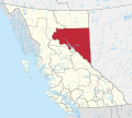 CAN BC Peace River Regional District locator.svg 1,944 × 1,737;1.47 MB
-
 Canola scene in Peace River Regional District, BC.jpg 4,608 × 2,304;2.15 MB
-
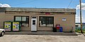 Cecil lake bc store.jpg 4,608 × 2,304;1.78 MB
-

-
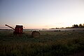 Foggy Field, Peace River RD, BC.jpg 4,752 × 3,162;3.59 MB
-
 Fort St John WV banner.jpg 17,593 × 2,525;4.41 MB
-
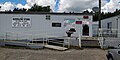 Goodlow bc store.jpg 4,608 × 2,304;2.12 MB
-
 Greg Kolodziejzyk.jpg 320 × 480;46 KB
-
 Jackfish Lake Rd., 12th June, 2017;1.jpg 2,062 × 1,796;865 KB
-
 Nabeshe River off Williston Lake - panoramio.jpg 1,600 × 1,200;914 KB
-
 Peace River & Northern Rockies WV banner.jpg 13,168 × 1,888;2.63 MB
-
 Peace River from South of Charlie Lake 1.jpg 16,977 × 2,513;4.71 MB
-
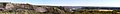 Peace River from Tea Creek.jpg 24,437 × 2,823;6.93 MB
-
 Peace River Valley on a cloudy day.jpg 5,184 × 3,888;8.29 MB
-
 Rain, Heat, Growth.jpg 3,876 × 2,423;6.79 MB
-
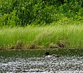
 Second photo of Watson Slough, Peace River, BC.jpg 4,608 × 3,072;1.74 MB
-
 Sundown on a field northeast of Fort St. John.jpg 2,522 × 1,892;3.24 MB
-
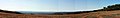
 The Peace River Valley, with the Rockies in the distance -a.jpg 4,746 × 1,067;1.27 MB


