Category:Perth and Kinross
Hopp til navigering
Hopp til søk
Council areas (municipalities) of Scotland: Aberdeen · Aberdeenshire · Angus · Argyll and Bute · Clackmannanshire · Dumfries and Galloway · Dundee · East Ayrshire · East Dunbartonshire · East Lothian · East Renfrewshire · Edinburgh · Falkirk · Fife · Glasgow · Highland · Inverclyde · Midlothian · Moray · North Ayrshire · North Lanarkshire · Outer Hebrides · Orkney Islands · Perth and Kinross · Renfrewshire · Scottish Borders · Shetland Islands · South Ayrshire · South Lanarkshire · Stirling · West Dunbartonshire · West Lothian

council area of Scotland    | |||||
| Last opp mediefiler | |||||
| Forekomst av |
| ||||
|---|---|---|---|---|---|
| Del av |
| ||||
| Plassering |
| ||||
| Hovedstad | |||||
| Folketall |
| ||||
| Areal |
| ||||
| offisielt nettsted | |||||
 | |||||

- Images relating to Perth and Kinross the council area in Scotland.
Underkategorier
Denne kategorien har følgende 35 underkategorier, av totalt 35.
*
A
- Aerial photographs of Perth and Kinross (25 filer)
- Atholl Highlanders (16 filer)
C
D
E
- Entrances in Perth and Kinross (2 filer)
G
H
I
M
N
O
P
- Panoramics of Perth and Kinross (4 filer)
- Post boxes in Perth and Kinross (11 filer)
R
S
T
- T in the Park (16 filer)
V
Filer i kategorien «Perth and Kinross»
Følgende 200 filer er i denne kategorien, av totalt 1 414.
(forrige side) (neste side)-
 853m top, Monadh Ghaig - geograph.org.uk - 1442548.jpg 640 × 359; 82 KB
-
-
 A boggy col north of Sròn Odhar - geograph.org.uk - 1442519.jpg 640 × 359; 84 KB
-
 A boggy col, Meall nan Aighean - geograph.org.uk - 1297053.jpg 640 × 359; 99 KB
-
 A Cut above the rest - geograph.org.uk - 1600984.jpg 640 × 427; 92 KB
-
 A flowery meadow bank on the North shore of the Tay - geograph.org.uk - 1942480.jpg 3 072 × 2 304; 4,15 MB
-
 A Frozen Allt Ghlinn Thaitneach - geograph.org.uk - 1734664.jpg 1 600 × 1 067; 297 KB
-
 A glimpse of the loch - geograph.org.uk - 4621232.jpg 800 × 600; 80 KB
-
 A Low Level Shee Water - geograph.org.uk - 1734742.jpg 1 600 × 1 067; 509 KB
-
 A pool in the stream - geograph.org.uk - 1125819.jpg 640 × 480; 90 KB
-
 A well-built cairn on Fiacail Mhòr - geograph.org.uk - 1364383.jpg 640 × 480; 77 KB
-

-
 A9 goes over the railway - geograph.org.uk - 1237140.jpg 640 × 349; 47 KB
-

-
 A9 waterfall - panoramio.jpg 1 350 × 898; 342 KB
-
 A9, Dalnacardoch - geograph.org.uk - 1266354.jpg 640 × 480; 81 KB
-
 A93 and house, looking north - geograph.org.uk - 1303067.jpg 640 × 480; 216 KB
-
 Aberdeenshire-Perthshire march - geograph.org.uk - 862443.jpg 640 × 480; 61 KB
-
 Aberfeldy to Dunkeld cycle route - geograph.org.uk - 86741.jpg 640 × 480; 107 KB
-
 Achalader ho.jpg 480 × 284; 77 KB
-
 Achalader House - panoramio.jpg 2 592 × 1 936; 2,89 MB
-

-
 Allt a' Bharnie - geograph.org.uk - 978512.jpg 640 × 359; 69 KB
-
 Allt a' Chire Mhòir - geograph.org.uk - 1382095.jpg 640 × 360; 69 KB
-
 Allt a' Choire Bhig - geograph.org.uk - 1382765.jpg 640 × 480; 104 KB
-
 Allt Connait - geograph.org.uk - 1311196.jpg 640 × 480; 103 KB
-
 Allt Druidhe - geograph.org.uk - 2604888.jpg 1 600 × 1 139; 469 KB
-
 Allt Eigeach - geograph.org.uk - 29134.jpg 640 × 421; 63 KB
-
 Allt na Moine Bàine - geograph.org.uk - 1769096.jpg 640 × 480; 115 KB
-
 Allt Uisgean - geograph.org.uk - 1381120.jpg 640 × 480; 110 KB
-
 An Dùn - geograph.org.uk - 2965765.jpg 640 × 480; 312 KB
-
 And they're off^ - geograph.org.uk - 689699.jpg 640 × 480; 123 KB
-
 Anglers at play - geograph.org.uk - 1892900.jpg 1 024 × 768; 165 KB
-
 Annat Burn - geograph.org.uk - 1892801.jpg 638 × 382; 321 KB
-
 Annaty burn in Scone Den - geograph.org.uk - 886107.jpg 640 × 480; 134 KB
-
 Approaching St Serf's Island - geograph.org.uk - 3977958.jpg 640 × 438; 233 KB
-
 Approaching the Summit of Birnam Hill - geograph.org.uk - 947285.jpg 640 × 437; 70 KB
-
 Arable land beside Loch Leven - geograph.org.uk - 1610626.jpg 640 × 480; 99 KB
-
 Arable land, Milnathort - geograph.org.uk - 1607556.jpg 640 × 480; 122 KB
-
 Arch to the pool - panoramio.jpg 4 608 × 3 072; 9,58 MB
-
 Ascending Goat Fell - Flickr - Graham Grinner Lewis.jpg 2 048 × 1 536; 586 KB
-
 At St Fillans 2 - geograph.org.uk - 4223667.jpg 5 937 × 3 958; 6,73 MB
-
 At the western shore of Loch Garry - geograph.org.uk - 6227819.jpg 1 600 × 900; 450 KB
-
 Auchingarrich Standing Stone - geograph.org.uk - 916301.jpg 640 × 480; 67 KB
-
 Autumn colours along Lady Mary's Walk - geograph.org.uk - 1029750.jpg 480 × 640; 162 KB
-
 Autumn colours at the Hermitage - geograph.org.uk - 1585706.jpg 640 × 427; 125 KB
-
 B 827 near Greenscares - geograph.org.uk - 910944.jpg 640 × 463; 106 KB
-
 B8062 - geograph.org.uk - 411192.jpg 640 × 480; 100 KB
-
 B827 Comrie to Braco road - geograph.org.uk - 882772.jpg 640 × 430; 88 KB
-
 B827, Looking south east towards Braco - geograph.org.uk - 909645.jpg 640 × 463; 129 KB
-
 Baldorran.jpg 1 280 × 513; 473 KB
-
 Bales, Dunkeld Park - geograph.org.uk - 1025919.jpg 640 × 480; 147 KB
-
 Balloglack Cottage - panoramio.jpg 3 264 × 2 448; 4,52 MB
-
 Barn At Kinkell Cottage - panoramio.jpg 1 256 × 858; 1,08 MB
-
 Barytes mine from Farragon Hill - geograph.org.uk - 406230.jpg 640 × 480; 64 KB
-
 Beach at Loch Laidon - geograph.org.uk - 4904082.jpg 800 × 600; 135 KB
-
 Bearded barley - geograph.org.uk - 886068.jpg 640 × 480; 62 KB
-
 Bedford Bridge, Glen Tilt - geograph.org.uk - 1121201.jpg 640 × 480; 123 KB
-
 Beech wood, Drummond Hill - geograph.org.uk - 2567323.jpg 640 × 480; 362 KB
-
 Beehives in the forest - geograph.org.uk - 1008863.jpg 640 × 331; 59 KB
-
 Beinn a ghlo 012.jpg 1 496 × 1 122; 329 KB
-
 Beinn a' Chuallaich - panoramio.jpg 2 560 × 1 920; 2,25 MB
-
 Beinn a'Chuallaich summit cairn - panoramio.jpg 2 560 × 1 920; 1,72 MB
-
 Beinn Dearg from near Beinn Bhreac - geograph.org.uk - 1300429.jpg 640 × 480; 92 KB
-
 Beinn Ghlas Summit - panoramio.jpg 1 680 × 1 116; 289 KB
-
-
 Beinn nan Eun, northwest ridge - geograph.org.uk - 1077319.jpg 640 × 480; 84 KB
-
 Below Bishop Hill - geograph.org.uk - 1609942.jpg 640 × 480; 103 KB
-
 Ben Vrackie and Loch a' Choire - geograph.org.uk - 1324940.jpg 640 × 360; 81 KB
-
 Beware soft verges on the B846 - geograph.org.uk - 1437849.jpg 640 × 499; 124 KB
-
 Big sand hill - geograph.org.uk - 1493531.jpg 640 × 480; 98 KB
-
 Birch woodland by Loch Leven cycle trail - geograph.org.uk - 1047562.jpg 640 × 360; 101 KB
-
 Birdfeeders And Birches - geograph.org.uk - 1638200.jpg 640 × 480; 164 KB
-
 Birds on a fence - geograph.org.uk - 2402969.jpg 3 000 × 4 000; 1,82 MB
-
 Birdwatching hide - geograph.org.uk - 3975307.jpg 640 × 464; 430 KB
-
 Black Spout Waterfall (5217921675).jpg 1 092 × 1 093; 207 KB
-
 Black Watch Memorial - geograph.org.uk - 1050202.jpg 640 × 480; 111 KB
-
 Black Water at Strone, Bridge of Cally - geograph.org.uk - 1011288.jpg 426 × 640; 163 KB
-
 Black Water Hall, Glen Shee - geograph.org.uk - 1033919.jpg 640 × 428; 101 KB
-
 Black Water, Dalruzion - geograph.org.uk - 1535226.jpg 640 × 480; 194 KB
-
 Black Water, Dalruzion - geograph.org.uk - 1535291.jpg 640 × 480; 193 KB
-
 Black-backed gull chick - geograph.org.uk - 4022445.jpg 640 × 461; 631 KB
-
 Blair Gardens - panoramio.jpg 1 617 × 1 129; 409 KB
-
 Bluewater aka Powmill Quarry.jpg 6 969 × 2 682; 6,86 MB
-
 Boathouse and Jetty, Talladh-a-Bheithe - geograph.org.uk - 1892652.jpg 640 × 480; 329 KB
-
 Boathouse, Dall - geograph.org.uk - 1892686.jpg 636 × 382; 253 KB
-
 Bog and Glas Coire - geograph.org.uk - 905062.jpg 640 × 359; 76 KB
-
 Bog wood on Sròn a' Chleirich - geograph.org.uk - 812486.jpg 640 × 480; 90 KB
-
 Bonhard House gardens - geograph.org.uk - 886114.jpg 480 × 640; 134 KB
-
 Bothy Allt Coire a' Chearcaill - geograph.org.uk - 118999.jpg 640 × 251; 46 KB
-
 Boulder, Loch Rannoch Shoreline - geograph.org.uk - 1894453.jpg 638 × 426; 333 KB
-
 Boulderand heather slope - geograph.org.uk - 484596.jpg 480 × 640; 133 KB
-

-
 Boulders in the bracken - geograph.org.uk - 1599339.jpg 640 × 498; 102 KB
-
 Boundary wall - geograph.org.uk - 611849.jpg 640 × 480; 146 KB
-
 Boundary Wall in Griffin Forest - geograph.org.uk - 429557.jpg 640 × 480; 122 KB
-
 Bracken overruns wall - geograph.org.uk - 1387883.jpg 613 × 640; 161 KB
-

-
 Bridge of Dillavaird - geograph.org.uk - 1386149.jpg 640 × 480; 112 KB
-
 Bridge of Dillavaird - geograph.org.uk - 1386154.jpg 480 × 640; 134 KB
-
 Bridge of Isla - geograph.org.uk - 816507.jpg 640 × 480; 39 KB
-
 Bridge over burn - geograph.org.uk - 1277744.jpg 640 × 480; 155 KB
-
 Bridge over the 'New' Leven Cut - geograph.org.uk - 1047678.jpg 640 × 360; 103 KB
-
 Bridge over the River Devon - geograph.org.uk - 1775526.jpg 640 × 480; 131 KB
-
 Brown hares - geograph.org.uk - 756218.jpg 640 × 480; 78 KB
-
 Bual a'Claidheimh - geograph.org.uk - 10458.jpg 640 × 480; 112 KB
-
 Burn running into Loch Garry - geograph.org.uk - 6013581.jpg 1 024 × 683; 375 KB
-
 Burn, Glen Lyon - geograph.org.uk - 2867613.jpg 640 × 360; 245 KB
-

-
 Cairn near Cordon Hill - geograph.org.uk - 1106100.jpg 640 × 480; 64 KB
-
 Cairn on shoulder of Ben Vuirich - geograph.org.uk - 845811.jpg 640 × 360; 61 KB
-
 Cam a' Choire Mòr - geograph.org.uk - 1382592.jpg 640 × 480; 109 KB
-
 Cam a' Choire Mòr - geograph.org.uk - 1596342.jpg 640 × 360; 60 KB
-
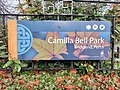 Camilla Bell Park in Perth.jpg 4 624 × 3 468; 4,17 MB
-

-
 Capercaillie at Dalerb - geograph.org.uk - 2171310.jpg 3 648 × 2 736; 5,22 MB
-
 Caravan park by the Loch - geograph.org.uk - 1983088.jpg 1 024 × 683; 152 KB
-
 Carey's Hole - geograph.org.uk - 2446157.jpg 1 600 × 1 074; 734 KB
-
 Carn an Fhidhleir - geograph.org.uk - 1054007.jpg 640 × 328; 53 KB
-
 Carnbo.jpg 3 072 × 2 304; 1,92 MB
-
 Carved Marker Post - geograph.org.uk - 1379137.jpg 480 × 640; 129 KB
-
 Castle Dow, Grandtully - panoramio.jpg 4 128 × 2 638; 6,9 MB
-

-
 Castlehill reservoir - panoramio (1).jpg 3 488 × 2 616; 2,16 MB
-
 Castlehill reservoir - panoramio.jpg 3 488 × 2 616; 2,16 MB
-
 Cattle grid, Amulree - Kenmore Road - geograph.org.uk - 1361722.jpg 640 × 480; 91 KB
-
 Cheese and mouse weathervane - geograph.org.uk - 522650.jpg 488 × 640; 56 KB
-
 Clearing in the reedbed - geograph.org.uk - 3455123.jpg 640 × 480; 474 KB
-
 CleavenDyke.jpg 1 728 × 1 867; 278 KB
-
 Cleish Hills ridge - geograph.org.uk - 1152960.jpg 640 × 427; 66 KB
-
 Cleuch Hill - geograph.org.uk - 801874.jpg 640 × 480; 81 KB
-
 Coastal Footpath on the North Bank of the Tay - geograph.org.uk - 1942420.jpg 3 072 × 2 304; 4,29 MB
-
 Coat of Arms of Perth and Kinross District Council 1975-1996.svg 1 095 × 748; 746 KB
-
 Coat of Arms of the Area Council of Perth and Kinross.svg 1 095 × 748; 738 KB
-
 Coire Chorse, a hanging valley - geograph.org.uk - 1472644.jpg 640 × 359; 83 KB
-
 Coire Dubh - geograph.org.uk - 1297033.jpg 640 × 480; 95 KB
-
 Coire Liath from the south - geograph.org.uk - 980447.jpg 640 × 480; 89 KB
-
 Coire Mhurcha - geograph.org.uk - 978509.jpg 640 × 359; 76 KB
-
-
 Col east of Creag an Sgliata - geograph.org.uk - 1558940.jpg 640 × 480; 93 KB
-
 Concrete Railway Viaduct - geograph.org.uk - 945319.jpg 640 × 480; 141 KB
-

-
-

-
 Core Hill towards Sauchanwood Hill - geograph.org.uk - 840747.jpg 640 × 480; 73 KB
-
 Cormorants on a spit of land in the Tay - geograph.org.uk - 2194259.jpg 1 600 × 1 600; 413 KB
-
 Corrugated shed. - geograph.org.uk - 1604240.jpg 640 × 427; 84 KB
-
 Corryvarkie Lodge, Loch Ericht - geograph.org.uk - 5495133.jpg 5 472 × 3 078; 6,98 MB
-
 Cottage in Butterstone - geograph.org.uk - 1768599.jpg 640 × 480; 151 KB
-
 County boundary fence - geograph.org.uk - 3141322.jpg 1 725 × 1 725; 1,57 MB
-
 Crag north of the Loch Ordie track - geograph.org.uk - 1004422.jpg 640 × 480; 79 KB
-
 Craggy viewpoint, Birnam Hill - geograph.org.uk - 1506089.jpg 640 × 480; 124 KB
-
 Craig a Barns - geograph.org.uk - 1025663.jpg 640 × 480; 125 KB
-
 Creag an Fheadain - geograph.org.uk - 1304031.jpg 640 × 480; 73 KB
-
 Creag Bheag - geograph.org.uk - 1575936.jpg 640 × 463; 77 KB
-

-
 Cricket pitch, The Cairnies - geograph.org.uk - 380260.jpg 640 × 480; 67 KB
-
 Croftmore - geograph.org.uk - 1046607.jpg 480 × 640; 82 KB
-
 Croftmore from the new road - geograph.org.uk - 1532925.jpg 640 × 480; 90 KB
-
 Cryptogamscape - Flickr - S. Rae.jpg 1 616 × 1 238; 830 KB
-
 Curved dry stone wall - geograph.org.uk - 1585622.jpg 480 × 640; 81 KB
-
 Daffodils, North Inch - geograph.org.uk - 1213053.jpg 640 × 480; 153 KB
-
 Dappled shade in Baluain Wood - geograph.org.uk - 1328569.jpg 640 × 480; 103 KB
-
 Deer on a hillside - geograph.org.uk - 478849.jpg 640 × 480; 77 KB
-
 Delivery, Loch Lyon - geograph.org.uk - 2862615.jpg 640 × 360; 251 KB
-
 Direction indicator above Blairgowrie - geograph.org.uk - 1533506.jpg 640 × 480; 170 KB
-
 Dirnanean Shepherd's House, Scotland.jpg 800 × 530; 173 KB
-
 Disused Kennel Building - geograph.org.uk - 380792.jpg 640 × 480; 100 KB
-

-
 Drumlins in Glen Shee - geograph.org.uk - 1502726.jpg 640 × 480; 86 KB
-
 Dry moorland, Meall nan Aighean - geograph.org.uk - 1303907.jpg 640 × 359; 87 KB
-

-
 Dry stone wall - geograph.org.uk - 1493889.jpg 480 × 640; 102 KB
-
 Dunmore - geograph.org.uk - 1602342.jpg 640 × 427; 54 KB
-
 Dunning's area on summer - panoramio.jpg 4 896 × 3 672; 7,42 MB
-
 Dusk at Loch Leven - geograph.org.uk - 3331970.jpg 640 × 463; 234 KB
-
 Dusk, Loch Leven - geograph.org.uk - 4753939.jpg 1 490 × 979; 1,47 MB
-

-
 Earn estuary - geograph.org.uk - 2243286.jpg 640 × 476; 75 KB
-
 East from Birnam Hill - geograph.org.uk - 1506075.jpg 480 × 640; 127 KB
-
 Easter Rattray arches - geograph.org.uk - 1593538.jpg 640 × 480; 140 KB
-
 Eastern side of Meall Corranaich - geograph.org.uk - 921639.jpg 640 × 480; 77 KB
-
 Easy On The Soda There - panoramio.jpg 1 501 × 997; 497 KB
-
 Ecology Field Trip - Vane Farm. - geograph.org.uk - 1559279.jpg 640 × 428; 45 KB
-
 Edge of Forest, Griffin - geograph.org.uk - 435368.jpg 640 × 480; 110 KB
-
 Edge of Loch Laidon - geograph.org.uk - 5372387.jpg 3 264 × 2 448; 3,38 MB
-
 Edradour Distillery - panoramio.jpg 4 272 × 2 848; 4,81 MB
-
 Eilean nam Faoileag - geograph.org.uk - 1892643.jpg 638 × 426; 255 KB
-
 Eilean nam Faoileag - geograph.org.uk - 1894440.jpg 480 × 640; 295 KB
-
 Eilean nam Faoileag - geograph.org.uk - 2054011.jpg 640 × 480; 177 KB
-
 Eilean nam Faoileag - geograph.org.uk - 2178534.jpg 1 500 × 981; 514 KB
-
 Eilean nam Faoileag, Loch Rannoch - geograph.org.uk - 4122023.jpg 1 024 × 681; 147 KB
-

-
 Electricity pylon near Loch Ordie - geograph.org.uk - 201975.jpg 480 × 640; 84 KB
-
 Entering Butterstone - geograph.org.uk - 1721406.jpg 640 × 485; 116 KB
-
 Entrance To Old Faskally - geograph.org.uk - 1638165.jpg 640 × 480; 153 KB
-
 Errol reedbeds and the Tay from Daleally - geograph.org.uk - 6245897.jpg 1 600 × 1 067; 640 KB
-
 Errol reedbeds at Daleally - geograph.org.uk - 6245729.jpg 1 600 × 900; 725 KB
-
 Errol reedbeds at Daleally - geograph.org.uk - 6245895.jpg 1 600 × 1 067; 1 017 KB
-
 Estate roads, Glen Daimh - geograph.org.uk - 1311182.jpg 640 × 480; 90 KB


.jpg)


.jpg)


