Category:Pfarrkirche Maria Hilf, Ebenthal
Jump to navigation
Jump to search
| Object location | | View all coordinates using: OpenStreetMap |
|---|
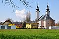
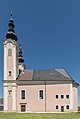
church building in Ebenthal, Austria  | |||||
| Upload media | |||||
| Instance of | |||||
|---|---|---|---|---|---|
| Named after | |||||
| Patron saint | |||||
| Location | Ebenthal in Kärnten, Klagenfurt-Land District, Carinthia, Austria | ||||
| Heritage designation | |||||
 | |||||
Media in category "Pfarrkirche Maria Hilf, Ebenthal"
The following 19 files are in this category, out of 19 total.
-
 Ebenthal Neuhausstrasse und Pfarrkirche Maria Hilf 14042010 83.jpg 2,848 × 4,288; 8.81 MB
-
 Ebenthal Pfarrkirche Maria Hilf 02022010 112.jpg 2,766 × 4,144; 1.58 MB
-
 Ebenthal Pfarrkirche Maria Hilf 13082015 6595.jpg 4,236 × 6,540; 7.49 MB
-
 Ebenthal Pfarrkirche Maria Hilf 15042010 53.jpg 2,832 × 2,832; 2.65 MB
-
 Ebenthal Pfarrkirche Maria Hilf 15042010 54.jpg 4,288 × 2,848; 7.77 MB
-
 Ebenthal Pfarrkirche Maria Hilf 15042010 56.jpg 2,832 × 4,256; 4.9 MB
-
 Ebenthal Pfarrkirche Maria Hilf Glockentuerme 13082015 6597.jpg 5,812 × 4,912; 5.9 MB
-
 Ebenthal Pfarrkirche Maria Hilf W-Ansicht 30122016 5944.jpg 3,889 × 6,628; 11.28 MB
-
 Ebenthal Pfarrkirche Maria Hilf West-Fassade 13082015 6596.jpg 7,092 × 4,765; 8.5 MB
-
 Ebenthal Pfarrkirche Maria Hilf Ost-Ansicht Apsis 30042016 1798.jpg 6,952 × 4,587; 21.16 MB
-
 Ebenthal Pfarrkirche Maria Hilf Ost-Ansicht Apsis 30042016 1799.jpg 5,062 × 3,816; 6.96 MB
-
 Ebenthal Pfarrkirche Maria Hilf SO-Ansicht 30042016 1803.jpg 3,401 × 6,374; 7.68 MB
-
 Ebenthal Pfarrkirche Maria Hilf Sued-Ansicht 30042016 1797.jpg 4,076 × 6,073; 8.19 MB
-
 Ebenthal Pfarrkirche Maria Hilf W-Portal 30122016 5945.jpg 4,710 × 7,116; 17.06 MB
-
 Ebenthal Pfarrkirche Maria Hilf West-Ansicht 30042016 1794.jpg 3,998 × 6,477; 15.52 MB
-
 Ebenthal Pfarrkirche Maria Hilf West-Portal 30042016 1796.jpg 4,700 × 6,940; 13.13 MB
-
 Kirche Ebenthal innen 01.jpg 4,294 × 3,289; 2.94 MB
-
 Kirche Ebenthal innen hinten.jpg 3,409 × 4,546; 2.94 MB
-
 Kirche Ebenthal innen hochkant.jpg 3,456 × 4,608; 3.77 MB


Categories:
- 18th-century architecture in Carinthia
- Baroque churches in Carinthia
- Churches in Ebenthal in Kärnten
- Churches in Dekanat Klagenfurt-Stadt
- Churches in the Roman Catholic Diocese of Gurk
- Cultural heritage monuments in Ebenthal in Kärnten
- Deanery Klagenfurt-Stadt
- Parish churches in Carinthia
- Pink buildings in Carinthia
- Saint Mary of Help churches in Carinthia
- Saints Peter and Paul churches in Carinthia