Category:Pfarrkirche Stoitzendorf
Jump to navigation
Jump to search
| Object location | | View all coordinates using: OpenStreetMap |
|---|
| This category shows the protected monument with the number 55879 in Austria. (Commons, de, Wikidata) |
church building in Lower Austria, Austria  | |||||
| Upload media | |||||
| Instance of | |||||
|---|---|---|---|---|---|
| Named after | |||||
| Location | Eggenburg, Horn District, Lower Austria, Austria | ||||
| Architectural style | |||||
| Diocese | |||||
| Heritage designation | |||||
 | |||||
Media in category "Pfarrkirche Stoitzendorf"
The following 13 files are in this category, out of 13 total.
-
 GuentherZ 2011-09-10 0394 Stoitzendorf Kirche.jpg 1,304 × 1,800; 918 KB
-
 GuentherZ 2011-09-10 0401 Stoitzendorf Kirche.jpg 1,800 × 1,643; 1.4 MB
-
 GuentherZ 2011-09-10 0402 Stoitzendorf Kirche Kriegerdenkmal.jpg 1,800 × 1,205; 1,011 KB
-
 Pfarrkirche Stoitzendorf Apsis.jpg 2,710 × 1,808; 2.98 MB
-
 Pfarrkirche Stoitzendorf Ausstattungsdetail.jpg 2,000 × 3,008; 3.45 MB
-
 Pfarrkirche Stoitzendorf Decke Detail.jpg 1,694 × 2,628; 2.9 MB
-
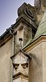 Pfarrkirche Stoitzendorf Fassadendetail.jpg 1,534 × 2,723; 2.7 MB
-
 Pfarrkirche Stoitzendorf Hochaltar.jpg 2,000 × 3,008; 3.99 MB
-
 Pfarrkirche Stoitzendorf Langhaus & Turm.jpg 1,414 × 2,285; 1.83 MB
-
 Pfarrkirche Stoitzendorf Langhausdecke.jpg 3,008 × 2,000; 4.15 MB
-
 Pfarrkirche Stoitzendorf Suedportal 1.jpg 1,766 × 2,700; 2.86 MB
-
 Pfarrkirche Stoitzendorf Suedportal.jpg 2,000 × 2,947; 3.52 MB
-
 Pfarrkirche Stoitzendorf Westansicht.jpg 1,595 × 2,495; 1.93 MB


