Category:Portvoller
Jump to navigation
Jump to search
village in the Outer Hebrides, Scotland, UK  | |||||
| Upload media | |||||
| Instance of | |||||
|---|---|---|---|---|---|
| Location |
| ||||
 | |||||
English: Portvoller (in Gaelic, Port Mholair) is a small village on the north tip of the Eye Peninsula (also known as Point), on the Isle of Lewis in northwestern Scotland. It is from the Outer Hebrides' only town, Stornoway.
Media in category "Portvoller"
The following 9 files are in this category, out of 9 total.
-

-
 Loch an t-Siumpain (geograph 2422617).jpg 640 × 424; 378 KB
-
 Loch an t-Siumpain - geograph.org.uk - 364266.jpg 640 × 427; 98 KB
-
 Near Port Mholair (geograph 2422770).jpg 640 × 421; 381 KB
-
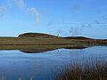 Reflections of Loch an t-Siumpain - geograph.org.uk - 918523.jpg 640 × 480; 53 KB
-
 Rocky shore near Port Mholair, Lewis - geograph.org.uk - 1525513.jpg 640 × 480; 75 KB
-
 The road to Tiumpan Head on the Eye Peninsula (geograph 4123816).jpg 640 × 480; 117 KB
-
 Tiumpan Head.jpg 4,000 × 3,000; 576 KB
-
 View over Loch an t-Siumpain - geograph.org.uk - 495770.jpg 640 × 415; 91 KB

.jpg)

.jpg)


.jpg)
