Category:Rail transport maps of Texas
Jump to navigation
Jump to search
States of the United States: Alaska · Arizona · California · Colorado · Connecticut · Delaware · Florida · Georgia · Idaho · Illinois · Indiana · Iowa · Kentucky · Maine · Maryland · Massachusetts · Michigan · Minnesota · Mississippi · Missouri · Nevada · New Hampshire · New Jersey · New Mexico · New York · North Dakota · Ohio · Oregon · Pennsylvania · Rhode Island · Texas · Utah · Vermont · Virginia · Washington · Wisconsin – Washington, D.C.
Subcategories
This category has only the following subcategory.
Media in category "Rail transport maps of Texas"
The following 18 files are in this category, out of 18 total.
-
 O. M. Roberts Texas Map No. 1 1881 UTA.jpg 3,277 × 2,824; 3.68 MB
-
 Cotton Belt Rail Line Map.svg 512 × 242; 133 KB
-
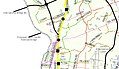
 Dallas-Fort Worth Rail.svg 2,060 × 1,440; 1.31 MB
-
 DARTRailMapInTrain.JPG 1,632 × 1,224; 571 KB
-
 HTC map 1867.png 552 × 476; 633 KB
-
 Laredo International Railway Bridge 2 map.JPG 951 × 550; 300 KB
-
 Marshall and East Texas Railway Map and Timetable.jpg 2,756 × 2,040; 2.23 MB
-
 Sectional Map of Texas Traversed by the Missouri, Kansas & Texas Railway 1904 UTA.jpg 2,688 × 2,577; 1.46 MB
-

-
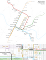 Project Connect Rail System Plan with Downtown Detail.png 2,550 × 3,300; 726 KB
-
 Railroad Commissioner's Map of Texas (27516493413).jpg 2,000 × 1,726; 909 KB
-
 Railroad Map of Texas East of the 100th Meridian.jpg 599 × 600; 138 KB
-
 Texas & Northern.svg 1,440 × 1,836; 1.89 MB
-
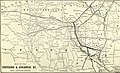 The Commercial and financial chronicle (1906) (14758913686).jpg 4,182 × 2,528; 1.3 MB
-
 'Texas New Yorker' Travelers' Railroad Map of the State of Texas 1872 UTA.jpg 6,778 × 9,481; 18.42 MB
-
 (Texas County Map with Route of the G.H.& S.A. Railway) 1876 UTA.jpg 2,931 × 1,599; 1.51 MB
-
 Correct Map of Texas...G.H.& S.A. Railway 1876 UTA.jpg 5,819 × 4,493; 4.94 MB
-
 International & Great Northern Railroad Correct Map of Texas 1878 UTA.jpg 2,688 × 4,063; 2.53 MB


.jpg)

.jpg)


_(14758913686).jpg)

_1876_UTA.jpg)

