Category:Rettendon
Jump to navigation
Jump to search
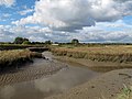
English: Rettendon is a small village in Essex, England about 8 miles to the South East of the county town Chelmsford, and approximately 3 miles roughly north of the nearby towns of Wickford and South Woodham Ferrers. It is situated near the River Crouch and borders the villages of Battlesbridge, South, West and East Hanningfield, Howe Green and Rettendon Common. The village was once owned by the Bishop of Ely, Cambridge, UK.
village and civil parish in Essex, England, UK  | |||||
| Upload media | |||||
| Instance of | |||||
|---|---|---|---|---|---|
| Location | Chelmsford, Essex, East of England, England | ||||
 | |||||
Subcategories
This category has the following 3 subcategories, out of 3 total.
C
- Coalhill (3 F)
R
- All Saints Church, Rettendon (26 F)
Media in category "Rettendon"
The following 200 files are in this category, out of 340 total.
(previous page) (next page)-
 "The Faithful birds" - geograph.org.uk - 2438443.jpg 480 × 640; 95 KB
-
 A barn at White House Farm - geograph.org.uk - 762084.jpg 640 × 451; 58 KB
-
 A Landscaped Footpath - geograph.org.uk - 3594291.jpg 424 × 640; 103 KB
-
 A Pair of Pillboxes - geograph.org.uk - 751210.jpg 640 × 426; 64 KB
-

-
 A yard at Battlesbridge Antiques Centre - geograph.org.uk - 5719303.jpg 640 × 480; 119 KB
-
 A130 crosses South Hanningfield Road - geograph.org.uk - 3872211.jpg 640 × 480; 110 KB
-
 A130 crossing the River Crouch - geograph.org.uk - 3260925.jpg 640 × 389; 46 KB
-
 A130 southbound - geograph.org.uk - 3260917.jpg 640 × 430; 43 KB
-
 A130 southbound - geograph.org.uk - 3260921.jpg 640 × 430; 50 KB
-
 A130, Rettendon Turnpike - geograph.org.uk - 4971087.jpg 640 × 212; 20 KB
-
 A132 - geograph.org.uk - 3170005.jpg 640 × 430; 28 KB
-
 A132 - geograph.org.uk - 3170024.jpg 640 × 430; 44 KB
-
 A132 near the Rettendon Turnpike - geograph.org.uk - 3169988.jpg 640 × 430; 39 KB
-
 A132, Rettendon Turnpike - geograph.org.uk - 3169993.jpg 640 × 430; 35 KB
-
 A132, westbound - geograph.org.uk - 3170031.jpg 640 × 430; 45 KB
-
 Across the Crouch - geograph.org.uk - 3539075.jpg 424 × 640; 71 KB
-
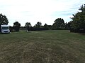
 AFC Woodham - geograph.org.uk - 3594273.jpg 640 × 424; 58 KB
-
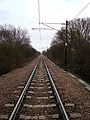
 Aircraft on the wires - geograph.org.uk - 5872401.jpg 4,608 × 3,456; 3.54 MB
-
 All Saints Church at Rettenden - geograph.org.uk - 4547220.jpg 4,000 × 3,000; 2.48 MB
-
 All Saints Footpath - geograph.org.uk - 2195324.jpg 2,000 × 1,500; 2.09 MB
-
 Allotments near Woodham Road - geograph.org.uk - 2677445.jpg 1,000 × 618; 432 KB
-
 An Essex View - geograph.org.uk - 2812037.jpg 1,600 × 1,200; 519 KB
-

-
 Antiques, antiques - geograph.org.uk - 4224728.jpg 1,024 × 762; 260 KB
-
 Arable field with pylons - geograph.org.uk - 3179094.jpg 2,804 × 1,733; 1.4 MB
-
 Artichoke, Hyde Hall, RHS Garden, Essex - geograph.org.uk - 4102818.jpg 1,024 × 768; 1,007 KB
-
 Artichoke, Hyde Hall, RHS Garden, Essex - geograph.org.uk - 4102820.jpg 768 × 1,024; 1.1 MB
-
 Australian Garden, Hyde Hall, Essex - geograph.org.uk - 4103848.jpg 1,024 × 683; 840 KB
-
 Australian Garden, Hyde Hall, Essex - geograph.org.uk - 4103850.jpg 683 × 1,024; 1.01 MB
-
 Autumn hedgerow - geograph.org.uk - 2677038.jpg 3,648 × 2,255; 3.18 MB
-
 Battles Bridge - geograph.org.uk - 5870084.jpg 4,608 × 3,456; 4.03 MB
-
 Battles Bridge ^ River Crouch - geograph.org.uk - 5406887.jpg 4,608 × 3,072; 1.85 MB
-
 Battles Bridge, Battlesbridge - geograph.org.uk - 5719355.jpg 640 × 480; 135 KB
-
 Battlesbridge Antique ^ Crafts Centre - geograph.org.uk - 5406914.jpg 4,608 × 3,072; 1.97 MB
-
 Battlesbridge Events sign - geograph.org.uk - 5870922.jpg 4,608 × 3,456; 4.08 MB
-
 Battlesbridge Free Church - geograph.org.uk - 4224725.jpg 955 × 1,024; 167 KB
-
 Battlesbridge Free Church - geograph.org.uk - 5407247.jpg 4,608 × 3,072; 1.9 MB
-
 Battlesbridge Free Church - geograph.org.uk - 5870013.jpg 4,608 × 3,456; 3.92 MB
-
 Battlesbridge Free Church - geograph.org.uk - 5870985.jpg 4,608 × 3,456; 3.73 MB
-
 Battlesbridge Free Church Hall - geograph.org.uk - 4827496.jpg 1,494 × 1,766; 1.01 MB
-
 Battlesbridge Free Church Hall - geograph.org.uk - 5407229.jpg 4,608 × 3,072; 1.95 MB
-
 Battlesbridge Free Church Hall - geograph.org.uk - 5407241.jpg 4,608 × 3,072; 2.04 MB
-
 Battlesbridge Free Church Hall - geograph.org.uk - 5870982.jpg 4,608 × 3,456; 3.88 MB
-
 Battlesbridge Free Church Hall sign - geograph.org.uk - 5407239.jpg 4,608 × 3,072; 1.72 MB
-
 Battlesbridge Free Church Notice Board - geograph.org.uk - 5869873.jpg 2,986 × 3,981; 5.2 MB
-
 Battlesbridge Harbour - geograph.org.uk - 2152994.jpg 1,024 × 768; 143 KB
-
 Battlesbridge Harbour - geograph.org.uk - 3534495.jpg 3,264 × 2,448; 1.4 MB
-
 Battlesbridge Harbour - geograph.org.uk - 5406882.jpg 4,608 × 3,072; 1.88 MB
-
 Battlesbridge in TQ7794 - geograph.org.uk - 2127223.jpg 881 × 1,024; 287 KB
-
 Battlesbridge in TQ7894 - geograph.org.uk - 2127219.jpg 721 × 1,024; 235 KB
-
 Battlesbridge Mill - geograph.org.uk - 3260894.jpg 640 × 430; 42 KB
-
 Battlesbridge Station - geograph.org.uk - 3916179.jpg 800 × 493; 92 KB
-
 Battlesbridge Tide Mill - geograph.org.uk - 5716592.jpg 640 × 480; 108 KB
-
 Battlesbridge Village Pond - geograph.org.uk - 5871035.jpg 4,608 × 3,456; 4.14 MB
-
 Battlesbridge Village Pond - geograph.org.uk - 5871261.jpg 4,608 × 3,456; 4 MB
-
 Battlesbridge Village Pond - geograph.org.uk - 5872380.jpg 4,608 × 3,456; 3.84 MB
-
 Battlesbridge Village Pond - geograph.org.uk - 5872406.jpg 4,608 × 3,456; 4.01 MB
-
 Bethel Tabernacle, South Hanningfield Road - geograph.org.uk - 5095361.jpg 1,487 × 1,600; 577 KB
-
 Boats, Battlesbridge - geograph.org.uk - 5719301.jpg 640 × 480; 122 KB
-
 Bones Lane Antique Centre sign - geograph.org.uk - 5871343.jpg 2,905 × 3,873; 4.78 MB
-
 Bones Lane Antiques Centre - geograph.org.uk - 3539130.jpg 424 × 640; 73 KB
-
 Brick Pill Box - geograph.org.uk - 776751.jpg 640 × 426; 87 KB
-
 Bridleway Border - geograph.org.uk - 2812054.jpg 1,600 × 1,200; 593 KB
-
 Bridleway off Buckhatch Lane - geograph.org.uk - 2467204.jpg 640 × 480; 194 KB
-
 Bridleway to Chalk Street - geograph.org.uk - 3209914.jpg 3,648 × 2,736; 4.81 MB
-
 Bromley Lodge - geograph.org.uk - 1142272.jpg 640 × 480; 46 KB
-
 Bus Shelter on Hawk Hill - geograph.org.uk - 5869890.jpg 4,608 × 3,456; 3.82 MB
-
 Bus Shelter on Hawk Hill - geograph.org.uk - 5871023.jpg 3,842 × 2,881; 4.24 MB
-
 Bus Shelters, near Rettendon Turnpike - geograph.org.uk - 2460570.jpg 640 × 480; 205 KB
-
 Bus stop, Battlesbridge - geograph.org.uk - 3260901.jpg 640 × 430; 47 KB
-
 Church Chase - geograph.org.uk - 2195368.jpg 1,500 × 2,000; 2.57 MB
-
 Church Chase entrance and village sign - geograph.org.uk - 2467081.jpg 640 × 480; 220 KB
-
 Churchgate Lakes - geograph.org.uk - 1987046.jpg 3,008 × 2,000; 1.44 MB
-
 Clematis in Walled Garden, Hyde Hall, Essex - geograph.org.uk - 4103827.jpg 1,024 × 683; 570 KB
-

-

-
 Creek Junction - geograph.org.uk - 3178448.jpg 3,648 × 2,736; 2.32 MB
-
 Cromwell House Antique ^ Crafts Centre - geograph.org.uk - 5871081.jpg 4,608 × 3,456; 3.85 MB
-
 Cromwell House sign - geograph.org.uk - 5870976.jpg 3,918 × 2,939; 4.92 MB
-
 Crouch view - geograph.org.uk - 2141565.jpg 1,024 × 768; 119 KB
-
 Crouch ^ Battlesbridge Harbour - geograph.org.uk - 3539082.jpg 640 × 424; 66 KB
-
 Curry Hill - geograph.org.uk - 2807849.jpg 1,600 × 1,162; 269 KB
-
 Don't touch - geograph.org.uk - 2141505.jpg 768 × 1,024; 152 KB
-
 Downhill Path - geograph.org.uk - 2808075.jpg 1,600 × 1,200; 558 KB
-
 Dragon in the Wood, Hyde Hall, Essex - geograph.org.uk - 4103519.jpg 1,024 × 683; 995 KB
-
 East towards Battlesbridge - geograph.org.uk - 1718879.jpg 1,980 × 2,640; 1.06 MB
-
 Electricity Pylon off Maltings Road - geograph.org.uk - 5869822.jpg 2,867 × 3,822; 3.47 MB
-
 Electricity Pylon off Maltings Road - geograph.org.uk - 5872403.jpg 2,944 × 3,926; 3.13 MB
-
 Entrance off Maltings Road - geograph.org.uk - 5869829.jpg 4,608 × 3,456; 3.84 MB
-
 Entrance to Muggeridge Farm - geograph.org.uk - 5869842.jpg 4,608 × 3,456; 4.1 MB
-
 Entrance to Oak Tree Farm - geograph.org.uk - 4143951.jpg 1,600 × 1,064; 504 KB
-
 Entrance to the fishing pond - geograph.org.uk - 5871015.jpg 3,000 × 4,000; 5.52 MB
-
 Essex Farmland - geograph.org.uk - 2812043.jpg 1,600 × 1,200; 346 KB
-
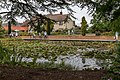
 Farm Pond - geograph.org.uk - 2196400.jpg 2,000 × 1,500; 2.25 MB
-
 Farmland view - geograph.org.uk - 2253877.jpg 2,000 × 1,500; 1.94 MB
-
 Farmland view - geograph.org.uk - 2254140.jpg 2,000 × 1,500; 2.11 MB
-
 Farmland view - geograph.org.uk - 2812065.jpg 1,600 × 1,200; 712 KB
-
 Farmyard Pillbox - geograph.org.uk - 2642474.jpg 3,008 × 2,000; 2.98 MB
-
 Fibre Cabinet on Maltings Road - geograph.org.uk - 5871148.jpg 2,944 × 3,926; 5.38 MB
-
 Field at Muggeridge Farm - geograph.org.uk - 5870955.jpg 4,000 × 3,000; 3.62 MB
-
 Field at Muggeridge Farm - geograph.org.uk - 5870958.jpg 4,608 × 3,456; 4.02 MB
-

-
 Floodgate ^ weir on the River Crouch - geograph.org.uk - 5406916.jpg 4,608 × 3,072; 1.85 MB
-

-
 Footpath junction - geograph.org.uk - 1987099.jpg 2,000 × 3,008; 1.47 MB
-
 Footpath oaks - geograph.org.uk - 1987054.jpg 2,000 × 3,008; 1.28 MB
-
 Footpath past hedgerow - geograph.org.uk - 2677048.jpg 3,441 × 2,127; 3.31 MB
-
 Footpath signpost off Maltings Road - geograph.org.uk - 5871068.jpg 3,000 × 4,000; 4.92 MB
-
 Footpath to Stacey's Farm - geograph.org.uk - 2935018.jpg 1,556 × 2,340; 1.49 MB
-
 Footpath to the A132 Burnham Road - geograph.org.uk - 5871064.jpg 3,000 × 4,000; 4.62 MB
-
 Footpath to the A132 Burnham Road - geograph.org.uk - 5871360.jpg 3,000 × 4,000; 6.75 MB
-
 Footpath to Woodham Road - geograph.org.uk - 3178384.jpg 3,648 × 2,736; 4.5 MB
-
 Footpath view - geograph.org.uk - 2195309.jpg 2,000 × 1,500; 2.44 MB
-

-
 Frasers Guest House sign - geograph.org.uk - 5870968.jpg 4,608 × 3,456; 4.07 MB
-
 Frasers Guest House, Battlesbridge - geograph.org.uk - 5870964.jpg 4,608 × 3,456; 4.09 MB
-
 Gardens at RHS Hyde Hall - geograph.org.uk - 2438455.jpg 640 × 480; 101 KB
-
 Ghost Koi in Lily Pond, Hyde Hall, Essex - geograph.org.uk - 4103103.jpg 1,024 × 683; 567 KB
-
 Ghost Koi in Lily Pond, Hyde Hall, Essex - geograph.org.uk - 4103104.jpg 1,024 × 683; 618 KB
-
 Ghost Koi in Lily Pond, Hyde Hall, Essex - geograph.org.uk - 4103105.jpg 683 × 1,024; 1.01 MB
-
 Great Coopers, Battlesbridge - geograph.org.uk - 5871100.jpg 3,866 × 2,900; 5.18 MB
-
 Gum tree at Hyde Hall - geograph.org.uk - 2438598.jpg 640 × 480; 126 KB
-
 Gun Position - geograph.org.uk - 751191.jpg 640 × 438; 110 KB
-
 Hanningfield View - geograph.org.uk - 2250918.jpg 1,494 × 2,000; 1.82 MB
-
 Hawk Hill - geograph.org.uk - 2152999.jpg 803 × 1,024; 159 KB
-
 Hawk Hill - geograph.org.uk - 3170087.jpg 640 × 430; 51 KB
-
 Hawk Hill and Rusting Relic - geograph.org.uk - 3539144.jpg 640 × 424; 97 KB
-
 Hawk Hill Bridge - geograph.org.uk - 3534420.jpg 3,264 × 2,448; 2.09 MB
-
 Hawk Hill Copse - geograph.org.uk - 2221149.jpg 2,000 × 1,500; 1.95 MB
-
 Hawk Hill Roundabout - geograph.org.uk - 3170050.jpg 640 × 384; 36 KB
-
 Hawk Hill ^ Battles Bridge - geograph.org.uk - 5406894.jpg 4,608 × 3,072; 1.56 MB
-
 Hawk Hill, Battlebridge - geograph.org.uk - 3170060.jpg 640 × 430; 61 KB
-
 Hawk Hill, Battlesbridge - geograph.org.uk - 4828216.jpg 2,087 × 1,746; 1.58 MB
-
 Hawk Hill, Battlesbridge - geograph.org.uk - 4828241.jpg 1,891 × 1,624; 972 KB
-
 Hawk Hill, Battlesbridge - geograph.org.uk - 4828250.jpg 1,816 × 1,716; 1.47 MB
-
 Hawk Hill, Battlesbridge - geograph.org.uk - 5406891.jpg 4,608 × 3,072; 1.84 MB
-
 Hawk Hill, Battlesbridge - geograph.org.uk - 5407373.jpg 4,608 × 3,072; 2 MB
-
 Hawk Hill, Battlesbridge - geograph.org.uk - 5407384.jpg 4,608 × 3,072; 1.94 MB
-
 Hawk Hill, Battlesbridge - geograph.org.uk - 5407385.jpg 4,608 × 3,072; 1.9 MB
-
 Hawk Hill, Battlesbridge - geograph.org.uk - 5869880.jpg 4,608 × 3,456; 3.77 MB
-
 Hawk Hill, Battlesbridge - geograph.org.uk - 5869913.jpg 4,608 × 3,456; 4.29 MB
-
 Hawk Lane Postbox - geograph.org.uk - 5870139.jpg 4,608 × 3,456; 3.8 MB
-
 Hawk Lane Postbox - geograph.org.uk - 5870153.jpg 4,608 × 3,456; 4 MB
-
 Hawk Lane Postbox - geograph.org.uk - 5871050.jpg 3,884 × 2,984; 6.55 MB
-
 Hawk Lane Postbox - geograph.org.uk - 5872366.jpg 2,944 × 3,926; 5.78 MB
-
 Hayes Farm Caravan Park - geograph.org.uk - 2141542.jpg 1,024 × 682; 165 KB
-
 Hayes Farm Caravan Park - geograph.org.uk - 2825066.jpg 1,600 × 1,200; 370 KB
-
 Hidden Pillbox - geograph.org.uk - 2221169.jpg 2,000 × 1,613; 2.86 MB
-
 Hidden Reservoir - geograph.org.uk - 2250931.jpg 2,000 × 1,500; 1.65 MB
-
 High and Dry - geograph.org.uk - 2141490.jpg 1,024 × 768; 116 KB
-

-
 Hoe Bridge - geograph.org.uk - 2254177.jpg 2,000 × 1,500; 1.58 MB
-
 Hoe Lane - geograph.org.uk - 2254179.jpg 2,000 × 1,500; 2.16 MB
-
 Hoe Lane, Rettendon - geograph.org.uk - 5716659.jpg 640 × 428; 99 KB
-
 House entrance off Maltings Road - geograph.org.uk - 5871238.jpg 3,000 × 4,000; 7.32 MB
-
 Houses, Main Road, Rettendon - geograph.org.uk - 5716648.jpg 640 × 428; 91 KB
-
 Hyde Hall Gardens - geograph.org.uk - 4933220.jpg 1,600 × 1,064; 356 KB
-
 Hyde Hall, RHS Garden, Essex - geograph.org.uk - 4102788.jpg 1,024 × 768; 1,017 KB
-
 Hyde Hall, RHS Garden, Essex - geograph.org.uk - 4102790.jpg 1,024 × 768; 1.14 MB
-
 Hyde Hall, RHS Garden, Essex - geograph.org.uk - 4102791.jpg 768 × 1,024; 1.31 MB
-
 Hyde Hall, RHS Garden, Essex - geograph.org.uk - 4102794.jpg 768 × 1,024; 1.44 MB
-
 Hyde Hall, RHS Garden, Essex - geograph.org.uk - 4102795.jpg 1,024 × 768; 1.03 MB
-
 Hyde Hall, RHS Garden, Essex - geograph.org.uk - 4102796.jpg 1,024 × 768; 1.23 MB
-
 Hyde Hall, RHS Garden, Essex - geograph.org.uk - 4102807.jpg 768 × 1,024; 1,017 KB
-
 Hyde Hall, RHS Garden, Essex - geograph.org.uk - 4102808.jpg 1,024 × 768; 1.03 MB
-
 Hyde Hall, RHS Garden, Essex - geograph.org.uk - 4102809.jpg 1,024 × 768; 989 KB
-
 Ilgar's Bridleway - geograph.org.uk - 2812048.jpg 1,600 × 1,200; 756 KB
-
 Ilgar's Farmland - geograph.org.uk - 2812060.jpg 1,600 × 1,200; 519 KB
-

-

-

-

-

-
 Joining the A130 - geograph.org.uk - 3260912.jpg 640 × 430; 50 KB
-
 Junction for the A130 on Runwell Road - geograph.org.uk - 3003170.jpg 1,600 × 1,200; 626 KB
-
 Junction of Runwell Road and the A130 - geograph.org.uk - 3003171.jpg 1,600 × 1,200; 558 KB
-
 Lazybones bootsale - geograph.org.uk - 1263592.jpg 640 × 428; 103 KB
-
 Lily Pond, Hyde Hall, Essex - geograph.org.uk - 4103101.jpg 1,024 × 683; 1.07 MB
-
 Lily Pond, Hyde Hall, Essex - geograph.org.uk - 4103107.jpg 1,024 × 683; 890 KB
-
 Lily Pond, Hyde Hall, Essex - geograph.org.uk - 4103109.jpg 1,024 × 683; 1.1 MB
-
 Lily Pond, Hyde Hall, Essex - geograph.org.uk - 4103110.jpg 683 × 1,024; 1,001 KB
-
 Lily Pond, Hyde Hall, Essex - geograph.org.uk - 4103838.jpg 683 × 1,024; 810 KB
-
 Line west to Battlesbridge - geograph.org.uk - 1982921.jpg 2,000 × 3,008; 1.37 MB
-
 Looking up the Hill, Rettendon Common - geograph.org.uk - 2467139.jpg 640 × 480; 111 KB
-
 Main Rd Rettendon - geograph.org.uk - 751293.jpg 640 × 426; 71 KB
-
 Main Road enters Rettendon Village - geograph.org.uk - 5716623.jpg 640 × 428; 89 KB
-
 Main Road, Rettendon Common - geograph.org.uk - 2190983.jpg 2,000 × 1,500; 1.44 MB
-
 Main Road, Rettendon Village - geograph.org.uk - 5716631.jpg 640 × 427; 109 KB
-
 Maltings Road sign - geograph.org.uk - 5869863.jpg 4,608 × 3,456; 4.01 MB
-
 Maltings Road sign - geograph.org.uk - 5871129.jpg 4,608 × 3,456; 4.01 MB
-
 Maltings Road, Battlesbridge - geograph.org.uk - 5869839.jpg 4,608 × 3,456; 3.95 MB
-
 Maltings Road, Battlesbridge - geograph.org.uk - 5869849.jpg 4,608 × 3,456; 3.77 MB
-
 Maltings Road, Battlesbridge - geograph.org.uk - 5869852.jpg 4,608 × 3,456; 3.87 MB
-
 Maltings Road, Battlesbridge - geograph.org.uk - 5869858.jpg 4,608 × 3,456; 3.92 MB
-
 Maltings Road, Battlesbridge - geograph.org.uk - 5870127.jpg 4,608 × 3,456; 3.9 MB
-
 Maltings Road, Battlesbridge - geograph.org.uk - 5872372.jpg 4,608 × 3,456; 4.01 MB
-
 Maltings Road, Battlesbridge - geograph.org.uk - 5872376.jpg 4,608 × 3,456; 3.88 MB
-
 Maltings Road, Battlesbridge - geograph.org.uk - 5872382.jpg 4,608 × 3,456; 4.01 MB
-
 Maltings Road, Battlsbridge - geograph.org.uk - 5869836.jpg 4,608 × 3,456; 4.01 MB


