Category:Rhyl
Перейти до навігації
Перейти до пошуку
Български: 300px|мини|Панорамен изглед от Рил
Cymraeg: Mae'r Rhyl yn dref glan môr yn Sir Ddinbych (a chyn hynny yn hen Sir y Fflint), yng ngogledd Cymru. Fe'i lleolir i'r dwyrain o'r Foryd, aber Afon Clwyd. Ar hyd yr arfordir i'r gorllewin mae Bae Cinmel a 4 milltir i'r dwyrain mae Prestatyn. 2 filltir i'r de mae tref Rhuddlan. Ei phoblogaeth yw 24,889 (Cyfrifiad 2001).
English: Rhyl is a seaside resort town on the north east coast of Wales, in the county of Denbighshire (within the preserved county of Clwyd, and formerly the historic county of Flintshire), at the mouth of the River Clwyd (Welsh: Afon Clwyd). To the west is the suburb of Kinmel Bay, with the resort of Towyn further west, Prestatyn to the east and Rhuddlan to the south. At the 2001 Census, Rhyl had a population of 24,889.
Suomi: Rhyl on kaupunki Denbighshiressä Walesin pohjoisrannikolla. Rhyl on ollut pitkään suosittu rantalomakohde. Matkailuperinne ulottuu aina Viktoriaaniselle ajalle, jolloin se tunnettiin eleganttina yläluokan kohteena. Toisen maailmansodan jälkeen seudun luonnne on muuttunut huomattavasti lähimmistä suurkaupungeista saapuneiden turistien johdosta. Se oli pahasti rappeutunut 1990-luvulle tultaessa, mutta sen jälkeen aluetta on uudistettu merkittävin investoinnein. Kaupungin asukasluku oli vuonna 2001 hieman alle 25 000 henkeä.
Italiano: Rhyl (Y Rhyl in gallese) è una cittadina di 25.000 abitanti situata sulla costa nord del Galles, presso la foce del fiume Clwyd, a circa 80 km da Liverpool. Affacciata sul mare d'Irlanda, Rhyl è una delle stazioni balneari più frequentate della Gran Bretagna. Fa parte della contea di Denbighshire.
Lietuvių: Rilis – miestas šiaurinėje Velso dalyje, ant Airijos jūros kranto. Tai kurortinis miestas, kuriame gyvena apie 27 tūkst. gyventojų. Miesto futbolo klubo Rhyl FC komanda yra viena stipriausių Velso aukščiausioje lygoje
Nederlands: Rhyl ( Welsh: Y Rhyl) is een klein stadje (town) aan de Ierse Zee, in het noorden van Wales. Het is gelegen in het bestuurlijke graafschap Denbighshire en in het ceremoniële behouden graafschap Clwyd, en tevens aan de mond van de rivier de Clwyd.
Norsk bokmål: Rhyl er en kystby ved Irskesjøen i Denbighshire, Wales. Den ligger ved elven Clwyds munning, og var tidligere et elegant viktoriansk feriested. Etter andre verdenskrig kom mange tilreisende fra Liverpool og Manchester, noe som førte til store forandringer for byen og omegnen.
Polski: Rhyl - nadmorskie miasto w północnej Walii nad morzem Irlandzkim u ujscia rzeki Clwyd. Ważny ośrodek turystyczny.Liczba mieszkańców 24 889.
Svenska: Rhyl är en hamnstad som ligger vid Irländska sjön, i kommunen (principal area) Denbighshire i norra Wales i Storbritannien, vid floden Clwyds mynning. Under den viktorianska tiden var staden ett lyxresmål, och efter andra världskriget flyttade många från Liverpool och Manchester dit. Detta påverkade stadens lokala kultur och minskade det kymriska språkets betydelse.
town in Denbighshire, Wales, UK  | |||||
| Завантажити медіафайл | |||||
| Є одним із | |||||
|---|---|---|---|---|---|
| Місце розташування | Денбігшир, Уельс | ||||
| Кількість населення |
| ||||
| офіційний сайт | |||||
 | |||||
Підкатегорії
Показано 12 підкатегорій із 12.
B
- Rhyl Beach (19 F)
- Belle Vue (Rhyl) (3 F)
- Brickfields Pond (6 F)
F
- Foryd Bridge (11 F)
P
- Pont y Ddraig, Rhyl (10 F)
R
- Rhyl Air Show (4 F)
- Rhyl Lifeboat Station (7 F)
- Rhyl Sun Centre (3 F)
T
Файли в категорії «Rhyl»
Показано 200 файлів цієї категорії (із 670).
(попередня сторінка) (наступна сторінка)-
 'Joey' the wooden war horse - geograph.org.uk - 6259739.jpg 1024 × 683; 219 КБ
-
 1st Rhyl Scout Group - geograph.org.uk - 4889280.jpg 640 × 476; 50 КБ
-

-
 44, Joan and a saloon railcar - geograph.org.uk - 4042392.jpg 640 × 480; 100 КБ
-
 A seat in the sun - geograph.org.uk - 3187844.jpg 1600 × 1200; 390 КБ
-

-
 A525 near Derwen Hotel - geograph.org.uk - 3394446.jpg 640 × 480; 56 КБ
-

-
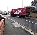 AAH Pharmaceuticals lorry, Elwy Street, Rhyl - geograph.org.uk - 5938922.jpg 1024 × 964; 197 КБ
-
 Aberkinsey Park - geograph.org.uk - 4889806.jpg 640 × 471; 55 КБ
-

-
 Afon Clwyd - geograph.org.uk - 4538440.jpg 640 × 426; 46 КБ
-

-
 Aldi, Rhyl - geograph.org.uk - 5587488.jpg 800 × 565; 105 КБ
-

-
 Alun Pugh at Rhyl Leisure Centre.jpg 1992 × 2658; 459 КБ
-
 Amusement arcade (5207609992).jpg 3872 × 2592; 6,39 МБ
-

-
 Apollo Bingo Club Rhyl - panoramio.jpg 4288 × 2864; 6,65 МБ
-
 Apollo Bingo Hall, Rhyl - geograph.org.uk - 5603533.jpg 800 × 750; 140 КБ
-
 Apollo Cinema, Rhyl - geograph.org.uk - 2790794.jpg 640 × 480; 47 КБ
-
 Approaching Foryd bridge from Rhyl - geograph.org.uk - 4887808.jpg 640 × 480; 55 КБ
-

-
 Approaching swans at Brickfield Pond - geograph.org.uk - 6264802.jpg 1024 × 683; 203 КБ
-
 B5119 Dyserth Road looking north - geograph.org.uk - 3394337.jpg 640 × 480; 34 КБ
-
 B5119 Dyserth Road newly re-aligned - geograph.org.uk - 3394407.jpg 640 × 481; 54 КБ
-
 B5119 Ffordd Dyserth - geograph.org.uk - 3394418.jpg 640 × 480; 47 КБ
-
 B5119, Rhyl to Dyserth Road - geograph.org.uk - 4890025.jpg 640 × 480; 70 КБ
-
 Back lane from Seabank Road, Rhyl - geograph.org.uk - 5590973.jpg 800 × 692; 141 КБ
-
 Balmoral Grove, Rhyl - geograph.org.uk - 5586977.jpg 800 × 704; 89 КБ
-
 Beach (6381764029).jpg 2592 × 3872; 3,81 МБ
-
 Beach shelter at Rhyl - geograph.org.uk - 555137.jpg 640 × 480; 61 КБ
-
 Beach with razor shells - geograph.org.uk - 6068050.jpg 800 × 600; 137 КБ
-
 Beachside Café, Rhyl - geograph.org.uk - 4174663.jpg 1600 × 1064; 505 КБ
-

-
 Beatrice Street Church, Oswestry, Sunday School trip to Rhyl.jpg 606 × 459; 79 КБ
-

-
 Benchmark at 55 Queens Street, Rhyl - geograph.org.uk - 2664963.jpg 3000 × 4000; 5,53 МБ
-
 Benchmark at 56 Water Street, Rhyl - geograph.org.uk - 2664979.jpg 3000 × 4000; 5,76 МБ
-

-
 Benchmark on Conwy Street. Rhyl - geograph.org.uk - 2481363.jpg 3000 × 4000; 1,46 МБ
-
 Benchmark on East Parade, Rhyl - geograph.org.uk - 2665083.jpg 3000 × 4000; 5,62 МБ
-
 Benchmark on Old Golf Road, Rhyl - geograph.org.uk - 2481498.jpg 3000 × 4000; 1,47 МБ
-
 Benchmark on Russell Road, Rhyl - geograph.org.uk - 2665096.jpg 3000 × 4000; 5,3 МБ
-
 Benchmark on the Vale Road railway bridge, Rhyl - geograph.org.uk - 2665064.jpg 3000 × 4000; 4,97 МБ
-
 Bend in the River Clwyd, Rhyl - geograph.org.uk - 5615455.jpg 800 × 425; 73 КБ
-
 Benkid77 Garden of Rememberance Sign, Rhyl 290609.JPG 1280 × 1024; 417 КБ
-
 Benkid77 Rhyl 1996.JPG 1719 × 1188; 338 КБ
-
 Benkid77 Rhyl Stone Circle 290609.JPG 1280 × 1024; 326 КБ
-
 Benkid77 Sunny Rhyl Mural 290609.JPG 1280 × 1024; 411 КБ
-
 Benkid77 Welsh litter bin 290609.JPG 1024 × 1280; 467 КБ
-
 Beside the Marine Lake in Rhyl - geograph.org.uk - 2602516.jpg 640 × 480; 51 КБ
-

-
 Blocked road, Clwyd Retail Park - geograph.org.uk - 2483743.jpg 640 × 480; 89 КБ
-
 Boat hoist on Foryd Harbour - geograph.org.uk - 2090563.jpg 1500 × 1000; 120 КБ
-
 Boats on the Afon Clwyd at Foryd - geograph.org.uk - 2602717.jpg 640 × 480; 59 КБ
-
 Boats on the River Clwyd at Rhyl - geograph.org.uk - 6127505.jpg 800 × 739; 100 КБ
-
 Boats on the River Clwyd, Rhyl - geograph.org.uk - 4174902.jpg 1600 × 1064; 583 КБ
-
 Boats on the River Clwyd, Rhyl - geograph.org.uk - 4174923.jpg 1600 × 1064; 482 КБ
-
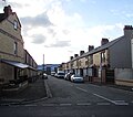
 Bodfor Street, Rhyl - geograph.org.uk - 5905457.jpg 983 × 1024; 163 КБ
-
 Breakwater and lifebuoy - geograph.org.uk - 5065564.jpg 640 × 427; 46 КБ
-
 Breakwater building - geograph.org.uk - 4887760.jpg 640 × 480; 72 КБ
-
 Bridge Cafe, Rhyl - geograph.org.uk - 5587552.jpg 800 × 697; 74 КБ
-

-

-
 Buildings at Rhyl Golf Club - geograph.org.uk - 4173654.jpg 1600 × 1064; 393 КБ
-
 Bungalows, Rhyl - geograph.org.uk - 4507145.jpg 640 × 426; 50 КБ
-
 Buses on East Parade - geograph.org.uk - 4891605.jpg 1000 × 816; 521 КБ
-
 Canterbury House, Rhyl - geograph.org.uk - 4889741.jpg 640 × 480; 78 КБ
-
 Car park, Rhyl Station - geograph.org.uk - 4538461.jpg 640 × 426; 47 КБ
-
 Caravan park on the outskirts of Rhyl - geograph.org.uk - 2566974.jpg 3888 × 2592; 2 МБ
-
 Casson for new bridge - geograph.org.uk - 3157949.jpg 1600 × 1200; 360 КБ
-
 CEF, 205 Wellington Road, Rhyl - geograph.org.uk - 5587521.jpg 800 × 635; 111 КБ
-
 Cefndy Road - geograph.org.uk - 2191024.jpg 4000 × 3000; 5,11 МБ
-
 CEI Marina, Rhyl - geograph.org.uk - 5608821.jpg 800 × 514; 81 КБ
-
 Celebration mosaic - geograph.org.uk - 4110323.jpg 640 × 480; 77 КБ
-

-
-
 Children playing on Rhyl Sands.jpg 708 × 513; 76 КБ
-
 Church in Rhyl - geograph.org.uk - 4538497.jpg 640 × 426; 42 КБ
-
 Clock tower (5207611068).jpg 2592 × 3872; 3,97 МБ
-
 Clock Tower - geograph.org.uk - 1736666.jpg 592 × 640; 107 КБ
-
 Clock tower, Rhyl - geograph.org.uk - 4538501.jpg 640 × 426; 29 КБ
-
 Clwyd Street, Rhyl - geograph.org.uk - 5588479.jpg 800 × 521; 90 КБ
-
 Clwydian hills - geograph.org.uk - 4110347.jpg 640 × 480; 29 КБ
-
 Coastal Cars - geograph.org.uk - 4682503.jpg 1000 × 742; 559 КБ
-
 Coastline taxi in High Street, Rhyl - geograph.org.uk - 5613512.jpg 800 × 642; 81 КБ
-
 Cob ^ Pen - geograph.org.uk - 4538471.jpg 640 × 426; 37 КБ
-
 Cob ^ Pen, Rhyl - geograph.org.uk - 5603515.jpg 800 × 700; 107 КБ
-
 Cob ^ Pen, Rhyl - geograph.org.uk - 5613448.jpg 800 × 672; 107 КБ
-
 Colourful railway bridge - geograph.org.uk - 4889725.jpg 640 × 480; 58 КБ
-

-
 Commerative of Rhyl 1794-2006 - panoramio.jpg 4288 × 2864; 5,79 МБ
-
 Commerative to Rhyl 1794-2006 - panoramio.jpg 4288 × 2864; 6,01 МБ
-
 Contrasting buildings Rhyl - geograph.org.uk - 4730423.jpg 640 × 427; 64 КБ
-
 Cookhouse - Pub and Premier Inn - geograph.org.uk - 6225701.jpg 800 × 568; 101 КБ
-

-

-

-

-
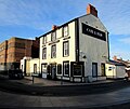
 Costigans pub Rhyl - geograph.org.uk - 1927075.jpg 3296 × 2472; 1,91 МБ
-
 David Cox - Rhyl Sands (Tate version).jpg 1536 × 1103; 167 КБ
-
 David Cox the elder (1783-1859) - Rhyl Sands - T04130 - Tate.jpg 1098 × 788; 99 КБ
-
 Crossing Pont y Ddraig - geograph.org.uk - 4486931.jpg 4900 × 3234; 1,82 МБ
-
 Crown Bard pub sign.jpg 259 × 346; 41 КБ
-
 Cumulus congestus pileus cloud - geograph.org.uk - 4110217.jpg 640 × 480; 26 КБ
-
 Cycle route 5 - geograph.org.uk - 968296.jpg 640 × 480; 94 КБ
-
 Cycle Route 84 direction sign, Rhyl - geograph.org.uk - 5939128.jpg 1024 × 1018; 200 КБ
-

-
 DayClox, 145 High Street, Rhyl - geograph.org.uk - 5613466.jpg 800 × 573; 91 КБ
-
 Denbighshire UK community map (Rhyl).svg 864 × 1305; 813 КБ
-
 Derelict building on Rhyl seafront - geograph.org.uk - 4486945.jpg 3184 × 2123; 1,37 МБ
-
 Derelict building on Rhyl seafront - geograph.org.uk - 4486948.jpg 3184 × 2123; 1,28 МБ
-

-
 Dilapidated grand Victorian houses - geograph.org.uk - 31938.jpg 576 × 432; 36 КБ
-
 Directions sign on a Rhyl corner - geograph.org.uk - 5588471.jpg 703 × 800; 118 КБ
-

-
 Dog walkers Paradise - geograph.org.uk - 2093077.jpg 640 × 480; 128 КБ
-

-

-

-
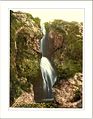 Dyserth Falls Rhyl Wales.jpg 832 × 1067; 193 КБ
-
 East along the A548 Rhyl Coast Road - geograph.org.uk - 6212914.jpg 800 × 561; 78 КБ
-
 East Parade in Rhyl - geograph.org.uk - 6225686.jpg 800 × 512; 91 КБ
-
 East side of Apollo Bingo Hall, Rhyl - geograph.org.uk - 5613453.jpg 800 × 600; 123 КБ
-

-
 Eglwys Bresbyteraidd Cymru, Rhyl - geograph.org.uk - 5588475.jpg 800 × 600; 98 КБ
-
 Electoral wards in the town of Rhyl, Denbighshire, Wales.png 700 × 610; 87 КБ
-
 Ellis Avenue, Rhyl - geograph.org.uk - 5590923.jpg 800 × 569; 103 КБ
-
 Elwy Street towards Rhyl railway station - geograph.org.uk - 5938941.jpg 995 × 1020; 215 КБ
-

-
 Fairground in Rhyl - geograph.org.uk - 237809.jpg 640 × 480; 65 КБ
-
 Farm road to Aberkinsey Farm - geograph.org.uk - 4890048.jpg 640 × 480; 89 КБ
-
 Farmfoods, Marina Quay, Rhyl - geograph.org.uk - 5615341.jpg 800 × 469; 102 КБ
-
 Farmland near Rhyl - geograph.org.uk - 4889812.jpg 640 × 480; 92 КБ
-
 Fast food outlets, Queen Street - geograph.org.uk - 4887740.jpg 640 × 480; 81 КБ
-
 Fenced-off site, West Parade, Rhyl - geograph.org.uk - 5615522.jpg 800 × 546; 80 КБ
-
 Ffordd Anwyl Rhyl - geograph.org.uk - 29823.jpg 512 × 384; 27 КБ
-
 Ffordd Wellington in Rhyl - geograph.org.uk - 2087540.jpg 1500 × 928; 150 КБ
-
 Ffrith Beach - geograph.org.uk - 4522884.jpg 4427 × 1700; 1,34 МБ
-
 Field on the outskirts of Rhyl - geograph.org.uk - 4889810.jpg 640 × 473; 65 КБ
-
 Fighting a relentless sea - geograph.org.uk - 3506404.jpg 1600 × 1200; 406 КБ
-
 Finger post at Pont y Ddraig - geograph.org.uk - 4175122.jpg 1600 × 1501; 950 КБ
-
 Flat farmland near Rhyl - geograph.org.uk - 4507141.jpg 640 × 426; 40 КБ
-

-
 Footpath leading to Green Lanes - geograph.org.uk - 4173394.jpg 1600 × 1064; 459 КБ
-
 Footprints in the sand - geograph.org.uk - 1870824.jpg 616 × 462; 111 КБ
-
 Former Amusements on West Parade, Rhyl - geograph.org.uk - 4174890.jpg 1600 × 1064; 428 КБ
-

-
 Former ride at Rhyl - geograph.org.uk - 4174722.jpg 1064 × 1600; 274 КБ
-
 Foryd Harbour - geograph.org.uk - 2090554.jpg 1500 × 992; 168 КБ
-
 Foryd Harbour - geograph.org.uk - 2090560.jpg 1500 × 1000; 169 КБ
-
 Foryd harbour from Pont y Ddraig - geograph.org.uk - 4037638.jpg 640 × 480; 53 КБ
-
 Frederick Street Rhyl - geograph.org.uk - 31817.jpg 576 × 432; 40 КБ
-
 Friesian cattle at Rhydorddwy Fawr - geograph.org.uk - 4889820.jpg 640 × 480; 59 КБ
-
 G E Tools Ltd store, Wood Road, Rhyl - geograph.org.uk - 5608234.jpg 800 × 666; 107 КБ
-
 Garford Road, Rhyl - geograph.org.uk - 3506395.jpg 1600 × 1200; 228 КБ
-
 Geufron Rhyl - geograph.org.uk - 30655.jpg 512 × 384; 30 КБ
-
 Girls dancing teams at competition - geograph.org.uk - 31941.jpg 576 × 432; 63 КБ
-
 Gorsedd stone circle, Rhyl - geograph.org.uk - 2665024.jpg 4000 × 3000; 5,55 МБ
-
 Gorsedd stones, Rhyl - geograph.org.uk - 2790167.jpg 640 × 480; 73 КБ
-
 Gorsedd Stones, Rhyl - geograph.org.uk - 2790169.jpg 640 × 480; 69 КБ
-
 Grade II listed Rhyl No. 2 signalbox - geograph.org.uk - 5938976.jpg 1004 × 1024; 238 КБ
-

-
 Green keeping at Rhyl Golf Course - geograph.org.uk - 3505415.jpg 1600 × 1200; 421 КБ
-
 Groyne and beach near Ffrith - geograph.org.uk - 4961894.jpg 5100 × 3400; 4,03 МБ
-

-
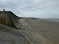
 Groyne on the beach at Rhyl - geograph.org.uk - 2103905.jpg 1500 × 974; 136 КБ
-
 Gwynedd Distributors, Rhyl - geograph.org.uk - 5587525.jpg 800 × 799; 160 КБ
-
 Harbour Seal (Phoca vitulina vitulina) - geograph.org.uk - 4890429.jpg 1000 × 750; 585 КБ
-
 Hawthorne Way - geograph.org.uk - 2191022.jpg 4000 × 3000; 5,05 МБ
-
 Heading out to sea - geograph.org.uk - 5930869.jpg 5184 × 3888; 4,09 МБ
-
 Heron Foods, High Street, Rhyl - geograph.org.uk - 5603454.jpg 541 × 640; 81 КБ
-
 High Street, Rhyl - geograph.org.uk - 3862601.jpg 1200 × 798; 315 КБ
-
 High Street, Rhyl - geograph.org.uk - 5603497.jpg 800 × 717; 119 КБ
-

-
 Hotels in Rhyl - geograph.org.uk - 3619581.jpg 4000 × 2248; 1,59 МБ
-
 Houses in Rhyl - geograph.org.uk - 4507146.jpg 640 × 426; 60 КБ
-
 Houses in Rhyl - geograph.org.uk - 4538505.jpg 640 × 330; 27 КБ
-
 Houses on Marsh Rd - geograph.org.uk - 4510986.jpg 640 × 426; 47 КБ
-
 Houses, Ffordd Anwyl - geograph.org.uk - 4507143.jpg 640 × 364; 45 КБ
-
 Houses, Sholing Rd - geograph.org.uk - 4538512.jpg 640 × 353; 30 КБ
-
 Hungry Tum, Rhyl - geograph.org.uk - 5608817.jpg 595 × 640; 72 КБ
-
 Imperial Hotel, Rhyl - geograph.org.uk - 5587595.jpg 800 × 631; 133 КБ
-
 In out, in out - but going nowhere - geograph.org.uk - 4110338.jpg 640 × 480; 84 КБ
-

-
 Inconvenient on Rhyl railway station - geograph.org.uk - 5613519.jpg 800 × 706; 135 КБ
-
 Indoor Market, Rhyl - geograph.org.uk - 5587472.jpg 800 × 539; 83 КБ
-
 Information board at Splashpoint - geograph.org.uk - 2790156.jpg 640 × 480; 89 КБ
-
 Joey looks out over Brickfield Pond - geograph.org.uk - 6264807.jpg 1024 × 718; 171 КБ
-
 Kamranz Rhyl - geograph.org.uk - 5587513.jpg 800 × 660; 122 КБ
-

-
 Kéisha's Kabin, Bodfor Street, Rhyl - geograph.org.uk - 5587586.jpg 667 × 800; 124 КБ
-
 Lake Avenue, Rhyl - geograph.org.uk - 5587493.jpg 800 × 575; 111 КБ
-
 Lakeside Cafe, Wellington Road, Rhyl - geograph.org.uk - 5587516.jpg 800 × 626; 119 КБ
-

-
 Lifebelt on the promenade at Rhyl - geograph.org.uk - 6224170.jpg 800 × 539; 84 КБ
-
 Lifebelt on the promenade at Rhyl - geograph.org.uk - 6224940.jpg 800 × 615; 82 КБ
-

-
 Lifebuoy by the Wales Coast Path - geograph.org.uk - 4961915.jpg 2789 × 4184; 2,48 МБ


.jpg)


.jpg)


.jpg)


.jpg)


.jpg)
_-_Rhyl_Sands_-_T04130_-_Tate.jpg)


.jpg)

.svg)


_-_geograph.org.uk_-_4890429.jpg)


