Category:Rivers of Michigan
Zur Navigation springen
Zur Suche springen
Bundesstaaten der Vereinigten Staaten: Alabama · Alaska · Arizona · Arkansas · Colorado · Connecticut · Delaware · Florida · Georgia · Hawaii · Idaho · Illinois · Indiana · Iowa · Kalifornien · Kansas · Kentucky · Louisiana · Maine · Maryland · Massachusetts · Michigan · Minnesota · Mississippi · Missouri · Montana · Nebraska · Nevada · New Hampshire · New Jersey · New Mexico · New York · North Carolina · North Dakota · Ohio · Oklahoma · Oregon · Pennsylvania · Rhode Island · South Carolina · South Dakota · Tennessee · Texas · Utah · Vermont · Virginia · Washington · West Virginia · Wisconsin · Wyoming – Washington, D.C.
Guam · Puerto Rico
Guam · Puerto Rico
Wikimedia-Kategorie | |||||
| Medium hochladen | |||||
| Ist ein(e) | |||||
|---|---|---|---|---|---|
| Kategorie kombiniert die Themen | |||||
| Kategorie enthält | |||||
| Michigan | |||||
Bundesstaat der Vereinigten Staaten von Amerika  someja satełitar in majo     | |||||
| Aussprache (Audiodatei) | |||||
| Ist ein(e) | |||||
| Ist Teil von | |||||
| Benannt nach | |||||
| Ort |
| ||||
| Liegt am oder im Gewässer | |||||
| Hauptstadt | |||||
| Gesetzgebende Körperschaft | |||||
| Exekutivorgan | |||||
| Höchstes Gericht |
| ||||
| Hymne |
| ||||
| Leiter der Regierung oder Verwaltung |
| ||||
| Besteht aus |
| ||||
| Datum der Gründung, Erstellung, Entstehung, Erbauung |
| ||||
| Küstenlinie |
| ||||
| Höchster Punkt | |||||
| Einwohnerzahl |
| ||||
| Fläche |
| ||||
| Höhe über dem Meeresspiegel |
| ||||
| Verschieden von | |||||
| Höchsttemperatur |
| ||||
| Historische Tiefsttemperatur |
| ||||
| offizielle Website | |||||
 | |||||
Unterkategorien
Es werden 67 von insgesamt 67 Unterkategorien in dieser Kategorie angezeigt:
In Klammern die Anzahl der enthaltenen Kategorien (K), Seiten (S), Dateien (D)
*
- River terraces in Michigan (2 D)
+
- Maps of rivers in Michigan (47 D)
.
- River name signs in Michigan (2 D)
A
B
- Big Sable River (4 D)
C
- Charlotte River (Michigan) (3 D)
- Cheboygan River (3 D)
- Clam River (2 D)
- Clinton River (Michigan) (5 D)
- Crystal River (2 D)
D
E
- Elk River (Michigan) (2 D)
F
- Flint River (Michigan) (14 D)
G
- Grass River, Michigan (1 D)
H
- Hurricane River (11 D)
I
- Irving Dam, taken by Lar (7 D)
K
M
- Mineral River (2 D)
O
- Ottawa River (Lake Erie) (11 D)
P
- Pere Marquette River (3 D)
- Pinnebog River (1 D)
- Platte River (Michigan) (4 D)
R
- Red Cedar River (Michigan) (10 D)
- Rifle River (3 D)
S
- Saline River (Michigan) (14 D)
- Sandy Creek (Michigan) (11 D)
T
W
Medien in der Kategorie „Rivers of Michigan“
Folgende 137 Dateien sind in dieser Kategorie, von 137 insgesamt.
-
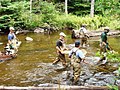
 15 Pull Team swims in the Black River, Holland, Michigan.jpg 960 × 640; 166 KB
-
 2009-0619-Petoskey-BearRiver1.JPG 3.648 × 2.736; 5,75 MB
-
 2012 Photo Contest - Landscape Category (7944739320).jpg 2.413 × 3.378; 1,96 MB
-
 Anna River.jpg 4.000 × 3.000; 2,63 MB
-
 Axtell Creek.jpg 2.336 × 1.626; 1,35 MB
-
 Bad River St Charles Michigan.jpg 1.280 × 960; 340 KB
-
 Baltimore River Michgian.jpg 3.024 × 4.032; 4,17 MB
-
 Baltimore River Sign.jpg 3.024 × 4.032; 3,29 MB
-
 Battle Creek River.jpg 2.816 × 2.112; 921 KB
-
 Betise River Wetland near Elberta.jpg 1.024 × 768; 149 KB
-
 Betsie River East of Elberta.jpg 1.024 × 768; 192 KB
-
 Black River 10th Street Port Huron Michigan.jpg 3.648 × 2.736; 5,75 MB
-
 Black river cheboygan county.jpg 5.184 × 3.456; 8,84 MB
-
 Boyne River (Michigan).jpg 5.179 × 2.913; 4,72 MB
-
 BoysDam49093.jpg 600 × 450; 188 KB
-

-
 Brundage Creek.jpg 2.592 × 1.936; 1,22 MB
-
 Canal and River, Belle Isle (NBY 6238).jpg 821 × 525; 80 KB
-
 CanyonFallsSturgeonRiver.jpg 1.936 × 1.288; 1,27 MB
-
 Cedar River (Gladwin County, Michigan).jpg 5.184 × 2.916; 3,99 MB
-
 Cedar River Gladwin Michigan.jpg 3.648 × 2.736; 7,85 MB
-
 Cedar river ns.jpg 250 × 187; 48 KB
-
 Coldwater River Freeport Michigan.jpg 3.648 × 2.736; 9,03 MB
-
 Confluence of the Chippewa and Pine rivers in Michigan.jpg 4.694 × 3.382; 6,22 MB
-
 Creek Viewed from Bridge on Allison Road London Township Michigan.JPG 4.752 × 3.168; 11,56 MB
-
 Cut River (Roscommon County, Michigan).jpg 5.151 × 2.898; 3,68 MB
-
 Dead River Outcropping, Near Dam.jpg 4.032 × 3.024; 3,75 MB
-
 Dowagiac River Pokagon Township Michigan.jpg 3.648 × 2.736; 9,83 MB
-
 Fawn River (St. Joseph County, Michigan).jpg 2.448 × 3.264; 1,04 MB
-
 Fawn River Florence Township Michigan.jpg 3.612 × 2.709; 7,27 MB
-
 Fly fishing Sturgeon River, Upper Michigan.jpg 3.504 × 2.336; 2,23 MB
-
 From kayak.jpg 744 × 564; 409 KB
-
 Gfp-michigan-porcupine-mountains-state-park-mouth-of-the-river.jpg 3.265 × 2.127; 1,6 MB
-
 Gfp-michigan-porcupine-mountains-state-park-river-at-presque-isle.jpg 3.333 × 2.214; 1,65 MB
-
 Gfp-michigan-porcupine-mountains-state-park-river-flowing-downstream.jpg 3.347 × 2.125; 1,57 MB
-
 Gfp-michigan-porcupine-mountains-state-park-river-heading-into-superior.jpg 3.396 × 2.235; 1,52 MB
-
 Gfp-michigan-porcupine-mountains-state-park-river-sunset.jpg 3.367 × 2.142; 1,98 MB
-
 Gfp-michigan-porcupine-mountains-state-park-rushing-river-scenery.jpg 3.415 × 2.230; 1,7 MB
-
 Gfp-michigan-porcupine-mountains-state-park-rushing-water-at-presque-isle.jpg 3.314 × 2.225; 1,67 MB
-
 Gfp-michigan-porcupine-mountains-state-park-stream-flowing-into-superior.jpg 3.404 × 2.224; 1,96 MB
-
 Gfp-michigan-sunset-over-the-river.jpg 3.348 × 2.224; 756 KB
-
 Gfp-michigan-upper-peninsula-across-the-river-at-dusk.jpg 3.292 × 2.223; 880 KB
-
 Gfp-michigan-upper-peninsula-fading-dusk-over-river.jpg 3.263 × 2.175; 1,25 MB
-
 Gfp-michigan-upper-peninsula-red-dusk-over-the-river.jpg 3.319 × 2.253; 863 KB
-
 Gfp-michigan-upper-peninsula-sunset-on-the-horizon.jpg 3.403 × 2.211; 761 KB
-
 Gratiot River.jpg 4.032 × 3.024; 1,24 MB
-
 Hamlin Lake Dam3.jpg 1.632 × 1.224; 495 KB
-
 Hersey River Reed City Michigan.jpg 3.648 × 2.736; 7,75 MB
-
 Hickory Creek (St. Joseph River tributary).jpg 2.688 × 1.865; 688 KB
-
 Indian River from North Central State Trail Cheboygan County Michigan.jpg 4.892 × 3.303; 8,97 MB
-
 Jordan River Webster Bridge.jpg 5.264 × 3.509; 12,64 MB
-
 Kayak in Marquette.jpg 960 × 720; 83 KB
-
 Leveque Creek - panoramio.jpg 2.592 × 1.944; 2,21 MB
-
 Little Cedar River (Tobacco River tributary).jpg 5.184 × 2.916; 5,51 MB
-
 Little Muskegon River Morley Michigan.jpg 3.648 × 2.736; 9,52 MB
-
 Little Rapid River (Michigan).jpg 5.183 × 2.916; 3,94 MB
-
 Little River Raisin Dundee Township Michigan.jpg 3.648 × 2.736; 8,89 MB
-
 Little Thornapple River Chester Township Eaton County Michigan.jpg 3.648 × 2.736; 8,23 MB
-
 Little Tobacco River.jpg 5.183 × 2.916; 4,42 MB
-
 Little Two Hearted River (Michigan).jpg 5.183 × 2.916; 3,33 MB
-
 Little Union River Gorge PLC-WF-12.jpg 3.845 × 2.574; 8,82 MB
-
 Little Union River Gorge PLC-WF-15.jpg 3.872 × 2.592; 6,62 MB
-
 Little Union River Small Steep Waterfall PLC-WF-13.jpg 3.339 × 2.113; 6,76 MB
-
 Little Union River Small Waterfall PLC-WF-9.jpg 3.872 × 2.592; 5,74 MB
-
 Ludington State Park Fall 2005 027.jpg 1.632 × 1.224; 486 KB
-
 Macatawa River - panoramio.jpg 3.456 × 5.184; 4,38 MB
-
 Macatawa River Holland Charter Township Michigan.jpg 3.333 × 2.500; 7,84 MB
-
 Malone Bay Trail Boardwalk (3057881458).jpg 4.354 × 2.358; 10,5 MB
-
 Manistee River.jpg 2.592 × 1.944; 2,2 MB
-
 ManisteeRiverTrailBridge2013.jpg 4.608 × 3.456; 5,34 MB
-
 Michigan '07 004 (6166326784).jpg 640 × 480; 330 KB
-
 Michigan '07 006 (6165792413).jpg 640 × 480; 309 KB
-
 Michigan '07 007 (6165792547).jpg 640 × 480; 325 KB
-
 Michigan '07 011 (6166327118).jpg 640 × 480; 323 KB
-
 Molasses River.jpg 5.184 × 2.916; 5,16 MB
-
 Mouth of the Two Hearted River (June 2021).jpg 5.184 × 2.916; 3,01 MB
-
 Munuscong River.jpg 3.848 × 1.820; 1,23 MB
-
 Neutral density filter demonstration.jpg 3.504 × 2.336; 2,99 MB
-
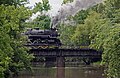 Nickel Plate Road 765 crossing bridge in Alma, MI.jpg 1.006 × 656; 746 KB
-

-
 Ocqueoc River Bridge.jpg 4.514 × 3.199; 20,58 MB
-
 Paint Creek (Augusta Township, MI - Liss Road).jpg 5.184 × 2.916; 4,3 MB
-
 Pendleton Creek - panoramio.jpg 2.048 × 1.536; 1,41 MB
-
-
 Photograph of George Encahl of Flint - NARA - 2128391.jpg 1.281 × 933; 680 KB
-
 Pigeon River Ottawa County Michigan.jpg 3.648 × 2.736; 10,31 MB
-
 Pilgrim River - panoramio.jpg 2.048 × 1.536; 1,4 MB
-
 Pinconning River Pinconning Township Michigan.jpg 3.648 × 2.736; 11,33 MB
-
 Pine Creek wetland - panoramio.jpg 2.592 × 1.944; 2,12 MB
-
 Pine River Alma Michigan.jpg 3.631 × 2.723; 6,87 MB
-
 Porcupine Mountains banner River.jpg 3.347 × 484; 347 KB
-
 Portage and St. Joseph Rivers, at Three Rivers, Michigan (67852).jpg 3.297 × 2.077; 2,82 MB
-
 Portage Creek (Mackinac County, MI) June 2021.jpg 5.183 × 2.916; 4,09 MB
-
 Prairie Creek.jpg 2.592 × 1.936; 1,62 MB
-
 Prairie River, Michigan.jpg 2.048 × 1.536; 528 KB
-
 Rabbit River Wayland Michigan.jpg 3.648 × 2.736; 7,56 MB
-
 Rapid River (Kalkaska County, Michigan).jpg 5.184 × 2.916; 3,43 MB
-
 Reserve Soldiers conduct off-road driver training (Image 1 of 14) (14007243907).jpg 6.006 × 3.996; 5,4 MB
-
 Rifle River (Michigan) August 2021.jpg 5.184 × 2.916; 4,09 MB
-
 River Road Scenic Byway - Fishing Area at Whirlpool River Access - NARA - 7721317.jpg 2.050 × 1.066; 551 KB
-
 Rocky River Flowerfield Township Michigan.jpg 3.648 × 2.736; 8,4 MB
-
 Rustic Bridge over Old Channel (NBY 7113).jpg 826 × 525; 103 KB
-
 Saganing River Standish Township Michigan.jpg 3.648 × 2.736; 8,9 MB
-
 Sentinel-2 L1C image on 2020-05-23 (2) 01.jpg 944 × 314; 88 KB
-
 Sentinel-2 L1C image on 2020-05-23 (2) 02.jpg 944 × 314; 41 KB
-
 Sentinel-2 L1C image on 2020-05-23 (2) 03.jpg 944 × 314; 61 KB
-
 Shaw Branch River in Michigan's Meridian-Baseline State Park.jpg 3.591 × 5.386; 19,96 MB
-
 Smaller-waterfall-web.jpg 1.200 × 1.800; 139 KB
-
 South Branch Galien River.jpg 2.807 × 2.031; 1,44 MB
-
 Stony Creek.jpg 4.349 × 1.850; 1,77 MB
-
 Sturgeonriver.jpg 403 × 376; 51 KB
-
 Sunset in elk ridge Michigan 2018.jpg 3.024 × 4.032; 459 KB
-
 Sycamore Creek Lansing Michigan spring.jpg 3.648 × 2.736; 10,48 MB
-
 Sycamore Creek Lansing Michigan.jpg 3.648 × 2.736; 8,67 MB
-
 The Narrows, Coldwater, Michigan (68044).jpg 3.294 × 2.070; 3,17 MB
-
 Trout River Rogers City Michigan.jpg 3.648 × 2.736; 10,35 MB
-
 US 41 Peshekee Bridge.jpg 3.008 × 2.000; 2,97 MB
-

-

-

-

-
-

-
-

-

-

-
 WaterworksColdwaterMI.jpg 1.280 × 1.024; 226 KB
-
 West Fork Portage Creek.jpg 5.258 × 2.084; 2,7 MB
-
 Wolverine Worldwide tannery in Rockford.jpg 2.797 × 1.808; 1,5 MB
-
 Banking ground, high bank, Cass River, by Jenney, J. A. (James A.).jpg 2.737 × 1.576; 1,64 MB
-
 Beaver dam on Marquette River, by Emery, A. G.jpg 2.737 × 1.381; 1,45 MB
-
 Dam for flooding logs, L. B. Curtis and Co's, by Jenney, J. A. (James A.).jpg 2.737 × 1.581; 1,82 MB
-
 Falls of the Munissing, from Robert N. Dennis collection of stereoscopic views.jpg 2.737 × 1.412; 1,68 MB
-
 Hauling at Thomas Foster's, by Jenney, J. A. (James A.).jpg 2.737 × 1.573; 1,59 MB
-
 High banking, by Jenney, J. A. (James A.) 2.jpg 2.737 × 1.569; 1,69 MB
-
 High banking, by Jenney, J. A. (James A.).jpg 2.737 × 1.558; 1,73 MB


.jpg)


.jpg)


.jpg)

.jpg)


.jpg)


.jpg)


.jpg)


.jpg)

.jpg)


.jpg)


.jpg)


.jpg)
.jpg)
.jpg)
.jpg)

.jpg)


_(14777166884).jpg)

.jpg)


.jpg)
_June_2021.jpg)


.jpg)
_(14007243907).jpg)
_August_2021.jpg)


.jpg)


.jpg)


.jpg)
.jpg)
.jpg)
.jpg)
.jpg)
.jpg)
.jpg)
.jpg)
.jpg)
.jpg)


.jpg)

.jpg)

.jpg)
_2.jpg)
.jpg)
_01.jpg)
_02.jpg)
_03.jpg)