Category:Rivers of Missouri
Hopp til navigering
Hopp til søk
USAs delstater: Alabama · Alaska · Arizona · Arkansas · California · Colorado · Connecticut · Delaware · Florida · Georgia · Hawaii · Idaho · Illinois · Indiana · Iowa · Kansas · Kentucky · Louisiana · Maine · Maryland · Massachusetts · Michigan · Minnesota · Mississippi · Missouri · Montana · Nebraska · Nevada · New Hampshire · New Jersey · New Mexico · New York · Nord-Carolina · Nord-Dakota · Ohio · Oklahoma · Oregon · Pennsylvania · Rhode Island · Sør-Carolina · Sør-Dakota · Tennessee · Texas · Utah · Vermont · Vest-Virginia · Virginia · Washington · Wisconsin · Wyoming – Washington D.C.
Guam · Puerto Rico
Guam · Puerto Rico
Wikimedia-kategori | |||||
| Last opp mediefiler | |||||
| Forekomst av | |||||
|---|---|---|---|---|---|
| Kategorien kombinerer emnene | |||||
| Kategori inneholder | |||||
| Missouri | |||||
delstat i USA     | |||||
| Uttale (lydfil) | |||||
| Forekomst av | |||||
| Del av | |||||
| Oppkalt etter | |||||
| Plassering | USA | ||||
| Tilgrensende vannmasse | |||||
| Hovedstad | |||||
| Lovgivende forsamling | |||||
| Utøvende makt | |||||
| Høyeste juridiske instans |
| ||||
| Offisiell hymne |
| ||||
| Øverste politiske forvaltningsleder |
| ||||
| Dato for etablering, fremstilling e.l. |
| ||||
| Høyeste punkt | |||||
| Folketall |
| ||||
| Areal |
| ||||
| Høyde over havet |
| ||||
| Forskjellig fra | |||||
| Høyeste temperatur |
| ||||
| Minimum temperature record |
| ||||
| offisielt nettsted | |||||
 | |||||
Underkategorier
Denne kategorien har følgende 28 underkategorier, av totalt 28.
*
- River banks in Missouri (4 filer)
- River beaches in Missouri (1 fil)
- Streambed boulders in Missouri (2 filer)
+
.
1
- 102 River (3 filer)
B
- Buffalo Creek (Current River tributary) (3 filer)
C
F
- Finley River (5 filer)
J
- James River (Missouri) (3 filer)
L
M
N
- Nodaway River (4 filer)
O
R
- River aux Vases (4 filer)
- River des Peres (59 filer)
S
W
Filer i kategorien «Rivers of Missouri»
Følgende 53 filer er i denne kategorien, av totalt 53.
-
 Mo rivers2.png 1 000 × 1 000; 640 KB
-
 American Eel (6149968085).jpg 480 × 547; 109 KB
-
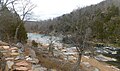
 Big Piney River near MO-17.jpg 4 608 × 3 456; 3,73 MB
-
 Birch Creek Bridge.JPG 3 648 × 2 736; 1,85 MB
-
 Black River Missouri 20140720 206b.jpg 767 × 532; 214 KB
-
 Bridge over the upper North Fork River.jpg 1 024 × 768; 277 KB
-
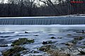
 Cedar Hill Dam on Big River in Missouri.JPG 800 × 600; 491 KB
-
 Current River, Missouri, panorama.jpg 2 283 × 902; 2,09 MB
-
 Elephant Rocks SP 1.jpg 640 × 427; 100 KB
-
 Eleven Point River, Missouri (6019795024).jpg 2 519 × 1 889; 3,08 MB
-
 Gfp-st-louis-shore-of-thebrook.jpg 3 383 × 2 228; 1,99 MB
-
 Grand Canyon Missouri (51215708642).jpg 4 032 × 3 024; 9,78 MB
-
 HFCA 1607 People Volume 2 087.jpg (95d7ea31d7264627b62506867b4ae68e).jpg 7 815 × 5 173; 2,42 MB
-
 Johnson-shutins-26aug06-a.jpg 2 422 × 828; 703 KB
-
 Johnsons Shutins autumn panorama-panini 20130126.jpg 5 474 × 2 433; 6,25 MB
-
 Johnsons Shutins head of shutins A.jpg 9 003 × 2 730; 8,48 MB
-
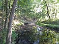
 LaBarque Creek April.JPG 4 608 × 3 456; 3,56 MB
-
 LaBarque Creek.jpg 960 × 1 280; 395 KB
-
 Lake Springfield Missouri.jpg 4 608 × 2 592; 1,28 MB
-
 Lewis-north-river.jpg 1 000 × 652; 351 KB
-
 Little Beaver Creek crossing in western Douglas County, Missouri.jpg 674 × 899; 180 KB
-
 Little Niangua River, Fiery Fork.jpg 188 × 250; 15 KB
-
 Little Osage River Missouri.jpg 1 280 × 1 024; 296 KB
-
-
 Looking west up Bear Creek, Weston Bend State Park, Missouri - panoramio.jpg 4 000 × 2 248; 3,18 MB
-
 Marmaton River.jpg 1 280 × 966; 789 KB
-
 MeramecRiver.jpg 4 272 × 2 848; 19 MB
-
 Missouri (19654170602).jpg 5 990 × 3 992; 13,71 MB
-
 Nodaway-lewis.jpg 889 × 843; 140 KB
-
 Above the old bridge (NYPL b11708063-G91F021 013F).tiff 3 072 × 1 723; 15,15 MB
-
 Little Piney River, on the Frisco, Newburgh, Mo (NYPL b12647398-70448).tiff 2 424 × 1 661; 11,53 MB
-
 Roaring River Beauty.jpg 3 872 × 2 592; 5,57 MB
-
 Roaring River Spring from Above.jpg 3 872 × 2 592; 7,45 MB
-
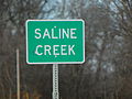 Saline Creek Bridge Sign.jpg 4 288 × 3 216; 4,21 MB
-
 Saline Creek, Missouri Railroad bridge.jpg 4 288 × 3 216; 4,24 MB
-
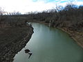 Saline Creek, Missouri view from Highway 61 bridge.jpg 4 288 × 3 216; 4,23 MB
-
 Saline Creek, Missouri, Highway 61 bridge.jpg 4 288 × 3 216; 3,96 MB
-

-

-
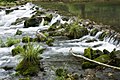
 Small-waterfalls.jpg - panoramio.jpg 5 184 × 3 456; 2,23 MB
-
 Stouts Creek - Missouri.jpg 4 608 × 2 717; 9,33 MB
-
 Stream in Forest 44.JPG 3 648 × 2 736; 6,57 MB
-
 Stream in Glassberg CA.JPG 3 264 × 2 448; 7,09 MB
-
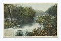
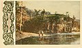
 There is something to see along the Frisco system (1903) (14573955678).jpg 3 120 × 1 810; 533 KB
-
 There is something to see along the Frisco system (1903) (14573961788).jpg 3 120 × 1 810; 586 KB
-
 There is something to see along the Frisco system (1903) (14760253732).jpg 3 120 × 1 810; 520 KB
-
 There is something to see along the Frisco system (1903) (14780449613).jpg 3 120 × 1 810; 569 KB
-
 Turkey Creek Missouri (48740545497).jpg 4 032 × 3 024; 4,33 MB
-
 USACE Brush Creek Kansas City.jpg 1 500 × 1 200; 994 KB
-
 USACE Mark Twain Lake and Dam.jpg 1 500 × 1 000; 406 KB
-

-

-
 Visitors canoeing in Ozark National Scenic Riverways. (b99193cae365459ea6a94c63d951ef58).jpg 7 896 × 5 235; 2,86 MB

.jpg)


.jpg)

.jpg)
.jpg)


.jpg)


.jpg)
.jpg)


_(14573955678).jpg)
_(14573961788).jpg)
_(14760253732).jpg)
_(14780449613).jpg)
.jpg)


.jpg)